
Where Flight Simulation Enthusiasts Gather from Around the World!
AVSIM Library - Search Results

| Category: Prepar3D V1-4 - Scenery | |
| Square Kilometre Array (MeerKAT) – South Africa |

|
Images related to this file:
File Description:

This scenery is of the MeerKAT radio telescope site (originally the Karoo Array Telescope – KAT but was changed to MeerKAT, meer=more) when the project was expanded to 64 dishes. It forms part of an international Square Kilometre Array (SKA) project. It is situated in the Karoo near the town of Carnarvon. The scenery includes the landing strip just North East of the biggest concentration of dishes. I could not find a code for this strip and called it FAKA (MeerKAT SKA), or take off from Carnarvon (FACN) and fly a heading of 320 degrees for 73 km. The scenery was designed and tested for P3D V5 to work with the ORBX Africa LC and Pilots NG2020 mesh products. I am not sure what the actual site would look like at night, but I included some night lighting to make the array visible after dark.
| Filename: | Square_Kilometre_Array_MeerKAT__South_Africa.zip |
| License: | Freeware |
| Added: | 14th August 2020, 22:53:38 |
| Downloads: | 99 |
| Author: | Johan Pienaar |
| Size: | 20.33 MB |
| Category: Flight Simulator 2004 - Scenery | |
| Airstrips of Southern Germany |
|
Images related to this file:
File Description:
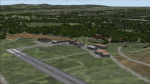
The next my Western Europe airstrips project, herewith about 170 small airfields, mostly in Baden-Wurttemberg and Bavaria, each enhanced with buildings, taxiways, parking spaces and aprons as appropriate, to further facilitate the generation of lightweight AI traffic in the area, without overloading the more major airfields.
Again, there's no photo-realism here, just a selection of basic 'generic' buildings, more or less accurately sized and placed to reflect the airfield layout as seen on on-line satellite imagery and aerial photography. These buildings have minimal effect on frame-rates, so are ideal for this kind of job. The airfields are aligned as well as possible with the roads etc. in UT Europe and the Genesis Europe mesh, but should mostly be fine in a default installation or other configuration.
Please read the rest of this "blurb" in the included text file. There may be some details of note or interest.
| Filename: | Airstrips_of_Southern_Germany.zip |
| License: | Freeware |
| Added: | 25th December 2024, 20:54:30 |
| Downloads: | 125 |
| Author: | Chris Eve |
| Size: | 2.84 MB |
| Category: Flight Simulator 2004 - Scenery | |
| EZ Scenery Cass Field (00CO) |
|
File Description:
FS2004 EZ Scenery CASS FIELD (00CO)
Briggsdale Colorado and surrounding parts of Eastern Co are well known for seeds. Seeds of almost any
kind imaginable like flowers, potatoes, bird seed and the list goes on and on. It is most always windy for there are no trees to slow the flow. Hot & windy in summer, cold and windy in winter and no natural enviromnent to harm plant growth. You can see the mountains to the west and more desolation to the east. A lonely place to drive through but rich in good people and seeds harvested for the world.
Area outside of airport's default flatten area require FS Global or Abasus extreme landscapes for elevation data. Download FREE library of RWY12 - EZ scenery objects (available on FlightSim.com or AVSIM) for objects. Ultimate Terrain USA for detailed landclass. FSX compatable.
Instructions inside.
jimmy R martin
| Filename: | EZ_Scenery_Cass_Field_00CO.zip |
| License: | Freeware |
| Added: | 6th June 2006, 01:54:47 |
| Downloads: | 619 |
| Author: | jimmy R martin |
| Size: | 255.55 KB |
| Category: Flight Simulator 2004 - Scenery Design | |
| TDFCalc2004 (Version 3) |
|
File Description:
This package is for FS2004 and FS2002 terrain designers. TDFCalc2004 is made for use with FSUIPC and FS2004. This is a version that includes true heading readings, and LOD8 Zone coordinates for VTP2 lines and polys. It is an FSUIPC registered freeware program that requires version 3.? of FSUIPC.dll installed to the FS2004 Module folder. FSUIPC is avaliable on the internet, and this program requires an application registration entered within FSUIPC. Usage with FS2002 or CFS2 requires no registration with the older versions of FSUIPC. LandCalc and TDFCalc2 are small programs which require the input of Latitude and Longitude, in 'DD:MM.decimal' format. Landcalc returns the names of the "CUSTOM" textures required by photoreal ( CUSTOM ) BGLs, and LandClass BGLs ( using values #253 or #252 ). TDFCalc2 returns valuable information concerning the X, Y coordinates needed for the creation of LWM and VTP polygons/lines. TMFViewerCalc requires input as Decimal Degrees.
| Filename: | TDFCalc2004_Version_3.zip |
| License: | Freeware |
| Added: | 5th October 2003, 18:48:15 |
| Downloads: | 1,324 |
| Author: | Richard Ludowise |
| Size: | 926.55 KB |
| Category: Flight Simulator 2004 - Scenery | |
| Armstrong Ontario; one airfield and two float bases |
|
File Description:
Armstrong CYYW airfield is 70 miles northeast of Thunder Bay, and close to Lake Nipigon. There isn't much of interest at the airfield by way of buildings (as there aren't many buildings!) and the only plane I saw was a fire fighting Canadaair CL 415. A basic airfield with one runway with lights and one without, and no maintenance. There is fuel, but it is locked up and not for sale.
The two float bases are 5 miles west (CJF6) and 10 miles southwest (CKN6) of Armstrong airfield. Lake Mackenzie is home to two companies, Armstrong Outposts (two Beavers) and Huron Air & Outfitters (an Otter and a Beaver) who both run fishing and hunting lodges. Wilderness North are further south on Lake Waweig, and I think they fly two Otters and a Beaver to their outpost camps. You need Ultimate Terrain, or there won't be any lakes!
| Filename: | Armstrong_Ontario_one_airfield_and_two_float_bases.zip |
| License: | Freeware |
| Added: | 24th February 2009, 00:51:42 |
| Downloads: | 894 |
| Author: | Roger Wensley |
| Size: | 7.03 MB |
| Category: Flight Simulator 2004 - Scenery | |
| Opa's Campground on Lake Texoma. |
|
Images related to this file:
File Description:
Opa's Campground. A ficticious campground located on the shores of beatiful Lake Texoma on the Texas-Oklahoma border. Created with the EZ and RWY12 Object placing programs, the scenery is packed with eye candy and some unusual features including AI Helicopter rides, an AI Windsurfer and AI boats moving about the lake plus fireworks on the 4th of July. There is a landing strip at the campground for those who arrive by air and start locations for seaplanes and automobiles. Lago sound files are included for those who have the Lago FSE program (optional). The scenery is designed to be used with the default FS2004 setup - it is not compatible with Ultimate Terrain - USA. If you are seeking a great place to "get away" for some fun, this is it. Please unzip (using folders option) to a temporary folder and follow the simple installation directions.
| Filename: | Opas_Campground_on_Lake_Texoma.zip |
| License: | Freeware |
| Added: | 10th December 2009, 14:58:21 |
| Downloads: | 776 |
| Author: | David "Opa" Marshall |
| Size: | 2.06 MB |
| Category: Flight Simulator 2004 - Scenery | |
| Inuvik CYXT in the Northwest Territories, Canada |
|
Images related to this file:
File Description:
Inuvik is a town of 3,500 or so inhabitants at N68 18 W133 29, which puts it 120 miles inside the Arctic Circle on the east side of the Mackenzie River delta and around 90 miles from where the Mackenzie meets the Beaufort Sea. There is a Canadian Forces base at the eastern end of the field, with shelters for six F18 fighters; the base in one form or another has been there for a while and is the reason for the generous length of asphalt runway.
Inuvik was established in the early 1960's as a replacement regional center for Aklavik which is 40 miles to the west across the delta and which flooded on a regular and inconvenient basis. This probably works without Ultimate Terrain but I haven't tested it. I also haven't tested it in FSX but I was told it works there too.
| Filename: | Inuvik_CYXT_in_the_Northwest_Territories_Canada.zip |
| License: | Freeware, limited distribution |
| Added: | 6th October 2010, 13:22:04 |
| Downloads: | 942 |
| Author: | Roger Wensley |
| Size: | 4.12 MB |
| Category: Flight Simulator X - Scenery | |
| San Diego Extras |
|
Images related to this file:
File Description:

Many extras around the San Diego area including carriers, cargo ships, criuse liners, destroyers, power and sail boats, various cranes, shoreline buildings and a strange but unique helipad built on huge rocks on the shoreline to the north on the coast. I thought there were too many open spots around the area so I filled most of them. Designed with a clean install of FSX so if you have addons such as Ultimate terrain, objects may appear where they were not intended to be. designed to enhance your FS world.
I'm keeping track of the number of downloads as to these "clean install" sceneries which will help me decide later in purchasing some addons to make my sceneries viewable to a larger number of users. An email would be appreciated regarding the success of you seeing the scenery properly.
Hope you do see the objects and thanks............enjoy!........savageale
| Filename: | San_Diego_Extras.zip |
| License: | Freeware |
| Added: | 11th July 2010, 09:40:52 |
| Downloads: | 2,501 |
| Author: | Tim Durham |
| Size: | 1 MB |
| Category: Civil Flight Simulators - Looking Glass Flight Unlimited 3 | |
| Flight Unlimited III Seattle Region expansion up to Vancouver |
|
Images related to this file:
File Description:
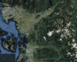
With this zip you get the opportunity to expand the Seattle region of your FU3 flight simulator up to Vancouver. The original region has 100 tiles (10x10) and the new region will hold 180 textured tiles (10x18). After all installation steps are done you will have a low resolution area from Coupeville Nolf up to Vancouver, but still better than OT texture. Everyone who's interested can obtain this set of megatiles with proper elevation and a basic scenery layout each one may take this to a more refined level later. Whether one elects to keep the basic textures or replace them with good orthophotos the terrain is there and new airports can be shared and used by everyone with an expanded high-res region. You will need 6 other files from the AVSIM library to prepare your game for this expansion, see readme file inside workfolder.
| Filename: | Flight_Unlimited_III_Seattle_Region_expansion_up_t.zip |
| License: | Freeware, limited distribution |
| Added: | 27th January 2011, 22:00:03 |
| Downloads: | 162 |
| Author: | Andre Meystre |
| Size: | 95.9 MB |
| Category: Flight Simulator X - Flight Plans | |
| OB-20 Holbrook AZ Low Altitude |
|
Images related to this file:
File Description:
FSX Flight Plan for OB-20 Holbrook AZ IFR high speed low altitude military training route. This is the fourth in a series of flight plans I will be uploading in the near future. This route goes through mostly flat and rolling terrain in Colorado, Utah, And Arizona. These are great routes for B-52, F-111, B-1B, B-2 A6, A4, Vulcan and any fighter or bomber enthusiasts. Of course you can fly the route with any aircraft of your choice. Included in this package are two spectacular gauges by Karol Chlebowski for TFR flying and Pave Tack which includes many advanced features for bombing, navigation and reconnaissance. These two gauges will greatly enhance your ability to fly these challenging routes and are a great companion of the flight plans. Another option to download Version 2.1 of my mini panel which has all this functionality and more.
| Filename: | OB20_Holbrook_AZ_Low_Altitude.zip |
| License: | Freeware, limited distribution |
| Added: | 9th July 2011, 05:56:49 |
| Downloads: | 226 |
| Author: | Bill McClellan |
| Size: | 984.16 KB |


© 2001-2026 AVSIM Online
All Rights Reserved
Privacy Policy |