
Where Flight Simulation Enthusiasts Gather from Around the World!
AVSIM Library - Search Results

| Category: Flight Simulator X - AFCAD Files | |
| Ekdahl Airport (NJ59), NJ |

|
File Description:
Located 04 miles S of Freehold, New Jersey, Ekdahl Airport is a private turf strip 1300' in length bordered closely by trees. This makes for an interesting landing as the 90' width of the runway is all the room you have to play with. However because it can be difficult to gauge your distance to trees and also because even the slightest brush with a tree can cause a crash, all trees immediately adjacent to the runway have crash disabled - mainly so you can turn your plane around if you land on Runway 02. The hard surface runway was removed so make sure your terrain mesh complexity is set as high as possible to get that bumpy ground realism. A windsock is listed as being available on this field but I could not locate it in any imagery and so placed it by default near the hangar building. You can start on the runways or parked in front of the hangar. Make sure your plane is capable of these take off and landing distances! Tree height around the field was not listed so I again used my best judgement from studying aerial photos. There is no fuel or parking for transient aircraft available. The field is not lit - daytime VFR operations only are recommended.
Scenery constructed with use of satellite images/streetview/aerial photos - the author has not been there in person.
This scenery is meant to be used in conjunction with MegaScenery Earth New Jersey/Delaware 002. It is not required, but apron use is minimized to allow satellite scenery to show through as much as possible, and objects are placed based on the MSE textures - lack of it may make scenery look out of place.
| Filename: | Ekdahl_Airport_NJ59_NJ.zip |
| License: | Freeware |
| Added: | 13th August 2011, 16:53:55 |
| Downloads: | 172 |
| Author: | Drew Sikora |
| Size: | 550.03 KB |
| Category: Flight Simulator 2004 - Scenery | |
| Cameri and Turbigo sceneries (rev. 3) - north Italy |
|
Images related to this file:
File Description:
The following files are required by this file:
http://library.avsim.net/esearch.php?DLID=163723&UploadID=&Name=&FileName=&Author=&CatID=root
http://library.avsim.net/esearch.php?DLID=186350&UploadID=&Name=&FileName=&Author=&CatID=root
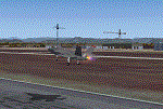
This scenery includes a global review of the previous Sceneries of Cameri Military airport (rev.2 Oct 2011), Cameri Museum (rev. 2 Oct 2011), Cameri Babini (rev. 2 oct 2011), Turbigo power station (rev. 2 Sep 2011 and update rev. 2.1 Oct 2014). All the above ARE NOW INCLUDED in this new unique scenery. Contents: Terrain in new version photo-realistic multi-seasons/night; adapted to Western Europe special elevation meshes; cover area of over 120 sqkm from Bellinzago-Oleggio (NW) to Magnago-Bienate (NE), from Novara (SW) to Cuggiono-Inveruno (SE); all the terrain has been restorated with 3D buildings, either through autogen that with specific dedicated objects (by GMax) and with significant addition of library objects ("dva51" and other existings). This scenery (located on the final approach to the Milan Malpensa international airport) includes the Cameri's Mil Airport with the Babini closed Army area and the planes of the Historical Museum of the airport; it is also included the thermoelectric power station of Turbigo. All the buildings are placed to recreate cities and villages covered in the photo-realistic terrain, including Bellinzago, Bienate, Buscate, Caltignaga, Cameri, Castano Primo, Castelletto Ticino, Cuggiono, Galliate, Inveruno, Magnago, Malvaglio, Nibbia, Novara, Oleggio, Pernate, Robecchetto, Romentino, Sant'Anna, San Pietro Mosezzo, Turbigo , Vanzaghello, and the covered Turin-Milan highway.
Details of the new buildings for the care and maintenance to F35 completely recreated, as obtainable from the current satellite view.
It REQUIRES the use of the following, to be downloaded separately :
- the libraries dva51 - the system of vegetations TreePlanter - the West Europe Meshes of Daniele Lanfranchi. See the Readme file. Enjoy!
Videos available here:
https://dl.dropboxusercontent.com/u/38829151/FS9/Cameri_Turbigo_v3%20shots.WMV
http://youtu.be/yVI2KeJKS5o
http://youtu.be/oKa0e_5kxIk
| Filename: | Cameri_and_Turbigo_sceneries_rev_3__north_Italy.zip |
| License: | Freeware |
| Added: | 21st January 2015, 21:32:36 |
| Downloads: | 994 |
| Author: | Aldo Della Vedova, Daniele Lanfranchi and Gian Mario Verga |
| Size: | 103.7 MB |
| Category: Civil Flight Simulators - Micro Flight | |
| Micro Flight 5 |
|
File Description:
Micro Flight is a state of the art flight simulator specializing in simulating ultralight flying vehicles and micro meteorological conditions.
Unlike other flight simulators, Micro Flight simulates the intricate flow of air over the ground and the effects of thermals created by the sun, making it ideal for simulating gliders of all types.
Micro Flight also simulates types of vehicles not simulated by other general aviation programs, such as: Hanggliders, Paragliders, Gyroplanes, Helicopters, Trikes, Balloons and more.
Flight instrumentation and navigational aids were made to resemble real ones, this includes the hand held GPS, standard flight instruments, head up display and more.
The whole enviroment which the user interacts with is three dimentional, even operating the instruments in the cockpit is made by manipulating them with the mouse and not just by pressing keys.
The terrain model used is detailed and optimized, giving the terrain a photorealistic look while still maintaing a high frame rate during run.
The program supports a wide variety of scenery formats, and can import aerial photography and USGS digital elevation data directly.
The program includes flight recording and anaylis, giving the user the ability to study the flight in detail and export it's path in digital form for any purpose.
The program has netplay mode which enables users to fly and communicate with each other.
All this and more make the program a unique and valueable tool for flight simulation.
Copyright Ilan Papini 1999 - 2004 ©
| Filename: | Micro_Flight_5.zip |
| License: | Commercial demo |
| Added: | 16th December 2004, 04:03:44 |
| Downloads: | 543 |
| Author: | Ilan Papini |
| Size: | 6.46 MB |
| Category: Flight Simulator 2004 - Scenery | |
| Hong Kong Kai Tak 1963 |
|
File Description:
This is Kai Tak airport as it was in 1963. Kowloon Bay has yet to be filled in, and the runway is only 8405 ft long. Includes mesh files by Holger Sandmann and charts of the era scanned by Chic Eather. Navaids backdated to the early 60's, except the IGS for runway 13 is included although not actually installed until 1974. Curving approach lights will help you find the runway. Chek Lap Kok airport has been removed. The IGS and other approaches created by Jim Vile. The AI aircraft will follow the curved approach to runway 13 in good weather or bad. Please note that Jim Vile has produced a modern version of this airport (kaitak98.zip).
| Filename: | Hong_Kong_Kai_Tak_1963.zip |
| License: | Freeware, limited distribution |
| Added: | 27th April 2006, 02:02:13 |
| Downloads: | 15,210 |
| Author: | Tom Gibson and Jim Vile |
| Size: | 5.74 MB |
| Category: Flight Simulator X - Scenery | |
| Archipelago of St-pierre & Miquelon (non-flat airport) |
|
File Description:
"The archipelago of St Pierre (LFVP) and Miquelon (LFVM)".
Theses islands are situated in the south of New Foundland island, beetwin Canada and United States.
All the archipelago is made up of a new local mesh, landclass, photorealists textures in 2m/pixel in St-Pierre island (4 seasons and the night) with specific autogen, the harbour, various buildings, churches, and reference marks
visual.
The airport of St-Pierre (LFVP) is created with a non-flat runway, as it
is in reality, whith a true lenght profil.
A basic mission named "De Miquelon à St Pierre" is placed at "beginner"
level for discover easely the archipelago.
This scenery is only for FsX and is not compatible with Fs 2004 (Fs9)."
| Filename: | Archipelago_of_Stpierre__Miquelon_nonflat_airport.zip |
| License: | Freeware, limited distribution |
| Added: | 4th July 2008, 16:11:23 |
| Downloads: | 3,937 |
| Author: | Marc-henri Guitteny |
| Size: | 17.41 MB |
| Category: Flight Simulator 2004 - AFCAD Files | |
| Puerto Vallarta, Mexico (MMPR) |
|
File Description:
AFCAD for the Puerto Vallarta Mexico Airport (MMPR) and Mesh released on August 19th, 2005 by José Luis Águila Boudib.
This AFCAD includes most gates and parking as close to real life as I could get it. I used some photos on the internet to get the real layout. Once you install this, the airport should come to life (provided you have the AI aircraft/schedules) with aircraft from AeroMexico, Mexicana, Aero California, Magnicharters and Azteca, as well US carriers like Delta, Continental, Alaska and American Airlines.
The G/A apron still needs expanding to look like the real MMPR, but I kept it within the fence in the scenery by Jose Luis.
| Filename: | Puerto_Vallarta_Mexico_MMPR.zip |
| License: | Freeware |
| Added: | 21st August 2005, 04:03:40 |
| Downloads: | 1,928 |
| Author: | Jeffrey S. Bryner |
| Size: | 3.47 KB |
| Category: Orbiter - Spaceships | |
| Hubble Space Telescope Update 1 |
|
File Description:
This is an update to the Hubble Space Telescope that comes with the 031105 build of ORBITER. It has the following upgrades:
-New mesh
-Correct behaviour of the Solar Arrays
-Axial Bay1 door animation
-Berthing and Postioning System(BAPS) meshes. This is the work cradle that the HST is placed on during the service missions. I also included the BAPS config that was used on the deployment mission, STS-31.
-The Solar Arrays can now be rotated using CTRL-R.
=== Known bugs ===
-The Axial Bay1 door and the Solar Array rotation is not saved after quiting ORBITER. Why?
=== Animation keys ===
Solar Array folding: CTRL-O
Solar Array rotation: CTRL-R
Hi-gain antennas: CTRL-A
Apeture door: CTRL-H
| Filename: | Hubble_Space_Telescope_Update_1.zip |
| License: | Freeware |
| Added: | 7th November 2003, 16:44:23 |
| Downloads: | 1,185 |
| Author: | David Sundstrom (Orbiter Fan) |
| Size: | 252.96 KB |
| Category: Flight Simulator 2004 - Gauges | |
| Apollo MX20 Multi-Function Display/GPS |
|
File Description:
This gauge is modeled after the Apollo MX20 Multi-Function Display. This gauge is written in XML and is designed to mesh with the default FS9GPS map input data. Compatible with FS2004 (FS9) ONLY!
Although I tried to make this gauge as close to the real Apollo MX20 as possible it is not considered to be an exact replica. It is limited to certain features that the FS9 data will provide. It does however have all the great features that the default FS9GPS offers and offers an alternative to the default GPS.
Size (pixel size) is the same as the FS9 default GPS so placement (or replacement) of the gauge is quick and easy.
| Filename: | Apollo_MX20_MultiFunction_DisplayGPS.zip |
| License: | Freeware |
| Added: | 24th December 2003, 05:29:16 |
| Downloads: | 9,189 |
| Author: | Keith Giveans |
| Size: | 156.91 KB |
| Category: Flight Simulator 2004 - Scenery Design | |
| Update of Turbigo's Power Station - VFR LIMC Malpensa, Italy |
|
Images related to this file:
File Description:

This scenery has been revised with complete new ground that solves the previous flickering problems; some objects, buildings and trees have been added. It DOES NOT INCLUDE any airport. Scenery requests Tree_v3 library; a special re-mesh file has been included, for users of special meshes (i/e Ragot Alps or Lod11)
Infos: the Turbigo's power station is placed approx 8 miles South LIMC Malpensa international airport of Milan, on the usual approach way for runways 35L and 35R.
content: new complete image of the ground; power station blocks 1, 2 & 3 with related 4 stacks with lights & smokes; boilers, esp, some ductworks & pipes, oil tanks, water treatment basins, bridges, some buildings and trees
| Filename: | Update_of_Turbigos_Power_Station__VFR_LIMC_Malpensa_Italy.zip |
| License: | Freeware |
| Added: | 25th September 2011, 14:39:16 |
| Downloads: | 1,797 |
| Author: | Aldo Della Vedova & Daniele Lanfranchi |
| Size: | 3.05 MB |
| Category: Flight Simulator 2004 - Scenery | |
| Puglia - Castel del Monte |
|
Images related to this file:
File Description:
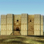
Re-Upload. I only upload this scenery that I downloaded from avsim before its crash. I'm not the original author but rather thank D. Benvenuti.
"NEW: more accurate dimensions (I hope within 1 meter or less)
Famous Frederick II castle in Puglia, near ANDRIA. It represented also in italian 1 eurocent coin.
For FS2002 and FS2004, best with Italy Landpack 4 and an accurate mesh scenery (such as Mauri's one).
Install it in an active scenery folder (or create a new one and make it active), casteldelmonte.bgl in the scenery folder and casteldelmonte.bmp in the texture one."
Made with EasyObiectDesign and AirportForWindows 2.60 - Copyright D.Benvenuti 2005 - Not for commercial use
| Filename: | Puglia__Castel_del_Monte.zip |
| License: | Freeware |
| Added: | 5th August 2011, 14:51:50 |
| Downloads: | 559 |
| Author: | D. Benvenuti |
| Size: | 115.77 KB |


© 2001-2026 AVSIM Online
All Rights Reserved
Privacy Policy |