
Where Flight Simulation Enthusiasts Gather from Around the World!
AVSIM Library - Search Results

| Category: Flight Simulator 2004 - Scenery | |
| Cessnock and Hidden Valley Farm, NSW, AUSTRALIA. |

|
File Description:
CESSNOCK just a short 25 minute flight from Sydney. Cessnock
was once the center of a large coal mining industry, is now
one of the main jumping off points for the wine growing district
of the Hunter Valley. HIDDEN VALLY FARM is your destination
for that "rural" type getaway. The grass strip will accomodate
single and twin engined aircraft. If your really good, try the Lear.
Directions to the farm at Cessnock and Warnervale (warn2004.zip) airports.
For use with or without SATPAC mesh scenery.
Textured required are Airport 2.6, VOD, Nova and Nova Gold.
| Filename: | Cessnock_and_Hidden_Valley_Farm_NSW_AUSTRALIA.zip |
| License: | Freeware |
| Added: | 4th June 2004, 14:03:01 |
| Downloads: | 2,053 |
| Author: | Clive Marriott |
| Size: | 3.34 MB |
| Category: Flight Simulator 2004 - Scenery | |
| Scenery Fuerstenfeldbruck - Airbase ETSF (Germany) Vers. 2 |
|
File Description:
This is the second version of the also by general aviation used Airbase ETSF "Fürsty" in southern Germany.
This new version includes:
» completely new designed hangars, some of them with controllable hangardoors.
» a new controll-tower.
» the buildings of the official school for the German Air Force.
» interactive air-marshallers.
» an improved airport-layout.
» the radio-tower of Schoengeising as a landmark for VFR-Flights.
» an exact landclassfile for the surroundings of the airbase.
It also includes some GA-AI-Traffic.
Compatible with MyWorld2004-Landclass and Werner Vogts "SRTM scenery mesh".
| Filename: | Scenery_Fuerstenfeldbruck__Airbase_ETSF_Germany_Ve.zip |
| License: | Freeware, limited distribution |
| Added: | 11th June 2004, 19:54:39 |
| Downloads: | 7,686 |
| Author: | Johannes Oelmaier |
| Size: | 2.53 MB |
| Category: Flight Simulator 2004 - Scenery | |
| Reservoirs and Lakes of Lesotho and Western Natal, South Africa |
|
File Description:
Replacement files for water bodies of eastern South Africa, in and near the Drakensberg Range (S28.1-29.5 E28.3-30.0). Natural and man-made lakes are now in their accurate position and elevation. Includes the Katse Dam reservoir in Lesotho as well as about 100 smaller lakes in Lesotho and western Natal not present in the FS default scenery. Based on a watermask derived from Landsat 7 ETM+ satellite data and compiled with a beta version of Jim Keir's "Slartibartfast" utility. Meant to be used with the Aeroworx SRTM LOD9 South Africa mesh.
| Filename: | Reservoirs_and_Lakes_of_Lesotho_and_Western_Natal_.zip |
| License: | Freeware, limited distribution |
| Added: | 8th May 2004, 02:43:38 |
| Downloads: | 6,203 |
| Author: | Holger Sandmann, Aeroworx |
| Size: | 464.27 KB |
| Category: Flight Simulator 2004 - AI Flight Plans | |
| Aero Tropics AI package Supplement |
|
File Description:
AERO TROPICS AI PACKAGE - SUPPLEMENT
This package is a supplement to "aerotropics.zip" (REQUIRED) posted on 7th August 2004
A new AFCAD for Darnley Island (YDNI) is included. This is only required if using the Australia STRM mesh by Andy Weir. If you are using default scenery, DO NOT use this AFCAD.
My apologies for omitting the airport list from the previous package. They are now listed here.
The IATA code "NLF" mysteriously crept into the previous flightplan. That has been replaced by the correct ICAO code of "YDNI".
| Filename: | Aero_Tropics_AI_package_Supplement.zip |
| License: | Freeware, limited distribution |
| Added: | 11th August 2004, 17:53:40 |
| Downloads: | 641 |
| Author: | Mal Lloyd |
| Size: | 6.87 KB |
| Category: Flight Simulator 2004 - Scenery | |
| Cuba Archipelago: Cayo Largo and Cayo Coco trees |
|
Images related to this file:
File Description:
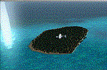
Dear Friends simmer of eternal fs 2004, with this job i want to i wanted as much as possible, increment the realism of default scenery of Cayo Largo and Cayo Coco fs 2004 using bgl of 'friend Gianluca Giovannini. I suggest to use some Cuba mesh freeware or payware. Down the lane I also Needless to say, the effect with the scenery taxi2gate (payware) is really better, but you can find a good scenery in the web.
Happy Flights and greetings from Italy, Fabio "fafoair" ferrari, Castione Presolana Bergamo.
| Filename: | Cuba_Archipelago_Cayo_Largo_and_Cayo_Coco_trees.zip |
| License: | Freeware, limited distribution |
| Added: | 14th March 2013, 04:12:34 |
| Downloads: | 907 |
| Author: | Fabio Ferrari "fafo air" |
| Size: | 4.94 MB |
| Category: Flight Simulator X - Scenery | |
| Falklands_2007 ** REPOST ** |
|
File Description:
Welcome to Falklands 2007 for Flight Simulator X.
This scenery has been released to commemorate the liberation of the Falkland Islands 25 years ago.
The scenery replaces the default mesh, landclass, coastlines and models with completely new and hand built components.
There are 325 ponds, not including the Black Tarn and Colorado ponds; my apologies if I have inadvertently missed out your favourite fishing hole!
There are 40 rivers.
There are 42 road segments.
There are 89 beaches.
There are 240 separate islands (not including the East and West Falklands themselves).
| Filename: | Falklands_2007__REPOST_.zip |
| License: | Freeware |
| Added: | 2nd June 2016, 15:40:58 |
| Downloads: | 1,916 |
| Author: | Brian Jamieson |
| Size: | 10.06 MB |
| Category: Flight Simulator 2004 - Scenery | |
| KCRW - Kanawha River Valley - West Virginia, USA |
|
Images related to this file:
File Description:

This scenery is made to blend with autogen scenery and the defaults of FS9. Transits crossing the southern Allegheny Mountains will follow this valley seeing some of the landmark bridges and dams of the central WV area. The New river bridge scenery is not included in this package because (not only my own version which works default mesh), but another fellow has made one. It also fits with this package and looks real good. This package blends well with default or compliments my Land Class Central Appalachia package.
| Filename: | KCRW__Kanawha_River_Valley__West_Virginia_USA.zip |
| License: | Freeware |
| Added: | 9th July 2015, 17:26:13 |
| Downloads: | 228 |
| Author: | Rick Connolly |
| Size: | 2.33 MB |
| Category: Flight Simulator 2004 - Scenery | |
| North Cascades Landscape Enhancements for Vancouver+ |
|
File Description:
This is a re-issue of my previously published landscape enhancement package for the North Cascades of northwestern Washington State, us_wa_nc.zip. These files have been edited and adjusted to be fully compatible with FSAddon's "Vancouver+ Part1" product and can be used with or without FlightOne's Ultimate Terrain USA or Canada/Alaska installed. Also included are batch files to remove incompatible flatten files from Richard Goldstein's Georender 4 "Darrington Muni", published by LAGO. Please note: don't use this package unless you have a registered copy of "Vancouver+" by FSAddon!!!
| Filename: | North_Cascades_Landscape_Enhancements_for_Vancouve.zip |
| License: | Freeware, limited distribution |
| Added: | 19th December 2005, 21:42:33 |
| Downloads: | 4,165 |
| Author: | Holger Sandmann |
| Size: | 11.66 MB |
| Category: Flight Simulator 2004 - Scenery | |
| Guelph Air Park CNC4 |
|
File Description:
This is another "must Have" for the General Aviation VFR flyer in Ontario, Canada. Guelph Air Park CNC4 is a Pilot Tranining airport and situated close to Kitchener-Waterloo(CYKF), Toronto Pearson(CYYZ) and Hamilton International(CYHM).
Guelph is also the home of the "TIGER BOYS", vintage aircraft restorers and pilots. A great history document by resident pilot Glenn Norman is included in the download.
This scenery is set to line up with Ultimate Terrain Canada/Alaska or Joel's Roads but neither of these is an absolute necessity.
| Filename: | Guelph_Air_Park_CNC4.zip |
| License: | Freeware, limited distribution |
| Added: | 20th January 2006, 05:31:02 |
| Downloads: | 4,101 |
| Author: | Al Gay - Flight Ontario |
| Size: | 12.65 MB |
| Category: Flight Simulator 2004 - Scenery | |
| Idaho County S80 Airport |
|
File Description:
Another small airport in beautiful Idaho. Near the mountains but not in them, this airport offers easy access and 24 hour operation. The airport NOTAM mentions skydiving activity, so I'm guessing the large circular dirt area is a landing target for the skydivers. All aprons were redrawn and buildings replaced according to better match Google Earth images. The landclass was modified to reduce the nearby city to a more realistic size and replace the farmland surrounding the airport.
This scenery was designed for Ultimate Terrain and may or may not work with the default scenery.
| Filename: | Idaho_County_S80__Airport.zip |
| License: | Freeware |
| Added: | 27th July 2008, 11:51:45 |
| Downloads: | 494 |
| Author: | Sidney Schwartz |
| Size: | 651.96 KB |


© 2001-2026 AVSIM Online
All Rights Reserved
Privacy Policy |