
Where Flight Simulation Enthusiasts Gather from Around the World!
AVSIM Library - Search Results

| Category: Flight Simulator X - Scenery | |
| Cerklje Ob Krki - LJCE |

|
File Description:
Cerklje ob Krki Airport (Slovene: Letališče Cerklje ob Krki) is the only military airport in Slovenia, and a civilian airport.The Cerklje ob Krki Air Base operates at it. The airport is in the midst of an enlargement and restructuring.
---------------------------------------------------------------------
The scenery of Cerklje Ob Krki - LJCE has been designed using ADE. Design is intended to be used with ORBX Global, and ORBX Vector.
Usage of default landclass and scenery objects is intended to achieve integrity with default FSX terrain.
| Filename: | Cerklje_Ob_Krki__LJCE.zip |
| License: | Freeware |
| Added: | 4th February 2025, 20:02:23 |
| Downloads: | 50 |
| Author: | Dawid Drobik |
| Size: | 1.75 MB |
| Category: Flight Simulator 2004 - Gauges | |
| TerraVue: Moving Map, Ground Proximity, Information pages |
|
File Description:
FS2004 Gauge: TerraVue. This gauge contains a moving map display with a terrain elevation legend color-keyed to the FS9 map. The legend allows the elevation of terrain lying ahead of the aircraft to be taken into account. TerraVue can display the FS map in seven ranges from 4 NM to 160 NM. The Map mode also employs animation to show the proximity between the aircraft and ground in a graphical and digital display with indicators showing whether the distance is increasing or decreasing. The gauge can be switched to the Information mode which will display up to four individual pages of data that is created by you. These scrollable pages may contain checklists, airport diagrams, approach plates, strip charts, etc. Fully functional, free software to help quickly construct these pages is included along with an illustrated tutorial that demonstrates the simple copy/paste process that tailors these pages to include whatever data you wish. For panel or separate window installation with TerraVue Icon gauge. By Glenn Copeland
| Filename: | TerraVue_Moving_Map_Ground_Proximity_Information_p.zip |
| License: | Freeware |
| Added: | 24th June 2006, 15:13:12 |
| Downloads: | 5,075 |
| Author: | Glenn Copeland |
| Size: | 1.92 MB |
| Category: Navigation and ATC - Navigation | |
| LSZS - Samedan visual approach chart v3 |
|
Images related to this file:
File Description:
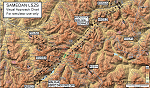
Custom made visual approach chart and pilot's briefing for Engadin (St. Moritz) Samedan LSZS airport in Switzerland, Europe's highest elevation airport (5,600 ft.) situated in the Swiss Alps. This airport is a day VFR operations only and has no instrument approach due to extreme terrain around it. A demanding visual descent into a canyon, in between steep rising terrain, is required to make the visual approaches for both runways with a steep 4.4* degrees final approach portion guided by the PAPI's. Still, executive jets up to Boeing 737(BBJ) size approach the airport often in the winter peak season VFR with these procedures. It is designed as per real operators' pilot briefing for Samedan. Real airport's full pilot briefing document also included. The real airport's excellent briefing (included) intentionally does not contain the maneuvers needed for the approach of jets through the mountains but only reporting points for all and maneuvers for light aircraft only. This gap is what this chart covers. Version 2 chart included better graphics and refined visual procedure for jets and version 3 now includes real pilot's briefing guide.
| Filename: | LSZS__Samedan_visual_approach_chart_v3.zip |
| License: | Freeware, limited distribution |
| Added: | 20th March 2015, 23:35:11 |
| Downloads: | 2,026 |
| Author: | Kyprianos Biris |
| Size: | 7.1 MB |
| Category: Flight Simulator 2004 - Scenery | |
| Mangalore Airport VOML |
|
File Description:
This scenery models Bajpe Airport, Mangalore (VOML) in Southern India (as seen in 2004). Works best when combined with my "India_76m-Mesh_Part_A" available at the AVSIM library.
Mangalore airport is known for it's infamously short runway that sits on top of a table-top mountain. This is modelled quite accurately in my mesh for Southern India. There have been quite a few near miss incidents in the past 20Yrs. So, if you're flying big tin, don't forget to step on the brakes ;-)
| Filename: | Mangalore_Airport_VOML.zip |
| License: | Freeware |
| Added: | 21st January 2006, 22:36:44 |
| Downloads: | 2,872 |
| Author: | Keith Sebastian |
| Size: | 169.52 KB |
| Category: Flight Simulator X - Scenery | |
| Courchevel Airport Scenery v1.0 |
|
File Description:
This is some very high detail scenery with some outstanding animations that include people walking around the airport, smoke emitting from chimneys, AI aircraft with flight plans specially made for the scenery, new airport mesh, New runway angle, Extra trees around air airport, Can crashes on the roads, custom buildings built in Gmax, an in-depth manual explaining the features of the scenery and also how to install the scenery, All the textures are merged into the BGL file, and much, much more.
| Filename: | Courchevel_Airport_Scenery_v10.zip |
| License: | Freeware |
| Added: | 7th October 2007, 18:03:26 |
| Downloads: | 10,991 |
| Author: | Steven Frost |
| Size: | 2.92 MB |
| Category: Flight Simulator 2004 - Scenery | |
| Tibet Scenery v9.3 |
|
File Description:
This is very likely the final version of the Tibet AddOn Scenery for Microsoft Flight Simulators FS2004 both missing airports in Tibet ZULS LXA Lhasa Gongkar Airport (other names: Gonggar, Gonga) and ZUBD BPX Changdu International Airport (other names: Bangda, Bamda, Pomda, Qamdo). Includes Potala Palace, seasonal textures and new terminal at Lhasa. Corrected river and mesh. Now ready for AI traffic. Requires AFCAD files (download info in readme.txt). Please read the new installation manual in the readme.txt (english/german).
| Filename: | Tibet_Scenery_v93.zip |
| License: | Freeware |
| Added: | 29th November 2003, 11:45:36 |
| Downloads: | 3,938 |
| Author: | Jan Martin |
| Size: | 416.3 KB |
| Category: Flight Simulator 2002 - Scenery | |
| Olympic National Park Bush Scenery |
|
File Description:
Ultra-challenging bush scenery set in Washington state's Olympic National Park, just west of Seattle. Consists mainly of small mountain lakes to test the skills of floatplane pilots, but there is also a special sloping airstrip for regular planes. There are 2 groups of scenery included: one on Mount Olympus itself, and the other just a few miles North of Emma Field in the southeast corner of the Park. Requires Steve Greenwood's Olympic National Park/Emma Field mesh (fst-30m10-wa-ef.zip).
| Filename: | Olympic_National_Park_Bush_Scenery.zip |
| License: | Freeware |
| Added: | 28th January 2003, 17:26:26 |
| Downloads: | 1,286 |
| Author: | James Belk |
| Size: | 3.04 MB |
| Category: Flight Simulator 2002 - Scenery | |
| Fish Lake Fix |
|
File Description:
This is a fix for the FS2002 default scenery that surrounds the airport at fish lake USFS in Idaho. It also works with Denney's mesh (originally created for FS2000, but works fine in FS2002). The default scenery has fish lake that is situated at the approach end of of runway 21 elevated about fifty feet above the elevation of the airport. This scenery .bgl flattens the lake area to make the approach to runway 21 as it is at the real airport.
| Filename: | Fish_Lake_Fix.zip |
| License: | Freeware |
| Added: | 22nd May 2003, 21:18:32 |
| Downloads: | 362 |
| Author: | Tim Slanczka |
| Size: | 209.95 KB |
| Category: Flight Simulator 2004 - Scenery | |
| New Airport for Canadian Mountain Parks Pack |
|
File Description:
FS2004 Scenery - This file adds 1 new airport to Canadian Mountain Parks Pack (cmpcanmtpks_v1.zip available at AVSIM) . Required is: cmpcanmtpks_v1.zip, Holger Sandmann's excellent BC mesh, which was the original reason for these files in the first place, and Lago's FSE demo file. Pack designed for low level visual 30 mile scenic flights. The strip is ficticious, but the names and places are real. There is parking for you to add your own AI traffic as well. One flight included.
| Filename: | New_Airport_for_Canadian_Mountain_Parks_Pack.zip |
| License: | Freeware |
| Added: | 27th April 2004, 17:53:12 |
| Downloads: | 710 |
| Author: | Peter Vibe |
| Size: | 296.49 KB |
| Category: Flight Simulator X - Scenery | |
| Anegada, British Virgin Islands |
|
File Description: Anegada, British Virgin Islands,
including
the correct redefinition of coasts and landscape
-airport: Capt Auguste George (TUPA) ville :The Settlement
running Window XP and Vista: FSX SP1 and SP2
Please Note:
This scenery works with the MESH in LOD 10 (30 m) of Caribbean arc that I have
generated from Nasa GDEM and deposited on the same web site files in a file
named Meshantilles.zip
| Filename: | Anegada_British_Virgin_Islands.zip |
| License: | Freeware |
| Added: | 26th July 2013, 17:22:11 |
| Downloads: | 1,107 |
| Author: | Valladier Jean Louis |
| Size: | 45 MB |


© 2001-2026 AVSIM Online
All Rights Reserved
Privacy Policy |