
Where Flight Simulation Enthusiasts Gather from Around the World!
AVSIM Library - Search Results

| Category: Flight Simulator X - Scenery | |
| SVSZ - Santa Barbara del Zulia - Zulia State, Venezuela |

|
Images related to this file:
File Description:
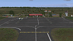
The "Miguel Urdaneta Fernandez" National Airport serves the cattle town of Santa Barbara del Zulia, located south of Lake Maracaibo in Zulia state. Serves air link between South Lake region and the capital of Zulia state, Maracaibo. Photo-terrain area improved with Autogen files. Only compatible with versions to FSX or P3Dv1v2v3.x. Also includes a friendly Auto-Install.
| Filename: | SVSZ__Santa_Barbara_del_Zulia__Zulia_State_Venezue.zip |
| License: | Freeware |
| Added: | 11th July 2016, 08:43:02 |
| Downloads: | 451 |
| Author: | David Maldonado |
| Size: | 58.41 MB |
| Category: Flight Simulator 2004 - Scenery | |
| Laguna del Sauce Airport, Punta del Este (SULS), Uruguay |
|
Images related to this file:
File Description:
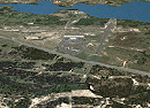
Photorealistic scenery of Laguna del Sauce / Curbelo (SULS) International Airport in Maldonado, Uruguay, version 1. This is the airport that serves the well-known beach resort of Punta del Este. This scenery package includes the airport facilities with the passenger terminal, general aviation area and the naval airbase on the banks of Laguna del Sauce lake. Several buildings and vehicles belonging to the airport have been recreated. Also included is the area around the airport recreated as photorealistic terrain with seasonal variations at a 4. 75 m/pixel resolution. Certain parts of the airport have been recreated with a 2 m/pixel photorealistic terrain. The aim of this scenery is to simulate flying to and around the airport under instrument flight rules (IFR) and also visual flight rules (VFR).
| Filename: | Laguna_del_Sauce_Airport_Punta_del_Este_SULS_Urugu.zip |
| License: | Freeware |
| Added: | 9th June 2010, 02:48:12 |
| Downloads: | 1,471 |
| Author: | "A Vuelo de Pajaro" / "As the Bird Flies" Design Group members: Diego Altgenug, Daniel Gazzano, Alan Pereira Pierce, Juan Pablo Simonet |
| Size: | 13.81 MB |
| Category: Flight Simulator 2004 - Scenery | |
| Calgary Alberta and Local Area Scenery |
|
File Description:
Calgary, Alberta, Canada
Version 1.1
This version contains the same 58 downtown buildings including the Calgary Tower and over 40 of the largest buildings, as of September, 2006. There are no new buildings in this version but several scenery (terrain) files have been added which replace Microsoft's default scenery for the Calgary area. This allows all the downtown buildings to be moved to their proper location rather than sitting in the default Bow River which looked more like a long lake. This version should work with Ultimate Terrain and other add on scenery files such as Holger Sandmann's bcmesh9e. Other enhancements include some VFR scenery based on the VFR Terminal Area Chart for Calgary, a more realistic Bow River, Elbow River, Glenmore Reservoir, Chestermere Lake and Ghost Lake.
| Filename: | Calgary_Alberta_and_Local_Area_Scenery.zip |
| License: | Freeware |
| Added: | 18th May 2010, 02:18:28 |
| Downloads: | 1,565 |
| Author: | Rick Engler |
| Size: | 713.92 KB |
| Category: Flight Simulator 2004 - Scenery | |
| Repost of St Jovite CSZ3 in Quebec Canada |
|
File Description:
This post is to get rid of an elevation problem I just noticed, and also to supply the revised AFCAD file.
St Jovite is a grass strip in Quebec near the town of St Jovite and Mont Tremblant tourist area. This version is intended for use with Ultimate Terrain, and I made it because I found that the original FS version and the one made by Leon Louis both clashed with Lac Ouimet, and with the float base scenery I had made there. There is no fuel or oil or maintenance available, but the grass runway is in excellent condition. I made one of my first trips from Rockcliffe to St Jovite, and found it a great destination. You probably need Ultimate Terrain for this to work, but it might work without.
| Filename: | Repost_of_St_Jovite_CSZ3_in_Quebec_Canada.zip |
| License: | Freeware |
| Added: | 15th February 2009, 15:44:14 |
| Downloads: | 364 |
| Author: | Roger Wensley |
| Size: | 850.54 KB |
| Category: Flight Simulator 2004 - Scenery | |
| AirFolies Casorezzo airfield, Italy - Revision 1 for VFR flights |
|
Images related to this file:
File Description:

Complete revision of previous "Casorezzo" scenery, realized on the real coordinates of the airfield including some buildings to real image. This review includes photo-realistic terrain multi-seasons/night. It requires the use of the "dva51" libraries and the "TreePlanter" system for vegetation; it is also realized with West Europe Elevation Meshes by Daniele Lanfranchi. Information: It represents the airfield "Air Folies" for ultralight of Casorezzo (MI), for trikes and other ultralights. Scenery contains a terrain 7x8 km, from Olcella (NW) to Parabiago west (NE), from Marcallo con Casone (SW) to Vittuone west (SE).
The airfield is located at 20 km NWW Milan, in the municipality of Casorezzo (N45.533199, E8.900685); grass runway of 280 m; Code: MICA. Enjoy!
Presentation video available here: http://youtu.be/8CfXr_hVWPU
| Filename: | AirFolies_Casorezzo_airfield_Italy__Revision_1_for.zip |
| License: | Freeware |
| Added: | 10th March 2015, 17:18:56 |
| Downloads: | 308 |
| Author: | Aldo Della Vedova - Daniele Lanfranchi |
| Size: | 76.45 MB |
| Category: Flight Simulator 2004 - Scenery | |
| Portland KPDX 2010 scenery for FS9 |
|
Images related to this file:
File Description:
Portland KPDX 2010 is a highly detailed and accurate replacement for the default FS9 KPDX scenery. The airport has been completely rebuilt and includes:
* All new taxiways, aprons, roads, buildings and parking areas, covering the airport itself and extending east along Airport Way to the I205 bridge.
* Custom terminal with accurate placement of jetways, gate numbers, ramp lighting and other features, including the Horizon Air terminal extension.
* Custom versions of the old short-term and recently completed long-term parking structures.
* Custom version of the very cool Horizon Air engine runup structure.
* The I205 bridge has been moved to its correct location. If you are using Ultimate Terrain the bridge and roads will now line up.
* Photo textures used wherever feasible.
Peter Ham made the excruciatingly detailed AFCAD and placed the zillions of scenery objects. Sidney Schwartz made the stunningly attractive custom scenery objects. This project represents many hours of work on our part, and we hope you enjoy using it as much as we enjoyed making it. This scenery was designed to work in conjunction with Ultimate Terrain. If you do not have Ultimate Terrain, some of the roads will probably be misplaced, but everything else should work OK.
| Filename: | Portland_KPDX_2010_scenery_for_FS9.zip |
| License: | Freeware |
| Added: | 25th November 2010, 14:19:19 |
| Downloads: | 5,709 |
| Author: | Sidney Schwartz & Peter Ham |
| Size: | 4.33 MB |
| Category: Flight Simulator X - Scenery | |
| KFHR Friday Harbor Photoreal |
|
Images related to this file:
File Description:
This Scenery consists of the FSX default airport of Friday Harbor, set on photorealistic terrain. Although the scenery has been compiled with night masks, night terrain has been excluded to reduce the file size. It has been designed for Megasceneryearth photorealistic scenery of the San Juan Islands but will also work with the default terrain. Seasonal variations are not included. The main scenery file has been subdivided into several smaller files, which can be switched off according to user preference. Full night textures are included with wash lighting in the terminal and carpark areas. All buildings have been custom modelled using real photographs, and include open hangers with interiors.
Next to the fuel station you will find Ernie's Cafe, much loved by resident and visiting pilots. Close to the airport you will find US style houses modelled on real photographs from the San Juan island. Surfaced airport taxiways and aprons have been kept to a minimum to allow the photoreal textures to show through. The scenery also includes sound effects and high definition people, these can be switched off if they place too much strain on your system. Please enjoy, and I hope you like my scenery as much as I enjoyed making it.
| Filename: | KFHR_Friday_Harbor_Photoreal.zip |
| License: | Freeware, limited distribution |
| Added: | 9th January 2012, 00:46:11 |
| Downloads: | 4,073 |
| Author: | George Keogh |
| Size: | 65.88 MB |
| Category: Flight Simulator X - AFCAD Files | |
| PAKT - Ketchikan airport - Ketchikan, Alaska - USA |
|
Images related to this file:
File Description:
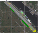
This AFCAD requires payware "Ultimate Terrain Alaska X"!! It will not work without it as it is built on the underlying terrain features and the included file "PAKT_AP.BGL" which has to be renamed or moved to a folder outside the FSX terrain environment. The original file included some errors which I tried to correct. This patch is published with permission.
Changes: The apron layout is corrected including now taxiway "C" leading to GA parking. The pavement has been changed to asphalt as it appears to be when taking aerial pictures as template. The runway got the proper overruns at both sides and the position of the ILS glideslope and localizer has been corrected as well as the DME. The layout of the airport building arrangement including the tower should be now closer to the real world and I added a working jetway. However, I used FSX default objects. As I was dependent on quite rare layout information I just tried to adjust the taxi paths and parking spots probably closer to the reality than before but I did not put any effort to name the parking spots like in real life nor did I take care for taxi signs (only the runway entries got such).
| Filename: | PAKT__Ketchikan_airport__Ketchikan_Alaska__USA.zip |
| License: | Check within download |
| Added: | 25th May 2013, 19:40:38 |
| Downloads: | 439 |
| Author: | Axel Birsul |
| Size: | 1.28 MB |
| Category: Flight Simulator X - AFCAD Files | |
| Weiss Farm Airport (JY24), NJ |
|
File Description:
Located 02 miles W of Allamuchy, New Jersey on 264 acres of land, Weiss Farm Airport is a private turf strip 1800' in length. The published width is 50' but you really have closer to 100' to play with. There are no services offered to transient aircraft but you can start parked next to the barn if you wish to taxi out to the runway. No hard surfaced runway is used to have your terrain mesh set as high as possible the start of Runway 23 is a bit slanted and bumpy so you may want to aim long on your approach. The airport is unlit so daytime VFR operations only are recommended.
Scenery constructed with use of satellite images/streetview/aerial photos - the author has not been there in person. This scenery is meant to be used in conjunction with MegaScenery Earth New York 007. It is not required, but apron use is minimized to allow satellite scenery to show through as much as possible, and objects are placed based on the MSE textures - lack of it may make scenery look out of place.
| Filename: | Weiss_Farm_Airport_JY24_NJ.zip |
| License: | Freeware |
| Added: | 21st April 2011, 10:09:59 |
| Downloads: | 192 |
| Author: | Drew Sikora |
| Size: | 593.91 KB |
| Category: Flight Simulator X - AFCAD Files | |
| Stoe Creek Farm Airport (7NJ2), NJ |
|
File Description:
Located 01 miles S of Canton, New Jersey, Stoe Creek Farm is a private turf field 1725' in length. The runway is largely clear of obstructions although on approach for Runway 05 you will deal with 20-30' trees a few hundred feet back from the threshold and there are transmission towers along the approach corridor to Runway 23 you should watch out for. The runway does have edge lighting, although the windsock is not lit at night and daytime VFR is still recommended. There are no services for transient craft at this airfield. Since you will be landing on terrain, it is recommended that your mesh complexity is set as high as possible.
Scenery constructed with use of satellite images/streetview/aerial photos - the author has not been there in person.
This scenery is meant to be used in conjunction with MegaScenery Earth New Jersey/Delaware 004. It is not required, but apron use is minimized to allow satellite scenery to show through as much as possible, and objects are placed based on the MSE textures - lack of it may make scenery look out of place.
| Filename: | Stoe_Creek_Farm_Airport_7NJ2_NJ.zip |
| License: | Freeware |
| Added: | 14th February 2011, 18:32:24 |
| Downloads: | 163 |
| Author: | Drew Sikora |
| Size: | 700.91 KB |


© 2001-2026 AVSIM Online
All Rights Reserved
Privacy Policy |