
Where Flight Simulation Enthusiasts Gather from Around the World!
AVSIM Library - Search Results

| Category: Flight Simulator X - Scenery | |
| Charlotte NC Uptown X |

|
File Description:
Requirements: Ultimate Terrain X USA
Optional Requirements: FTX Orbx Global
This scenery includes:
- Photoreal Charlotte, NC Uptown (2015)
- Handplaced Autogen Buildings To Match w/ Photoreal Scenery
- Custom Handmade Night Lighting
- Time Warner Cable Arena
- Duke Energy Building
There will be a V2 coming soon!!
| Filename: | Charlotte_NC_Uptown_X.zip |
| License: | Freeware |
| Added: | 28th June 2015, 00:16:20 |
| Downloads: | 673 |
| Author: | William Campbell |
| Size: | 118.47 MB |
| Category: Flight Simulator 2004 - Scenery | |
| LFRK 2005 - Caen-Carpiquet Airport |
|
Images related to this file:
File Description:
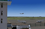
FS2004 Caen-Carpiquet Airport (LFRK) scenery. The scenery can be used with Ultimate Terrain Europe, MAAM cemetery and Taburet's roads add-ons. We recommend to use LFRK AI GA Traffic available on Avsim (lfrk_ga_traffic.zip). By Normansim (Frederik Bilhaut, Jean-Michel Magniez and Philippe Tonin).
| Filename: | LFRK_2005__CaenCarpiquet_Airport.zip |
| License: | Freeware, limited distribution |
| Added: | 7th May 2015, 00:23:15 |
| Downloads: | 430 |
| Author: | Philippe Tonin, Frederik Bilhaut, Jean-Michel Magniez (Normansim) |
| Size: | 4.92 MB |
| Category: Prepar3D V5 - AFCAD Files | |
| P3D V5 Afcad for Paulo Ricardo Viracopos SBKP |
|
File Description:
An unofficial patch for Paulo Ricardo's Payware SBKP Scenery to make it fully compatible with P3D V5. Contains a new Afcad file with custom exclusions as well as CVX files to address conflicts with the P3D V5 terrain.
Please read the 'readme' file before installing
| Filename: | P3D_V5_Afcad_for_Paulo_Ricardo_Viracopos_SBKP.zip |
| License: | Freeware |
| Added: | 18th May 2022, 02:56:40 |
| Downloads: | 121 |
| Author: | Martin Richards |
| Size: | 9.7 KB |
| Category: Strike Fighters: Project 1 - Mods, Utilities and Patches | |
| A-1H MiG Killers Missions and Bonus Skin |
|
File Description:
A-1H MiG killers is a package of missions with a matching skin.
To fully use this package, you need the following:
1. SFP1 with SP2 installed.
2. DigitalOverload's final release: A-1H Version 4.0a addon aircraft.
3. Flyable MiG-17 mod.
4. Gephard's DRV terrain and/or KB's SEA terrain.
The missions recreate two historical encounters. Both encounters represent the only MiG kills made by A-1Hs in Vietnam. Each encounter is covered by multiple missions covering both sides.
The skin is an improvement of Marcelo's outstanding VietnamNavyGrey skin that comes with the A-1H addon, which happens to be the VA-176 MiG killers of the second encounter.
| Filename: | A1H_MiG_Killers_Missions_and_Bonus_Skin.zip |
| License: | Freeware |
| Added: | 23rd August 2004, 20:37:21 |
| Downloads: | 1,016 |
| Author: | Stephen Lynn Flores |
| Size: | 865.77 KB |
| Category: Strike Fighters: Project 1 - Mods, Utilities and Patches | |
| Wings Over Vietnam Enhanced Planning Maps |
|
File Description:
Enhanced planning maps for the stock Wings Over Vietnam SEA Terrain, Version 1.0. This is a very basic supplement to make it easier to design WOV SEA missions. Paint Shop Pro 9 was used to combine the stock planning maps with text to mark key target areas. Kreelin's WOVQMD was used to identify target area locations and names based on the terrain files. The text is 50% transparent, which makes it a light gray tone. The low resolution map looks ok in the game... But I suggest using the higher resolution map (MAP2) for mission planning. The optimum WOVQMD mission design solution is using a desktop resolution of 1600x1200 with MAP2.
| Filename: | Wings_Over_Vietnam_Enhanced_Planning_Maps.zip |
| License: | Freeware |
| Added: | 12th November 2004, 07:30:46 |
| Downloads: | 770 |
| Author: | Stephen Lynn Flores |
| Size: | 509.19 KB |
| Category: Flight Simulator 2004 - Scenery | |
| Calcinate del Pesce - Italy revision 2.0 |
|
Images related to this file:
File Description:
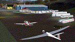
Complete revision of Calcinate del Pesce, airport for gliders. This scenery updates the previous one (Calcinate_v1) issued for FS9 standard meshes, with real meshes and photo-real terrain, multi-season and night. This scenery covers an area of about 17x9 km, from Monate lake (SW) and Medu (NW) to Arcisate (NE) and Bizzozzero/Gurone (SE). This first release includes autogen/library objects for 42% of the total terrain (center/sud-west areas).
The use of this scenery requests: Daniele Lanfranchi's meshes of West Europe for FS9; Itacoast2, italian coast lines review; TreePlanter, extra library for trees; dva51 object library, for extra object library. Enjoy.
| Filename: | Calcinate_del_Pesce__Italy_revision_20.zip |
| License: | Freeware |
| Added: | 27th March 2014, 21:36:35 |
| Downloads: | 622 |
| Author: | Aldo Della Vedova, Daniele Lanfranchi |
| Size: | 35.98 MB |
| Category: Flight Simulator X - Scenery | |
| SVMD - Merida, Venezuela |
|
Images related to this file:
File Description:
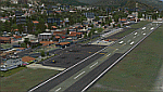
SVMD is an airport located 3 km southwest of downtown Merida, Venezuela, at an elevation of 1,526 m MSL. Its runway is 1,630 m long.
The runway has a gradient slope of +/- 4.05 %, for that reason, this airport is the most difficult and dangerous to land in Venezuela.
It is situated in a valley in the Andean mountains, surrounded by higher terrain in all
quadrants. Night operations are prohibited. Runway 07 is used for landings only and Rwy 25 is used only for take off.
Photo-terrain area improved with Autogen files.
Only compatible with versions to FSX or P3Dv1v2v3.x.
Also includes a friendly Auto-Install.
| Filename: | SVMD__Merida_Venezuela.zip |
| License: | Freeware |
| Added: | 9th December 2015, 09:13:34 |
| Downloads: | 1,047 |
| Author: | David Maldonado |
| Size: | 72.62 MB |
| Category: Flight Simulator X - Scenery | |
| WV29 - Valley Point Airport |
|
Images related to this file:
File Description:
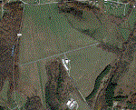
Valley Point (WV29) is a privately owned airport nestled in the hills of Albright, West Virginia. This has been updated from defualt FSX to include the north south grass runway.
Based on local a local flight instructor, the airport should always be approached for landing going north bound towards rising terrain (if the winds are less than 10 knots). This assists with braking. A go around should never be attempted going northbound after the wheels impact the ground.
Takeoffs should always be performed going south bound (if the winds are less than 10 knots) due to steeply rising terrain (300 feet above the airport) to the north.
| Filename: | WV29__Valley_Point_Airport.zip |
| License: | Freeware |
| Added: | 28th June 2021, 04:14:34 |
| Downloads: | 115 |
| Author: | David Abreu |
| Size: | 2.17 KB |
| Category: Flight Simulator X - Scenery | |
| Whale Island (Hi Resolution Photo and mesh), New Zealand |
|
Images related to this file:
File Description:
Whale Island (Maori Name: Moutohora) is a small island located off the Bay of Plenty coast of New Zealand's North Island. It is located about 12 kilometers north of the town of Whakatane. A whaling station existed on the island during the 19th century. The 1.43 km island is a remnant of a complex volcano which has eroded, leaving two peaks. This is still an area of volcanic activity and there are hot springs on the island in Sulphur Valley, McEwans Bay, and Sulphur Bay.
This Hi Resolution scenery was created from a 0.25m pixel resolution Ortho-rectified Aerial mosaic owned by Environment Bay of Plenty (The Bay of Plenty Regional Council) and flown in 2007. The imagery has been slightly de-sampled for use in Flight Simulator X and utilizes the a custom hi resolution 5m Mesh derived from photogrammetry data off the photos. The textures are intended for summer daylight flying only, although due to the evergreen nature of New Zealand's native bush, the Islands appearance remains relatively constant throughout the year.
The island contains a small helicopter pad which is used for checking the various radio antennas on the Island. There is also a small Department of Conservation hut near the south western tip of the Island. These objects have been added from the FSX library of objects. Make sure to turn up your graphics sliders to make the most of this data! To find the Island fly north from Whakatane airport.
| Filename: | Whale_Island_Hi_Resolution_Photo_and_mesh_New_Zeal.zip |
| License: | Freeware, limited distribution |
| Added: | 20th January 2010, 10:12:14 |
| Downloads: | 4,650 |
| Author: | Tim Barnes |
| Size: | 9.94 MB |
| Category: Flight Simulator X - Scenery | |
| Branson Airport KBBG--New Airport, Scenery, and Flight Plans |
|
Images related to this file:
File Description:
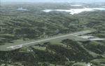
This project adds a new, detailed Branson Airport KBBG (Missouri) to FSX, which opened in May 2009, and is a privately developed commercial airport. The construction of the airport, which involved the flattening of several Ozark Mountains, is claimed to be the largest earthmoving project in Missouri history. As a result, the airport actually sits on a manmade plateau, surrounded by rolling hills. The airport uses the ICAO identifier BBG, however, the airlines use the IATA code BKG. The airport is served by AirTran, Frontier, and ExpressJet (Branson AirExpress), and is located in hilly terrain. Aircraft equipped with a terrain avoidance warning system may experience system activation on final approach. Birds are in the vicinity of the airport. AFCAD with sloping terrain created using Airport Design Editor X v1.47.07, and the hilltops were cleared and flattened and roads were added using SBuilderX 3.13. The terminal, hangar, FBO, and cars were added and modified from stock FSX scenery, using the FSX Object Tool, to resemble as closely as possible the actual airport.
| Filename: | Branson_Airport_KBBGNew_Airport_Scenery_and_Flight.zip |
| License: | Freeware |
| Added: | 5th August 2010, 01:08:33 |
| Downloads: | 2,004 |
| Author: | Carlyle Sharpe |
| Size: | 6.02 MB |


© 2001-2026 AVSIM Online
All Rights Reserved
Privacy Policy |