
Where Flight Simulation Enthusiasts Gather from Around the World!
AVSIM Library - Search Results

| Category: Flight Simulator X - Scenery | |
| RNAS Anthorn / HMS Nuthatch 1950's - Cumbria, UK |

|
File Description:
This scenery is a representation of RNAS Anthorn (HMS Nuthatch) after runway and taxiway upgrades completed in 1948. It is not 100% accurate and no claim is being made that it is.
The scenery was made using ADE and is intended for use in FSX along with Horizon GenX VFR scenery but should work ok in Basic FSX.
This is the third version and is an update of "rnas_anthorn__1950s.zip". The second version was incomplete when i uploaded it (apologies).
Changes are fairly minor and are limited to textures and a few building additions. ZipDive! for Images...
Requires "RAF Buildings" by Ted Andrews - "MBC Studios Object Library for FSX" - "UKVFR Add ons scenery". Also requires Heli Traffic 2009" for Helo AI to be displayed but not necessary for scenery to display.
| Filename: | RNAS_Anthorn__HMS_Nuthatch_1950s__Cumbria_UK.zip |
| License: | Freeware |
| Added: | 8th April 2015, 22:02:28 |
| Downloads: | 465 |
| Author: | Mark John Byers |
| Size: | 174.74 MB |
| Category: Prepar3D V1-4 - Scenery | |
| LTFE - Milas Bodrum Airport - Turkey |
|
Images related to this file:
File Description:
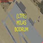
LTFE - Accurate positioning according to the latest charts, google map coordinates and the Navigraph runway coordinates data.
Upon planning a flight from Istanbul to Bodrum, I realized that the airport has been developed with the addition of the international terminal, and the conversion of the old taxiway A into a runway (10R - 28L), and thus decided to quickly make this update.
Milas–Bodrum Airport (IATA: BJV, ICAO: LTFE) is an international airport that serves the Turkish towns of Bodrum and Milas. The airport is situated 36 km northeast of the town of Bodrum, and 16 km south of Milas.
The airport is surrounded by beautiful scenery of hills, with a steep approach of 3.90 degrees due to the surrounding terrain.
Please read the included README file for the simple install instructions.
| Filename: | LTFE__Milas_Bodrum_Airport__Turkey.zip |
| License: | Freeware, limited distribution |
| Added: | 5th July 2017, 17:46:12 |
| Downloads: | 767 |
| Author: | Ahmed Abdessalam |
| Size: | 945.88 KB |
| Category: Prepar3D V1-4 - Scenery | |
| Mitiga International Airport HLLM P3DV4 |
|
File Description:
This Addon for P3D V4, Currently the most realistic and best addon for MITIGA airport.
Changes:
- APT position aligned.
- Correct Taxiway designators.
- Corrected stands and thier positions.
Info about the airport:
The airport has a diverse international history and has been known by a variety of names. It was originally built in 1923 as an Italian air force base called aeroporto militare di Mellaha. It became a German air base during World War II. The airbase was captured by the British 8th Army in January 1943 and transferred to the control of the US Army Air Forces, who called it Mellaha AAF until 1945, when they renamed it Wheelus Air Base for a US airman killed that year. American use continued until the 1969 Libyan coup d'état.
[email protected]
| Filename: | Mitiga_International_Airport____HLLM_P3DV4.zip |
| License: | Freeware |
| Added: | 12th February 2019, 15:47:52 |
| Downloads: | 869 |
| Author: | Hamza Aswaid |
| Size: | 58.32 MB |
| Category: Flight Simulator 2004 - Scenery | |
| Dallas Ft. Worth KDFW / DFW, version 3.2 |
|
Images related to this file:
File Description:

Thank you for downloading this scenery. This is an extensive upgrade to the default Dallas/Ft. Worth International airport. The brand new Terminal D is added and in use now at DFW. FRF's rendition of this terminal is in no way photoreal or exact as it is in real life. The basic shape and dimensions are correct,but due to the limitations of the building blocks available to me at the time, We were not able to design the curved roof and some other architectural details of the actual building. The gates are generally accurate and I have seen no parking problems so far. The original main terminals remain with new, more accurate jetways. The overhead tramway which circles the entire terminal area has been added. It is not perfectly correct or photoreal, but it is a good basic representation.
An AFCAD is included with accurate parking per the DFW website and AA.com. There is a substantial frame rate hit with full AI traffic and weather enabled, but it is not a slideshow.
Update from v3:
The afcad file for KDFW is all new, made with AFX, and reflects recent updates to the taxiway layout. The new afcad file is no longer "all runways active" due to the incorrect behavior of AI aircraft overflying the main runways when using the 13/31's. The new end-around taxiway at the end of Rwys 17R/C is now in place. The runway 18R/17C extensions are reflected as well as associated new taxiways and signage. Parking changes are now reflected per the DFW website. Visual changes include the midfield hangar change from Delta to American titles, courtesy of Joe Degregorio.
| Filename: | Dallas_Ft_Worth_KDFW__DFW_version_32.zip |
| License: | Freeware |
| Added: | 30th May 2010, 10:39:01 |
| Downloads: | 23,458 |
| Author: | William Morgan, FRFSTUDIO.NET |
| Size: | 10.12 MB |
| Category: Flight Simulator 2004 - Scenery | |
| Toronto Downtown Airport CYTZ Ontario, Canada |
|
Images related to this file:
File Description:
CYTZ is on an island in Lake Ontario and immediately adjacent to downtown Toronto. This updates the version made by Flight Ontario as there have been major changes since Porter Airlines purchased the airport. The obvious and main new item is the terminal, made with photo textures and with ten gates sized to accomodate the Dash 8-400 they currently use. The terminal has a passenger entrance and a vehicle setdown point as part of the link to the ferry terminal that wraps around the west side of the original and preserved terminal building. The ferry terminal is included here, along with a ferry. Also new are the car parking, road routing, gate and taxi markings, taxiways, taxiway signage, taxiway lighting, runway lighting, aprons, apron lighting (from Sid Schwartz and you will need to install his "lights_ss_v2"), fences, fuel tanks, tanker trucks, access roads to navigation equipment, ai parking, static parked planes, parked cars, apron equipment, and the useable floatplane ramp. The AI includes Porter, Jazz, several GA aircraft, and a helicopter. Only 3 of these require downloads. The Lake Ontario AI includes three large ships, typical of the traffic to be seen on all the Great Lakes. CYTZ has three runways and there is an airport diagram included. 08-26 has ILS and is the only runway actually long enough to be used by Porter; FS9 atc will ignore this. There is fuel available and it is dispensed from a truck. The longer projection from the front of the terminal building is a covered ramp that leads up from the terminal basement level, used by towed luggage trolleys. The gates are not powered in any way except for the weather cover that protects passengers as they cross the small area of asphalt between plane and gate. I did not try to reproduce this in FS9.
| Filename: | Toronto_Downtown_Airport_CYTZ_Ontario_Canada.zip |
| License: | Freeware, limited distribution |
| Added: | 23rd October 2012, 12:52:14 |
| Downloads: | 1,806 |
| Author: | Roger Wensley + Flight Ontario |
| Size: | 12.43 MB |
| Category: Flight Simulator 2004 - Scenery | |
| CPR5 - Woodstock - Ontario, Canada |
|
Images related to this file:
File Description:
This is the first of a south Ontario series. Woodstock is a town with a population of around 38,000, located 50 miles west of Lake Ontario. The airfield is 3 miles west of the town, with a single grass runway just over 3,000 feet long and 100 plus feet wide, aligned 05/23 in FS9 (in fact it is now 06/24 due to the magnetic north wandering off during the last 10 years). There have been at different times varying amounts of gravel mixed in with the grass on both runway and taxiway; the majority surface by far is grass and I have left it all as such, as there is no visually convincing way to mix the two without unreal sharp edges. The apron is on the northern side of the runway, and is now modified in shape to maximise the area available for crops. There are 10 "T" hangars and a small clubhouse in a single long building. There is no fuel, runway lighting, or taxiway or apron lights so usage is effectively restricted to daylight hours. To the east of CPR5 and on the edge of the town is a private airstrip with 2,800 feet of asphalt runway; I have added this as a visual reference, along with several large grain silos on the other side of the road. Hidden in plain sight amid the surrounding farmland, the first sighting of CPR5 is actually always of the adjacent and far more visible buildings just to the east of the apron, which are owned by a company that deals with everything to do with boats, up to and including fishing gear. These have been included. As ditches cannot be effectively duplicated in FS9 I have included some fences which do not exist in real life, to give some needed visual clues.
| Filename: | CPR5__Woodstock__Ontario_Canada.zip |
| License: | Freeware, limited distribution |
| Added: | 8th July 2015, 13:36:05 |
| Downloads: | 186 |
| Author: | Roger Wensley |
| Size: | 5.57 MB |
| Category: Flight Simulator 2004 - Scenery | |
| Grande Prairie CYQU in Alberta, Canada, Updated |
|
Images related to this file:
File Description:
This is a new version of the original post from March 2014, made in 2018. It was made mainly to provide some missing textures, but has been modified to also add parked trucks and floodlights to the de-icing area (the floodlights are inoperative as they will not be on when there is no de-icing in progress) and also street and car parking lighting, a few more parked planes, and some further objects on the terminal apron area. The runway approach lighting was also corrected; moving the airport so that the ILS on 29 did not coincide with the roads would have been nice, but meant too many complications at this stage. The scenery is complete in itself and can be installed as-is if you do not have the original post. Grande Prairie is at 2,195 feet asl, 65 miles southeast of Dawsons Creek, 90 miles southwest of Peace River and around 60 miles east of the Rockies. The town has a population of around 55,000 and growing. The name comes from the wide expanse of prairies all around the town, and there is also a large forested area to the southwest leading up to the Rockies which supplies raw material for industries in the town. The airport is just to the west of the town. It was originally a military base, built during WW2. The two runways are 07-25 and 11-29 and 6,200 and 6,500 feet respectively, both 200 feet wide; runway headings had changed by 2010 in real life but take this as it was in 2008. When one is the active runway then the other is used as a taxiway. Taxiway A is very wide with in real life a repaired central section marked out for use.
| Filename: | Grande_Prairie_CYQU_in_Alberta_Canada_Updated.zip |
| License: | Freeware, limited distribution |
| Added: | 13th December 2018, 04:12:11 |
| Downloads: | 209 |
| Author: | Roger Wensley |
| Size: | 34.97 MB |
| Category: Flight Simulator 2004 - Aircraft Repaints, Textures and Modifications | |
| Palestinian Airlines Airbus A320-233 |
|
File Description:
"Airbus A320-233 Palestinian Airlines" in its future livery, based of the incredible
iFDG A320 aircraft. This baby here is very highly detailed. textures upsampled to 32-bit with mipmaps removed for maximum quality.that's why, i guess, it will work only with FS2004. if you want to fly with FS2002, then simply downsample the texture
files as you like using DXTBMP which is also a freeware that you can find on www.avsim.com or www.flightsim.com. The aircraft model includes most of the standard features including animated control surfaces, wingviews, flaps and full lighting configuration. FULL PACKAGE. simply download and enjoy!!
I have included a special ATC call-sign for the "Palestinian airlines" with the most proper spelling in both english and arabic.
just import the file to your "editvoicepack 3.1" for editing ATC call-signs, and which you can also download from www.avsim.com or www.flightsim.com.
| Filename: | Palestinian_Airlines_Airbus_A320233.zip |
| License: | Freeware |
| Added: | 16th December 2004, 23:09:38 |
| Downloads: | 762 |
| Author: | Loai Hamad |
| Size: | 7 MB |
| Category: Flight Simulator 2004 - AI Flight Plans | |
| Ultimate GA Citation 550 AI Pack |
|
File Description:
The Ultimate GA team is proud present their very first release. With this package you will have every civilian, military and government operated Citation 550, S550 and 551 flying 'realistic' routings as AI traffic in your sim.
There are flightplans and repaints for over 1,100 aircraft operating over 20,000 weekly sectors. Major corporate operators such as Citation Shares (FIV),
Netjets Europe(NJE), Executive Jet(EJM) are covered with flightplans based on historic information from real world flights. Air Taxi operators from every part of the globe are covered. Fixed call signs are included to add even more reality.
Amongst the repaints, there are over 100 detailed liveries with accurate tail numbers and 19 generic schemes so that no AI aircraft is without a repaint.
Original model by Dee Waldron is included with revised flight dynamics by Henry Tomkiewicz. Flightplan text files are also included for FS2002 users.
| Filename: | Ultimate_GA_Citation_550_AI_Pack.zip |
| License: | Freeware, limited distribution |
| Added: | 10th April 2005, 18:45:11 |
| Downloads: | 15,659 |
| Author: | Dee Waldron, Henry Tomkiewicz, UltimateGA |
| Size: | 13.36 MB |
| Category: Flight Simulator 2004 - Scenery | |
| CYQV Yorkton Municipal Airport Saskatchewan Version 2 |
|
Images related to this file:
File Description:
Yorkton Municipal Airport is situated approximately three kilometers north of the City of Yorkton, Saskatchewan, Canada. The airfield was built in 1940 for the Royal Canadian Air Force, as a British Commonwealth Air Training Plan station. Today, only a few of the wartime buildings remain and only two of the orginal four runways remain in operation. The airport continues, however, as the prinicipal hub of general aviation services for the east-central region of Saskatchewan.
CYQV was constructed using GMAX and represents the airport as it was in the Summer of 2008. It includes custom models of all the buildings at the airport, runway signs, refueling facilites,garages, weather station, fencing and trees, and a rotating beacon. CYQV includes custom ground textures to replicate the decommissioned runways and taxiways.
Version 2 replaces the original lost in the AVSIM hack and includes a number of improvements (see readme).
| Filename: | CYQV_Yorkton_Municipal_Airport_Saskatchewan_Versio.zip |
| License: | Freeware |
| Added: | 7th May 2010, 12:52:18 |
| Downloads: | 1,997 |
| Author: | Gregory Putz |
| Size: | 6.72 MB |


© 2001-2026 AVSIM Online
All Rights Reserved
Privacy Policy |