
Where Flight Simulation Enthusiasts Gather from Around the World!
AVSIM Library - Search Results

| Category: Flight Simulator X - Scenery | |
| RAF Dunholme Lodge - Lincolnshire, England **UPDATE** |

|
File Description:
This is an-update to correct the location of the Tower, if you have installed my version uploaded on the 15 or 23 Oct 15
RAF Dunholme Lodge was a Royal Air Force station located between the parishes of Welton and Dunholme in Lincolnshire, England.
The grass airfield was first used by the Royal Air Force during 1941 and 1942 for use by Handley Page Hampden aircraft from nearby RAF Scampton, and was officially opened as a RAF Station in September 1942 as part of RAF Bomber Command with the building of three hard runways.
The main occupier of the station was 44 Squadron, with the Avro Lancaster four-engined heavy bomber, which moved in from RAF Waddington in May 1943 and stayed until it moved to RAF Spilsby in September 1944.
In November 1944 flying operations ceased due the proximity of other stations which did not allow night flying. At the end of the war 120 Lancaster's had been lost on operations from Dunholme Lodge.
From 1948 the site was host to motorcycle and car racing until 1959 when the base was reopened as an active RAF station when it became an active Bloodhound surface-to-air missile station with 141 Squadron. The Squadron in 1964 and the station finally closed in 1964. Source: Wikipedia.
| Filename: | RAF_Dunholme_Lodge__Lincolnshire_England_UPDATE.zip |
| License: | Freeware |
| Added: | 28th October 2015, 18:41:50 |
| Downloads: | 262 |
| Author: | Terry Boissel |
| Size: | 335.14 KB |
| Category: Flight Simulator 2004 - AI Aircraft | |
| Sky Airline Airbus A319-111 CC-AFY |
|
Images related to this file:
File Description:

Sky Airline is an airline based at Comodoro Arturo Merino Benitez International Airport in Santiago, Chile.
It is the second largest airline in the country behind rival LAN Airlines. It has international routes to Peru, Argentina, Bolivia and Brazil. It operates under a semi-low cost model, although its service is superior compared to other European or US low cost carriers.
It also operates charter flights in Chile and South America. Source Wiki. //
Flightplans may be available on AVSIM/Flightsim.com.
This works for both FS9 and FSX. Tested in FSX. FS9 model used.
For FSX users make sure you have UNCHECKED "Aircraft casts shadows on the ground" under the Aircraft - Exterior Settings in FSX to make any FS9-based model visible during the day!
Texture quality; FSX Native: DDS DXT5 with alpha. FS9 Native: BMP DXT3 with alpha.
FSX Light Fix included in the DDS night texture.
Custom Light Map. Custom Shadows, Highs, Weathering as usual...
Included repaint is for the following model; DJC_A319 from DJC.
By renaming the texture files to "EvolveAI_A319_CFM_T & EvolveAI_A319_CFM_L" it will also work for EvAI's model.
This is a non-reflective model.
Model is available on AVSIM and FlightSim.com or on the author/developers site.
You need the basekit for this to work!!
Do make sure you copy the texture folder(s) in the respective folder.
| Filename: | Sky_Airline_Airbus_A319111_CCAFY.zip |
| License: | Freeware, limited distribution |
| Added: | 22nd July 2012, 15:11:11 |
| Downloads: | 959 |
| Author: | Stephan Faessler / ImpulseAI |
| Size: | 1.45 MB |
| Category: Prepar3D V1-4 - Scenery | |
| Moscow City X DEMO |
|
Images related to this file:
File Description:
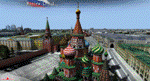
Moscow City X DEMO is a very detailed model of Moscow metropolitan area in Russia, together with lite sceneries of 7 airports (UUWW Vnukovo, UUDD Domodedovo, UUBW Zhukovski, UUMO Ostafyevo, UUBM Myachkovo and UUMB Kubinka), many heliports and thousands of buildings. This product is fully compatible with FSX/FSX:SE/P3Dv1/P3Dv2/P3Dv3/P3Dv4 and FSW by Dovetail.
It's a fully functional DEMO version of the commercial payware product, copmatible with both UUEE Moscow Sheremetyevo X by Drzewiecki Design and UUDD Moscow Domodedovo FSX/P3D by MDesign. It features same airport layout as in the full version but with limited 3D objects and low resolution textures. Using this free demo ensures no problems with online (VATSIM, IVAO, multiplayer etc.) flying in case some users use the payware scenery and some don't.
Moscow is the capital city and the most populous federal subject of Russia. It's the second most populous city in Europe after Istanbul and the 8th largest city proper in the world, as well as the largest amongst high income economies.
It's equipped with an automatic installer, which means that the scenery will be automatically added to the Flight Simulator Scenery Library.
Please uninstall all previous versions of the airports included in this package that you may have installed before. Please make also sure that no duplicated AFCAD files are installed!
Enjoy your virtual flying with Drzewiecki Design!
| Filename: | Moscow_City_X_DEMO.zip |
| License: | Freeware, limited distribution |
| Added: | 23rd August 2017, 01:37:36 |
| Downloads: | 580 |
| Author: | Drzewiecki Design |
| Size: | 18.56 MB |
| Category: Flight Simulator X - AI Aircraft | |
| Sky Airline Airbus A319 (CC-AFY) |
|
Images related to this file:
File Description:

Sky Airline is an airline based at Comodoro Arturo Merino Benitez International Airport in Santiago, Chile.
It is the second largest airline in the country behind rival LAN Airlines. It has international routes to Peru, Argentina, Bolivia and Brazil.
It operates under a semi-low cost model, although its service is superior compared to other European or US low cost carriers.
It also operates charter flights in Chile and South America. Source Wiki.
Flightplans may be available on AVSIM/Flightsim.com.
This works for both FS9 and FSX. Tested in FSX. FS9 models used.
For FSX users make sure you have UNCHECKED "Aircraft casts shadows on the ground" under the Aircraft - Exterior Settings in FSX to make any FS9-based model visible during the day!
Texture quality; FSX Native: DDS DXT5 with alpha. FS9 Native: BMP DXT3 with alpha.
FSX Light Fix included in the DDS night texture.
Custom Light Map. Custom Shadows, Highs, Weathering as usual...
Included repaint is for the following model; DJC_A319 from DJC.
By renaming the texture files to "EvolveAI_A319_CFM_T & EvolveAI_A319_CFM_L" it will also work for EvAI's model.
This is a non-reflective model.
Model is available on AVSIM and FlightSim.com or on the author/developers site.
You need the basekit for this to work!!
Do make sure you copy the texture folder(s) in the respective folder.
| Filename: | Sky_Airline_Airbus_A319_CCAFY.zip |
| License: | Freeware, limited distribution |
| Added: | 13th July 2012, 16:14:22 |
| Downloads: | 404 |
| Author: | Stephan Faessler, ImpulseAI |
| Size: | 1.45 MB |
| Category: Flight Simulator 2004 - Scenery | |
| HLLQ El Beida/Labraq |
|
Images related to this file:
File Description:
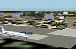
Googly scenery for HLLQ El Beida/Labraq - a joint civilian and military airport
near the north coast of Libya that is poorly provided for in Flight Simulator
2004. These scenery files add taxiways, aprons, buildings and other airport
features, so that you and your "AI" traffic can land, taxi, park and take off
in a realistic manner.
The city of Al Beida, or Al Bayda' or El Beda or Al Baidhah (depending on who
you are) has achieved its own airport status by using the end of a dead runway
at Labraq Air Base. In turn the airbase has contracted to use the opposite end
of the runway as its base of activity. The city is served by jets of Libyan
Airways and turboprop craft of Air One Nine and Ghadames Air Transport.
The scenery does not purport to be ultra-accurate. Based on high-detail satellite
imagery from Google Earth, the layout is proportionally correct but the added
airport features, such as buildings, are built from default Microsoft objects
and add-on libraries so will not look like the real thing.
You are not obliged to download and install any additional scenery libraries,
but to enjoy this scenery in its entirety, you may wish to. It will work fine,
with or without. [File re-uploaded at request of AVSIM]
| Filename: | HLLQ_El_BeidaLabraq.zip |
| License: | Freeware |
| Added: | 28th May 2010, 20:42:26 |
| Downloads: | 1,286 |
| Author: | John Hinson |
| Size: | 73.79 KB |
| Category: Flight Simulator 2004 - Scenery | |
| FTTN Am-Timan, Chad |
|
File Description:
Googly scenery for Am-Timan (ICAO: FTTN, ICAO: ANC), also known as Am
Timan, Am Timane, Am Timmane, Umm Timman - take your pick! It is a small
airport serving a small city of the same name in South-Eastern Chad,
almost exactly centred in the continent of Africa.
The airport was upgraded in 1971 by the French Foreign Legion to allow
military transport craft to land, but it still retains a sand/dirt
strip. The airport is served today by a couple of flights a week using
Fokker Fellowship jets of Toumai Air Tchad.
The entire area is very dry and sandy but for some reason it is depicted
in Flight Simulator as green and lush. Microsoft have only provided a runway
at this airport and this scenery seeks to redress the situation so that you
and your "AI" traffic can use the airport realistically.
The scenery does not purport to be ultra-accurate. Based on high quality
satellite imagery from Google Earth, the layout is proportionally correct but the
added airport features, such as buildings, are built from default Microsoft objects
and add-on libraries so will not look exactly like the real thing.
You are not obliged to download and install any additional scenery libraries,
but to enjoy this scenery in its entirety, you may wish to. It will work fine,
with or without.
| Filename: | FTTN_AmTiman_Chad.zip |
| License: | Freeware |
| Added: | 24th December 2008, 13:31:36 |
| Downloads: | 883 |
| Author: | John Hinson |
| Size: | 83.66 KB |
| Category: Flight Simulator 2004 - Scenery | |
| MRAO Turtuguero, Costa Rica |
|
Images related to this file:
File Description:
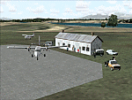
Googly scenery for MRAO Turtuguero, Costa Rica - another one that Microsoft
forgot in FS2004. It is a small domestic airport located on a long spit of
land that almost seems like an island. Turtuguero is just a village but the
airport also serves the lush Tortuguero National Park (rain falls all the
year round here) which draws thousands of visitors each year. The airport
is served daily by DHC-6 Twin Otters of Nature Air.
These scenery files create the airport and add taxiways, aprons, buildings and other airport features, so that you and your "AI" traffic can land, taxi, park and take
off in a realistic manner.The scenery does not purport to be ultra-accurate. Based on less-than-perfect satellite imagery from Google Earth, the layout is as good as I can get it, but some imagination has been used as I cannot tell what buildings exist. The
buildings and other features I have provided are built from default Microsoft
objects and add-on libraries so will not look exactly like the real thing.
You are not obliged to download and install any additional scenery libraries,
but to enjoy this scenery in its entirety, you may wish to. It will work fine,
with or without. [File re-uploaded at request of AVSIM]
| Filename: | MRAO_Turtuguero_Costa_Rica.zip |
| License: | Freeware |
| Added: | 28th May 2010, 20:40:00 |
| Downloads: | 1,174 |
| Author: | John Hinson |
| Size: | 65.12 KB |
| Category: Flight Simulator 2004 - Scenery | |
| Z19O - Hamat Airbase - Batroun, Lebanon |
|
Images related to this file:
File Description:
Hamat is a village near the coast of Lebanon, around 25 miles north of Beirut. The airport runway was built during the civil war to the west of Hamat in the late 1970's, between Hamat and another village called Wuajh Al Hajar. The intention was have an alternative to Beirut airport, which could be (and often was) closed by shell fire from any or all of the sides involved in the civil war, or by bombing by those who were not directly part of the civil war but occasionally joined in. It has been used for drag racing, occasional freefall parachuting (this may continue) and is now an army base with mostly helicopter use. The runway is around 5,600 feet of asphalt, 90 feet wide and aligned 02/20. There is no lighting. The apron is set well back from the runway and has hangars at each end; one set is four hangars long, and at the other end of the apron there are three hangars. There are also the remains of some radar to the west of the apron, bombed (in 1982?). The runway has been repositioned and the surrounding landclass modified to reduce one village to it's approximate actual size and to create a second village which was missing entirely. An intrusive road has been deleted, and the airfield grass area also modified.
| Filename: | Z19O__Hamat_Airbase__Batroun_Lebanon.zip |
| License: | Freeware, limited distribution |
| Added: | 23rd May 2015, 10:03:10 |
| Downloads: | 224 |
| Author: | Roger Wensley |
| Size: | 8.53 MB |
| Category: Flight Simulator 2004 - AFCAD Files | |
| Southwestern British Columbia Airport Corrections |
|
File Description:
As shorelines, water bodies, roads, railways and other features become more accurate in addon scenery, inaccuracies in airport placement become apparent. Although Microsoft did an excellent job of using published data to place airports, the published information is not always accurate. Some airports in the area of interest were misplaced by as much as 850m, thus conflicting with water and/or roadways. This release corrects Canadian airports in South-western British Columbia, in LOD5 cell 15x14 (915140). This area covers a portion of Vancouver Island from Duncan to Victoria, and the BC Mainland as far east as Douglas Lake and north of Pemberton. In this region CAK3, CAL3, CBT6, CYHE, CYLY, and CYPS are corrected, and Bruce Ellison has kindly modified his CAM3 for inclusion; see separate readme document for details. All these airports have been activated for AI use. A few buildings that may conflict from roads have been removed from CYNJ. The unrealistically large flatten and airport polygon at CYYJ is reduced in size. Airport features that end up in the water have been removed from CYVR and the overly large flatten there reduced. Some Rwy12 goodies have been tossed in as well, but if these are not important to the user, it is not necessary to have Rwy12 installed. Ultimate Terrain or similar accurate hydrology and roads recommended. FSGenesis 38m mesh or other high quality terrain mesh recommended.
| Filename: | Southwestern_British_Columbia_Airport_Corrections.zip |
| License: | Check within download |
| Added: | 30th May 2005, 07:31:45 |
| Downloads: | 3,002 |
| Author: | Jon Patch, Bruce Ellison |
| Size: | 1.53 MB |
| Category: Dovetail Games Flight Sim World - Scenery | |
| POLISH AIRPORTS VOL. 2 X V4 DEMO |
|
Images related to this file:
File Description:
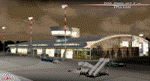
POLISH AIRPORTS VOL. 2 X V4 DEMO is a package of detailed sceneries of EPSC Szczecin, EPLL Lodz, EPZG Zielona Gora and EPRA Radom airports in Poland, fully compatible with FSX/FSX:SE/P3Dv1/P3Dv2/P3Dv3/P3Dv4 and FSW by Dovetail.
This product is a fully functional DEMO version of the commercial payware product. It features same airports layout as in the full version but with limited 3D objects and low resolution textures. Using this free demo ensures no problems with online (VATSIM, IVAO, multiplayer etc.) flying in case some users use the payware scenery and some don't.
Szczecin-Goleniow "Solidarnosc" (SZZ/EPSC) is the main domestic and international airport serving the city of Szczecin in Poland. Lodz Wladyslaw Reymont (LCJ/EPLL), formerly known as Lodz-Lublinek Airport, is a regional airport in central Poland. Zielona Gora-Babimost (IEG/EPZG) is a regional post-military airport located within the greater Zielona Gora agglomeration. Radom Airport (RDO/EPRA), also known as Radom-Sadków Airport is a civil and military airport in central Poland
The product is equipped with an automatic installer, which means that the scenery will be automatically added to the Flight Simulator Scenery Library. Please uninstall all previous versions of this airport you may have installed before. Please make also sure that no duplicated AFCAD files are installed.
Enjoy your virtual flying with Drzewiecki Design!
| Filename: | POLISH_AIRPORTS_VOL_2_X_V4_DEMO.zip |
| License: | Freeware, limited distribution |
| Added: | 23rd August 2017, 01:44:09 |
| Downloads: | 68 |
| Author: | Drzewiecki Design |
| Size: | 23.79 MB |


© 2001-2026 AVSIM Online
All Rights Reserved
Privacy Policy |