
Where Flight Simulation Enthusiasts Gather from Around the World!
AVSIM Library - Search Results

| Category: Flight Simulator 2004 - AI Aircraft | |
| Republic F-105 Thunderchief (Part 2) |

|
Images related to this file:
File Description:

Republic F-105 Thunderchief (Part 2). This is another Jake Burrus aircraft I have been able to bring to the flightsim world. Originally introduced in 1958 as a low-level nuclear weapons delivery aircraft in the middle of the Cold War, this aircraft became the backbone of conventional bombing during most of the Vietnam War. As a testament to the aircraft's role, the bravery of its pilots, and the ferocity of the North Vietnamese air defense network, nearly half of the 833 airframes were lost in combat operations. Due to the extensive combat use of the Thud, it had a relatively short service life, with limited use after Vietnam, until the aircraft's final retirement in 1984.
This is part 2 of 2 parts, and represents the use of the F-105D/F/G from 1966-1984; to include 35 model variants and 130 repaints. Aircraft model by Jake Burrus and Mike Pearson, master textures and repaints by Mike Pearson, flight dynamics by Mike MacIntyre. Please read the documentation contained in the file.
| Filename: | Republic_F105_Thunderchief_Part_2.zip |
| License: | Freeware |
| Added: | 29th December 2013, 20:23:35 |
| Downloads: | 625 |
| Author: | Michael Pearson |
| Size: | 38.47 MB |
| Category: Flight Simulator 2004 - Scenery | |
| Chiang Mai Photo scenery (Chiangmai city) |
|
Images related to this file:
File Description:
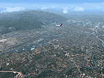
Chiang Mai was founded in the late 13th century. It was once the capital of Lanna, an independent Thai Kingdom and has preserved its unique cultural heritage to a marked degree. It is located 700 km (435 mi) north of Bangkok, among the highest mountains in the country. The city is on the Ping river, a major tributary of the Chao Phraya river. Culture of Chiang Mai is architecture reflects Lanna Thai,Burmese,Sri Lankan and Mon influences.There are some 300 temples in the city and on its outskirts. The Golden Age of Lanna-Chiang Mai lies some 500 years back in the time of king Tilokarat,but the city has recently been undergoing a process of regeneration,and while full of the bustle of modern life,it hasn't lost touch with its glorious past.
This scenery just only preview the real thing. If you visit Thailand, this city is the "must" see in your trip. The best time to go to Chiangmai is winter time since the weather is cool and bright sunny.
| Filename: | Chiang_Mai_Photo_scenery_Chiangmai_city.zip |
| License: | Freeware |
| Added: | 30th August 2010, 13:13:46 |
| Downloads: | 2,567 |
| Author: | PARIWAT LORDNGERN / Thaiflight Simulator |
| Size: | 26.31 MB |
| Category: Flight Simulator X - Scenery | |
| FSX: Enhanced Major Metro Autogen (requires FSX Enhanced Autogen World ) |
|
File Description:
This is the second and final part of our enhanced autogen release. This package repairs and upgrades 48 major city autogen building textures world-wide and RESTORES the light maps Aces missed in which large numbers of buildings (Paris, Berlin, London, etc) have been dark since the release of FSX. It includes North America, South America, Asia, Eurasia, Middle East, Europe, Africa and Australia. You MUST install PART ONE (fsx_enhanced_autogen.zip) before using this package. There are links included with the instructiions of this package to PART 1 should you need them along with instructions for FTX users. The included textures will add all the default missing light maps, blend perfectly with GEX Enhanced USA/Canada and are a great match for our upcoming GEX Europe release. Please note these are only textures for major metro auto-generated buildings and are not the city skyscrapers and landmarks. There is absolutely no performance loss -or- performance gain when using these textures which are ONLY for FSX and can not be used in FS9. Happy Holidays from Team GEX to the entire sim community!
| Filename: | FSX_Enhanced_Major_Metro_Autogen_requires_FSX_Enha.zip |
| License: | Freeware, limited distribution |
| Added: | 27th December 2008, 02:28:47 |
| Downloads: | 14,646 |
| Author: | Nick Needham and Anthony Vos of Ground Environment X |
| Size: | 14.21 MB |
| Category: Flight Simulator 2004 - Scenery | |
| Sanikiluaq CYSK in Hudson Bay, Nunavut, Canada |
|
Images related to this file:
File Description:
Sanikiluaq is a village 740 or so inhabitants at N56 30, W79, which means in the southern part of Hudson Bay, close to James Bay. The village is at the north end of Flaherty Island, which is the largest of the Belcher Islands. You might fly there from La Grande Riviere in Quebec (200 miles SSE) or maybe from Moosonee in Ontario at the bottom of James Bay (350 miles SSW). Sanikiluaq village does not feature in FS9, so the first thing to do was to add it; it is the right shape and with around the right number of houses on the right streets but as I wasn't going to model 100+ individual houses just think of it as a hand-made auto-generated village. I also had to move the airfield over beside the river, so there is a DELETE file and a GRASS file and a ROADS file, as well as an AFCAD for AI and a scenery file. And AI for a visiting Air Inuit plane.
| Filename: | Sanikiluaq_CYSK_in_Hudson_Bay_Nunavut_Canada.zip |
| License: | Freeware, limited distribution |
| Added: | 11th October 2010, 23:15:41 |
| Downloads: | 516 |
| Author: | Roger Wensley |
| Size: | 2.21 MB |
| Category: Flight Simulator 2004 - Scenery | |
| Terrace CYXT in BC Canada Updated |
|
Images related to this file:
File Description:
This version of Terrace has night textures that work, good news for the 319 downloaders who did not tell the author that the ones already posted did not work. Why? Terrace is fifteen miles east and inland from Prince Rupert, which is 500 miles north of Vancouver up the BC coast. It is at the point in the mountains where two fjords meet, one coming from Prince Rupert and the other from Kitimat. There are two runways, the main one is a recently-extended 7,500 feet long and lighted 33/15 and the second is 5,373 feet of unlit 03/21. The apron has been enlarged to be able to accomodate a Boeing 737; though I don't think there is an airline using a 737 for flights to Terrace I have parked an Air Canada jet and the pics show the planes that do fly to Terrace, Air Canada and Hawk Air Dash 8-300's. The aircraft and the textures are down-loadable and and can be used for AI.
| Filename: | Terrace_CYXT_in_BC_Canada_Updated.zip |
| License: | Freeware, limited distribution |
| Added: | 3rd July 2010, 03:28:31 |
| Downloads: | 1,065 |
| Author: | Roger Wensley |
| Size: | 3.72 MB |
| Category: Flight Simulator 2004 - Scenery | |
| Terrace CYXT in British Columbia, Canada - REVISED |
|
Images related to this file:
File Description:
This version includes the correct Piper Cub texture, unreported by all but one downloader (why?).
Terrace is fifteen miles east and inland from Prince Rupert, which is 500 miles north of Vancouver up the BC coast. It is at the point in the mountains where two fjords meet, one coming from Prince Rupert and the other from Kitimat. The airport is a couple of miles south of the town and on the south side of the Skeene River. There are two runways, and the main one is a recently-extended 7,500 feet long and lighted 33/15. The second is 5,373 feet of unlit 03/21. The apron has been enlarged to be able to accommodate a Boeing 737 so I have parked an Air Canada jet there, but the pics show the planes that do fly to Terrace, and these are Air Canada and Hawk Air Dash 8-300's. The original aircraft and the textures are down-loadable and and can be used for AI.
| Filename: | Terrace_CYXT_in_British_Columbia_Canada__REVISED.zip |
| License: | Freeware, limited distribution |
| Added: | 21st February 2010, 16:25:38 |
| Downloads: | 1,112 |
| Author: | Roger Wensley |
| Size: | 3.39 MB |
| Category: Flight Simulator 2004 - Scenery | |
| Clinton Point CWCP, Horton River CWHR & Keats Point CWKP; DEW sites in Northwest Territories, Canada |
|
Images related to this file:
File Description:
These are three DEW line sites in northern mainland Canada, to the east of Tuktoyaktuk.
Clinton Point is almost 300 miles east of Tuktoyaktuk and on the Northwest Territories and Nunavut border. It is the site of a closed DEW station (closed in 1993) and all the buildings have been removed, unlike many other sites where buildings are still almost complete. The roads and the gravel runway down by the beach are still there.
Horton River is 150 miles east of Tuktoyaktuk, up on higher land above the cliffs at around 500 feet ASL. The NWS (North Warning System) replaced the I site which was there previously and which ceased operations in 1963. The NWS is serviced by helicopter from a barge 400 yards away on the beach.
Keats Point is 270 miles east of Tuktoyaktuk, 7 miles from the coast but significantly close to a lake, which was probably used for float plane delivery in the summer (or ski plane delivery in the winter) of NWS station elements during construction.
| Filename: | Clinton_Point_CWCP_Horton_River_CWHR__Keats_Point_.zip |
| License: | Freeware, limited distribution |
| Added: | 17th July 2012, 18:57:08 |
| Downloads: | 282 |
| Author: | Roger Wensley |
| Size: | 2.07 MB |
| Category: Flight Simulator X - Scenery | |
| CYBL (2011) Version 2 for FS9, FSX and Prepar3D |
|
Images related to this file:
File Description:
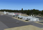
CYBL (2011) portrays the Campbell River (British Columbia, Canada) Airport and surrounding area, including the BC Forest Service tanker base, as it appeared in late 2011. (Campbell River, a small city mid-way up the eastern shore of Vancouver Island, is the "salmon capital" of North America and the gateway to Desolation Sound - summer cruising grounds for thousands of yachts from across the Pacific Northwest. Hence, CYBL is host to a lot of visiting GA.) This add-on includes a selection of Custom AI and static aircraft painted to represent aircraft based or often seen at CYBL. CYBL has recently completed a major runway extension and terminal upgrade - both of which are reflected in CYBL (2011). CYBL (2011) is compatible with BC Roads (FS9 only), ORBX FTX USA Canada Pacific Northwest and both FS9 and FSX versions of Ultimate Terrain.
Generally, this new version is visually identical to its predecessor - even though quite different internally. As well, to the extent possible, it is compatible with Prepar3Dv2. (v2.03 fixes a vehicle texture issue in 2.02)
| Filename: | CYBL_2011_Version_2_for_FS9_FSX_and_Prepar3D.zip |
| License: | Freeware, limited distribution |
| Added: | 22nd June 2014, 17:20:43 |
| Downloads: | 4,230 |
| Author: | Don Grovestine |
| Size: | 43.78 MB |
| Category: Flight Simulator 2004 - AI Aircraft | |
| Oberpfaffenhofen v2.2 - traffic package |
|
Images related to this file:
File Description:
This AI-Package has been prepared for the Oberpaffenhofen Airport (EDMO) located in
South-Germany 20 NM west of Munich and contains the following beautiful aircraft:
Dornier Do-27, Do-28, Do-228, Fairchild/Dornier, FD-328 Turboprop and Jet version,
FD-728 (did not go onto production line) and the amphibian Dornier Seastar,
Boeing-707 (AWACS/E3A), Breguet-Atlantic, Dassault/Dornier Alpha-Jet,
Lockheed-P3 Orion, British-Aerospace Canberra B.20, Hawker Sea-Fury, North-American
F-86A, and Bell UH-1D. The corresponding scenery "oberpfaffenhofen-v2.2_fs2004.zip"
is available here at the library.
Most of the planes perform testflights after a long term maintenance in the local
traffic pattern and some of the bigger ones leave IFR (in accordance with
"Instrument Flight Rules") to other airfields per attached flightplan. All the attached outstanding airplanes have been created by well known designers(see briefing). My part was just to put them together and to generate an almost reasonable AI-Flightplan. Gentlemen, let's take a rest, watching the airplanes and listening to ATC.
Re-upload.
| Filename: | Oberpfaffenhofen_v22__traffic_package.zip |
| License: | Freeware |
| Added: | 8th April 2011, 11:49:12 |
| Downloads: | 2,048 |
| Author: | Klaus Jone |
| Size: | 23.59 MB |
| Category: Flight Simulator 2004 - AI Aircraft | |
| Douglas DC-7 for AI Traffic |
|
Images related to this file:
File Description:

Douglas DC-7 for AI Traffic. The DC-7 propliner was designed for long-range commercial transport, being one of the first aircraft to utilize the polar routes from Europe to North America. Although the DC-7 was a very advanced aircraft for its time of production, it was produced at the cusp of the commercial jetliner age and was quickly eclipsed by a new generation of air travel. Subsequently the DC-7 was not as commercially successful as its predecessors, and only a handful remain in the cargo and aerial firefighting roles. In conjunction with Jake Burrus, I present an 8-LOD AI traffic model to bring this classic transport aircraft to the flightsim world. This package includes 14 models, 40 repaints, and a Photoshop paint kit. The paints in this package focus on DC-7 use from the 1970s to present day, with a few vintage paints thrown in. Aircraft model and master textures by Jake Burrus and Michael Pearson, flight dynamics and repaints by Michael Pearson.
| Filename: | Douglas_DC7_for_AI_Traffic.zip |
| License: | Freeware |
| Added: | 14th July 2015, 20:54:18 |
| Downloads: | 970 |
| Author: | Michael Pearson |
| Size: | 23.99 MB |


© 2001-2026 AVSIM Online
All Rights Reserved
Privacy Policy |