
Where Flight Simulation Enthusiasts Gather from Around the World!
AVSIM Library - Search Results

| Category: Flight Simulator 2004 - Scenery | |
| Fort Graham CBW3 in British Columbia Canada |

|
Images related to this file:
File Description:
Fort Graham is what looks like a very small village on the eastern shore of Williston Lake in northern British Columbia, around 100 miles north of Mackenzie (a previous post). The lake, while not large by Canadian standards, is well over 100 miles long but squeezed in width to a maximum of 5 miles amid the surrounding Rockies. The airfield has a gravel runway of 5,000 feet aligned 13-31 and at 2,230 feet ASL. There is no lighting. The operator of the airfield (and presumably the "village" too) is Finlay River Outfitters, a company that is based in Mackenzie and "outfits" hunting trips in the local area. I have posted this as Fort Graham CBW3, but I suggest that you just add it to your previously created "BC airfields" and avoid the inevitable doubling up of common textures etc. Up to you. If you find a defect, email me.
| Filename: | Fort_Graham_CBW3_in_British_Columbia_Canada.zip |
| License: | Freeware, limited distribution |
| Added: | 23rd November 2020, 20:13:11 |
| Downloads: | 108 |
| Author: | Roger Wensley |
| Size: | 7.75 MB |
| Category: Flight Simulator 2004 - Scenery | |
| Seward PAWD in Alaska V2 plus 6AK5 |
|
Images related to this file:
File Description:
This is V2, the combined original and also V1. If you have already installed V1 then you do not need this. The town of Seward (population around 2,700) is on the east coast of the Kenai Peninsula, 70 miles east of Kenai town and also 70 miles southeast of Anchorage, amid mountains and glaciers at the northern end of the 20 mile long and fjord-like Resurrection Bay. It is also at the southern end of both the Alaska Railway and the Seward Highway, and has a sheltered dock for freight and also for cruise liners. Passengers from the liners can enjoy local attractions (dog sledging on a glacier?) and also easily continue further north by bus or train to Anchorage or to other tourist attractions such as Denali. The airport is next to the port and the town, with two runways aligned (in FS9, not taking account of the recently wandering magnetic north) 15-33 and 12-30, both asphalt and 2,100 and 4,200 feet long respectively. Only 12-30 (and its taxiways) is lit, with VASI on 30. There are no regularly scheduled flights to Seward; with buses and trains running direct from Anchorage there is no money to be made. There are some charter flights coordinated with cruise liners, and some freight flights, the very occasional visit by the Coastguard, but most flights are GA, air taxi,or short scenery-viewing trips for summer tourists. In a mountainous area the only sure thing about the behaviour of AI aircraft is that it is unpredictable but often involves a mountain; nothing to be done about it. At Seward there is also marine AI from and to the port, in the shape of a cruise liner and an Alaskan ferry, but the latter only if you have Holger Sandmann's Alaska scenery installed. Also included with this is a correction for Fire Island 6AK5, near Anchorage, that takes the airfield out of the water; this is something I have meant to do for the last 5 years.
| Filename: | Seward_PAWD_in_Alaska_V2_plus_6AK5.zip |
| License: | Freeware, limited distribution |
| Added: | 19th January 2016, 18:27:26 |
| Downloads: | 591 |
| Author: | Roger Wensley |
| Size: | 12.47 MB |
| Category: Flight Simulator X - Scenery | |
| MYXY - Duncan Town, Ragged Island Chain, Bahamas - Version 2 |
|
File Description:
The Ragged Island Chain consists of a string of small islands in the Bahamas. Only one island, Ragged Island, has a settlement on it which is known as Duncan Town. This FSX scenery improves the airstrip at Duncan Town and creates a new private airstrip on Nurse Cay. The airstrip at MYXY (Duncan Town) has been lengthened by 500 feet and widened by 25 feet. Six parking ramps now exist as well as a fuel pump and helipad. Additional taxiways have been added and lights for the runway, taxiways and apron. A small building has been added to serve as a combined terminal, control tower, and customs office. There is also a hangar to protect your plane from tropical storms. These improvements were necessary to accomodate the increased air traffic due to the new high rise tropical hotel, the Ragged Island Resort. There is also a lighthouse on the island and a cruise ship with helipad just off to the east. A large private yacht just to the north also has a helipad. You can watch dolphins swim at both of those locations - the helipads make great viewing spots. About 20 miles north of Ragged Island is Nurse Cay (MYXN). This is where my private airstrip and villa are located. The airstrip has a 2500 ft concrete runway and a parallel taxiway as well as a helipad. The runway, taxiways, and apron are all lit for night operations. The airstrip was built right on a marsh so wandering off the runway or taxiways could result in getting wet. You will find a variety of birds flying around at various locations throughout this scenery. A flight plan is also included for a dusk flight from Ragged Island (MYXY) to Nurse Cay (MYXN). So come on out to Ragged Island, because it's better in the Bahamas! This is version 2 and supercedes my original file - this version corrects the runway numbers at MYXN.
| Filename: | MYXY__Duncan_Town_Ragged_Island_Chain_Bahamas__Ver.zip |
| License: | Freeware |
| Added: | 24th August 2007, 15:55:49 |
| Downloads: | 2,408 |
| Author: | Mike Lanza |
| Size: | 13.43 KB |
| Category: Flight Simulator 2004 - Scenery | |
| Twin Lakes Airstrips in British Columbia Canada |
|
Images related to this file:
File Description:
There are three grass airstrips within sight of each other from the air at Twin Lakes in BC, which is between the close junction of Elkin Lake and Vedan Lake. The two lakes are similarly shaped and sized and in the same narrow valley between high ground that runs north-south; hence the name. Elkin is to the north, and Vedan is to the south. Twin Lakes CAG4 is on the strip of land between the two lakes and it is unclear to me who it belongs to etc. It is not in the Nav Canada copy that I have with me which is from 2010, and the online version does not cover grass strips. It is probably owned by whoever lives in the house next to the red hangar. The runway is 3,600 feet of grass aligned 14-32 at 3,945 feet ASL. Chaunigan Lake Lodge CF83 is over to the northwest from Twin Lakes by around 2 miles or so and as the name suggests it services the Lodge of that name, which is on the northeast corner of Chaunigan Lake. The runway is 2,600 feet of grass aligned 02-20 at 4,900 feet ASL. You might want to read about altitude power reductions for the take off. Elkin Creek Guest Ranch CBL9 is at the southern end of Vedan Lake and serves the ranch. This appears to be another high-budget operation and the runway is 3,670 feet of grass aligned 36-18 at 3,999 feet ASL. I have posted this as three separate airstrips, but I suggest that you add these to your "BC airfields" folder as previously suggested. Up to you. If you find a defect, email me. Ignore the post of Chilanko Lodge posted today. I requested Avsim to delete it but it seems they didn't read the email. It was originally posted as a correction for the original post of the three posted here.
| Filename: | Twin_Lakes_Airstrips_in_British_Columbia_Canada.zip |
| License: | Freeware, limited distribution |
| Added: | 21st November 2020, 23:29:09 |
| Downloads: | 126 |
| Author: | Roger Wensley |
| Size: | 25.39 MB |
| Category: Flight Simulator 2004 - Scenery | |
| PAEN, PAEX, 3AK4, 30AK, 52AK - Alaska, USA |
|
Images related to this file:
File Description:
The town of Kenai is on the east coast of Cook Inlet, 60 miles southwest of Anchorage. The airport is in the northern part of the town, with a runway aligned 1-19, 7,550 feet long and 150 feet wide (with an ILS on 19). A second runway is gravel, 2,000 feet long and for winter use by ski planes. There is also a water runway, and all three are aligned the same and called "1 left-19 right" (the main runway) "1 right-19 left" (gravel) and "1 water-19 water". The taxiways are extensive and designed for a far larger traffic than the airport has today, though even now the airport is fairly busy. In FS9 a water runway for AI cannot work with an ATC control tower; the water part of PAEN has therefore been separated into another call sign PAEX which has ONLY the water runway; the tower will therefore direct the plane that makes contact to use the water runway. The PAEN airport runway has taxiway connections at each end and also two intermediates; at the northern end there are in fact two so a total of 5; B, C, D, E, and F; there is an airport diagram included. GA traffic goes to one of two parking aprons, both at the southern end, and at the far southern end there is the hangar for the Civil Air Patrol. The AI includes aircraft from my previous Alaska posts, as Kenai is where I sent them when they departed from, for instance, Palmer. Airlines and cargo companies that operate from and to Kenai are included in the AI: ERA (which has recently changed it's name), Grant Aviation, Air North, Wings of Alaska, North Star Air, and a small local company Air Supply Alaska, along with Fedex, UPS, Everts, and Northern Air Cargo. There is also GA and float AI. Nearby smaller airfields are included, partly because one of them was dramatically misaligned in FS9.
| Filename: | PAEN_PAEX_3AK4_30AK_52AK___Alaska_USA.zip |
| License: | Freeware, limited distribution |
| Added: | 26th December 2015, 15:33:19 |
| Downloads: | 485 |
| Author: | Roger Wensley |
| Size: | 23.08 MB |
| Category: Flight Simulator X - Aircraft Repaints, Textures and Modifications | |
| George Bush N2S-1 Stearman (N50061) |
|
Images related to this file:
File Description:
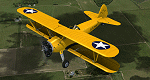
This is a repaint only, for the payware Vertigo Studios Stearman Vol.1 set. This repaint depicts the restored Stearman N2S-1, N50061, owned/operated by Paul Ehlen and based at the Wings of the North Museum at Flying Cloud Airport, Eden Prairie, Minnesota. The aircraft, originally manufactured as U.S. Navy BuNo. 3347, is one of five Stearmans known to still exist that were flown by President George H. W. Bush as a cadet in the Navy. He flew this aircraft while training in the cold Minnesota winter at Wold-Chamberlain Airfield, Naval Air Station Minneapolis (modern-day KMSP), in January and early February 1943. The aircraft was sent to AirCorps Aviation for ground-up restoration in 2014, and emerged in 2015 as one of, if not the most period-authentic restored Stearmans to-date, restored to just as it was in 1943 (no electric starter (only hand-crank start) and no radios of any sort). The aircraft won "Best Stearman" at Oshkosh 2015.
| Filename: | George_Bush_N2S1_Stearman_N50061.zip |
| License: | Freeware |
| Added: | 22nd January 2017, 04:10:24 |
| Downloads: | 213 |
| Author: | John Terrell |
| Size: | 25.25 MB |
| Category: Flight Simulator X - Scenery | |
| RAF Manston 1944 |
|
File Description:
RAF Manston (ICAO EGMH)was an RAF station in the north-east of Kent, on the Isle of Thanet from 1916 until 1996. The site is now split between a commercial airport Kent International Airport (KIA) and a continuing military use by the Defence Fire Training and Development Centre (DFTDC), following on from a long-standing training facility for RAF firefighters at the Manston base.
Source: Wikipedia
I have represented it here in 1944 leading up to its part in Operation Market garden and D Day. It was one of the few airfields installed with the Fog Investigation Dispersal Organisation (FIDO) system designed to remove fog from airfields by burning it off with petrol and I have represented this with the 8 fuel tanks at the 29 end of the mail runway. I have laid the station out roughly according to an old map made in the mid 40s but I make no claims to the accuracy of building I have used.
| Filename: | RAF_Manston_1944.zip |
| License: | Freeware |
| Added: | 26th April 2016, 00:15:35 |
| Downloads: | 160 |
| Author: | Terry Boissel |
| Size: | 1.71 MB |
| Category: Flight Simulator X - Scenery | |
| X2MB - RAF Membury - Berkshire, England |
|
File Description:
RAF Membury (ICAO X2MB) is a former Royal Air Force station built in the civil parish of Lambourn in Berkshire, England. The airfield is located approximately 4.6 miles (7.4 km) mi north-northwest of Hungerford, at the Membury services stop of the M4 motorway; about 60 miles (97 km) miles west-southwest of London. The airfield also lies immediately next to the Iron Age hill fort of Membury Camp.
Opened in 1942, it was used by both the Royal Air Force (RAF) and United States Army Air Forces (USAAF). During the war it was used by several combat units with varying missions. It was also a major supply and maintenance depot. After the war, it was a private airport until the construction of the M4 motorway in the 1960s when it was closed.
Today the remains of the airfield are located on private property with the former technical site now being an industrial estate (Membury Business Park).
Source: Wikipedia
| Filename: | X2MB__RAF_Membury__Berkshire_England.zip |
| License: | Freeware |
| Added: | 7th April 2016, 17:26:37 |
| Downloads: | 126 |
| Author: | Terry Boissel |
| Size: | 1.63 MB |
| Category: Flight Simulator X - Scenery | |
| RAF Ludford Magna |
|
File Description:
RAF Ludford Magna was a Royal Air Force airfield operated by Bomber Command during the Second World War and the Cold War. The station lay on agricultural farmland immediately south of the village of Ludford, Lincolnshire and was sited 21.4miles (34.4 km) north east of the county town of Lincoln, Lincolnshire, England. The remains of the station can be seen from the B1225 Caistor High Street, and the long distance footpath the Viking Way passes right next to the eastern perimeter track.
It was the highest bomber airfield in England at 428 feet (130 m) above sea level, and cost £803,000 to build.
All credit must go to the following authors without whose work I could not have made this scenery; all credit for the models contained in it is theirs I merely placed it. If you don't have any of the third party addons you will only see the runway and peri track: Ted Andrews - Ian Pearson - Mike Hudson
| Filename: | RAF_Ludford_Magna.zip |
| License: | Freeware |
| Added: | 5th October 2015, 20:07:32 |
| Downloads: | 339 |
| Author: | Terry Boissel |
| Size: | 20.9 KB |
| Category: Flight Simulator X - Aircraft Repaints, Textures and Modifications | |
| Boeing B-17G (42-102550) |
|
Images related to this file:
File Description:
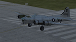
B-17G-55-BO 42-102550 of the 452nd BG. 42-102550 crashed on November 29, 1944, at Charlotte, North Carolina. Icy conditions caused the new B-17 to skid off the end of the runway and come to rest on the Southern Railway tracks as train was approaching. Crew No. 590 of Squadron "S" of the 326th base Unit training pout of MacDill. Irony is they just won "Crew of the Month" so they were allowed to fly anywhere they wanted to, so for their reward, they flew to Charlotte N.C. No injuries, the crew landed long and overran the end of the runway. A great story with a local woman who put a broom in a fire so it could be used to flag down an oncoming train! The plane had to be destroyed to get it off the tracks and the military split up the crew as punishment.
Repaint by Will "dafraz48" Turner, based on the A2A paintkit, March 2015.
| Filename: | Boeing_B17G_42102550.zip |
| License: | Freeware |
| Added: | 11th March 2015, 13:51:53 |
| Downloads: | 93 |
| Author: | Will Turner |
| Size: | 11.67 MB |


© 2001-2026 AVSIM Online
All Rights Reserved
Privacy Policy |