
Where Flight Simulation Enthusiasts Gather from Around the World!
AVSIM Library - Search Results

| Category: Flight Simulator 2004 - Scenery | |
| Fort Nelson CYYE in British Columbia, Canada |

|
Images related to this file:
File Description:
Fort Nelson is close to the Peace River in the northeast corner of British Columbia, around 70 miles from the northern border, 90 from the eastern border, and 80 miles east of the Rockies. The wartime construction of the Alaska Highway actually started from Fort Nelson, as there was already a road from Fort St John (which is close to Dawson Creek) north to Fort Nelson. The airfield was part of this construction effort and after the wartime ferrying of planes to Russia it was used by the US Army Air Force and then by the Canadian Air Force. Fort Nelson flourished with the oil and gas exploration of the 1950's and the following years, and this continued to grow until the collapse of the oil price in 2014.
The town of Fort Nelson became the capital of the Northern Rockies Regional District when it was founded in 2009, and as a result the official name of the Fort Nelson airport is the Northern Rockies Regional Airport. The date for this scenery is around 2016, by which time the economic fortunes of the town were in decline. Five times per day flights by Central Mountain Air were starting to be reduced in number to the current (in 2022) one per day and none on Sunday; in the AI included here there are two flights per day. The main resident users of the airport are four helicopter companies, the helicopters presumably used for maintenance trips to whatever parts of the oil and gas fields that are still in use in the surrounding area.
There are two runways, the main one is aligned 03-21, 6,400 feet long and 200 feet wide, with ILS at the southern end and PAPI at the northern. The second runway (a narrower rebuild on a previously existing runway) is aligned 07-25 and 77 feet wide, and is without any lights. These are the alignments as per the original build of FS9 and not as per the approximate 2016 date of the buildings; I had a problem at a very late stage in making this scenery which prevented me from continuing with some final details.
On YouTube there is a series of posts by Angle of Attack showing the preparation and then the flight of an old Cessna 172 from Homer to Oshkosh for the installation of modern instruments. Interesting for me as they visit or fly over airfields I have made (Homer, Merrill, Tok Junction, Burwash, Silver City, Haines Junction, Watson Lake, Fort Nelson, and Grande Prairie) but in the winter so it all looks very different.
| Filename: | Fort_Nelson_CYYE_in_British_Columbia_Canada.zip |
| License: | Freeware, limited distribution |
| Added: | 23rd January 2022, 20:11:18 |
| Downloads: | 187 |
| Author: | Roger Wensley |
| Size: | 28.35 MB |
| Category: Flight Simulator 2004 - Scenery | |
| Schefferville CYKL & Squaw Lake CSZ9 in Quebec Canada |
|
Images related to this file:
File Description:
Schefferville is a town in an area of Quebec that is surrounded by Labrador, the border taking an unusual wriggly course instead of the normal Canadian straight line. One has to presume that there was a lot of political negotiation involved. Take a look at Google Earth to see what I mean. The town was established in 1954 (initially at a site a bit north of the present location, and with a different name) to support newly established iron ore mining. To assist with the exploration for further iron ore and the construction of the railway it seems that there was a forced relocation of native population. Although iron ore mining around Schefferville in its current location flourished through the late 1960's these relocated folk were neglected and suffered "destitute poverty". Through the 1970's iron ore mining declined and ceased in Schefferville in 1982, when most of the 4,000 or so non-native residents left. Since the year 2000 there have been moves to reopen mining in the area and production restarted in 2011, the approximate date of this scenery. The main reason why iron ore mining started again in Schefferville as opposed to any other area in Quebec or Labrador is the existing railway, used for ore transportation. There is no road connection and the airport is the only other means of access for the 250(?) town inhabitants. This population figure is somewhat of a guess, and the town inhabitants are largely company officers who change and move in and out as required by their work. Schefferville airport is to the east of the town. It has a single lit asphalt runway that is aligned 18-36 and is 4,975 feet long and 150 feet wide, with PAPI at both ends. Air Inuit flights connect with Kuujjuaq to the north and Sept-Isles to the south with onward connections to all parts of Canada. There are other charter flights for company personnel. The terminal building has been renovated and the photos show just how dilapidated it had become before this was done. I like it. This scenery also includes Squaw Lake, a float base that is used by Air Saguenay. Or was, as the company was closed in 2019 after an accident involving several deaths. The reason for Air Saguenay establishing a float base here was, once again, the railway, which allowed people to reach Schefferville for a reasonable cost. They could then use the float planes for a shorter distance and reasonable price to reach fishing lodges on the lakes to the north. If you find an error email me please, and note that my email address has been changed to rogwens at Gmail dot com.
| Filename: | Schefferville_CYKL__Squaw_Lake_CSZ9_in_Quebec_Cana.zip |
| License: | Freeware, limited distribution |
| Added: | 1st August 2021, 16:10:32 |
| Downloads: | 126 |
| Author: | Roger Wensley |
| Size: | 16.63 MB |
| Category: Flight Simulator 2004 - Scenery | |
| 71AK - Bluff Park Farm, plus others |
|
Images related to this file:
File Description:
Bluff Park Farm 71AK is on the northern side of Knik Arm, opposite Birchwood on the southern side. Wasilla Creek Airpark 05AK is just under 5 miles northeast of Wolf Lake. Memory Lake 5AK8 is 3 miles north of the town of Wasilla. The others, which are all in with the Wasilla Creek Airpark scenery, are scattered around and are mostly included in this list because of FS9 to UT altitude anomalies. Where there is a hangar or another building this as been added, but where there are no buildings I have just made the elevation adjustments so that there is no ridiculous "runway-in-a-hole" situation visible near one of the other airfields that I have made in the area. This post includes, in total, 71AK, 05AK, 5AK8, 3AK2, 05AK, 5AK5, 16AK, 34AK, 59AK, and AK65.
| Filename: | 71AK__Bluff_Park_Farm_plus_others.zip |
| License: | Freeware, limited distribution |
| Added: | 26th October 2014, 02:05:06 |
| Downloads: | 215 |
| Author: | Roger Wensley |
| Size: | 4.74 MB |
| Category: Flight Simulator X - Aircraft Repaints, Textures and Modifications | |
| Boeing C-75 Stratoliner "Navajo" |
|
Images related to this file:
File Description:
This repaint is for the FSX version 1.1 JBK Boeing 307 Stratoliner and is in dds format.
In early 1942, the USAAF impressed all five of TWA's SA-307B Stratoliners, making modifications to extend their range, using them as VIP transports under the C-75 designation. These aircraft served until 1944 in the Air Transport Command with their TWA crews. They were rebuilt that year as SA-307B-1s and returned to TWA.
Navajo (c/n 2001) was impressed as 42-88627. In Feb 1942, surveyed the Air Transport Command southern route from Washington DC to Cairo via Natal Brasil. The following month carried Generals Marshall, Eisenhower, Clark, Col. Vandenberg, Admiral Towers, Averill Harriman, and Harry Hopkins, across the North Atlantic to England on a VIP "all brass" flight. Returned to TWA in July 1944 and rebuilt as SA-307B-1 N19909.
| Filename: | Boeing_C75_Stratoliner_Navajo.zip |
| License: | Freeware |
| Added: | 29th December 2016, 07:30:47 |
| Downloads: | 134 |
| Author: | Willy McCoy |
| Size: | 15.77 MB |
| Category: Flight Simulator 2004 - Scenery | |
| VFR of Lario, Area D2 - Como lake, Italy |
|
Images related to this file:
File Description:
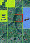
This is the seventh scenery of the "VFR of Lario" project, made with photorealistic terrain and some 3D GMax realistic objects. This scenery covers approximately an area of 7.5x6 kmt, from
north of Bellano (NW) to Casargo (NE), and from Fiumelatte (SW) to Cortenova (SE) and includes the NLC piers of Varenna and Bellano; it includes several dedicated buildings as Vezio castle (Perledo), villa Monastero, S.Giorgio church, marina, piers, hotel Olivedo, and some villas (Varenna), Tommaso Grossi square with pier and light fountain, S.Nazaro-Celso and S.Rocco-Sebastiano churches, Cantoni old cotton mill, group of houses by the lake (Bellano). There are also included four viaducts between the tunnels of the freeway 36, with moted traffic. Hydrofoil G. Marconi at Bellano pier together with other minor boats and docks alongside the lake coast; a moted traffic of motorboats is placed between Varenna's piers.
| Filename: | VFR_of_Lario_Area_D2__Como_lake_Italy.zip |
| License: | Freeware |
| Added: | 23rd July 2012, 15:45:14 |
| Downloads: | 1,259 |
| Author: | Aldo Della Vedova, Daniele Lanfranchi, Gian Mario Verga |
| Size: | 17.95 MB |
| Category: Prepar3D V5 - Scenery | |
| Victoria Falls Bridge – Southern Africa |
|
Images related to this file:
File Description:
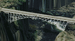
The Victoria falls bridge is located just below the spectacular Victoria water falls in the Zambezi River linking Zimbabwe and Zambia. The steel bridge was completed in 1905 and spans the 200m wide and 128 m wide gorge just below the 1708 m wide falls. This area seems to be a bit neglected in the sim despite the latest add-ons so I decided to spruce it up a little by adding a spray effect for the falls and making some changes to the surface to try to show the waterfall.
I used the P3D 5.3 SDK and tested it in P3D V5.3 using the ORBX Africa LC and Pilots NG2020 mesh products The falls and bridge is 10nm to the north of FVFA in Zimbabwe or 165 degrees from FLNH if you want to approach it from the Zambia side.
| Filename: | Victoria_Falls_Bridge___Southern_Africa.zip |
| License: | Freeware |
| Added: | 1st February 2022, 01:06:27 |
| Downloads: | 66 |
| Author: | Johan Pienaar |
| Size: | 12.78 MB |
| Category: Flight Simulator X - Aircraft Repaints, Textures and Modifications | |
| Cessna 195 Businessliner (N999MH) |
|
Images related to this file:
File Description:
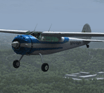
N999MH, (Strangely, no date for when it was built) left sunny California to live at Compton Abbas Airfield, Wiltshire (EGHA) The owner, Detiger Elizabeth, (I'm intrigued by that name)a member of The Air Squadron UNA, won't thank me for bringing this up: "25 October 2003. "After a normal start, the pilot taxied his tail wheel aircraft across the grass towards the holding area for Runway 26. The weather was good with a light north-westerly surface wind. Two other aircraft were stationary, holding for the runway, and the pilot of N999MH failed to see one of these aircraft.The right wing of N999MH struck the propeller of one of these aircraft, G-AYEV." Oops!
As per usual, only download this paint if you possess a bona fide copy of Alabeo's C195 Businessliner 'cos you know it ain't right otherwise. ;-)
| Filename: | Cessna_195_Businessliner_N999MH.zip |
| License: | Freeware |
| Added: | 7th April 2014, 18:56:21 |
| Downloads: | 383 |
| Author: | Ron Attwood |
| Size: | 17.13 MB |
| Category: Flight Simulator X - Aircraft Repaints, Textures and Modifications | |
| Lockheed Martin F-35A RNLAF 311 "Bald Eagle" Sqn update |
|
Images related to this file:
File Description:
Lockheed Martin F-35A for FSX by Dino Cattaneo in (yet fictional) RNLAF livery. My sixth paint resembles a future 311 Sqn livery, located at Volkel AB, The netherlands. This repaint is an update to my previously uploaded 311 Sqn repaint, with some minor changes in the tail section and engine nozzle. 311 Squadron is an old occupant of Volkel airbase soil. The squadron logo represents a North-American bald eagle in attack position. The predator bird is know for it's agility and fabulous hunting skills. Combine that with the squadrons task and aircraft flown in history (all fighters) and you will soon conclude to the squadrons motto; "Ut Aquila Praedans", which translates to "Hunting like the eagle". You need the excellent payware Lockheed Martin F-35A by Dino Cattaneo in order to use this repaint. Enjoy!
| Filename: | Lockheed_Martin_F35A_RNLAF_311_Bald_Eagle_Sqn_upda.zip |
| License: | Freeware |
| Added: | 17th August 2010, 00:44:32 |
| Downloads: | 168 |
| Author: | Rene Spaan |
| Size: | 19.44 MB |
| Category: Flight Simulator X - Scenery | |
| Tatoi Airbase (LGTT) |
|
Images related to this file:
File Description:
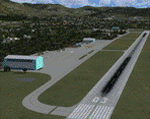
Tatoi AB is located north of Athens and is the home of the Air Training Comand of the Hellenic Air Force as well as all the Academys for basic training of all officer ranks of aircrew and ground crew for the Air Force. The Air force Museum is also based there with a substantial collection of historical static exhibits. Tatoi is also home of three Aeroclubs, the Athens Aeroclub, the Mesogion Aeroclub and Dekeleia Aeroclub as well as the Athens gliding club.
This addon will substantially revamp the scenery for LGTT as well as move the airport to its correct location. All buildings are custom made to represent the actual ones as closely as possible, based on existing photographs as well as my own experiences of being a member of the Athens Aeroclub and currently training there for my PPL.
| Filename: | Tatoi_Airbase_LGTT.zip |
| License: | Freeware |
| Added: | 25th June 2010, 22:10:09 |
| Downloads: | 3,502 |
| Author: | Vassilios Dimoulas |
| Size: | 13.5 MB |
| Category: Flight Simulator X - Scenery | |
| EGHA Compton Abbas |
|
File Description:
All additional Buildings were placed using default objects.
AI traffic uses default aircraft which was scheduled by hand using the TrafficDatabaseBuilder from the SDK tools provided by FSX Deluxe.
Any additional roads and modified Landclass & water features were created using FSX-KML.
This package adds the apron , Hangars, clubhouse and the fueling station has been moved to the correct spot between the hangars.
Some of the local roads have been added to allow road access to the airfield.
The main wooded areas have been added to the North and south of the airfield and cropland defined surrounding the immediate area although FSX insists on putting trees on some steeper slopes.
I have also included 3 of the villages nearby , Compton Abbas, Ashmore and Fontmell Magna .
It also provides parking spots and ATC interaction along with some AI traffic.
Hope you like it :)
| Filename: | EGHA_Compton_Abbas.zip |
| License: | Freeware, limited distribution |
| Added: | 1st October 2007, 17:08:37 |
| Downloads: | 1,887 |
| Author: | Len Hickman |
| Size: | 17.45 KB |


© 2001-2026 AVSIM Online
All Rights Reserved
Privacy Policy |