
Where Flight Simulation Enthusiasts Gather from Around the World!
AVSIM Library - Search Results

| Category: Flight Simulator 2004 - Aircraft Repaints, Textures and Modifications | |
| Italian Air Force Supermarine Spitfire Mk Vb |

|
File Description:
The Spitfire MK V was one of the best known marks, powered by the Merlin 46 of 1440 hp. It served from the Summer of 1941 on, and was the first Spitfire to serve overseas.The trop was modified to operate in dusty and adverse envionments such as North Africa. These modifications extracted a small performance penalty. The Regia Aeronautica (Royal Italian Air Force) received 53 Spitfires Mk V from R.A.F., during August of 1944, but , due to their poor conditions, only 33 of them were used. These planes, assigned to 20 Gruppo of 51 Stormo were based on Galatina Airport (Lecce, Italy). Two of these Spits flown during the last mission of Regia Aeronautica during WW2 (5 May 1945). Textures only for payware 'Sky Unlimited Spitfire Mk V'. Repaint by Manuele Villa.
| Filename: | Italian_Air_Force_Supermarine_Spitfire_Mk_Vb.zip |
| License: | Freeware |
| Added: | 30th October 2006, 11:08:47 |
| Downloads: | 366 |
| Author: | Manuele Villa |
| Size: | 1.2 MB |
| Category: Flight Simulator 2004 - Scenery | |
| Igloolik CYGT in Nunavut Canada |
|
Images related to this file:
File Description:
Igloolik is a village of 1,600 or so inhabitants at N 69 22 W 81 49 on Igloolik Island, off the northeast corner of the Melville Peninsula. It's name means approximately "Place With A House". The village does not feature in FS9 but is included in this scenery with approximately the right shape, as were the series of northern sceneries before this one. The airfield runway is 4,095 feet of gravel 100 feet wide and is at 173 feet above sea level. There is a gradient to it, but unfortunately this cannot be replicated in FS. I added the roads, a new airfield background, plus of course there is the scenery file and the AFCAD and AI, which has two planes visiting, a First Air HS748 and a Canadian North Dash 8-100.
| Filename: | Igloolik_CYGT_in_Nunavut_Canada.zip |
| License: | Freeware, limited distribution |
| Added: | 23rd December 2010, 02:28:26 |
| Downloads: | 522 |
| Author: | Roger Wensley |
| Size: | 2.7 MB |
| Category: Flight Simulator X - Scenery | |
| Kuujjuaq CYVP - v2 |
|
Images related to this file:
File Description:
Kuujjuaq is in northern Quebec, Canada. At the southern end of Ungava Bay, and 30 miles up the Koksoak River. it was previously called Fort Chimo. Kuujjuaq is considered the capital of Nunavik, a well known northern caribou hunters and a large base of Air Inuit relay.
The scenery includes:
- The airport and its major buildings and objects,
- Weather radar on a hill northeast of the airport,
- The Zelada Desgagnes stranded facing the village and Sedna Desgagnes traveling between Kuujjuaq and the Ungava Bay,
- Large boats moving on the Koksoak River, near the island Koksoak,
- Hydrobase Stewart Lake, 2.3 miles north of the airport,
- A hunting camp (with caribou!), A geological camp and fishing camp (with cabins, tents and canoes).
| Filename: | Kuujjuaq_CYVP__v2.zip |
| License: | Freeware, limited distribution |
| Added: | 12th March 2014, 09:23:10 |
| Downloads: | 2,108 |
| Author: | Jean-Pierre Fillion, Pierre Gallant |
| Size: | 7.04 MB |
| Category: Flight Simulator 2004 - Scenery | |
| Jenny Lind Island CWJL in Nunavut, Canada |
|
Images related to this file:
File Description:
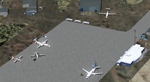
This was a DEW line Auxiliary Station on Jenny Lind Island; the island is about 14 miles by 12 miles and off the southeast corner of Victoria Island, 85 miles east of Cambridge Bay. The station was closed in 1992 but is still there as "closed" meant "shut the door and walk away". There has been some later removal of diesel tanks and other polluting items but the buildings are still intact, and the runway is 4,470 feet of gravel 150' wide. At the western end there is an apron and a large hangar. There are of course no lights, signage, or windsock. A North Warning System station was built in 1990, 6 miles inland to the northwest of the runway. This has a shorter (1,400'?) gravel runway (and named CWJX here).
| Filename: | Jenny_Lind_Island_CWJL_in_Nunavut_Canada.zip |
| License: | Freeware, limited distribution |
| Added: | 15th November 2012, 13:55:29 |
| Downloads: | 190 |
| Author: | Roger Wensley |
| Size: | 1.65 MB |
| Category: Flight Simulator 2004 - AFCAD Files | |
| Boston Logan Int'l (KBOS) with active Crosswind Runways |
|
Images related to this file:
File Description:
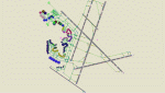
This is a high spec AFCAD2 for the (Freeware) FS2004 Boston Logan Int'l Airport (KBOS) scenery by Fly Tampa / George Grimshaw. This afcad has been built using FAA Charts and information from the Airport Website. All gates are named and have airlines assigned to them. The Fedex and UPS aprons are represented and can accommodate many cargo aircraft. The final parking area is random GA parking and the various maintenance areas to the north of the airport. This airport now features an accurate tower view. Finally, by using the crosswind runway technique, all runways can be used simultaneously for take-off and landing (see brief). Enjoy!!
This file will work with version 2.1 of the airport ONLY (adds the new runway 14/32, new American Eagle gates).
| Filename: | Boston_Logan_Intl_KBOS_with_active_Crosswind_Runwa.zip |
| License: | Freeware |
| Added: | 4th March 2010, 13:26:27 |
| Downloads: | 2,246 |
| Author: | Lee Brompton |
| Size: | 40.32 KB |
| Category: Flight Simulator 2004 - Scenery | |
| Treasure_Island |
|
File Description:
FS2004 Treasure Island around late 1920's to the mid 1930's
Scenery by Tha Fox's Hangar.
This is a recreation of Treasure Island in San Fransisco. This
scenery inclueds The Pan Am sea plane base at the south end of
the Island and the Navy airfield at the north end. At the Pan Am
end there was the two big hangars, two smaller hangar side by side
and the Pan American terminal. At the Navy end there was two runways
for a short time, but about the mid 30's the Navy removed one
of the runways and most of the Navy airtrafic consiced of the
airships.
In this scenery addon I included boath runway on at the Navy end
of the airfield and Pan Am's installation at the south end.
| Filename: | Treasure_Island.zip |
| License: | Freeware |
| Added: | 6th February 2009, 09:37:04 |
| Downloads: | 735 |
| Author: | Kenny Fox |
| Size: | 4.83 MB |
| Category: Flight Simulator 2002 - Scenery | |
| DEW Line Stations for Alaska, Canada And Greenland |
|
File Description:
This scenery is meant to capture the essence of the Distant Early Warning (DEW) Line of radar and communications stations stretching from the Aleutian Islands in Alaska across the Northern shores of Alaska and Canada into Greenland. The package includes 78 of the DEWLine stations. The DEW Line served as the early warning system for North America during the years of the cold war. Many of the stations were built in the 50’s with others added in the 60’s, 70’s and into the 80’s. Most of these installations have now been closed. Many of the objects have been modeled from photographs. Where possible, site photographs were used to insure that the layouts were as representative of the sites as possible. They are, however, representations only.
| Filename: | DEW_Line_Stations_for_Alaska_Canada_And_Greenland.zip |
| License: | Freeware, limited distribution |
| Added: | 1st February 2003, 00:19:18 |
| Downloads: | 5,230 |
| Author: | Al Gay and Bear Baker |
| Size: | 11.65 MB |
| Category: Flight Simulator 2004 - Scenery | |
| OLRA - Rayak Air Base in the Bekaa Valley, Lebanon - Updated |
|
Images related to this file:
File Description:
This is an updated version that includes the AI planes and WITH SCENERY TEXTURES. Rayak OLRA is at 3,183 feet asl in the Bekaa Valley in Lebanon, a short hop over the mountains from Beirut. It has a single runway almost 10,000 feet long, aligned 40-220. It used to be the main base of the small Lebanese air force (I think three Hawker Hunters) but is now, although still in use, relegated to secondary status since a new base was opened in the north of Lebanon. I believe there are also some civilian users, though that could be misinformation. I made this after a recent visit. Which does not mean that the buildings are all totally accurate but it is for sure better than the default FS9.
| Filename: | OLRA__Rayak_Air_Base_in_the_Bekaa_Valley_Lebanon__.zip |
| License: | Freeware, limited distribution |
| Added: | 24th May 2014, 19:47:41 |
| Downloads: | 495 |
| Author: | Roger Wensley |
| Size: | 3.69 MB |
| Category: Flight Simulator X - Scenery | |
| OOMS - Seeb Muscat Int'l Airport 2015 - Oman |
|
Images related to this file:
File Description:
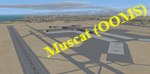
Muscat - Seeb Int'l airport, Oman, serving the the capital of the Sultanate of Oman, is undergoing a major construction of new passenger terminal (North Civilian Apron). The new northern runway (08L/26R) is fully operational with ILS and RNAV, 4000m X 60m.
The current default airport aprons and taxiway remain the same, so simmers could still taxi in and out from the old operational apron to the new runway (A long way though!). An updated version will be pushed once the construction is completed.
Compatible with both FSX and P3D.
| Filename: | OOMS__Seeb_Muscat_Intl_Airport_2015__Oman.zip |
| License: | Freeware, limited distribution |
| Added: | 15th February 2016, 20:23:01 |
| Downloads: | 1,428 |
| Author: | Ahmed Abdessalam |
| Size: | 237.04 KB |
| Category: Flight Simulator 2004 - Scenery | |
| Bari Palese Macchie 2011 (LIBD) - Airport scenery |
|
Images related to this file:
File Description:
This FS2004 scenery reproduce the international airport "Bari Palese Macchie" (Icao: LIBD) located in the south-east region of Italy named "Puglia", 10 km north of the city Bari.
The greatest part of the airport buildings and the ground fleet vehicle are designed with photoreal textures after watching a lot of airport pictures;hundred of object, markings, static and some dynamic vehicle are placed on the scenery; the buildings, gates number and Afcad file are the same as the real airport at spring 2011. Frame rate friendly (all object designed with GMax and LOD technique) and full night lighting. Extensive handbook and set-up procedures in English and Italian language.The scenery is full compatible with photoreal background and UTE because every object is placed in the right position in according to the satellite image.
| Filename: | Bari_Palese_Macchie_2011_LIBD__Airport_scenery.zip |
| License: | Freeware |
| Added: | 11th October 2011, 04:02:13 |
| Downloads: | 9,738 |
| Author: | Alberto Di Bolzano/AlbySim Scenery Design |
| Size: | 26.42 MB |


© 2001-2026 AVSIM Online
All Rights Reserved
Privacy Policy |