
Where Flight Simulation Enthusiasts Gather from Around the World!
AVSIM Library - Search Results

| Category: Flight Simulator X - Scenery | |
| YBLT - Ballarat Aerodrome - Victoria, Australia |

|
Images related to this file:
File Description:
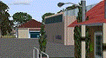
YBLT (Ballarat Aerodrome) is a regional 'airport' in the central west of the State of Victoria, Australia and utilises infrastructure from the days of RAAF operations which lasted till the early 1960's. Thus the buildings are now a bit outdated but this file does not reflect that as I have not done any custom texturing so everything in this package tends to look a bit new and crispy.
Note the name of this 'airport'. The locals are adamant it is an aerodrome, not an airport. I have not found any freeware or commercial offerings for an alternative to the default and so I have put one together.
This is a reasonable approximation of the airport /aerodrome but is not entirely accurate as the hangars/buildings I have modelled myself are generic ones I have done and do not look exactly like the ones at that facility. The connecting road is not in true alignment as I have created it so as it blends into the surrounding default scenery.
| Filename: | YBLT__Ballarat_Aerodrome__Victoria_Australia.zip |
| License: | Freeware |
| Added: | 21st October 2014, 01:51:16 |
| Downloads: | 838 |
| Author: | Robert Budd |
| Size: | 4.43 MB |
| Category: Flight Simulator 2004 - AFCAD Files | |
| T.F. Green State Airport - Providence (PVD/KPVD) |
|
File Description:
AFCAD of the KPVD airport. Includes accuarate gate numbering and locations for all airlines serving the airport as well as assigned cargo areas and parking for general aviation aircraft. This is my continuing series of doing airports that have been neglected by both MS and the community. Hopefully this will enhance flying into this airport for those of you that frequent it. Terminal space for this airport is actually slightly better then previous airports I've done but still a bit on the small side, I've had to expand the ramp space from the default since it was shaped wrong. Every gate, however, is present and correctly numbered and airlines assigned to the right gates based on the PVD airport website. Delta, US Airways and Southwest seem to be the dominant carriers to this airport. I will be continuing to do mid sized aiports accross the US and then probably do some updates to my original Central America and Caribbean afcads. Hope this enhances your flying into and out of the beautiful state of Rhode Island.
| Filename: | TF_Green_State_Airport__Providence_PVDKPVD.zip |
| License: | Freeware |
| Added: | 2nd July 2004, 21:09:44 |
| Downloads: | 1,088 |
| Author: | Jason Diaz |
| Size: | 127.73 KB |
| Category: Flight Simulator X - Flight Plans | |
| When The Land Trembles |
|
File Description:
At 8:46 A.M. a 6.2 in the Richter Scale Earthquake hit the western mountains of Guatemala, Central America.
Two Flight Routes have been set up by the Civil Defence and SAR authorities. They use
two airports to reconnoiter their respective areas. It has been reported that two mines
in the western Pine Mountains have been heavely hit and in Mine 1( Socrates Fer Coal Ltd ) there are some
wounded miners which must be picked up. Mine 2 (Ductil Ltd.Mine No.33) has been totally abandoned and
must be looked at for important documentation pertaining to security (?)
You can choose RED FLIGHT, where you will use a good transport aircraft, since you must pick up
the wounded and others---- or BLUE FLIGHT which is a " reconnaissance" flight out to a lake area and access
the damage as well as land and bring radio communications equipment to the communities.
Either way, this is dangerous stuff-----are your wits ready for such flying tasks?????----By the way, Dr. Lalita
Mazsis is counting on you to fly her safely....OH Boy!!!!!!!!------
| Filename: | When_The_Land_Trembles.zip |
| License: | Freeware, limited distribution |
| Added: | 19th October 2007, 21:11:11 |
| Downloads: | 674 |
| Author: | Gera Godoy C |
| Size: | 449.4 KB |
| Category: Flight Simulator 2004 - AI Aircraft | |
| Israeli Air Force Part 6 - Tel Nof Air Base F-15 |
|
Images related to this file:
File Description:

Tel Nof Air Base was founded in July 1939 during the British Mandate as RAF Aqir and served as the main Royal Air Force station in Palestine. It is located near the "city of science" Rehovot in central Israel.
The base is the primary operational and training center for all IDF paratroop forces, as well as the home of Unit
699 (a.k.a. Maslul), the Israeli Defense Force Airborne Combat Search and Rescue (CSAR) unit under the Special
Air Force Command (KAHAM). The ORT Israel - the Administration for Research and Development and Training -
operates the Air Force Industry School at Tel Nof.
In addition to the two operational squadrons on F-15, Tel Nof is home to the MANAT evaluation unit which
conducts flight testing and evaluation of aircraft and weapons systems. This unit is designated as the 601 squadron
AFCADs: Giorgio Perotti and MAIW Team, Models: Nick Black, FDE and Effects Design: John Stinstrom,
Henry Tomkiewicz, Michael MacIntyre and Nick Needham, Repaints: Ray Parker, Voicepacks: Stewart Pearson,
Flightplans and Custom Scenery: Giorgio Perotti, Scenery objects: John Stinstrom and Ted Andrews.
| Filename: | Israeli_Air_Force_Part_6___Tel_Nof_Air_Base_F15.zip |
| License: | Freeware |
| Added: | 24th January 2014, 21:27:14 |
| Downloads: | 489 |
| Author: | MAIW - Giorgio Perotti |
| Size: | 37.66 MB |
| Category: Flight Simulator X - Scenery | |
| PABE - Bethel Airport - Alaska, USA |
|
Images related to this file:
File Description:
Bethel Airport is a state owned, public use airport located three nautical miles (6 km) southwest of the central business district of Bethel.
Construction began September 21, 1941, and the airfield was activated July 4, 1942; it is also known as Bethel Air Base. It was used by Air Transport Command as auxiliary airfield for Lend-Lease aircraft being flown to Siberia. The facility was transferred to Eleventh Air Force, then to Alaskan Air Command in 1945; it became the joint-use Bethel Airport. It was used for construction of AC&W Bethel Air Force Station in mid 1950s. Full jurisdiction was turned over to Alaska Government in 1958.
Added and adjusted aprons and buildings. Also added additional parking. Added runway 1R/19L.Re-numbered runways to conform with AirNav data.
Created with Airport Design Editor 9x by ScruffyDuck Software using current FAA documentation and Google Earth measurements, this package offers a replacement for FSX's stock airport. All these enhancements are as close to the real airport as I can get with stock library objects and custom buildings.
| Filename: | PABE__Bethel_Airport__Alaska_USA.zip |
| License: | Freeware |
| Added: | 5th December 2014, 13:35:35 |
| Downloads: | 991 |
| Author: | Wayne Roberts |
| Size: | 94.58 KB |
| Category: Flight Simulator 2004 - Scenery | |
| CYXD - Edmonton City Centre - Alberta, Canada V1 |
|
Images related to this file:
File Description:
Edmonton is in central Alberta, Canada. The City Centre airport has had other names (Edmonton Municipal, Blatchford Field) and was the first licensed airfield in Canada, in 1929. The history of aviation in northern Canada would not be complete if Edmonton was not included as a chapter in its own right. Unfortunately progress takes little notice of past glory and CYXD has now been closed and will be "redeveloped", in sharp contrast to the thriving City Centre airport in Toronto. This version for FS9 includes in the AI a 737 of Western Pacific, an airline that became Canadian Airlines in a merger in 1987. So this CYXD is maybe in the middle eighties, or perhaps the middle nineties with a vintage 737 being used for short haul to Calgary for sentimental reasons. Scheduled flights were in fact stopped in 1995, with the field being used for GA, charter flights, and medical evacuations etc since then. I have included many of the surrounding buildings, as the "City Centre Airport" really is surrounded by and part of the neighbourhood.
| Filename: | CYXD__Edmonton_City_Centre__Alberta_Canada_V1.zip |
| License: | Freeware, limited distribution |
| Added: | 14th September 2014, 21:13:01 |
| Downloads: | 1,633 |
| Author: | Roger Wensley |
| Size: | 54.85 MB |
| Category: Flight Simulator 2004 - Sounds | |
| AIG Alpha India Group Tower Package Release 7 |
|
Images related to this file:
File Description: UPDATE FOUND HERE:

This is the seventh release package of 33 EditVoicepack files for FS2004/FSX by the Alpha India Tower Group. This package includes all previously released files since Package Release 6. Our goal is to provide accurate ATC calls in order to provide Microsoft Flight Simulator traffic with quality ATC. These sounds are the best that we have been able to compile and are accurate as of release date and to the extent that our data and the limitations of the EditVoicepack allow. Included in this package release are AEROLIMOUSINE, ALBASTAR, AN28, AN3, AN32, AN8, AZAMAT, BRICKYARD, CENTRAL AMERICAN, COLUMBA AIR, CYLD, CZECH HOLIDAYS, DREAM TEAM, EM-EXPRESS, FLYING CENTER, GALILEO, HILO, JET EXECUTIVE, LUZAVIA, MCCALL, NAFT, NAKLAO, OPERA JET, SPECAIR, TAG ESPANA, TAIMYR, TAXI JET, TIBET, TIME AIR, TU154, TUNISIAN AIRFORCE, and Y7. Visit us at www.alpha-india.net for more information.
| Filename: | AIG_Alpha_India_Group_Tower_Package_Release_7.zip |
| License: | Freeware, limited distribution |
| Added: | 2nd September 2011, 22:43:25 |
| Downloads: | 3,241 |
| Author: | Alpha India Group |
| Size: | 26.38 KB |
| Category: Prepar3D V1-4 - Scenery | |
| Piarco International Airport - TTPP V1.2 |
|
File Description:
TTPP v1.2 - In this version, problems with markings in tax lanes have been fixed. The textures of the taxi stands have also been redone. More vehicles and vegetation were included.
Piarco International Airport (IATA: POS, ICAO: TTPP) is an international airport serving the island of Trinidad and is one of two international airports in Trinidad and Tobago. The airport is located 30 km (19 mi) east of Downtown Port of Spain, located in the adjacent town of Piarco. It is the seventh busiest airport in the Caribbean in terms of passengers served[6] and third busiest in the English-speaking Caribbean, after Sangster International Airport and Lynden Pindling International Airport. The airport is also the primary hub and operating base for the country's national airline, as well as the Caribbean's largest airline, Caribbean Airlines.
Piarco International Airport has direct scheduled service to destinations in the United States, Canada, Central America, South America and Europe. It is also a significant transit hub for the Southern Caribbean and serves as the primary connection point for many passengers travelling from Guyana.
| Filename: | Piarco_International_Airport__TTPP_V12.zip |
| License: | Freeware |
| Added: | 4th February 2022, 03:49:10 |
| Downloads: | 559 |
| Author: | Eduardo Puelker |
| Size: | 53.65 MB |
| Category: Prepar3D V1-4 - Scenery | |
| LGLR military base (P3D4) |
|
File Description:
Hi there !!
My name is Dimitri.
This is my FIRST EVER creation for flight simulation. And i like to share it with you all.
It's my hometown airport LGLR military base, Larissa city, here in central Greece.
When microsoft released FSX, i noticed that THIS airport was COMPLETLY ruined, empty .. and completly
misplaced at the wrong place on the map !! I tried for years, to find a good add-on but ....
nothing good so far ... Then lockheed martin toke over the code from microsoft and created P3D.
But still, this airport remained as it was before, nothing changed... I was SO mad, that i thought
I should do something about it my self.. so, here we are, i fixed it.
This airport was created with "Airport design editor version.177" and SbuilderX v.315
I was using ORBX base pack, with ORBX Europe LC and ORBX vector during the creation.
Keep in mind that i am using some small ORBX library objects like, grass, bushes and so on...
If you don't have ORBX installed, i don't know if this is gonna work.
| Filename: | LGLR_military_base_P3D4.zip |
| License: | Freeware |
| Added: | 4th August 2019, 17:25:21 |
| Downloads: | 700 |
| Author: | Dimitris P. Mylonas |
| Size: | 12.24 MB |
| Category: Flight Simulator 2004 - Scenery | |
| KSNA, John Wayne-Orange County Airport |
|
Images related to this file:
File Description:

John Wayne Airport (IATA: SNA, ICAO: KSNA, FAA LID: SNA) is an airport in an unincorporated area in Orange County, California, with its mailing address in the city of Santa Ana, which is also the county seat, hence the International Air Transport Association (IATA) airport code. The main entrance to the airport is off of MacArthur Blvd in Irvine, the city that abuts the airport from the north and east. Newport Beach and Costa Mesa form the southern and western boundaries, respectively, together with a small unincorporated area along the Corona del Mar (73) Freeway. Santa Ana lies just north, not actually touching the airport directly. Originally named Orange County Airport, the county Board of Supervisors renamed it in 1979 to honor the actor John Wayne, who resided in neighboring Newport Beach and died that year. It also became the first airport to be named after an entertainer.
The main runway, at 5,701 feet (1,738 m), is one of the shortest of any major airport in the United States, resulting in most passenger aircraft operating from the airport to be no larger than the Boeing 757. However, some larger cargo aircraft, such as the FedEx A310/300, fly from SNA. Some gates are built to handle planes up to the size of a Boeing 767, which can operate with payload/fuel load restrictions. No wide-body passenger aircraft are currently in scheduled service at the airport.
| Filename: | KSNA_John_WayneOrange_County_Airport.zip |
| License: | Freeware, limited distribution |
| Added: | 11th October 2011, 04:03:32 |
| Downloads: | 4,874 |
| Author: | Mateusz Stabryla MK-Studios |
| Size: | 59.73 MB |


© 2001-2026 AVSIM Online
All Rights Reserved
Privacy Policy |