
Where Flight Simulation Enthusiasts Gather from Around the World!
AVSIM Library - Search Results

| Category: Flight Simulator 2004 - Scenery | |
| Shaktoolik 2C7 in Alaska |

|
Images related to this file:
File Description:
Shaktoolik is a coastal village 35 miles north of Unalakleet, with a fishing population of around 250. It was originally established inland on the Shaktoolik River but moved to the coast in 1933. Due to storms and erosion it was again moved in 1967, to its current location 2 miles further north. Confusingly, what is called "New Shaktoolik 38A" was in fact only "new" in 1967 and has since been replaced by "Shaktoolik 2C7" further north, built on wider land with a longer gravel runway of 4,000 feet. 38A is still visible but unusable, with the sheds being used for other purposes. There are flights from Unalakleet, included in the AI here as a further modification to the Bethel PABE AI. A note here about my scenery making. This is post number 500 and there will not be many more to follow this as I am almost at the end of the photos I either took or found for scenery purposes. There is a limit to what can be located online and I have already been making use of the little there is; eg Unalakleet. So, if you are near an airport (preferably Canadian or Alaskan) and have a camera..... Let me know.
| Filename: | Shaktoolik_2C7_in_Alaska.zip |
| License: | Freeware, limited distribution |
| Added: | 27th July 2019, 21:00:56 |
| Downloads: | 105 |
| Author: | Roger Wensley |
| Size: | 4 MB |
| Category: Flight Simulator X - AFCAD Files | |
| Flying W Airport (N14), NJ |
|
File Description:
Located 01 miles SW of Lumberton, New Jersey on 170 acres of land, Flying W Airport services small to medium GA aircraft as well as helicopters. Transient storage are tie downs only. There are plenty of places to park. The main parking area in on the west side of the airport on the south end of the north tarmac and can handle wingspans of up to 50 feet. You can also park slightly north among the static aircraft or east of the runway on the grass. Collisions are disabled with static craft in these areas to assist with parking. Both 100LL and Jet-A are available by stopping at the south tarmac next to the fuel tank or the north tarmac by the fuel trucks in front of the terminal. Trees are summertime ONLY.
Scenery constructed with use of satellite images/streetview, the author has not been there in person.
This scenery is meant to be used in conjunction with MegaScenery Earth New Jersey/Delaware 002. It is not required, but apron use is minimized to allow satellite scenery to show through as much as possible, and objects are placed based on the MSE textures - lack of it may make scenery look out of place.
| Filename: | Flying_W_Airport_N14_NJ.zip |
| License: | Freeware |
| Added: | 24th October 2010, 18:53:47 |
| Downloads: | 217 |
| Author: | Drew Sikora |
| Size: | 805.7 KB |
| Category: Flight Simulator 2004 - Scenery | |
| Cape Dyer CWFD in Nunavut, Canada |
|
Images related to this file:
File Description:
Cape Dyer is on the southeast corner of Baffin Island, around 120 miles east of Pangnirtung at approximately N66 45 W61 30. There is a fine view north up the Davis Strait between Baffin Island and Greenland, and this is the whole reason for the airfield's existance as it was built to support the construction and operation of a DEW line radar station, which has now been updated to a North Warning System site. There are two camps; the upper camp is on the east side of the Cape and is where the radars are located, linked by a gravel road to the lower camp, which is on the west and more sheltered side of the Cape on the clifs above Sunneshine Fjord. The runway is 5,000' of 150' wide gravel, and it is lighted and at 1,320' feet ASL. Cape Dyer is now listed as abandoned in the Canada Flight Supplement. It is, however, still there and presumably is still used for access to the North Warning System equipment, which is automated and generally unmanned. The buildings were modeled for this scenery and include a hanagar large enough to accommodate a C-130. Ultimate Terrain is not required as it does not cover northern Canada.
| Filename: | Cape_Dyer_CWFD_in_Nunavut_Canada.zip |
| License: | Freeware, limited distribution |
| Added: | 21st June 2011, 19:30:07 |
| Downloads: | 488 |
| Author: | Roger Wensley |
| Size: | 1.9 MB |
| Category: Flight Simulator 2004 - Scenery | |
| Arctic Runway Signs in the "Northern Domestic Airspace", Canada |
|
Images related to this file:
File Description:
These are scenery bgl's to replace those previously posted for Cape Dorset, Gjoa Haven, Igloolik, and Whale Cove. All of these airfields are within what is marked on the chart as "Northern Domestic Airspace" and their runway signage is not given as a magnetic bearing but as a true bearing. This is because at those latitudes, close to magnetic north, the magnetic field is more vertical than horizontal and magnetic readings become unreliable. Planes report their course as a true course, and fly at a height that reflects their true course instead of their magnetic course. The picture shows the runway sign for Qikiqtarjuaq CYVM (which used to be called Broughton Island) which I am working on right now, and I realised that my training was so far behind me that I had forgotten all of the above. The boundary line of the two air spaces is not a straight line; the furthest south it reaches is on the west coast of Hudson Bay just north of Churchill. To the east it passes through the southern end of Baffin Island, and to the west it is north of the coast at the Alaskan border, and there is an illustration included here.
| Filename: | Arctic_Runway_Signs_in_the_Northern_Domestic_Airsp.zip |
| License: | Freeware, limited distribution |
| Added: | 11th June 2011, 03:06:36 |
| Downloads: | 307 |
| Author: | Roger Wensley |
| Size: | 1.21 MB |
| Category: Flight Simulator 2004 - Scenery | |
| Northern Canada Mining CYOA & CHB3 in Canada |
|
Images related to this file:
File Description:
These are two airfields in northern Canada, serving two mining operations. The furthest north is Hope Bay CHB3 in Nunavut. It is in a sheltered inlet less than 3 miles from the northern mainland coast and around 65 miles southwest of Cambridge Bay. The owner is Hope Bay Mining Ltd, and their operation mines gold out of a tunnel rather than open cast. The airfield is incorporated into the road that leads north to the sea; traffic is halted by traffic lights when a flight is expected. The runway is 3,000 feet of gravel aligned 01-19 and with PAPI at both ends.
The second airfield serves the Ekati diamond mine and is some 265 miles southwest of Hope Bay, in the Northwest Territories. Ekati was the first Canadian diamond mine and is 195 miles northeast of Yellowknife and less than 20 miles north of a later mine, Diavik (by Sid and Pete). CYOA reflects the relative value of the two mining operations and is far better equipped than Hope Bay. It can be described as an airport while Hope Bay remains an airfield. The runway is 6,400 feet of gravel aligned 36-18 with PAPI and strobe approach lights at both ends. The scale of the mining operation can only be described as huge.
| Filename: | Northern_Canada_Mining_CYOA__CHB3_in_Canada.zip |
| License: | Freeware, limited distribution |
| Added: | 11th August 2018, 22:59:06 |
| Downloads: | 217 |
| Author: | Roger Wensley |
| Size: | 8.24 MB |
| Category: Prepar3D V1-4 - Scenery | |
| POLISH AIRPORTS VOL. 2 X V4 DEMO |
|
Images related to this file:
File Description:
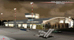
POLISH AIRPORTS VOL. 2 X V4 DEMO is a package of detailed sceneries of EPSC Szczecin, EPLL Lodz, EPZG Zielona Gora and EPRA Radom airports in Poland, fully compatible with FSX/FSX:SE/P3Dv1/P3Dv2/P3Dv3/P3Dv4 and FSW by Dovetail.
This product is a fully functional DEMO version of the commercial payware product. It features same airports layout as in the full version but with limited 3D objects and low resolution textures. Using this free demo ensures no problems with online (VATSIM, IVAO, multiplayer etc.) flying in case some users use the payware scenery and some don't.
Szczecin-Goleniow "Solidarnosc" (SZZ/EPSC) is the main domestic and international airport serving the city of Szczecin in Poland. Lodz Wladyslaw Reymont (LCJ/EPLL), formerly known as Lodz-Lublinek Airport, is a regional airport in central Poland. Zielona Gora-Babimost (IEG/EPZG) is a regional post-military airport located within the greater Zielona Gora agglomeration. Radom Airport (RDO/EPRA), also known as Radom-Sadków Airport is a civil and military airport in central Poland
The product is equipped with an automatic installer, which means that the scenery will be automatically added to the Flight Simulator Scenery Library. Please uninstall all previous versions of this airport you may have installed before. Please make also sure that no duplicated AFCAD files are installed.
Enjoy your virtual flying with Drzewiecki Design!
| Filename: | POLISH_AIRPORTS_VOL_2_X_V4_DEMO.zip |
| License: | Freeware, limited distribution |
| Added: | 23rd August 2017, 01:43:57 |
| Downloads: | 408 |
| Author: | Drzewiecki Design |
| Size: | 23.79 MB |
| Category: Dovetail Games Flight Sim World - Scenery | |
| POLISH AIRPORTS VOL. 2 X V4 DEMO |
|
Images related to this file:
File Description:

POLISH AIRPORTS VOL. 2 X V4 DEMO is a package of detailed sceneries of EPSC Szczecin, EPLL Lodz, EPZG Zielona Gora and EPRA Radom airports in Poland, fully compatible with FSX/FSX:SE/P3Dv1/P3Dv2/P3Dv3/P3Dv4 and FSW by Dovetail.
This product is a fully functional DEMO version of the commercial payware product. It features same airports layout as in the full version but with limited 3D objects and low resolution textures. Using this free demo ensures no problems with online (VATSIM, IVAO, multiplayer etc.) flying in case some users use the payware scenery and some don't.
Szczecin-Goleniow "Solidarnosc" (SZZ/EPSC) is the main domestic and international airport serving the city of Szczecin in Poland. Lodz Wladyslaw Reymont (LCJ/EPLL), formerly known as Lodz-Lublinek Airport, is a regional airport in central Poland. Zielona Gora-Babimost (IEG/EPZG) is a regional post-military airport located within the greater Zielona Gora agglomeration. Radom Airport (RDO/EPRA), also known as Radom-Sadków Airport is a civil and military airport in central Poland
The product is equipped with an automatic installer, which means that the scenery will be automatically added to the Flight Simulator Scenery Library. Please uninstall all previous versions of this airport you may have installed before. Please make also sure that no duplicated AFCAD files are installed.
Enjoy your virtual flying with Drzewiecki Design!
| Filename: | POLISH_AIRPORTS_VOL_2_X_V4_DEMO.zip |
| License: | Freeware, limited distribution |
| Added: | 23rd August 2017, 01:44:09 |
| Downloads: | 68 |
| Author: | Drzewiecki Design |
| Size: | 23.79 MB |
| Category: Flight Simulator X - Scenery | |
| POLISH AIRPORTS VOL. 2 X V4 DEMO |
|
Images related to this file:
File Description:

POLISH AIRPORTS VOL. 2 X V4 DEMO is a package of detailed sceneries of EPSC Szczecin, EPLL Lodz, EPZG Zielona Gora and EPRA Radom airports in Poland, fully compatible with FSX/FSX:SE/P3Dv1/P3Dv2/P3Dv3/P3Dv4 and FSW by Dovetail.
This product is a fully functional DEMO version of the commercial payware product. It features same airports layout as in the full version but with limited 3D objects and low resolution textures. Using this free demo ensures no problems with online (VATSIM, IVAO, multiplayer etc.) flying in case some users use the payware scenery and some don't.
Szczecin-Goleniow "Solidarnosc" (SZZ/EPSC) is the main domestic and international airport serving the city of Szczecin in Poland. Lodz Wladyslaw Reymont (LCJ/EPLL), formerly known as Lodz-Lublinek Airport, is a regional airport in central Poland. Zielona Gora-Babimost (IEG/EPZG) is a regional post-military airport located within the greater Zielona Gora agglomeration. Radom Airport (RDO/EPRA), also known as Radom-Sadków Airport is a civil and military airport in central Poland
The product is equipped with an automatic installer, which means that the scenery will be automatically added to the Flight Simulator Scenery Library. Please uninstall all previous versions of this airport you may have installed before. Please make also sure that no duplicated AFCAD files are installed.
Enjoy your virtual flying with Drzewiecki Design!
| Filename: | POLISH_AIRPORTS_VOL_2_X_V4_DEMO.zip |
| License: | Freeware, limited distribution |
| Added: | 23rd August 2017, 01:43:20 |
| Downloads: | 2,316 |
| Author: | Drzewiecki Design |
| Size: | 23.79 MB |
| Category: Flight Simulator 2004 - Scenery | |
| Knight Inlet CF36 float base in British Columbia, Canada |
|
Images related to this file:
File Description:
Knight Inlet is a floating lodge that organises "nature experiences", ranging from close encounters with local grizzly bears to fishing. Knight Inlet is to the north of "the narrows" where the Inside Passage gets squeezed between the mainland and Vancouver Island, and there is a chart section attached with a pointer to the location. At the bottom of the chart is Campbell River floatbase, and to the west is Port Hardy. Knight Inlet initially runs east-west, and the lodge is tucked into a smaller north-south offshoot, close to where the main inlet turns north. The water runway here is in the middle of the north-south offshoot, though of course in reality the "runway" is wherever the wind dictates it to be. The names highlighted in green on the chart are float bases to be renovated and posted with working AI. The buoyed log boom next to the lodge is to keep escaped logs from drifting in and colliding with boats; float plane pilots keep their eyes peeled too. Because of large hills adjacent to the lodge the landing of the AI may or may not take place, depending on wind direction and whether or not they fly into rock before landing. Take off and departure are far more reliable, particularly if the wind is from the south. Most of the AI is from Vancouver Harbour, Harbour Air Otters and West Coast Air Beavers, plus a SeAir Beaver from Campbell River and a private Cessna from the nearby Minstrel Island. This is the second in a series of new and renovated float bases in BC (the first being Sproat Lake) and to cope with the AI demands FSAddon have authorised the inclusion here of a bunch of AI Otters and Beavers that were originally part of a payware scenery for the area. Thanks are due there.
| Filename: | Knight_Inlet_CF36_float_base_in_British_Columbia_C.zip |
| License: | Freeware, limited distribution |
| Added: | 23rd December 2016, 08:16:24 |
| Downloads: | 219 |
| Author: | Roger Wensley |
| Size: | 16.95 MB |
| Category: Flight Simulator X - Scenery | |
| Santa Cruz de la Sierra - Bolivia |
|
File Description:
Scenery Photoreal: Santa Cruz de la Sierra, Bolivia
Santa Cruz de la Sierra: (English: Holy Cross of the Mountain Range), commonly known as Santa Cruz, is the
capital of the Santa Cruz department in eastern Bolivia (17 45', South, 63 14', West)at 416 m above sea level.
The city of Santa Cruz is located not far from the easternmost extent of the Andes Mountains and they are
visible from some parts of the city its Situated too on the Pirai River.
The city of Santa Cruz and its metropolitan area are home to over 70% of the population of the department and
it is one of the fastest-growing cities in the world.
Airports: (NOT included in this package, just Scenery Photoreal of the city)
Viru Viru International Airport (IATA: VVI, ICAO: SLVR) in Santa Cruz de la Sierra, Bolivia is Bolivia's largest
international airport. Viru Viru handles domestic, regional, and international flights from Bolivia to
North America, South America and Europe and is the hub for Bolivia's biggest airline Boliviana de Aviacion (BoA).
The airport is able to handle the largest commercial jets.
El Trompillo Airport (IATA: SRZ, ICAO: SLET) is located in the south part of Santa Cruz, Bolivia, about 2 km
(1.25 miles) away from the central plaza. Airport type:(Public / Military).
Compatible with both FSX and P3D.
| Filename: | Santa_Cruz_de_la_Sierra__Bolivia.zip |
| License: | Freeware |
| Added: | 23rd June 2015, 17:09:33 |
| Downloads: | 1,713 |
| Author: | Marcos A. Rivas Torrez |
| Size: | 69.85 MB |
© 2001-2026 AVSIM Online
All Rights Reserved
Privacy Policy |