
Where Flight Simulation Enthusiasts Gather from Around the World!
AVSIM Library - Search Results

| Category: Flight Simulator X - Scenery | |
| SVGI - Guiria, Venezuela |

|
Images related to this file:
File Description:
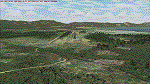
Located to north-east of Venezuela (Nearby Trinidad W.I.), With photo-terrain scenery from satellite imagery.
This scenery is only for FSX SP1 SP2 or Acceleration, is not compatible with previous versions. Includes terminal building with stardard FSX library objects.
| Filename: | SVGI__Guiria_Venezuela.zip |
| License: | Freeware |
| Added: | 19th September 2013, 21:00:45 |
| Downloads: | 1,126 |
| Author: | Pedro Luis Paz |
| Size: | 26.81 MB |
| Category: Flight Simulator X - Aircraft Repaints, Textures and Modifications | |
| Sounds Air Cessna 206 |
|
Images related to this file:
File Description:
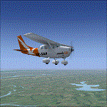
Repaint for the Carenado Cessna 206,SoundsAIR. Sounds Air is a locally owned and operated airline based at Picton Airport, in the heart of Marlborough, New Zealand. Sounds Air links the North and South Islands between Wellington, Picton, Blenheim and Nelson.
| Filename: | Sounds_Air_Cessna_206.zip |
| License: | Freeware |
| Added: | 10th September 2010, 03:08:22 |
| Downloads: | 360 |
| Author: | Daniel Trevers |
| Size: | 4.27 MB |
| Category: Flight Simulator 2004 - Scenery | |
| Chicago Midway Airport (KMDW) |
|
File Description:
An impassioned plea in the forums inspired me to model a better than default scenery of Chicago Midway Airport. I have modeled terminals a,b and c, the parking lot, and the 'tincan' hangers to the north. Hope You enjoy it.
| Filename: | Chicago_Midway_Airport_KMDW.zip |
| License: | Freeware |
| Added: | 15th November 2004, 23:40:14 |
| Downloads: | 14,193 |
| Author: | Steve Whalin |
| Size: | 1.11 MB |
| Category: Flight Simulator 2004 - Scenery | |
| Sleap Airfield - Shropshire |
|
Images related to this file:
File Description:
Sleap Airfield - Home of the Shropshire Aero Club not far from Wem - North Shropshire - England
A fairly accurate representation of this small airfield which used to be an RAF wartime airfield in both WWI and WWII. Now a private flying club
| Filename: | Sleap_Airfield__Shropshire.zip |
| License: | Freeware |
| Added: | 9th May 2010, 08:16:52 |
| Downloads: | 475 |
| Author: | Barrie Larks |
| Size: | 3.35 MB |
| Category: Flight Simulator 2004 - Scenery | |
| RAF Woodvale Air Base, EGOW, Formby, UK. |
|
Images related to this file:
File Description:
This scenery, for FS2004, reproduces Woodvale Air Base, EGOW, in the north-west of England. The layout of runways and taxiways is reasonably authentic I believe (checked according to Google Earth at least), certainly more so than the default scenery.
| Filename: | RAF_Woodvale_Air_Base_EGOW_Formby_UK.zip |
| License: | Freeware |
| Added: | 5th November 2009, 21:06:34 |
| Downloads: | 1,016 |
| Author: | Martin Stebbing |
| Size: | 146.77 KB |
| Category: Flight Simulator 2004 - Aircraft Repaints, Textures and Modifications | |
| Vision Airlines Boeing 737-800 |
|
Images related to this file:
File Description:
Vision Airlines Boeing 737-800 w/ Winglets. repaint for the PMDG Boeing 737-800.
Vision Airlines, formerly Vision Air, is an airline headquartered in North Las Vegas, Nevada, United States. The airline operates flights for their tour business of the Grand Canyon, Marble Canyon, Hoover Dam, and Monument Valley out of North Las Vegas airport utilizing Dornier 228 and Dornier 328 aircraft. In addition, during the summer months, Vision Airlines transports white water rafters to various destinations along the Colorado River.
Vision Airlines also operates a charter division that utilizes Boeing 737, Boeing 767, Dornier 228 and Dornier 328 aircraft.
| Filename: | Vision_Airlines_Boeing_737800.zip |
| License: | Freeware |
| Added: | 3rd July 2010, 00:11:03 |
| Downloads: | 227 |
| Author: | Ernesto Alvarez |
| Size: | 8.46 MB |
| Category: Flight Simulator 2002 - Scenery | |
| Lower Mainland of Southern British Columbia, Canada Mesh |
|
File Description:
New high-resolution (76-m) terrain mesh of the Lower Mainland area of British Columbia, covering a 4-degree longitude by 1.5-degree latitude transect (N48.5-50, W120-124) from Bowen Island to Manning Park. It gives a much better representation of the subtle terrain in Vancouver and the Fraser Valley, the beautiful North Shore Mountains, and the extreme topography of the North Cascades southeast of Chilliwack. Made from 100-m digital elevation data, resampled to LOD9 (76-m) horizontal spacing. Designed as an add-on to my LOD7 mesh of the entire province but can be used independently. By Holger Sandmann.
| Filename: | Lower_Mainland_of_Southern_British_Columbia_Canada.zip |
| License: | Freeware, limited distribution |
| Added: | 20th January 2003, 18:17:35 |
| Downloads: | 6,160 |
| Author: | Holger Sandmann |
| Size: | 8.29 MB |
| Category: Flight Simulator 2004 - Scenery Design | |
| BFU_North Update |
|
File Description:
Update: This allows FS9 to list 'BFU_North' in the Go to Airport's list with its available starting points.
In addition to the above, this bgl adds local radio communications for BFU_North airspace (ATC) and the start/approach points for Rwy's 29 and 11, a water start, and several parking options. The pages of the GPS are also more complete with pertinent info.
You must have already installed "BFU North" by Naji Chehabeddine. filename: bfunorth.zip
BFU North is an original FS2002 scenery that is compatible with FS2004.
**This update is for FS2004 only. Do not use this update (AF2_BFUN.bgl) in FS2002.**
| Filename: | BFU_North_Update.zip |
| License: | Freeware, limited distribution |
| Added: | 21st March 2004, 22:45:02 |
| Downloads: | 795 |
| Author: | Brent Hricziscse |
| Size: | 2.23 KB |
| Category: Flight Simulator 2004 - Scenery | |
| Colorado 2, Soaring Scenery_Upload |
|
File Description:
FS2002/2004 Colorado 2, Soaring Scenery.
This file came about because I wanted some lifts to keep gliders over Colorado Region, to soaring flights from Larkspur City to Colorado Springs City,Colorado,USA and so on.
It adds some ridge lifts to default Microsoft scenery
And it will be useful to everybody who wants begin primary and advanced glider flight instruction.
The lift begins 900 feet above ground level and the lift field is a North-South line which begins near Larkspur City North of Colorado Springs City
Installation:
Unzip MIcrosoft Simulator9.zip file inside Microsoft Games folder
Good flights end better Landings.
| Filename: | Colorado_2_Soaring_Scenery_Upload.zip |
| License: | Freeware |
| Added: | 9th March 2006, 03:55:21 |
| Downloads: | 414 |
| Author: | Francisco Augusto Vargas Carneiro |
| Size: | 93.82 KB |
| Category: Flight Simulator X - AFCAD Files | |
| LUBL - Balti-Leadoveni Intl. Airport - Balti, Moldova |
|
File Description:
Balti International Airport (IATA: BZY, ICAO: LUBL), also known as Balti-Leadoveni International Airport is one of the two airports serving the city of Balti, Moldova. Located 15 km (9.3 mi) north of the city center
(or 9 km from the city limits, Dacia district), in the north of the country, it is the second largest airport of Moldova, servicing cargo and charter passengers flights. Another airport in the area, Balti City Airport,
located within the city limits, is primarily used for emergency interventions of regional importance.
The airport charts can be found at http://www.moldovacc.org/index.php/pilots thnak you to vatsim Moldova.
| Filename: | LUBL__BaltiLeadoveni_Intl_Airport__Balti_Moldova.zip |
| License: | Freeware |
| Added: | 17th October 2012, 22:29:41 |
| Downloads: | 344 |
| Author: | Anwar Gonzalez |
| Size: | 3 MB |
© 2001-2026 AVSIM Online
All Rights Reserved
Privacy Policy |