
Where Flight Simulation Enthusiasts Gather from Around the World!
AVSIM Library - Search Results

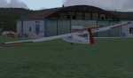
| Category: Fly! II - Aircraft | |
| ASH25 Glider System package v1.0 |

|
File Description:
This project shows how Fly! freedom development (SDK) can be used with other vehicles than general or heavy aircrafts.
We have developed in this package thermals and updrafts, a special tow sequence and a workaround flight model.
The general glider choosen by F2FDesign for this package is an ASH25 type.
Please note that several PC dll are involved in this project.
| Filename: | ASH25_Glider_System_package_v10.zip |
| License: | Freeware |
| Added: | 8th July 2004, 13:45:23 |
| Downloads: | 373 |
| Author: | Jarno (F2FDesign), TJ-Leen-LaurentC (rotw) |
| Size: | 1.17 MB |
| Category: Flight Simulator 2004 - Scenery | |
| Canaima National Park Mesh Scenery |
|
File Description:
Covers over 3 million hectares in south-eastern
Venezuela. Roughly 65% of the park is covered
by table mountain (tepui) formations. Include
Angel Falls, the world's tallest waterfall
(1000 m). Made from GOTOPO30 DEM using Microsoft
Terrain SDK Tools, with a resolution of 3,75
arc sec using graphical interpolation techniques.
Also works great in FS2002.
By David Maldonado - September, 2003
| Filename: | Canaima_National_Park_Mesh_Scenery.zip |
| License: | Freeware |
| Added: | 21st September 2003, 19:02:25 |
| Downloads: | 4,183 |
| Author: | David Maldonado |
| Size: | 922.91 KB |
| Category: Flight Simulator 2002 - AI Flight Plans | |
| Traffic Tools Source Code v1.3.3 |
|
File Description:
This package contains all the source code for TrafficTools. This is essentially an SDK for software developers interested in AI traffic management tools. This material is now public domain and can be freely distributed. Anyone may use this code for any purpose and incorporate it into any products, freeware or commercial, with no royalties or credit required. The code is in C language.
| Filename: | Traffic_Tools_Source_Code_v133.zip |
| License: | Freeware |
| Added: | 27th November 2002, 03:39:17 |
| Downloads: | 2,978 |
| Author: | Lee Swordy |
| Size: | 78.22 KB |
| Category: Flight Simulator 2004 - Scenery Design | |
| Program for TaxiwaySign Creation FSConnect Version |
|
File Description:
Program create XML file with Taxiway Signs description for use in FS2004 SDK BGLCOMP compiler , is coupled with FS via FSConnect or FSUIPC , unfortunately in FS2004 in this moment you need registered version. If you have FSConnect instaled , use this interface , in other case FSUIPC , FSConnect.dll is included , Copy it into your modules folder (Thank's Russel Dirks for their Big tool). Description in included PDF file.
| Filename: | Program_for_TaxiwaySign_Creation_FSConnect_Version.zip |
| License: | Freeware |
| Added: | 30th January 2004, 20:17:04 |
| Downloads: | 1,396 |
| Author: | Vladimir Svoboda (Cesmina) |
| Size: | 510.55 KB |
| Category: Flight Simulator 2002 - Scenery | |
| Terrain Mesh for Canada's Maritime Provinces (1/2) |
|
File Description:
The files in this package contain a new 76m (LOD09) terrain mesh for Canada's Maritime Provinces. The source data is the Shuttle Radar Topography Mission (SRTM-3, 90m). All data were compiled and edited in MicroDEM 6.02, converted with BIGBSQ and resampled to LOD (Level of Detail) 9, or 76.4 meters horizontal resolution, with the Microsoft Terrain Software Developer's Kit (SDK) utilities. Two parts : Maritimes09a.zip and Maritimes09b.zip.
| Filename: | Terrain_Mesh_for_Canadas_Maritime_Provinces_12.zip |
| License: | Freeware, limited distribution |
| Added: | 18th May 2003, 13:05:32 |
| Downloads: | 3,563 |
| Author: | Gilles Gauthier |
| Size: | 19.16 MB |
| Category: Flight Simulator X - Utilities | |
| Yet Another Google Earth Tool (FSX) |
|
File Description:
This little program for FSX allows to save two types of file : a single position file and a complete path file for Google Earth program (Each leg of the path is ~1NM long). It also allows to create a direct link between a Google Earth window and an instance of FSX and to follow your position on the Google view (it uses new SDK MS SimConnect.dll)
| Filename: | Yet_Another_Google_Earth_Tool_FSX.zip |
| License: | Freeware |
| Added: | 18th October 2006, 19:59:35 |
| Downloads: | 2,527 |
| Author: | laurent claude |
| Size: | 945.02 KB |
| Category: Flight Simulator X - Utilities | |
| FS Model Checker |
|
File Description:
FS Model Checker will scan a selected folder and its subfolders for models. The models that are found will be analyzed to determine their Flight Simulator and SDK version. While written to identify old models in FSX, it can be used with any version of Flight Simulator. You must have the .Net Framework version 2.0 installed. This version fixes the bug while scanning without logging enabled.
| Filename: | FS_Model_Checker.zip |
| License: | Freeware |
| Added: | 19th December 2007, 21:22:48 |
| Downloads: | 1,719 |
| Author: | Daniel van Os |
| Size: | 8.3 KB |
| Category: Flight Simulator X - Miscellaneous Files | |
| CV-6 U.S.S. ENTERPRISE |
|
File Description:
FEATURES:
- hardened flight deck and hangar deck
- Operational arrestor cables (Acceleration users)
- Air Boss camera view for watching deck operations
- Stable water dynamics / top speed in the low 30's
- radar and screws ambient animation
- custom wake effect
- night textures
** Tested in single and Multiplayer at different realism settings using Acceleration and DX9 ;
compiled with the FSX SDK for FSX ONLY * By Bruce Fitzgerald
| Filename: | CV6_USS_ENTERPRISE.zip |
| License: | Freeware |
| Added: | 1st January 2009, 02:42:11 |
| Downloads: | 1,912 |
| Author: | Bruce Fitzgerald |
| Size: | 5.72 MB |
| Category: Flight Simulator X - Scenery | |
| Nowy Targ (EPNT) |
|
Images related to this file:
File Description:
Scenery of the Nowy Targ aerodrome located close to the High Tatra mountains located between Poland and Slovakia. Contains detailed phototexture which blends perfecty with the payware Tatra Photo Scenery, FSX-sdk compiled objects done with Gmax and few custom landmarks, such as TV mast on Gubalowka mountain, cross on the Giewont mountain, hospital and a few more. Enjoy the beauty of Tatra Mountains!
| Filename: | Nowy_Targ_EPNT.zip |
| License: | Freeware, limited distribution |
| Added: | 29th January 2011, 01:45:10 |
| Downloads: | 4,009 |
| Author: | Marek M. Misiewicz, Bartlomiej Chyc, Lukasz Kubacki |
| Size: | 62.71 MB |
| Category: Flight Simulator 2002 - Scenery | |
| Terrain Mesh for Canada's Maritime Provinces (2/2) |
|
File Description:
Re-upload. The files in this package contain a new 76m (LOD09) terrain mesh for Canada's Maritime Provinces. The source data is the Shuttle Radar Topography Mission (SRTM-3, 90m). All data were compiled and edited in MicroDEM 6.02, converted with BIGBSQ and resampled to LOD (Level of Detail) 9, or 76.4 meters horizontal resolution, with the Microsoft Terrain Software Developer's Kit (SDK) utilities. Two parts : Maritimes09a.zip and Maritimes09b.zip.
| Filename: | Terrain_Mesh_for_Canadas_Maritime_Provinces_22.zip |
| License: | Freeware, limited distribution |
| Added: | 29th January 2010, 00:42:41 |
| Downloads: | 237 |
| Author: | Gilles Gauthier |
| Size: | 23.59 MB |
© 2001-2026 AVSIM Online
All Rights Reserved
Privacy Policy |