
Where Flight Simulation Enthusiasts Gather from Around the World!
AVSIM Library - Search Results

| Category: Flight Simulator X - Utilities | |
| V7.3.1 Addit! Pro Add-on Manager |

|
Images related to this file:
File Description:
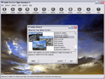
Addit! Pro is a comprehensive addon manager for Flight Simulator X. Easily install, manage and remove aircraft, adventures, flights, flight plans, gauges, missions, panels, A.I. airport and facilities data, scenery, sounds, textures, videos, weather and more! Archive add-ons to Addit! Pro's File Cabinet or recreate them in zip files. Modify your aircraft, panels and sounds. Automatically update FS's Scenery Library. Includes FS Configuration Manager, complete scenery library editor, ZIP/RAR support and much more! See Readme.htm for details. Requires Flight Simulator X: Standard or Deluxe Edition. By Joseph Stearns. [email protected]. Shareware--please register to install an unlimited number of add-ons. See Register.htm.
| Filename: | V731_Addit_Pro_Addon_Manager.zip |
| License: | Shareware, limited functionality |
| Added: | 30th November 2009, 20:42:28 |
| Downloads: | 1,264 |
| Author: | Joseph Stearns |
| Size: | 10.66 MB |
| Category: Flight Simulator 2004 - AI Flight Plans | |
| Air Luxor Winter 04-05 |
|
File Description:
FS2002/2004 "Air Luxor" flight plans for the winter 2004-2005 period, which have been compiled according to the timetable available both on their web site and on Amadeus server (week 10th Jan, 2005 - 16th Jan, 2005). Air Luxor is a scheduled and charter airline based in Lisboa, Portugal.
Their winter schedule includes destinations such as Bissau, Funchal, Lisboa, Oporto, Paris-Orly, São Tomé, as well as a weekly flight to both Recife and Salvador, in Brazil. Except for this brazilian charter flight operated each tuesday from Lisboa, this file includes ONLY scheduled flights, no charter... Fully compatible with Traffic Tools by Lee Swordy (available on this site).
| Filename: | Air_Luxor_Winter_0405.zip |
| License: | Freeware |
| Added: | 15th January 2005, 18:57:10 |
| Downloads: | 2,131 |
| Author: | Jean-Philippe DELWICHE |
| Size: | 4.59 KB |
| Category: Flight Simulator X - Utilities | |
| V7.3.3 Addit! Pro Add-on Manager |
|
Images related to this file:
File Description:
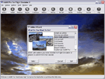
Addit! Pro is a comprehensive addon manager for Flight Simulator X. Easily install, manage and remove aircraft, adventures, flights, flight plans, gauges, missions, panels, A.I. airport and facilities data, scenery, sounds, textures, videos, weather and more! Archive add-ons to Addit! Pro's File Cabinet or recreate them in zip files. Modify your aircraft, panels and sounds. Automatically update FS's Scenery Library. Includes FS Configuration Manager, complete scenery library editor, ZIP/RAR support and much more! See Readme.htm for details. Requires Flight Simulator X: Standard or Deluxe Edition. By Joseph Stearns. [email protected]. Shareware--please register to install an unlimited number of add-ons. See Register.htm.
| Filename: | V733_Addit_Pro_Addon_Manager.zip |
| License: | Shareware, limited functionality |
| Added: | 2nd December 2011, 01:22:41 |
| Downloads: | 760 |
| Author: | Joseph Stearns |
| Size: | 10.8 MB |
| Category: Flight Simulator 2004 - Scenery | |
| Project Mexico Real LOD9 File 4 of 4 |
|
Images related to this file:
File Description:
File 4th of 4 of a Terrain Mesh that covers the entirety of Mexican Territory and related bordering U.S., Guatemala and Belice areas, part of the "Proyecto M�©xico Real" project, compiled at LOD9 (2.48 arcseconds in latitude and 3.3 arcseconds in longitude) resolution from INEGI data. Intended to enhance the virtual flying experience with the more detailed LOD10 version and complement the LOD8 version compiled from the same data. Compatible backwards with Flight Simulator 2000, Flight Simulator 2002 and Combat Flight Simulator 2. Refer to the file contents about the cover area to this compressed file. (Re-upload due to AVSIM hack)
| Filename: | Project_Mexico_Real_LOD9_File_4_of_4.zip |
| License: | Check within download |
| Added: | 6th June 2010, 08:50:44 |
| Downloads: | 2,729 |
| Author: | Juan Jose Galvan Bautista |
| Size: | 54.82 MB |
| Category: Flight Simulator 2004 - Scenery | |
| Project México Real LOD9 File 3 of 4 |
|
Images related to this file:
File Description:
Re-upload. File 3rd of 4 of a Terrain Mesh that covers the entirety of Mexican Territory and related bordering U.S., Guatemala and Belice areas, part of the "Proyecto México Real" project, compiled at LOD9 (2.48 arcseconds in latitude and 3.3 arcseconds in longitude) resolution from INEGI data. Intended to enhance the virtual flying experience with the more detailed LOD10 version and complement the LOD8 version compiled from the same data. Compatible backwards with Flight Simulator 2000, Flight Simulator 2002 and Combat Flight Simulator 2. Refer to the file contents about the cover area to this compressed file. (Re-upload due to AVSIM hack)
| Filename: | Project_Mxico_Real_LOD9_File_3_of_4.zip |
| License: | Check within download |
| Added: | 6th June 2010, 03:15:08 |
| Downloads: | 2,600 |
| Author: | Juan José Galvén Bautista |
| Size: | 53.8 MB |
| Category: Flight Simulator 2004 - AI Aircraft | |
| Ultimate Gulfstream 4 Part 2 |
|
File Description:
Ultimate GA is delighted to bring you the most comprehensive and detailed AI package to date.
These packages contain (in total) 358 repaints covering all 558 known Gulfstream 4, Gulfstream 300 and Gulfstream 400 in service. The flightplans were created with highly accurate flight plan data gleamed from flight tracking resources flying over 6500 weekly sectors.. Major fractional fleet operators, such as Netjets are covered, all corporate owners and every military and government operated example.
Very easy installation for FS2004 users, flight plan textfiles are included for FS2002 users.
Part Two of Four. Please download all four files prior to installation.
| Filename: | Ultimate_Gulfstream_4_Part_2.zip |
| License: | Freeware, limited distribution |
| Added: | 23rd September 2005, 14:46:44 |
| Downloads: | 10,915 |
| Author: | Ultimate GA, Henry Tomkiewicz |
| Size: | 12.25 MB |
| Category: Flight Simulator X - Utilities | |
| FS Earth 5.0 for Google Earth |
|
File Description:
This program acts as an interface between Flight Simulator X and Google Earth, letting to follow a flight in real time, over the satellite images generated by Google Earth. Flights can be saved, and many options are available for fine tuning the performance, as well as the map's style (zoom, tilt, orientation). Works on a single computer running FSX and Google Earth all together or, for best experience, can be used on two networked computers running respectively FSX (master) and Google Earth (slave). AI and Multiplayer traffic is also displayed in Google Earth, with course prediction and other information. Requires Flight Simulator X and Google Earth. The program running in trial mode works only around Anchorage, Alaska, (PANC / ANC) for a maximum of five minutes per flight session. Version 5.0 has improved compatibility with latest releases of Google Earth and several additional improvements. A version for FS2004 is available also.
| Filename: | FS_Earth_50_for_Google_Earth.zip |
| License: | Shareware, time limited |
| Added: | 19th July 2007, 00:46:27 |
| Downloads: | 1,104 |
| Author: | Luciano Napolitano |
| Size: | 2.44 MB |
| Category: Flight Simulator 2004 - Aircraft Repaints, Textures and Modifications | |
| FAA Beechcraft B-300F Super King Air N80 |
|
File Description:
FAA Beechcraft B-300F Super King Air N80 in actual FAA colors. Beginning in 1995 all markings identifying the aircrafts as operated by the FAA were removed for security reasons.
N80 (cn FF-15) entered the FAA fleet in 1988 as a calibrator for flight inspection duties and is based at the Flight Inspection Field Office (FIFO) at Atlantic City, (New Jersey). In 1986 the FAA ordered 19 of the Super King Airs, designated BE-300Fs by Beechcraft to reflect the modified version with an upgraded AFIS system auxiliary-power unit, heavier electrical system modified to handle the unique mission requirements of flight inspection, and a secondary air conditioning system to provide for the cooling of the added electronics. Textures only. 3D model: Esa Kaihlanen/Juri Pelkonen, Flight Dynamics: Ari Kaihlanen, Textures Siegfried Schaeffer/Rui Cristina. Sound by Leon Medado. Repainted by Hans Hermann, Virtual Birds Factory
| Filename: | FAA_Beechcraft_B300F_Super_King_Air_N80.zip |
| License: | Freeware, limited distribution |
| Added: | 11th October 2007, 13:06:18 |
| Downloads: | 392 |
| Author: | Repainted by Hans Hermann |
| Size: | 4.79 MB |
| Category: Flight Simulator 2004 - Utilities | |
| FS Earth 5.2 for Google Earth and FS2004 |
|
File Description:
This program acts as a link between Flight Simulator 2004 and Google Earth, letting to follow a flight in real time, over the satellite images generated by Google Earth. Flights can be saved, and many options are available for fine tuning the performance, as well as the map's style (zoom, tilt, orientation). Works on a single computer running FS2004 and Google Earth all together or, for best experience, can be used on two networked computers running respectively FS2004 (master) and Google Earth (slave). AI and Multiplayer traffic is also displayed in Google Earth, with course prediction and other information. Requires Flight Simulator 2004 and Google Earth. The program running in trial mode works only around Anchorage, Alaska, (PANC / ANC) for a maximum of five minutes per flight session. Version 5.2 has new aircraft icons & labels and improves the compatibility with Windows Vista. A version for FSX is available also.
| Filename: | FS_Earth_52_for_Google_Earth_and_FS2004.zip |
| License: | Shareware, time limited |
| Added: | 4th September 2008, 19:11:30 |
| Downloads: | 1,241 |
| Author: | Luciano Napolitano |
| Size: | 3.59 MB |
| Category: Flight Simulator 2002 - Gauges | |
| AFG Heads Up Guidance System Version 2.0 |
|
File Description:
FS2002 Heads Up Guidance System. This photo realistic HUD is based on a real world
HUD used in 737s and regional jets. It's the second version of the award winning AFG HGS v1 which was first true heads up guidance system for MSFS
because it can be used by itself for all phases of flight and has special modes for
instrument and visual approaches. There is a flight path vector and a guidance cue that can
command a change in flight path as small as .04 degrees. Panel.cfgs for DreamFleet's 734,
project magenta and some of the default panels, along with a pdf manual are included. New features include autoland (without default FS2002 approach guidance) which solves the infamous glide slope capture problem. The code has been rewritten so there are much faster frame rates, more accurate guidance, more accurate flight path vectoring and more.
| Filename: | AFG_Heads_Up_Guidance_System_Version_20.zip |
| License: | Freeware, limited distribution |
| Added: | 1st August 2002, 21:32:35 |
| Downloads: | 10,872 |
| Author: | Jon Gibbs |
| Size: | 1.64 MB |


© 2001-2026 AVSIM Online
All Rights Reserved
Privacy Policy |