
Where Flight Simulation Enthusiasts Gather from Around the World!
AVSIM Library - Search Results

| Category: Flight Simulator 2004 - Scenery | |
| Mehrabad Ver 1.0 (Tehran-Iran) |

|
Images related to this file:
File Description:

.::PERSIAN-SIM::. This package contains a simple scenery of Mehrabad Intl Airport OIII (Tehran-IRAN) and its buildings, aprons and hangars. The aprons contain all civil ,military and others. The AFCAD file of the airport is designed and updated exactly using the latest changes of Mehrabad which includes the following changes: 1.The complete change of Taxiway names and Taxiway signs; 2.Additional west parking space with 10 parking positions (APRON 4); 3.TWY 13 has been eliminated; 4.Apron names have been changed; 5.The position of Fire Fighting Station is changed (a new station is built); 6.All Parking positions are changed in names and headings. This version of Mehrabad is fully freeware and is available only from PERSIAN-SIM and AVSIM Library. The PROFESSIONAL version of Mehrabad (Payware), including the realistic scenery, buildings, static aircrafts, and realistic dynamic scenery, will be available soon on www.PERSIAN-SIM.com.
| Filename: | Mehrabad_Ver_10_TehranIran.zip |
| License: | Freeware, limited distribution |
| Added: | 3rd November 2010, 23:26:41 |
| Downloads: | 1,646 |
| Author: | PERSIAN-SIM ::: Behnam Zamani |
| Size: | 5.12 MB |
| Category: Flight Simulator 2004 - Scenery | |
| Diavik Diamond Mine CDK2 |
|
Images related to this file:
File Description:
The Diavik Diamond Mine is located about 200 miles NE of Yellowknife in Canada's Northwest Territory. It a relatively new facility, having been begun production in 2003. The only means of access are by air or ice road. (If you are a James Bondian super villian plotting world domination, Diavik would be a great place for your secret underground headquarters.) This scenery is completely scratch built. In addition to the airstrip itself, I used Google Earth pics to create a photo ground texture of the adjoining facility. The buildings of the main processing complex are very simply modeled, as is the large open pit mine.
This scenery was designed for use with Ultimate Terrain and was not tested in the default scenery. (As far as I can tell, Ulimate Terrain does not affect the area around Diavik, so it should work OK.) It may or may not work in FSX.
| Filename: | Diavik_Diamond_Mine_CDK2.zip |
| License: | Freeware |
| Added: | 4th February 2011, 18:07:48 |
| Downloads: | 581 |
| Author: | Sidney Schwartz & Peter Ham |
| Size: | 994.9 KB |
| Category: Flight Simulator 2004 - Scenery | |
| South West Islands, Japan and Taiwan Ver.3.0 |
|
Images related to this file:
File Description:
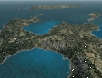
FS2004 Scenery SWIJT2004 Ver 3.0 (South West Islands, Japan and Taiwan)
These files improve specific scenerys (South West Islands of Japan and Taiwan, Asia) of FS2004. Included islands: Ohsumi Islands, Tokara Islands, Amami Islands, Okinawa lands, Kerama-Kume Islands, Miyako Islands, Yaeyama Islands and Taiwan Island.
In this scenery design, the coastline was reproduced as exactly as possible, following the specification of FS2004. Moreover, 90m mesh geographical data is reproduced by
using SRTM 3arc/sec. Correction of missing holes is perfect.
==NOTAM== I exhibited "SWIJ2k4.zip" on August 26, 2004.
However, it became clear that some of files of "SWIJ2k4" are infringing on the opyright of Microsoft. Then, I stopped public presentation of "SWIJ2k4". I apologize for having
made you trouble to those who already downloaded "SWIJ2k4.zip". New "SWIJT2k4.zip" is vast scenery which covered South West Islands, Japan and Taiwan Island. Please install new "SWIJT2k4".
By Kazuo Kawamura
| Filename: | South_West_Islands_Japan_and_Taiwan_Ver30.zip |
| License: | Freeware, limited distribution |
| Added: | 4th December 2011, 00:05:05 |
| Downloads: | 7,743 |
| Author: | Kazuo Kawamura |
| Size: | 20.5 MB |
| Category: X-Plane - Scenery | |
| WZ38 Susi Air Kegata Airstrip v1.0.0 |
|
Images related to this file:
File Description:
This is an X-Plane 11 scenery for Kegata Airstrip (WZ38) in Kegata, Papua, Indonesia. It is said to be home to the world shortest commercial flight, between Kegata Airstrip (WZ38) and Apowo Airstrip (WX15), duration of 1min and 15sec from take off to landing, and operated by Susi Air. This is one of the destinations for "PT ASI Pujiastuti Aviation", operating as Susi Air, an Indonesia airlines established in late 2004 by Mrs. Susi Pudjiastuti. This scenery was tested and is operational (as of January 07, 2017) in "X-Plane 11 Public Beta #5 64 bit", Windows 10 Home. It was also tested but is NOT operational (as of January 07, 2017) in "X-Plane 10.51 64 bit", Windows 10 Home (terrain mesh issues + exclusion areas from XP11 do not work in XP10 = scenery full of trees and quite bad mesh). Sorry, XP11 only.
| Filename: | WZ38_Susi_Air_Kegata_Airstrip_v100.zip |
| License: | Freeware |
| Added: | 8th January 2017, 23:38:06 |
| Downloads: | 68 |
| Author: | Rui Mesquita |
| Size: | 1.54 MB |
| Category: X-Plane - Scenery | |
| WXPN Susi Air Pulau Nurseen Airstrip v1.0.0 |
|
Images related to this file:
File Description:

This is an X-Plane 11 scenery for Pulau Nurseen Airstrip (WXPN) in the Island of Nurseen, Indonesia. This is a fictitious airfield, located in a tiny isolated island. This fictitious airfield may serve as a stopover for flights between Java and Papua, for the Susi Air scenery package. This is one of the destinations for "PT ASI Pujiastuti Aviation", operating as Susi Air, an Indonesia airlines established in late 2004 by Mrs. Susi Pudjiastuti. This scenery was tested and is operational (as of January 17, 2017) in "X-Plane 11 Public Beta #5 64 bit", Windows 10 Home. It was also tested and is not really operational (as of January 17, 2017) in "X-Plane 10.51 64 bit", Windows 10 Home. XP10's mesh is different, and presents problems in placing the runway over the water, instead of the land, plus some terrain elevations issues as well. Sorry, XP11 only.
| Filename: | WXPN_Susi_Air_Pulau_Nurseen_Airstrip_v100.zip |
| License: | Freeware |
| Added: | 18th January 2017, 05:00:53 |
| Downloads: | 45 |
| Author: | Rui Mesquita |
| Size: | 2.65 MB |
| Category: Flight Simulator X - Scenery | |
| Termopoli Grecia |
|
File Description:
A flight in the history of ancient Greece have realized the scenario of Thermopylae where today you can see a monument that recalls the exploits of the Spartans against the Persian Empire The Battle of Thermopylae was fought by the Greek city-states, united in an alliance and guided by King Leonidas I of Sparta against the Persian empire ruled by Xerxes in September of 480 BC.
The VFR flight is to take off with a single propeller touring from LG53 (Lamia Greece) from the runway 13 and taking runway heading to reach 2500Ft coordinates N 38.47.15 E 22:30:37 to admire the scenery and return to the departure airport . In the package you will find a Termopoli.zip Termopoli_City.bgl files you will put in the folder scenery addon scenery folder and the scenario will be automatically activated. Good Flight
We accept criticism and advice [email protected]
| Filename: | Termopoli_Grecia.zip |
| License: | Freeware |
| Added: | 7th September 2016, 21:58:14 |
| Downloads: | 278 |
| Author: | Pasquale Marrulli |
| Size: | 1.67 KB |
| Category: Prepar3D V1-4 - Scenery | |
| Square Kilometre Array (MeerKAT) – South Africa |
|
Images related to this file:
File Description:

This scenery is of the MeerKAT radio telescope site (originally the Karoo Array Telescope – KAT but was changed to MeerKAT, meer=more) when the project was expanded to 64 dishes. It forms part of an international Square Kilometre Array (SKA) project. It is situated in the Karoo near the town of Carnarvon. The scenery includes the landing strip just North East of the biggest concentration of dishes. I could not find a code for this strip and called it FAKA (MeerKAT SKA), or take off from Carnarvon (FACN) and fly a heading of 320 degrees for 73 km. The scenery was designed and tested for P3D V5 to work with the ORBX Africa LC and Pilots NG2020 mesh products. I am not sure what the actual site would look like at night, but I included some night lighting to make the array visible after dark.
| Filename: | Square_Kilometre_Array_MeerKAT__South_Africa.zip |
| License: | Freeware |
| Added: | 14th August 2020, 22:53:38 |
| Downloads: | 99 |
| Author: | Johan Pienaar |
| Size: | 20.33 MB |
| Category: Flight Simulator 2004 - Scenery | |
| UKSD 's Military Airfields in Yorkshire - UPDATE |
|
File Description:
Update for Military Airfields in Yorkshire, deals with a few compatibility issues with other scenery. See the pdf document for more details. Also add's a few more RAF type buildings to Topcliffe, Linton on Ouse and Church Fenton.
| Filename: | UKSD_s_Military_Airfields_in_Yorkshire__UPDATE.zip |
| License: | Freeware, limited distribution |
| Added: | 11th January 2006, 04:57:18 |
| Downloads: | 3,239 |
| Author: | Stephen Legg & Rob Brittain |
| Size: | 3.18 MB |
| Category: Flight Simulator 2004 - Scenery Design | |
| EZ-Aussie |
|
File Description:
Flags of Australia for EZ-Scenery.
Pure silk flags on a solid steel pole, topped with a 24 carat solid gold ball.
14 flags of the great land down under.
Library bgl, txt files and DXT1 textures included.
| Filename: | EZAussie.zip |
| License: | Freeware |
| Added: | 21st January 2006, 22:37:45 |
| Downloads: | 1,019 |
| Author: | Lou Frost |
| Size: | 76.11 KB |
| Category: Flight Simulator 2004 - AFCAD Files | |
| LIRF - Rome Fiumicino "Leonardo Da Vinci" |
|
File Description:
After months of work, Skycolors Team proudly presents the LIRF (Roma Fiumicino "Leonardo Da Vinci") airport, afcad for FS2004 default scenery. The layout is based on charts of LIRF aerodrome from JEPPESEN and AIP (Aeronautical Information Publication) Italy.
| Filename: | LIRF__Rome_Fiumicino_Leonardo_Da_Vinci.zip |
| License: | Freeware |
| Added: | 5th August 2006, 17:43:54 |
| Downloads: | 2,359 |
| Author: | Claudio A. Dobre / Skycolors Team |
| Size: | 913.96 KB |


© 2001-2026 AVSIM Online
All Rights Reserved
Privacy Policy |