
Where Flight Simulation Enthusiasts Gather from Around the World!
AVSIM Library - Search Results

| Category: Flight Simulator X - Scenery | |
| Grise fiord New 2017+A full approach and landing video+Grise Fiord village! |

|
File Description:
This is Grise Fiord a beautiful small airport in Nunavut, Canada. I hand placed every single object and re-positioned the runway, aprons and parking spaces too make it 99.9% accurate! This scenery features Grise Fiord Airport and Grise Fiord village, with a static First Air ATR-72-300. As well as that, I included a video showing you how to land at the airport without crashing (easier said than done!) I hope you have lots of fun with this airport and expect high quality freeware scenery in the future-Ols. Requires UTX Canada
| Filename: | Grise_fiord_New_2017A_full_approach_and_landing_vi.zip |
| License: | Freeware |
| Added: | 22nd December 2017, 18:09:52 |
| Downloads: | 474 |
| Author: | Ollie Seaward |
| Size: | 90.46 MB |
| Category: Flight Simulator 2002 - Scenery | |
| Elvington Airfield, North Yorkshire,UK |
|
File Description:
ELVINGTON AIRFIELD for FS 2002 This version is placed and aligned almost correctly.It is not compatible with the Visual Flight VFR scenery but fits into the default scenery.A simpler version, to fit the VFR scenery,is posted at Avsim. An NDB, VOR, Tower and ILS are included to aid navigation but do not exist in real life.Gerrish Gray's trees library is required. It will appear in the "go to" menu, on the map view and on the GPS and is made using the excellent FSSC by Derek Leung.
| Filename: | Elvington_Airfield_North_YorkshireUK.zip |
| License: | Freeware |
| Added: | 19th June 2003, 17:59:36 |
| Downloads: | 508 |
| Author: | Nick Cooper |
| Size: | 318.41 KB |
| Category: Flight Simulator X - Scenery | |
| NZGA- Galatea Aerodrome (VectorLandClass, New Zealand) |
|
Images related to this file:
File Description:
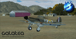
Welcome to Galatea (ICAO: NZGA), a gateway to exploring the Urewera ranges and the east coast of New Zealand. Galatea is a small and basic airstrip with only one old hanger, a public toilet and a small clubhouse on a wide plain surrounded by native bush and pine plantation near Murupara in the Bay of Plenty of New Zealand. It is a grass strip of 1025m length and 60m width and aligned 01/19 with a group rating of 8. No night lighting or fuel is available.
The FSX model includes custom textures and models placed on an aerial image. It makes extensive use of items from the free VLC object libraries which are required to be installed (download from www.vectorlandclass.co.nz downloads menu). This scenery and the VLC libraries have been funded
by sales of VectorLandClass and although you do not need VLC to use it, your purchase helps further development.
To the south west of Murupara township and sawmill is the LakeLand Helicopters base which just fits onto the photo-real coverage. Library objects have been placed here although they may not be accurate as the site was not visited when taking reference photos. This airfield makes a great stop over when flying between Rotorua, Mount Tarawera, Whakatane or Gisborne.
We hope you enjoy exploring the area!
| Filename: | NZGA_Galatea_Aerodrome_VectorLandClass_New_Zealand.zip |
| License: | Freeware, limited distribution |
| Added: | 15th November 2012, 23:35:42 |
| Downloads: | 1,127 |
| Author: | Tim Barnes / VectorLandClass |
| Size: | 45.7 MB |
| Category: Flight Simulator X - Scenery | |
| Pichlingersee - LOW1 |
|
Images related to this file:
File Description:
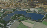
The Pichlingersee (LOW1) is a quarry pond near Linz (LOWL) in Austria (Upperaustria). The ILS approach to the runway 27 cross this lake. The helipad is in possession of Water Rescue Department and was not build on land. It was build "in water".
For the implementation of this area about 500 objects were set by hand from myself. Including not only trees and shrubs, but also signs, park benches, emergency call boxes (gernerated in gmax) etc at there right place. At night it was dark in real, so I does not create night texture. The scenery has 1.5 km ground imagery at 20cm per pixel and vary (hope) with the seasons.
Der Pichlingersee ist ein Baggersee in der Nhe von Linz (LOWL) in sterreich (Obersterreich). Der ILS Anflug auf die Landebahn 27 fhrt genau ber diesen See. Die Hubschrauberplattform gehrt der dortigen Wasserrettung und wurde nicht auf dem Land, sondern in den See hinein gebaut.
Fr die Umsetzung des Areals wurden von mir ber 500 Objekte von Hand gesetzt. Darunter nicht nur Bume und Strucher, sondern ebenso Schilder, Parkbnke, Notrufsulen (in gmax generiert) usw. an ihrem richtigen Platz. Da es dort in der Realitt nachts stockdunkel ist, habe ich auf Nachttexturen verzichtet. Die Szenerie hat eine 1.5 km Bodentextur mit 20cm/px und wechselt (hoffentlich) mit den Jahreszeiten.
| Filename: | Pichlingersee__LOW1.zip |
| License: | Freeware |
| Added: | 9th January 2013, 00:44:19 |
| Downloads: | 1,998 |
| Author: | Oliver Brandl |
| Size: | 54.71 MB |
| Category: Flight Simulator 2004 - AFCAD Files | |
| KORD - Chicago O'Hare - Chicago, USA - Runway 10C / 28C |
|
File Description:
This is the second of my two KORD AFCADs, the first for FSX and this one for FS9. Both add the newly opened runway 10C-28C and change the old runway10-28 to runway10L-28R. In this one, as in the FSX version. I use completely default objects, so no additional downloads of scenery are required. All Taxiways have been correctly identified using ADE9X and taxiway signs placed to reflect the ground situation as of the 1311 AIRAC Cycle that ends Nov 14, 2013. I added RNAV and CATIII ILS/DME approaches for both Rwy 10C and Rwy 28C you can select in the default GPS. In the default FS9 file for KORD runway 32L, which still exists, is given as an ILS/DME approach using 108.95, the same frequency as the new runway 10C-28C. I could not delete the ILS/DME for 32L (cannot delete stock navaids in FS9). It interfered with the CAT III ILS/DME for 10C-28C, so I simply changed the ILS frequency for 32L to the same frequency as for 14R. Please note further that in the 1311 AIRNAV supplement for KORD there are no approaches listed for 32L, so I deleted all approaches for 32L, but the waypoints for those approches remain in place (since they are stock navaids and, hence, cannot be deleted).
| Filename: | KORD__Chicago_OHare__Chicago_USA__Runway_10C__28C.zip |
| License: | Freeware |
| Added: | 13th November 2013, 22:03:13 |
| Downloads: | 766 |
| Author: | Randy Tyndall |
| Size: | 60.25 KB |
| Category: Flight Simulator X - Scenery | |
| Airport update for Chicago O'Hare Intl Airport (KORD), Illinois, USA |
|
Images related to this file:
File Description:
This updated version reflects the changes taking place at the airport with two optional files and made only for FSX users, not made or suitable for use in P3D: There is one version with the Crosswind runways operating where all 8 runways will be used for takeoff/landing and one version as the default airport runway operation: Runway 9C/27C and its taxiways now added with ILS approaches included for it, runway 9R/27L now at its new extended length and the ILS approaches corrected for it, the runway reconfiguration is now complete, the new extension and gates added to terminal 5, all aprons, taxiways and taxi signs updated to the latest charts, assigned parking as per their website where possible with extra parking including 2 gates for the A380 (gates M9 and M19), extra fuel trucks, support vehicle roads rebuilt and many other scenery improvements and objects added, airport views are from inside the central control tower (when in tower view), there is also a file for the nearby airport Chicago Executive formally Palwaukee Municipal (KPWK) which uses the same frequency as the KORD ILS for rwy 9C/27C, this bgl file for KPWK has the ILS frequency for Rwy 16 corrected to 109.75, so as not to cause a conflict at KORD, please view the readme before installation.
| Filename: | Airport_update_for_Chicago_OHare_Intl_Airport_KORD.zip |
| License: | Freeware, limited distribution |
| Added: | 22nd January 2022, 01:59:01 |
| Downloads: | 52,754 |
| Author: | Ray Smith |
| Size: | 5.95 MB |
| Category: Flight Simulator X - Scenery | |
| KEFD -Ellington 2025 Refresh FSX (Circa 2006-2010)- Johnson Space Center Houston |
|
Images related to this file:
File Description:

This is a complete refresh in 2025 for the entire Houston Bay Area and KEFD. This is a freeware update for KEFD, published 2025 for FSX, and includes CVX landclass and ADEX.bgl files for KEFD and surrounding greater area, circa 2006-2010. File includes very accurate landclass fixes for the surrounding Bay Area of Houston, and I added tons of VFR scenery objects, featuring Johnson Space Center Houston. Including:
-- Pasadena water treatment facility (Rwy 17)
-- NASA buoyancy lab
-- Pasadena shopping center off of Beltway 8
-- San Jacinto College
-- Pasadena convention center
-- Johnson Space Center Houston
-- Baybrook mall area
-- storage units across from Rwy 35Landclass fixes are extremely accurate, as I used satellite imagery from circa 2006-2010 era. This was both an era when the 147th FW was active, and there was a lot less buildings in the era. -- In addition:
-- I added NASA T38 and F16 parking with ramps
-- Straightened out the very crooked and inaccurate runways and taxis from the other freeware
-- added lighting to KEFD ramps and parking
-- added parking for coast guard MH 65 and helicopter parking for user.
-- Landclass fixes for the barren Spring-cypress greater area (KIAH-KDWH area).I hope you enjoy, north and southeast Houston no longer look like farms and fields with sparce patches of random houses. -DJN
| Filename: | KEFD_Ellington_2025_Refresh_FSX_Circa_20062010_Joh.zip |
| License: | Freeware |
| Added: | 26th May 2025, 23:25:14 |
| Downloads: | 61 |
| Author: | Dan Nelson |
| Size: | 23.49 MB |
| Category: Flight Simulator X - Scenery | |
| RCMQ Ching Chuan Kang Air Base, Taiwan |
|
File Description:
This is an improvement of the default RCMQ Ching Chuan Kang Air Base, a dual-use airport in Central Taiwan that was built by the US in 1960s to serve as a divert base for B-52 bombers during Vietnam War. It is now the home of ROCAF 427th Tactical Fighter Wing flying F-CK-1 Ching-Kuo fighters. It is also served by airlines with flights to domestic destinations as well as Hongkong, China, and Vietnam. Satellite imagery available online were used to reposition taxiways, add and resize aprons, and add civilian gates and military aircraft parking. Prominent buildings were represented using stock library objects. Created using Airport Design Editor 1.39b by Mike Huang.
| Filename: | RCMQ_Ching_Chuan_Kang_Air_Base_Taiwan.zip |
| License: | Freeware |
| Added: | 7th February 2009, 19:31:44 |
| Downloads: | 2,690 |
| Author: | Mike Huang |
| Size: | 522.5 KB |
| Category: Flight Simulator 2004 - Scenery | |
| 42VA - Virginia Beach Airport & Museum (v1.1) |
|
Images related to this file:
File Description:
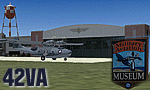
42VA - Virginia Beach Airport & Museum V1.1, located in Virginia Beach, VA USA.
This facility is a private airport used by the Fighter Factory to maintain, display and fly vintage and replica aircraft, mainly from the World War 2 era. The art deco building, grass landing strip, checkered water tower and hangars are home to one of the world's largest private collection of vintage aircraft.
Most objects using custom photo-real 32bit textures designed in GMAX. Optional DXT3 textures included. Also includes new AFCAD file, more accurate airport grounds perimeter, area roads, animated hangar doors, and area landclass. No AI traffic included with this release, but AI functionality designed into AFCAD. By EdGeneer Cox.
| Filename: | 42VA__Virginia_Beach_Airport__Museum_v11.zip |
| License: | Freeware, limited distribution |
| Added: | 5th February 2010, 16:39:44 |
| Downloads: | 1,600 |
| Author: | Ed Geneer Cox |
| Size: | 30.59 MB |
| Category: Flight Simulator 2004 - Scenery | |
| Hay River CYHY, 2010 |
|
Images related to this file:
File Description:
First established as a permanent settlement in 1892, Hay River is located on the south shore of Great Slave Lake in the Canadian Northwest Territories. Like the territorial capital city of Yellowknife 115 miles to the north on the opposite shore of the lake, Hay River experiences brutal weather conditions, with an average mid winter temperature of minus 27C (minus 18F).
* Aprons and taxiways completely redone to be more accurate.
* Missing ground and water features added, land class adjusted.
* All default buildings replaced. Custom terminal building and other custom objects.
* Roads and railroads in vicinity of airport redone.
* Buffalo Airways AI traffic and static water bomber aircraft.
| Filename: | Hay_River_CYHY_2010.zip |
| License: | Freeware |
| Added: | 12th March 2010, 10:14:00 |
| Downloads: | 1,947 |
| Author: | Sidney Schwartz & Peter Ham |
| Size: | 13.2 MB |


© 2001-2026 AVSIM Online
All Rights Reserved
Privacy Policy |