
Where Flight Simulation Enthusiasts Gather from Around the World!
AVSIM Library - Search Results

| Category: Flight Simulator 2004 - Scenery | |
| Hamilton Air Force Base 1955 - 1962 |

|
File Description:
This scenery represents my attempt to create Hamilton AFB (SRF) as it was during 1955 through 1962. This Scenery includes complete traffic files for 1955, 1957, 1959 and 1962 along with all the many different aircraft types which were stationed there, many included with this package. Many custom repaints by DeltaDart of the actual squadron colors and and orginal aircraft and paints by Mike Pearson and David Wooster also covering actual squadrons at Hamilton. Timetable included for you ai watchers. Enjoy. By Al Von Pingel
| Filename: | Hamilton_Air_Force_Base_1955__1962.zip |
| License: | Freeware |
| Added: | 17th December 2022, 02:35:39 |
| Downloads: | 108 |
| Author: | Al Von Pingel |
| Size: | 86.25 MB |
| Category: Flight Simulator 2004 - AFCAD Files | |
| EHAM for NL2000, Multiple Runways, First Attempt |
|
File Description:
AFCAD2 File for :
Amsterdam, Schiphol Intl Airport, the Netherlands ( EHAM )
for NL2000 Scenery .
with Runways 06 and 36R for landings and 36L and 36C for take-offs .
NL2000 scenery can be found on Avsim as nl2kv291.zip .
All credits to NL2000 team for the NL2000 scenery, many many thanks .
( Not to bo used with the default scenery )
This Afcad file was originally made by Victor Nauta as af2nl2k29v2_eham.zip .
But now with breakthrough NON parallel runway assignment by Project AI, Jim Vile and
Reggie Fields, non-parallel runways can be used simultaniously .
Thanks to Jim .
Although created to use all runways, something I can't do about it is to make FS9
use South or West bound traffic .
Now only North bound traffic is possible as Victor Nauta also complained about and didn't see a solution as well .
Even with maximum wind from South-West ( a common thing in the Netherlands ) AI is still assigned to North or East bound .
I have closed Runway 9 as it is rarely used, and also Runway 4 ( Gen. Aviation ) closed to avoid smaller turboporops landing there .
Have fun, Silvester
| Filename: | EHAM_for_NL2000_Multiple_Runways_First_Attempt.zip |
| License: | Freeware |
| Added: | 8th October 2004, 20:18:30 |
| Downloads: | 1,728 |
| Author: | Silvester van Wijk / Victor Nauta / Project AI |
| Size: | 17.39 KB |
| Category: Flight Simulator 2004 - Scenery | |
| Los Angeles VTerminal (KLAX) 2009 V2 |
|
File Description:
UPDATE: After reports of people not getting the complete file, I have re-uploaded it. The problem was my program that I was using to zip the file. I have since changed programs and fixed the problem. Sorry for the inconvenience.
The LAX Vterminal was originally released to a select few virtual airlines and can now be yours. These were West Express, Atlantic Sun, Empora Virtual, City Bird, Arizona Pacific, and Family Virtual Airlines. The terminal contains three concourses, forty-three (43) gates, and eight overflow parking spots. Parking assignments have not been assigned to any of the gates, so you will need to go through and do so. The terminal was created by Michael Wood and Nick O'Dell. It was designed to fit the needs of virtual airlines, in order to return parking spots in the main terminal to their real world owners. This scenery is frame rate friendly, and will not take up a lot of space on your hard drive. Included in this file are AFCAD's for the default and OceanFlight scenery. Enjoy our scenery, and look for more scenery projects coming in the near future.
| Filename: | Los_Angeles_VTerminal_KLAX_2009_V2.zip |
| License: | Freeware, limited distribution |
| Added: | 16th March 2009, 11:13:46 |
| Downloads: | 1,805 |
| Author: | Nick O'Dell, Michael Wood |
| Size: | 231.75 KB |
| Category: Flight Simulator X - Scenery | |
| The Hawaiian Islands - Kauai, Part 1 of 5 |
|
File Description:
The complete scenery package is 446MB in size. In order to accommodate AvSim's file size requirement, this scenery has been broken into five smaller files. However, all five files -- Hawaii-Kauai-RS-01.zip through Hawaii-Kauai-RS-05.zip -- are necessary for this scenery to work properly. My apologies in advance for the added complexity this involves. "Hawaii-Kauai-RS-01" includes a ReadMe with detailed instructions on how to install this scenery.
Kauai itself is the fourth largest of the main Hawaiian Islands. Also known as the "Garden Isle" due to it's lush tropical foliage, it is located about 105 miles (170 kilometers) west of Oahu and just to the east of tiny Niihau. The east side of Mount Wai'ale'ale is considered to be one of the wettest spots on earth receiving an average annual rainfall of 460 inches (1,200 cm). All that water has carved out deep valleys in the central mountains, the most scenic of which is Waimea Canyon, often referred to as "The Grand Canyon of the Pacific". From shoreline cliffs to mountainous heights, to pristine beaches, enjoy exploring this picture postcard perfect landscape.
| Filename: | The_Hawaiian_Islands__Kauai_Part_1_of_5.zip |
| License: | Freeware |
| Added: | 13th July 2010, 17:03:20 |
| Downloads: | 6,112 |
| Author: | Rich Sorochak |
| Size: | 88.18 MB |
| Category: Flight Simulator 2004 - Scenery | |
| Dease Lake CYDL 2010 v1.1 |
|
Images related to this file:
File Description:
Version 1.1 adds the three hazard beacons that define the boundaries of the night circuit, as depicted in the included chart. Many thanks to Lane Street for creating the beacons and giving us permission to include them in the scenery. This scenery is complete and does not require the previous verion. Dease Lake CYDL airport is located about 2 miles south of Dease Lake in stunningly beautiful northwest British Columbia. (The lake directly to the east of the airport is Allan Lake.) Scheduled passenger service to Smithers and Bob Quinn Lake is provided by Northern Thunderbird Air (http://ntair.ca/). CYDL also serves as a base for Pacific Western Helicopters (http://www.pwh.ca/). This version moves the airport slightly to its correct location. All aprons & taxiways have been redone and all default buildings replaced. The little terminal building is photo real. The missing town of Dease Lake and the missing lake south of Allan lake have been added. This scenery was designed for use with Ultimate Terrain and was not tested in the default scenery. It may or may not work in FSX. Previous version had 307 downloads.
| Filename: | Dease_Lake_CYDL_2010_v11.zip |
| License: | Freeware |
| Added: | 6th November 2010, 22:30:24 |
| Downloads: | 793 |
| Author: | Sidney Schwartz & Peter Ham |
| Size: | 1.8 MB |
| Category: Flight Simulator 2004 - Scenery | |
| KCLT Charlotte Douglas International Airport |
|
Images related to this file:
File Description:
In 2008 runway 18R/36L at KCLT was renamed 18C/36C in anticipation of a third parallel under construction. The new runway was to be designated 18R/36L and was finally activated on January 6, 2010. This scenery adds that new runway to the default Charlotte Douglas International Airport (KCLT). This is a complete rebuild of my previous upload, KCLT2010 (not required) that inadvertently removed approximately 30 airports in the Charlotte area, including Fayetteville and Spartanburg. It also includes Terminal E, which was added in 2002, but never made it into the default FS2004 scenery.
I used Airport Design Editor (ADE9x) to modify the default FS2004 KCLT file, renaming the default 18R/36L to 18C/36C, create the new taxiways, taxi signs, NavAids, 18R-36L runway, and Terminal E. I used Abacus EZ-Scenery to add jetways, gate markings, and ramp lights. All files, libraries, and textures are either default or included. No additional downloads are required. AI Aircraft were acting normally on my system. I sat at Taxiway W2 for the new Runway 18R/36L and watched AI Aircraft land and take off from it after creating this scenery.
| Filename: | KCLT_Charlotte_Douglas_International_Airport.zip |
| License: | Freeware, limited distribution |
| Added: | 12th January 2011, 22:34:51 |
| Downloads: | 3,563 |
| Author: | Randy Tyndall |
| Size: | 1022.34 KB |
| Category: Flight Simulator X - Scenery | |
| Ireland VFR Small Airports part 4 |
|
File Description:
Ireland VFR Small Airports Part 4.
Three new airports for FSX, consisting of EI50 Limetree, EI55 Eyne and EICN Coonagh. Limetree and Eyne are 70km southwest of EIDW Dublin. Coonagh is 16km East of EINN Shannon. These airports have been built from scratch, are standalone, and designed to sit on the default terrain. The scenery features custom runways and textures together with full custom models and textures based on real photographs. The scenery has been tested and authenticated by real local pilots. More realistic landclass, autogen rivers and roads have been added to the areas around the airports. It also features many HD textures, AI aircraft and road traffic. The scenery uses seperate elements which can be switched on or off according to the users preference and hardware.
This scenery is real flying 'by the seat of your pants'. There are no lights, navaids, or ILS and runway markings are eaten by the sheep.
Full installation instructions, settings, credits, hints and tips can be found in the README file.
Please enjoy and I hope you like the airports as much as I enjoyed making them.
| Filename: | Ireland_VFR_Small_Airports_part_4.zip |
| License: | Freeware, limited distribution |
| Added: | 15th October 2013, 05:28:25 |
| Downloads: | 2,148 |
| Author: | George Keogh |
| Size: | 164.6 MB |
| Category: Flight Simulator X - Scenery Design | |
| Animated Flags |
|
Images related to this file:
File Description:
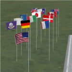
This scenery addon has been developed on Win 7 for FSX Flight Simulator SP1 or SP2. It has also been tested with Microsoft Acceleration, but compatibility is not guaranteed by the author.
The package provides a little collection of animated flags for scenery designers and FS users who do understand the handling of folders and files for FSX. The animated flag models have been developed with GMAX. Along with the textures the package includes the model (mdl) and bgl files. The XML files for the individual placement of a flag into a FSX scenery are included as well.
The documentation contains a step by step description on how to place the flag into the FSX scenery, on a position of your choice. In order to paint your own individual animated flag, the Appendix B of the documentation describes in detail on how to do it. However, a basic experience on how to work with graphical tools like Photoshop, GIMP, Paint Shop Pro etc. is required to paint the extures/colors for a new flag. For credits look at the pdf documentation inside the zip file. By Dietmar Loleit
| Filename: | Animated_Flags.zip |
| License: | Freeware |
| Added: | 17th October 2014, 22:59:25 |
| Downloads: | 661 |
| Author: | Dietmar Loleit |
| Size: | 5.98 MB |
| Category: Dovetail Games Flight Sim World - Scenery | |
| SEATTLE X DEMO |
|
Images related to this file:
File Description:

SEATTLE X DEMO features an extremely detailed scenery of large area of Seattle, USA, fully compatible with FSX, FSX SE, P3D v1/v2/v3/v4 and FSW by Dovetail.
With Seattle X you are free to fly to any of 5 airports: KSEA Tacoma (available soon), KPAE Paine Field, KBFI Boeing Field, KRNT Renton, S50 Auburn, admire some of the world-renowned landmarks, bridges, harbours, heliports, seaplane bases, ships, etc.
This Demo version features both - the City and the Airports packages (commercial poducts) and includes some downtown buildings as well as all airports with terminals but with low resolution textures, non-animated jetways and generally much less details. This ensures no problems with online (VATSIM, IVAO and multiplayer) flying in case some users have the payware scenery and some don't.
It's equipped with an automatic installer, which means that the scenery will be automatically added to the Flight Simulator Scenery Library.
Please uninstall all previous versions of the above-mentioned airports you may have installed before. Please make also sure that no duplicated AFCAD files are installed.
Enjoy your virtual flying with Drzewiecki Design!
| Filename: | SEATTLE_X_DEMO.zip |
| License: | Freeware |
| Added: | 10th December 2017, 18:04:52 |
| Downloads: | 157 |
| Author: | Drzewiecki Design |
| Size: | 93.61 MB |
| Category: X-Plane - Scenery | |
| RAF Gutersloh ETUO |
|
Images related to this file:
File Description:
File Description:
X-Plane 11 Scenery - RAF Gutersloh AB (ICAO: ETUO)
The scenery represents the former airbase of RAF Gutersloh, one of the most populated military bases in West Germany during the Cold War, due to its location near the former East/West border. This scenery reflects the era at the end of the 1980s/beginning of the 90s, when the Harrier GR3 was in operation there, along with Chinook helicopters.
The airfield was built in 1935 and was used by the German Air Force during WW2, flying the Junkers JU-86 and Heinkel H-111. The first British squadrons were stationed there from 1947, with Mosquitos, Vampires and then Canberras.
The first Harrier arrived at Gutersloh in January 1977 and 3 and 4 Squadrons became resident until their farewell in 1993, after the cold war had ended. The airfield is currently used by the British army, but they will leave in 2014 to relinquish the area to the Government of Gutersloh for civil usage.
High detailed scenery by Manfred Schyma and Pete Beeby, supported by the Airfield Construction Group. X-Plane Version designed by Dietmar Hanne
| Filename: | RAF_Gutersloh_ETUO.zip |
| License: | Freeware |
| Added: | 25th May 2018, 23:53:43 |
| Downloads: | 264 |
| Author: | Dietmar Hanne |
| Size: | 142.94 MB |


© 2001-2026 AVSIM Online
All Rights Reserved
Privacy Policy |