
Where Flight Simulation Enthusiasts Gather from Around the World!
AVSIM Library - Search Results

| Category: Flight Simulator 2004 - Scenery | |
| WAML Palu/Mutiara, Indonesia |

|
Images related to this file:
File Description:
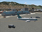
Googly scenery for WAML Palu/Mutiara, Indonesia. In Flight Simulator 2004 little
is provided other than a runway at this small domestic airport, although in the
real world it sees regular jet flights from airlines such as Batavia Air, Bouraq
Indonesia Airlines, Garuda Citylink, Lion Airlines and Merpati Nusentara and
smaller aircraft from operators like Airfast Service and Indonesia Air Transport.
These scenery files add aprons, taxiways, buildings and other airport features
to Flight Simulator's limited representation and allow "AI" traffic to land,
taxi, park and take off in a realistic manner.
The scenery does not purport to be ultra-accurate. Based on high-detail satellite
imagery from Google Earth, the layout is proportionally correct but the added
airport features, such as buildings, are built from default Microsoft objects
and add-on libraries so will not look exactly like the real thing.
You are not obliged to download and install any additional scenery libraries,
but to enjoy this scenery in its entirety, you may wish to. It will work fine,
with or without.
| Filename: | WAML_PaluMutiara_Indonesia.zip |
| License: | Freeware |
| Added: | 15th May 2010, 01:11:30 |
| Downloads: | 1,770 |
| Author: | John Hinson |
| Size: | 140.88 KB |
| Category: Flight Simulator 2004 - Scenery | |
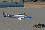
| Tofino CYAZ 2012 |
|
Images related to this file:
File Description:
I've always had a particular fondness for Tofino CYAZ, located on the west coast of Vancouver Island. I made my first Tofino scenery in 2005 using Lago's FSE, and an updated version in 2006 using EZ-Scenery. Neither of those included custom models. This final version is a complete, from-the-ground-up rebuild. Every building and many of the other scenery objects are custom made based on photos and using photo textures. (The images in the "Tour" folder will take you on a tour of the real and virtual airport.) In the time since the first two virtual versions were made, a new terminal building has been added to the east ramp at the real Tofino, along with some new hangers, and the scenery includes these changes. Tofino has an NDB instrument approach (CYAZ NDB A.pdf), but night operations are not allowed. For this reason the new terminal building has no night lighting. The golf clubhouse restaurant and pro shop are open after dark for your shopping and dining pleasure. This scenery represents many hours of work...I hope you enjoy it.
| Filename: | Tofino_CYAZ_2012.zip |
| License: | Freeware |
| Added: | 19th August 2012, 14:33:09 |
| Downloads: | 649 |
| Author: | Sidney Schwartz |
| Size: | 10.14 MB |
| Category: Flight Simulator 2004 - Scenery | |
| MRE Mara Serena, Kenya |
|
File Description:
Googly scenery for Mara Serena, Kenya, a small airfield serving the Mara Serena
Safari Lodge in the Masai Mara National park. The original metalled runway has
fallen into disuse and these days a rough dirt runway alongside it is used by
the twice daily flights of Air Kenya Express to and from Nairobi and the
occasional light aircraft.
Flight Simulator 2004 has made no provision for traffic with only a runway
provided and this scenery seeks to redress the situation. The airport has no
ICAO code (MRE is the IATA code) but Microsoft Flight Simulator has created an
unofficial ICAO of HK0A.
The scenery does not purport to be ultra-accurate. Based on high quality
satellite imagery from Google Earth, the layout is proportionally correct but the
added airport features, such as buildings, are built from default Microsoft objects
and add-on libraries so will not look exactly like the real thing.
You are not obliged to download and install any additional scenery libraries,
but to enjoy this scenery in its entirety, you may wish to. It will work fine,
with or without.
| Filename: | MRE_Mara_Serena_Kenya.zip |
| License: | Freeware |
| Added: | 16th April 2008, 19:19:33 |
| Downloads: | 988 |
| Author: | John Hinson |
| Size: | 68.01 KB |
| Category: Flight Simulator 2004 - Scenery | |
| YEVD Evans Head Memorial, Australia |
|
File Description:
Googly scenery for YEVD Evans Head Memorial, a former RAAF Training base in
New South Wales, Australia, now reduced to a single runway and small apron.
In its heyday it was home to the RAAF No 1 Bombing and Gunnery and the RAAF No 1
Air Observers Schools and it was said to be the largest training base in the
southern hemisphere - at that time it had four runways.
Flight Simulator 2004 has made no provision for traffic with only a runway
provided and this scenery seeks to redress the situation so that you and your
"AI" traffic can use the airport.
The scenery does not purport to be ultra-accurate. Based on high quality
satellite imagery from Google Earth, the layout is proportionally correct but the
added airport features, such as buildings, are built from default Microsoft objects
and add-on libraries so will not look exactly like the real thing.
You are not obliged to download and install any additional scenery libraries,
but to enjoy this scenery in its entirety, you may wish to. It will work fine,
with or without.
| Filename: | YEVD_Evans_Head_Memorial_Australia.zip |
| License: | Freeware |
| Added: | 19th April 2008, 10:23:02 |
| Downloads: | 544 |
| Author: | John Hinson |
| Size: | 71.78 KB |
| Category: Flight Simulator 2004 - Scenery | |
| OPDB Dalbandin, Pakistan |
|
Images related to this file:
File Description:

Googly scenery for OPDB Dalbandin, Pakistan - a quiet domestic airport for
which no operational facilities are provided in Flight Simulator 2004. These
scenery files add/correct the runways, apron, taxiways, buildings and other
airport features so that you and your "AI" traffic can land, taxi, park
and take off in a realistic manner.
The airport appears to be served all of once per week by ATRs of Pakistan
International Airways so will hardly buzz with activity, but you will be
assured of a friendly welcome when you arrive.
The scenery does not purport to be ultra-accurate. Based on high-detail satellite
imagery from Google Earth, the layout is proportionally correct but the added
airport features, such as buildings, are built from default Microsoft objects
and add-on libraries so will not look like the real thing.
You are not obliged to download and install any additional scenery libraries,
but to enjoy this scenery in its entirety, you may wish to. It will work fine,
with or without.
[File re-uploaded at the request of AVSIM]
| Filename: | OPDB_Dalbandin_Pakistan.zip |
| License: | Freeware |
| Added: | 5th May 2010, 22:32:37 |
| Downloads: | 1,017 |
| Author: | John Hinson |
| Size: | 65.99 KB |
| Category: Flight Simulator 2004 - Scenery | |
| SPHZ Anta/Comandante German Arias Grazz, Peru |
|
Images related to this file:
File Description:
Googly scenery for SPHZ Anta/Comandante German Arias Grazz, Peru - a small
domestic airport for which nothing more than a runway is provided in Flight
Simulator 2004. These scenery files add the apron, taxiways, buildings and
other airport features so that you and your "AI" traffic can land, taxi, park
and take off in a realistic manner.
The airport is served daily by domestic operator L C Busre and perhaps also
others using small aircraft, but little information has been found on activity
in this area.
The scenery does not purport to be ultra-accurate. Based on high-detail satellite
imagery from Google Earth, the layout is proportionally correct but the added
airport features, such as buildings, are built from default Microsoft objects
and add-on libraries so will not look like the real thing.
You are not obliged to download and install any additional scenery libraries,
but to enjoy this scenery in its entirety, you may wish to. It will work fine,
with or without.
[File re-uploaded at request of AVSIM]
| Filename: | SPHZ_AntaComandante_German_Arias_Grazz_Peru.zip |
| License: | Freeware |
| Added: | 23rd May 2010, 01:24:24 |
| Downloads: | 1,224 |
| Author: | John Hinson |
| Size: | 65.15 KB |
| Category: Prepar3D V1-4 - AFCAD Files | |
| LGAT Athens Hellinikon - Disused v3 |
|
Images related to this file:
File Description:
Version 3 of the scenery with refinements. This scenery includes the disused Athens, Greece, capital airport in its current status. Default FSX & P3D scenery do not include old LGAT airport at all and this why this scenery was created since the landsite still looks like this in that location. The airport closed in year 2002 after being replaced from Athens International Airport - Eleftherios Venizelos LGAV in March 2001. The northwest side of the airport was then used for Athens 2004 Olympics athletic installations and the southeast side remains disused. The scenery is a modification of Angelo Tassoglou (LGAT2B.ZIP) by permission of the author. It contains only basic stock MS objects without any custom items and therefore is very light in performance load. Angelo has moved the airport in the correct location where it should be (due to obsolete coordinates reference system used by MS). This, nowadays disused, airport is not meant to be used for flying in FS but only to have it visually correct when flying above. Version 3 removes some remaining ground taxiway lighting that was left in version 2.
| Filename: | LGAT_Athens_Hellinikon__Disused_v3.zip |
| License: | Freeware |
| Added: | 26th April 2016, 00:32:13 |
| Downloads: | 1,474 |
| Author: | Kyprianos Biris |
| Size: | 4.04 MB |
| Category: Flight Simulator 2004 - Scenery | |
| DTTR El Borma, Tunisia |
|
File Description:
Googly scenery for El Borma (ICAO: DTTR, IATA: EBM), a small airport with a
long runway deep in the Tunisian desert near the Algerian border. El Borma,
also known as Al Borma or Al Burmah is one of Tunisia's top onshore oil and
natural gas sources and it is this that probably justifies the twice-weekly
flights operated by ATR turboprops of Sevenair.
Microsoft have only provided runways at this airport in Flight Simulator
2004 and this scenery seeks to redress the situation so that you and your
"AI" traffic can use the airport realistically.
The scenery does not purport to be ultra-accurate. Based on high quality
satellite imagery from Google Earth, the layout is proportionally correct but the
added airport features, such as buildings, are built from default Microsoft objects
and add-on libraries so will not look exactly like the real thing.
You are not obliged to download and install any additional scenery libraries,
but to enjoy this scenery in its entirety, you may wish to. It will work fine,
with or without.
| Filename: | DTTR_El_Borma_Tunisia.zip |
| License: | Freeware |
| Added: | 17th December 2008, 16:49:15 |
| Downloads: | 1,027 |
| Author: | John Hinson |
| Size: | 58.32 KB |
| Category: Flight Simulator X - Scenery | |
| 2016 Kigali Intl (HRYR) Rwanda |
|
Images related to this file:
File Description:
This sequel to the 2009 Kigali Intl (HRYR) Rwanda scenery (by Jacques Botha and Frits Beyer) brings it up to date with the current layout and enables full compliance with FTX Global/Vector and FSX. Buildings are added and adjusted to their real-world locations, and the new taxiway and south apron are added according to the May 2016 satellite imagery. In addition to real-world gate locations, custom apron markings are added along with apron lighting. The landclass around Kigali is also updated, and SRTMGL1 (30m) mesh is included. This scenery can be complemented by the Goma (FZNA) and Gisenyi (HRYG) scenery (FSX_FZNA-HRYG_CS.zip), and GA flightplans are included to supplement the commercial traffic at Kigali and provide more activity at FZNA and HRYG.
Updates were created or rebuilt in a manner which carefully aligns airport data with current satellite imagery. Scenery was created using Airport Design Editor X v1.70.6042, SBuilderX 3.13, and the FSX Object Placement Tool. Scenery objects were added and modified from stock FSX scenery to resemble as closely as possible the actual airports. The FSX apron lights included are from the set created by Jim Dhaenens.
| Filename: | 2016_Kigali_Intl_HRYR_Rwanda.zip |
| License: | Freeware |
| Added: | 4th August 2016, 21:10:09 |
| Downloads: | 3,380 |
| Author: | Carlyle Sharpe, Jacques Botha, and Frits Beyer |
| Size: | 17.12 MB |
| Category: Flight Simulator X - Scenery | |
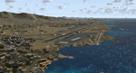
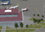
| LGSK - Skiathos Airport, Greece |
|
Images related to this file:
File Description:
LGSK Skiathos Airport Greece.
Skiathos Island lies off the east coast of mainland Greece and is often referred to as 'Europe's St. Maarten' with landing aircraft skimming the beach and the nearby harbour. At 5341feet the runway is short and narrow and usually only captains are allowed to perform landings. Seasonal taffic includes Munich, Gatwick, Rome, Oslo and Stockholm, with scheduled flights to Athens.
This scenery has been designed to sit on the excellent photoreal scenery by Angelo Tassoglou, available here on Avsim, just search for 'Skiathos.zip'. Please note, it will not work with the default terrain. It also uses many objects from my LGKF Kefallinia scenery, also available here at Avsim.
The scenery features added vegetation, detailed airport buildings based on real photographs, animated windsocks, flags, road traffic, people, trees, waves, birds and air traffic. All the scenery files have been divided so they can be switched on or off according to user preference. It has been designed for and tested in DX9 and FSXA only.
Please enjoy and I hope you like my scenery as much as I enjoyed building it.
Required files:
skiathos.zip by Angelo Tassoglou
LGKF Kefallinia by George Keogh
| Filename: | LGSK__Skiathos_Airport_Greece.zip |
| License: | Freeware, limited distribution |
| Added: | 28th January 2013, 00:13:54 |
| Downloads: | 15,986 |
| Author: | George Keogh |
| Size: | 20.47 MB |
© 2001-2026 AVSIM Online
All Rights Reserved
Privacy Policy |