
Where Flight Simulation Enthusiasts Gather from Around the World!
AVSIM Library - Search Results

| Category: Flight Simulator 2004 - Scenery | |
| Argyle International Airport, Saint Vincent |

|
Images related to this file:
File Description:
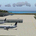
This is a scenery created by me of the soon to be completed Argyle International Airport on the island nation of Saint Vincent and the Grenadines. This scenery was created as a pet project of mine out of personal love for the project. The airport was created using only default scenery objects and the only thing that was changed was the type and direction of the turning point at the RWY04 end. I'm sharing this so FS2004 simmers can see what the airport will be like on completion. The scenery is 100% customizable to suit your preference. All I ask is that you don't change the actual airport design. I hope that this will bring you hours and hours of flying fun.
Important: This scenery requires the full RWY12 Scenery Library including the Gate Markings SS files. Also the Lesser Antilles Mesh is required.
| Filename: | Argyle_International_Airport_Saint_Vincent.zip |
| License: | Freeware |
| Added: | 22nd December 2013, 21:57:40 |
| Downloads: | 528 |
| Author: | Cilbert Campbell |
| Size: | 6.8 KB |
| Category: Flight Simulator 2004 - Scenery | |
| VVCR Cam Ranh Airport, Vietnam - Additional Files |
|
Images related to this file:
File Description:
This zip file contains additional files for my original scenery of Cam Ranh Airport, released under the file name VVCRv1.zip. To use these files you should download and install VVCRv1.zip first.
Users of the add-on mesh for Indochina by Rolf Keibel, created for Combat Flight Simulator 2, will find that much of the runway is not visible. The replacement file will cure this problem.
Whichever mesh you use, the long bridge just south of the airport will appear to be broken (it looks like a drawbridge its east end!). This is an error within Microsoft's scenery - a file to correct this is included.
Unfortunately, some of the optional scenery objects referred to in my scenery, which I advised could be downloaded as tl_rwy12.zip have been withdrawn. The necessary scenery items for my scenery are included here.
[File re-uploaded at request of AVSIM]
| Filename: | VVCR_Cam_Ranh_Airport_Vietnam__Additional_Files.zip |
| License: | Freeware |
| Added: | 7th May 2010, 11:00:46 |
| Downloads: | 3,461 |
| Author: | John Hinson & Todd Lucas |
| Size: | 3.19 MB |
| Category: Flight Simulator X - Scenery | |
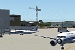
| FIMP - Sir Seewoosagur Ramgoolam Intl - Mauritius *New Terminal & Airport Layout* |
|
Images related to this file:
File Description:

This scenery adds the new terminal and taxiways, and rebuilds the aprons and runway to provide a fully functioning AI traffic extension for runway 14. The airport is assigned a mean elevation, allowing it to blend naturally with the surrounding terrain, and landclass is provided for the entire island. This scenery is most effective when used in combination with "mauritius_fsx.zip" by Max Kraus. This scenery is optimized to fit seamlessly with FTX Global/Vector and should also be fully functional in all FSX configurations. The airport is updated to reflect current satellite imagery and positioning. Scenery was created using Airport Design Editor X v1.61.5298, SBuilderX 3.13, and the FSX Object Placement Tool. Scenery objects were added and modified from stock FSX scenery to resemble as closely as possible the actual airport. The FSX apron lights included are from the set created by Jim Dhaenens.
| Filename: | FIMP__Sir_Seewoosagur_Ramgoolam_Intl__Mauritius_Ne.zip |
| License: | Freeware |
| Added: | 10th July 2015, 16:16:40 |
| Downloads: | 8,785 |
| Author: | Carlyle Sharpe |
| Size: | 5.06 MB |
| Category: Flight Simulator 2004 - Scenery | |
| Wilgrove Airpark (8A6) |
|
Images related to this file:
File Description:
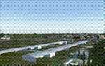
Wilgrove Airpark (8A6) is a small GA airport located just east of Charlotte, NC. It is often forgotten by pilots in Flightsimulator, yet it is a very busy place in the real-world, due to it's huge popularity with student and weekend GA pilots. There has never been a really good, accurate representation of this little gem created for the flightsim, so I decided to try my hand at it. This is my very first scenery project, and I hope you enjoy it. It was designed with ADE9X, and it requires RWY12 and EZ-Scenery objects extensively,(not included) so you will need to download these freeware scenery libraries prior to installation of this package for the Wilgrove Airpark scenery to display properly. - Glenn Mullis
| Filename: | Wilgrove_Airpark_8A6.zip |
| License: | Freeware, limited distribution |
| Added: | 22nd September 2010, 16:59:32 |
| Downloads: | 278 |
| Author: | Glenn Mullis |
| Size: | 4.4 MB |
| Category: Flight Simulator 2004 - Scenery | |
| West Sussex Piers |
|
File Description:
The piers and works between Selsey Bill and Beachy Head; at Bognor, Littlehampton, Worthing, Shoreham, Brighton West, and Brighton; mark the route of the low-level air-speed world record flight by Neville Duke in a Hawker Hunter in 1953 at an average speed of 747 mph. This scenery was made for the FS Kiosk at the Tangmere Museum, Sussex, England, to enable visitors to emulate Neville Duke's record flight in the Hunter, and is released to the FS community for that purpose. and any other, such as racing. The zipfile contains two sets of coastal objects for the same area; one is for FS2004 using the default scenery, the other for FS2004 using VFR photo scenery, such as JustFlight's "Photograhic Scenery" or "Roads & Rivers of Europe".
| Filename: | West_Sussex_Piers.zip |
| License: | Freeware |
| Added: | 7th August 2005, 12:55:06 |
| Downloads: | 2,165 |
| Author: | John McKeon |
| Size: | 484.05 KB |
| Category: Flight Simulator X - Scenery | |
| Lake Magpie - Quebec bush scenery |
|
File Description:
This scenery is fictitious and created for the pleasure of all. All the objects are already included in FSX and no other library was used. This scenery simulates the Headquarters of Aérovirtuel bush flying section for the region of Duplessis, Qc. The Lake Magpie is about 100Km North West of Havre St-Pierre. This place is hilly but perfect for a quick response for emergencies in the East part of Québec. This base has all services, oil gaz included.Must have before installing the Aerovirtuel bush flying sceneries:
1-Quebec Elevation 38m (LOD10) Gilles Gauthier sur http://avsim.com/ 5 files.
2-Quebec Scenery - Lakes and Rivers (1/5) http://avsim.com/ 5 files and one fix
3-Quebec Scenery - Addition of Roads http://avsim.com/
| Filename: | Lake_Magpie__Quebec_bush_scenery.zip |
| License: | Freeware, limited distribution |
| Added: | 10th November 2007, 22:15:41 |
| Downloads: | 846 |
| Author: | Denis Dupuis |
| Size: | 416.57 KB |
| Category: Flight Simulator X - AFCAD Files | |
| Newton Airport (3N5), NJ v1.0.1 |
|
File Description:
Located 03 miles S of Newton, New Jersey on 90 acres of land, Newton Airport is a public airstrip. No services are offered for transient aircraft. Trees are summertime ONLY.
Scenery constructed with use of satellite images/streetview, the author has not been there in person.
This scenery is meant to be used in conjunction with MegaScenery Earth New York 005. It is not required, but apron use is minimized to allow satellite scenery to show through as much as possible, and objects are placed based on the MSE textures - lack of it may make scenery look out of place.
Visit http://www.blade-edge.com/MSEAirports/?page_id=223 for more information and pictures.
Revision Notes: Moved mis-placed start location to runway
| Filename: | Newton_Airport_3N5_NJ_v101.zip |
| License: | Freeware |
| Added: | 15th January 2011, 02:43:50 |
| Downloads: | 213 |
| Author: | Drew Sikora |
| Size: | 884.5 KB |
| Category: Flight Simulator X - AFCAD Files | |
| Markle Airport (2NJ6), NJ |
|
File Description:
Located 05 miles N of Phillipsburg, New Jersey, Markle Airport is a private turf strip. No transient services are offered. Trees are summertime ONLY. 30ft trees and some houses surround the runway to the south and the west, the eastern threshold is on the edge of a steep ravine leading down to the Delaware River.
Scenery constructed with use of satellite images/streetview, the author has not been there in person.
This scenery is meant to be used in conjunction with MegaScenery Earth New York 007. It is not required, but apron use is minimized to allow satellite scenery to show through as much as possible, and objects are placed based on the MSE textures - lack of it may make scenery look out of place.
| Filename: | Markle_Airport_2NJ6_NJ.zip |
| License: | Freeware |
| Added: | 29th October 2010, 21:31:35 |
| Downloads: | 172 |
| Author: | Drew Sikora |
| Size: | 329.68 KB |
| Category: Flight Simulator X - AFCAD Files | |
| Alliance Airport (23NJ), NJ |
|
File Description:
Located 02 miles SE of Pittsgrove, New Jersey on 3 acres of land, Alliance Airport is a privately-owned turf airstrip included in FSX. If you don't plan on making any trips here, then this AFCAD file will remove the runway and prevent it from randomly sticking out on the satellite textures.
Scenery constructed with use of satellite images/streetview, the author has not been there in person.
This scenery is meant to be used in conjunction with MegaScenery Earth New Jersey/Delaware 004. It is not required, but apron use is minimized to allow satellite scenery to show through as much as possible, and objects are placed based on the MSE textures - lack of it may make scenery look out of place.
| Filename: | Alliance_Airport_23NJ_NJ.zip |
| License: | Freeware |
| Added: | 22nd October 2010, 06:03:59 |
| Downloads: | 203 |
| Author: | Drew Sikora |
| Size: | 174.79 KB |
| Category: Flight Simulator X - AFCAD Files | |
| Matthews Airport (NJ09), NJ |
|
File Description:
Located 03 miles S of Belvidere, New Jersey, Matthews Airport is a private turf strip 2000' in length. No services are offered for transient aircraft. A parking spot is available for users to start on the concrete pad in front of the hangar. Field is not lit, daytime VFR only is recommended.
Scenery constructed with use of satellite images/streetview/aerial photos - the author has not been there in person.
This scenery is meant to be used in conjunction with MegaScenery Earth New York 007. It is not required, but apron use is minimized to allow satellite scenery to show through as much as possible, and objects are placed based on the MSE textures - lack of it may make scenery look out of place.
| Filename: | Matthews_Airport_NJ09_NJ.zip |
| License: | Freeware |
| Added: | 14th June 2011, 06:09:05 |
| Downloads: | 272 |
| Author: | Drew Sikora |
| Size: | 572.92 KB |
© 2001-2026 AVSIM Online
All Rights Reserved
Privacy Policy |