
Where Flight Simulation Enthusiasts Gather from Around the World!
AVSIM Library - Search Results

| Category: Flight Simulator 2004 - Scenery | |
| 28A - Goose Creek Airport |

|
Images related to this file:
File Description:
FS2004 Scenery--Goose Creek Airport (28A), is a small GA airfield located near Indian-Trail, North Carolina (NC), USA. It is home to Pressley Aviation Inc., a popular flight-training school. This scenery package uses common objects from the Rwy12 and EZ-Scenery libraries (not included) and these are required for correct scenery display. A good high-quality terrain mesh from FSGenesis or equivalent supplier is also recommended for best results. It will work with the default FS2004 terrain engine as well.
| Filename: | 28A__Goose_Creek_Airport.zip |
| License: | Freeware |
| Added: | 30th October 2011, 14:42:17 |
| Downloads: | 740 |
| Author: | Glenn Mullis |
| Size: | 3.81 MB |
| Category: Flight Simulator 2004 - Utilities | |
| The New ChartMap, v4 |
|
File Description:
The new ChartMap_ver4 is a program completely rebuilding with a new graphics power and a new database. Now is possible to use the PDF format for every kind of charts. You can everywhere download it. The important thing is to use the conventional letter below in this tutorial (vds restrictions). This is a new version.
ChartMap_ver4 is a small stand-alone Windows utility for Flight Simulators allowing a number of airport charts to be stored and available on screen whilst still flying.
The database is empty. To work download Italians Airports Charts and Procedures Series 1, 2 and 3.
| Filename: | The_New_ChartMap_v4.zip |
| License: | Freeware |
| Added: | 30th January 2010, 09:42:02 |
| Downloads: | 2,485 |
| Author: | Carlo Chiappisi |
| Size: | 1.07 MB |
| Category: Flight Simulator 2004 - Utilities | |
| Kneeboard References & Checklists |
|
Images related to this file:
File Description:
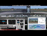
In this utility, designed for Flight Simulator 2004 but probably usable for FSX and others, there are several documents for aircraft References (main content) + Control procedures (minor content)
to be used within the electronic kneeboard of simulator. Addressed to those wish to change Reference/Checklist existing or missed ones (i/e from aircraft downloaded). Contents:
more than 320 folders and files.htm usable for reference and procedures, plus a table that summarizes the treated material. Images and contents from the courtesy of Eurocontrol, editor of Aircraft Performance Database. Enjoy! A Youtube tutorial can be found here: https://youtu.be/yfTLjVMOQ9I
| Filename: | Kneeboard_References__Checklists.zip |
| License: | Freeware |
| Added: | 17th January 2017, 15:41:35 |
| Downloads: | 328 |
| Author: | Aldo Della Vedova |
| Size: | 85.86 MB |
| Category: Flight Simulator 2004 - Miscellaneous Files | |
| World of Fireworks |
|
File Description:
WORLD OF FIREWORKS FS9
Add firework display scenes easily in flight simulator 2004 to anywhere around the world using your own FS2004
effects files with Microsoft's freeware bglcomp.exe program.Just fly to where you want it to appear and write down the
lat. and lon. cordinates and run it through the program then add your scenery into FS9,restart and view your show.
You can also use this with many other effects such as steam,volcanos,forest fires ect by reading the manual.
My own fireworks tutorial included with 2 examples ready to go as a walkthrough.
By: Ron Jeffers
| Filename: | World_of_Fireworks.zip |
| License: | Freeware |
| Added: | 16th December 2004, 23:04:19 |
| Downloads: | 5,518 |
| Author: | Ron Jeffers |
| Size: | 523.44 KB |
| Category: Flight Simulator 2004 - Gauges | |
| sRadar80 Navigational Radar |
|
File Description:
FS2004 Gauge: sRadar80, navigational radar- This nose-mounted, forward-scanning radar will display simulated echoes from ground-based targets that will assist navigation. Screen blips represent FS objects located within the simulator world. With six ranges available (2nm-80nm), cross-country radar navigation and low visibility approaches are possible (see pictures). Scan sensitivity (GAIN) allows adjustments to minimize screen clutter. On-screen wiper scan, push-to-display nm scale, plus many other features. For panel and window installations with included icon gauge. Also, tutorial illustrating a radar approach using the features of sRadar80. By Glenn Copeland
| Filename: | sRadar80_Navigational_Radar.zip |
| License: | Freeware |
| Added: | 29th April 2006, 04:54:56 |
| Downloads: | 6,273 |
| Author: | Glenn Copeland |
| Size: | 230.11 KB |
| Category: Flight Simulator 2004 - Scenery | |
| Richmond VA Intl. Airport |
|
File Description:
Richmond Intl. Airport in Richmond VA for FS2004. Features newly designed jetways. An Afcad2 file is included which uses the star runway system to activate all three runways. It is also strongly suggested that the Rwy12 v1.2 program and all of the static object libraries be previously installed. There is a self-installer included for hassle-free installation of scenery and texture files. Important: a previous installation of the file FS9JETS2.ZIP is also required. Please read the kric.doc file for more important information.
| Filename: | Richmond_VA_Intl_Airport.zip |
| License: | Freeware, limited distribution |
| Added: | 12th June 2006, 04:49:44 |
| Downloads: | 3,238 |
| Author: | Patrick Finch |
| Size: | 1.64 MB |
| Category: Flight Simulator 2004 - Scenery | |
| Joslin-Magic Valley Regl KTWF |
|
File Description:
FS2004 Scenery-Joslin Field - Magic Valley Regl Airport (KTWF) serves Twin Falls, ID and Twin Falls County and is owned by the City & County Of Twin Falls. The airport has more than one runway. The longest is a paved runway extending 8703 feet. The facility is at an elevation of 4151 feet at a distance of about 4 miles from Twin Falls. Created with EZ Scenery, Rwy12 and Lago's FSE with AFCAD2 and Traffic Tools. Textures for custom EZ Scenery objects included. By John B. Loney, Jr.
| Filename: | JoslinMagic_Valley_Regl_KTWF.zip |
| License: | Freeware |
| Added: | 3rd July 2006, 01:48:04 |
| Downloads: | 1,094 |
| Author: | John B. Loney, Jr. |
| Size: | 891.05 KB |
| Category: Flight Simulator X - Scenery | |
| EGUO - Colerne, United Kingdom - UPDATE |
|
File Description:
Slight update of EGUO Colerne Airfield. **ORIGINAL FILE WAS MISSING THE SCENERY FILE FOR WHAT EVER REASON. THE SCENERY FILE IS INCLUDED HERE** 3AEF operate at EGUO regularly, and that is my main design considerations, along with the help of Google Earth. Hope you enjoy Colerne as much as I do! Designed with Rwy12 Object Library, but may not be used.. If you do not have the file library, then most additional objects will be un-viewable- it is needed- available here at AvSim.
| Filename: | EGUO__Colerne_United_Kingdom__UPDATE.zip |
| License: | Freeware |
| Added: | 8th July 2008, 13:32:36 |
| Downloads: | 867 |
| Author: | Lewis Mann |
| Size: | 393.08 KB |
| Category: Flight Simulator X - Scenery | |
| 5R2 - Ocean Springs Airport (MS) |
|
Images related to this file:
File Description:

NOTE: This scenery requires the RWY12 and EZScenery Object libraries. 5R2 is located in Ocean Springs, Mississippi and is the airport where I learned to fly, having never been upgraded in FS, I decided it was time to do so.
It is not 100% accurate as of yet, I will be updating it once I find the time to visit it in the real world again. I hope you enjoy flying the beautiful Gulf Coast! This scenery was originally made for the great community of FSEconomy
| Filename: | 5R2__Ocean_Springs_Airport_MS.zip |
| License: | Freeware, limited distribution |
| Added: | 8th August 2012, 23:24:57 |
| Downloads: | 389 |
| Author: | Joseph Chamberlain |
| Size: | 502.78 KB |
| Category: Flight Simulator 2004 - Scenery | |
| San Antonio International Airport 'KSAT' |
|
File Description:
This scenery is built for FS2004. This scenery was created with Abacus EZ Scenery, but you do not need the EZS libraries. On the contrary you will need the RWY12 libraries installed. I have added a terminal replacement, airport vehicles, parking spots, GA hangars, and lights. The gates are designed for certain size planes. The gates are assigned as the airport's website (http://www.sanantonio.gov/aviation/) indicates. I used Google Earth Imagery to very accurately place the gates.
| Filename: | San_Antonio_International_Airport_KSAT.zip |
| License: | Freeware |
| Added: | 1st March 2007, 23:34:29 |
| Downloads: | 3,937 |
| Author: | Brandon DePalo / Watsup Sceneries |
| Size: | 2.25 MB |


© 2001-2026 AVSIM Online
All Rights Reserved
Privacy Policy |