
Where Flight Simulation Enthusiasts Gather from Around the World!
AVSIM Library - Search Results

| Category: Flight Simulator 2004 - Scenery | |
| Goodspeed Airport (42B) - East Haddam, Connecticut |

|
Images related to this file:
File Description:
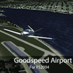
Goodspeed is a privately owned airfield in East Haddam, Connecticut that operates as a public access general aviation facility. The runway is a short 2120 feet and is carefully placed in a shoreline meadow of the Connecticut river. Surrounded by the dense forests and community, the airport is a tight approach, further hampered by the presence of the East Haddam Bridge, which sits under the runway 14 approach. The airport has limited parking facilities for transient aircraft, and it is not common for visiting aircraft to park in the grass in front of the "terminal". Hanger facilities are provided as well. Nearby is the famous Goodspeed Opera House, established back in the 19th century, the house still has operas other performances regularly.
Features:
-High Resolution Ground textures around airport;
-Accurate models of all airport buildings;
-Detailed taxiways and runways;
-Super HD grass and pavement;
-Custom aerial imagery for area, including autogen;
-Full seasonal textures (Spring, Summer, Fall, Winter);
-Various "Easter Eggs";
-Deer (at dusk);
-Christmas Lights (During the Holiday Season);
-Night Textures;
-Runway Lights, obstruction lights;
-And much more!
Created by Dustin Mosher www.dmosher.info
| Filename: | Goodspeed_Airport_42B__East_Haddam_Connecticut.zip |
| License: | Freeware, limited distribution |
| Added: | 4th March 2010, 13:34:02 |
| Downloads: | 685 |
| Author: | Dustin Mosher |
| Size: | 62.8 MB |
| Category: Flight Simulator 2004 - Scenery | |
| Hope Field near Ottawa Ontario, Canada |
|
Images related to this file:
File Description:
The field is newly included in the Canada Flight Supplement. Unusually for a grass field the runway has the numbers marked out in white; given that this is a private airfield that does not invite unexpected guests and has only one plane based there, and presuming that the owner can remember his own runway headings, it is unlikely that these will still be there in a year's time. There is no hangar as yet. To the west is highway 416 and to the east is the Rideau River, both of which run north-south. Lke Rockcliffe (which is to the north) the airfield is right on the edge of the Ottawa control zone, so you should already be below 1,500 feet ASL when approaching from the south and talking to Ottawa tower when arriving from the north. The runway is 07/25 and 2,800 feet long, which should be enough for almost anybody, and the field is at 315 feet ASL. Manotick is a mile to the north east on the Rideau River and the Rideau Valley Airpark CPL3 is six miles south in the bend of the Rideau where it turns west.
| Filename: | Hope_Field_near_Ottawa_Ontario_Canada.zip |
| License: | Freeware, limited distribution |
| Added: | 10th July 2010, 19:34:51 |
| Downloads: | 201 |
| Author: | Roger Wensley |
| Size: | 3.15 MB |
| Category: Flight Simulator X - AFCAD Files | |
| Southern Cross Airport (C01), NJ |
|
File Description:
Located 03 miles SW of Williamstown, New Jersey on 18 acres of land, Southern Cross is a public turf airstrip with an ample 2400' runway. The runway is hard surfaced in order to allow for AI traffic to use this airport, however the end user must enable flights to arrive/depart from this airfield within their AI traffic program in order for AI to appear here. Tie down space is available north of Runway 09 and fuel is available at the tank next to the hangar. This airport is not lit at night so daytime VFR operations only are recommended. In addition to trees at the ends of both runways, power lines are strung up across there too.
Scenery constructed with use of satellite images/streetview/aerial photos - the author has not been there in person.
This scenery is meant to be used in conjunction with MegaScenery Earth New Jersey/Delaware 004. It is not required, but apron use is minimized to allow satellite scenery to show through as much as possible, and objects are placed based on the MSE textures - lack of it may make scenery look out of place.
| Filename: | Southern_Cross_Airport_C01_NJ.zip |
| License: | Freeware |
| Added: | 25th March 2011, 16:38:00 |
| Downloads: | 192 |
| Author: | Drew Sikora |
| Size: | 630.77 KB |
| Category: Flight Simulator X - Scenery | |
| Frankfurt Main Airport v5 (EDDF) scenery |
|
Images related to this file:
File Description:
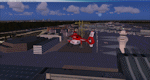
This major release commemorates the opening of the new Northwest Runway. Using ADE 1.50, this scenery package represents the layout of the airport as of October 2011 and includes major updates to the land class data to provide the most realistic environment around the airport.
Other major features include the new 07L/25R runway setup for landings only plus associated navaids, taxiway signs, high-speed taxiways and also reconfigures the other runways as per current operations.
In addition, adds several new features, such as new Gmax models for the DB Schenker and CCT hangars at South Cargo City, a new animated rotating beacon to the North control tower, brand new G gate apron area (9 new parking spots with night lighting) at the site of Terminal 3 as well as a host of other airport buildings and parking lots added on the south side. Other updates include construction work on taxiway Sierra as per real airport as well as latest runway/taxiway textures.
A number of other miscellaneous updates are also featured so see the readme file for more details. Stay tuned for v6 which will add further updates to this freeware FSX Frankfurt scenery.
| Filename: | Frankfurt_Main_Airport_v5_EDDF_scenery.zip |
| License: | Freeware |
| Added: | 25th November 2011, 09:14:18 |
| Downloads: | 2,422 |
| Author: | Mark Aldridge |
| Size: | 4.98 MB |
| Category: Flight Simulator X - Scenery | |
| RAF Balderton |
|
File Description:
RAF Balderton is a former Royal Air Force station located 2.0 miles (3.2 km) south of Newark-on-Trent, sandwiched between the now extinct Great Northern Railway (GNR) Bottesford-Newark line and the A1 road in Nottinghamshire, England.
Opened in 1942, it was used by both the Royal Air Force and United States Army Air Forces. During the war it was used primarily as a troop carrier transport airfield and after for munitions storage before it was closed in 1957.
With the facility released from military control, Balderton was returned to agriculture, the runway concrete disappearing as hardcore under the AI road improvements of the 1960s. At that time, the developed Al was routed west of the original road, over the eastern perimeter track of the airfield, before coming back to the east to bypass Balderton village and Newark.
Gypsum open-pit mining has also taken its toll where quarrying has completely obliterated the airfield, with single track roads all that remain of the runway and perimeter track, and the occasional concrete runway end or pile of rubble.
Today the remains of the airfield are located on private property being used as agricultural fields.
| Filename: | RAF_Balderton.zip |
| License: | Freeware |
| Added: | 17th February 2016, 23:32:44 |
| Downloads: | 233 |
| Author: | Terry Boissel |
| Size: | 759.04 KB |
| Category: Flight Simulator 2004 - Scenery | |
| Johnson Creek 3U2 Forest Service airfield in Idaho USA |
|
Images related to this file:
File Description:
This airfield is in the mountains of Idaho, around 25 miles south of Big Creek U60, which was the second in the series to be posted. Johnson Creek is very regularly used for picnic fly-ins and overnight camping, as can be seen from the number of videos posted. Again, the creek does not appear in FS9 as it is only around 20 feet or so wide, plus within Ultimate Terrain I have streams turned off for the reasons given in the U60 post. The runway is at 4,933 feet ASL, 3,480 feet long, aligned 35-17, and in good condition. The shower facilities are south of the centre of the runway and on the eastern side; as a result planes mostly, but not all, park on the eastern side and towards the south. There are Forest Service workshop buildings on the east side of the runway near the centre. If you have a wind from the south then some AI planes will actually manage to land. I should have mentioned before that these are all made with only the default FS9 mesh, and that I will be reposting them again for use with the FSGenesis 19m mesh.
| Filename: | Johnson_Creek_3U2_Forest_Service_airfield_in_Idaho.zip |
| License: | Freeware, limited distribution |
| Added: | 25th May 2017, 17:54:06 |
| Downloads: | 172 |
| Author: | Roger Wensley |
| Size: | 4.81 MB |
| Category: Flight Simulator 2004 - AFCAD Files | |
| EHAM for NL2000, Multiple Runways, First Attempt |
|
File Description:
AFCAD2 File for :
Amsterdam, Schiphol Intl Airport, the Netherlands ( EHAM )
for NL2000 Scenery .
with Runways 06 and 36R for landings and 36L and 36C for take-offs .
NL2000 scenery can be found on Avsim as nl2kv291.zip .
All credits to NL2000 team for the NL2000 scenery, many many thanks .
( Not to bo used with the default scenery )
This Afcad file was originally made by Victor Nauta as af2nl2k29v2_eham.zip .
But now with breakthrough NON parallel runway assignment by Project AI, Jim Vile and
Reggie Fields, non-parallel runways can be used simultaniously .
Thanks to Jim .
Although created to use all runways, something I can't do about it is to make FS9
use South or West bound traffic .
Now only North bound traffic is possible as Victor Nauta also complained about and didn't see a solution as well .
Even with maximum wind from South-West ( a common thing in the Netherlands ) AI is still assigned to North or East bound .
I have closed Runway 9 as it is rarely used, and also Runway 4 ( Gen. Aviation ) closed to avoid smaller turboporops landing there .
Have fun, Silvester
| Filename: | EHAM_for_NL2000_Multiple_Runways_First_Attempt.zip |
| License: | Freeware |
| Added: | 8th October 2004, 20:18:30 |
| Downloads: | 1,728 |
| Author: | Silvester van Wijk / Victor Nauta / Project AI |
| Size: | 17.39 KB |
| Category: Flight Simulator 2002 - AFCAD Files | |
| Denver International Airport KDEN with WestWind Terminal Overlay |
|
File Description:
This is a 4 part (base and 3 overlays) FS2002 facility file for KDEN. This file can be used with the WestWind Training Center scenery file available from http://www.flywestwind.com/Scenery/denverterm.htm. The base file is named KDEN1BB.txt, is for non-express/non-regional commercial aircraft,
not of the WestWind livery, uses runways 35L for departures and 35R for arrivals, and has 8 heavy gates, 14 medium gates, and 20 small gates. The first overlay is named KDEN2BB.txt, is for express/regional commercial aircraft, not of the WestWind livery, uses runway 26 for departures and arrivals, and has 19 small gates. The second overlay is named KDEN3BB.txt, is for general aviation aircraft, uses runway 7 for departures and arrivals, and has 7 parking spaces. The third overlay is named KDEN4BB.txt, is for all commercial aircraft of the WestWind livery only, uses runway 16 for departures and arrivals, and has 1 heavy gate and 13 small gates. You do not have to utilize the WestWind overlay if you do not want to, it will not affact the scenery and the remainder of the airport will work fine if you simply ignore it.
| Filename: | Denver_International_Airport_KDEN_with_WestWind_Te.zip |
| License: | Freeware |
| Added: | 18th November 2002, 00:15:30 |
| Downloads: | 458 |
| Author: | Boyd Barker |
| Size: | 78.13 KB |
| Category: Flight Simulator X - AFCAD Files | |
| CYLW - Kelowna International Airport / Kelowna, British Columbia, Canada |
|
Images related to this file:
File Description:
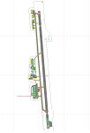
CYLW - Kelowna International Airport / Kelowna, British Columbia, Canada
This airport update was made with the latest version of ADE (Airport Design Editor) and made for FSX as a replacement for the stock (default) airport. I found that most stock airports in FSX lack a decent amount of character and realism and I've done my best to correct that wherever possible. I've made several additions to the airport which are listed below. All these enchancements are as close to the real airport as I can get with stock library objects. I've used satellite images, terminal photos and maps throughout the whole process so building locations are as accurate as possible. Happy landings in the beautiful Canada!
Features:
*Expanded parking apron
*Main terminal building with it's 8 gates some with jetways
*Seperate parking aprons for GA traffic
*Runway accurately expanded to 8,900ft to reflect 2008 runway project
*Hangar and other airport buildings added
*Airport vehicles and objects throughout the airport
*Main road in front of airport added with static vehicles
*Parking lots with static vehicles
*Airport fire station with fire trucks
*Static de-icing vehicles & runway plow
*2 Helipads
(Next up: CYWG Winnipeg Intl Airport)
| Filename: | CYLW__Kelowna_International_Airport__Kelowna_Briti.zip |
| License: | Freeware |
| Added: | 22nd July 2012, 15:13:45 |
| Downloads: | 1,132 |
| Author: | Jaison Diaz |
| Size: | 10.38 KB |
| Category: Flight Simulator 2004 - Scenery Design | |
| Small Airstrip Objects SS FS9 scenery objects |
|
File Description:
As far as I know, this is the most comprehensive collection to date of small airport scenery objects. More importantly, these are, for the most part, objects that have never before been made available. Most of these objects were suggested by Rob de Vries in the Netherlands, who also provided me with many useful photos on which to base the designs. My thanks to Rob.
Objects include:
* Runway end and side markers in a variety of materials and colors.
* Ground markings of various kinds, including a compass rose, runway & airport closed indicators, and general aviation parking guides.
* Animated wind T, tetrahedron, and wind sock (wind sock by Jörg Dannenberg).
* Segmented circles in two styles and colors, with runway and pattern indicators. (For information on how to use segmented circles, see enclosed FAA document circles.pdf.)
* Weathered asphalt and concrete surfaces.
Most of the objects come in new and weathered versions. In addition, the segmented circles and wind indicators come with and without night lighting. These are standard FS9 scenery objects and can be placed using Instant Scenery or other programs that are able to use FS9 scenery libraries.
| Filename: | Small_Airstrip_Objects_SS_FS9_scenery_objects.zip |
| License: | Freeware |
| Added: | 12th November 2007, 08:17:15 |
| Downloads: | 5,040 |
| Author: | Sidney Schwartz |
| Size: | 3.97 MB |


© 2001-2026 AVSIM Online
All Rights Reserved
Privacy Policy |