
Where Flight Simulation Enthusiasts Gather from Around the World!
AVSIM Library - Search Results

| Category: Flight Simulator X - Scenery | |
| LEMG-X-JVX |

|
Images related to this file:
File Description:
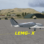
LEMG, Malaga, Spain.
Hello Flightsim friends.
This is an reworked ADE [Scruffy Duck] scenery of LEMG, Malaga Airport, Spain, for FSX
It was annoying to find that almost everything was wrong at LEMG in FSX.
Runway numbers, Exits, Entrances to the Apron etc.
I've tried to get all the runways, turn offs and runway signs in their correct positions.
The Runways are now: 13 and 31 instead of 14 and 32
-crows next to entrance D13 at the NW end of the runway 13 and south of the airport almost halfways.-Seagulls next to the shore line.-Fishingships, a Cruiseliner and a freighter at sea.-Oil tanks near Apron entrance D2 [extremely dense setting]- Some military objects on the MIL part of the airport plus extra buildings.-Somewhere in the mountains there should be Eagles I know they are there but heck, I didn't yet see them my self :-) The MAR approach should lead you past them though]
AVSIM upload only
| Filename: | LEMGXJVX.zip |
| License: | Freeware, limited distribution |
| Added: | 1st April 2010, 02:21:00 |
| Downloads: | 1,728 |
| Author: | Joost Visser |
| Size: | 435.24 KB |
| Category: Flight Simulator X - AFCAD Files | |
| Var-Sky Airport (JY08), NJ |
|
File Description:
Located 02 miles E of Woodstown, New Jersey on 38 acres of land, Var-Sky Airport is a private turf strip 1165' in length and a slightly challenging approach with trees closely bordering the sides of both runway ends. This airport has lighting on the runway however there is no beacon and the windsock (located atop the hangar) is not lit. There are no services offered for transient aircraft. There is no hard surfaced runway so having your terrain mesh settings as high as possible is recommended.
Scenery constructed with use of satellite images/streetview/aerial photos - the author has not been there in person.
This scenery is meant to be used in conjunction with MegaScenery Earth New Jersey/Delaware 004. It is not required, but apron use is minimized to allow satellite scenery to show through as much as possible, and objects are placed based on the MSE textures - lack of it may make scenery look out of place.
| Filename: | VarSky_Airport_JY08_NJ.zip |
| License: | Freeware |
| Added: | 19th April 2011, 06:21:50 |
| Downloads: | 195 |
| Author: | Drew Sikora |
| Size: | 361.96 KB |
| Category: Flight Simulator X - AFCAD Files | |
| CYQG - Windsor International Airport - Windsor, Ontario, Canada v1.1 |
|
Images related to this file:
File Description:
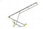
This airport update was made with the latest version of ADE (Airport Design Editor) and made for FSX as a replacement for the stock (default) airport. I've made several changes to the airport which are listed below. All these enchancements are as close to the real airport as I can get with stock library objects. I've used satellite images, terminal photos and maps throughout the whole process so building locations are as accurate as possible. Happy landings in the beautiful Canada!
Features:
Expanded parking apron, Main terminal building with parking for commercial aircraft,
Seperate parking aprons for GA traffic, Hangars and other airport buildings added,
Airport vehicles and objects throughout the airport, Airport fire station with fire truck,
De-icing vehicle/runway plow, Static fuel station with fuel vehicles
Newly expanded taxiway for runway 7/25 (v.1.1), New hangar and taxiway near runway 30 threshold (v1.1)
| Filename: | CYQG__Windsor_International_Airport__Windsor_Ontar.zip |
| License: | Freeware |
| Added: | 31st July 2012, 11:21:35 |
| Downloads: | 719 |
| Author: | Jaison Diaz / Endeavour AI |
| Size: | 105.69 KB |
| Category: Flight Simulator 2004 - Scenery | |
| Ontario Small Fields in Canada: #04 Stoney Point (Le Cunff) CRML V1 |
|
Images related to this file:
File Description:
This is the fourth in a series of small airfields in southern Ontario, Canada. It is Stoney Point (Le Cunff) CRML, a field near a small town (Stoney Point) close to Lake St Clair. The airfield has a grass runway of 2,250 feet, aligned 18/36; with trees around the house gardens between road and runway the south threshold is displaced by 250 feet. The markers approximately show the touchdown point north of the runway end. Le Cunff is the family name of the owners, included to differentiate between this and another Stoney Point field, CRJ2. I found the default FS9 airfield at the correct elevation of 625 feet, but sitting on a plateau, despite my Genesis Mesh. This looked so unreal that I have revised this to an incorrect lower elevation of 580. So if you find the airfield sitting in a hole in your installation you now know the reason. Let me know, with a screenshot please.
| Filename: | Ontario_Small_Fields_in_Canada_04_Stoney_Point_Le_.zip |
| License: | Freeware, limited distribution |
| Added: | 29th July 2015, 16:08:32 |
| Downloads: | 146 |
| Author: | Roger Wensley |
| Size: | 1.6 MB |
| Category: Flight Simulator 2004 - Scenery | |
| WAHR - Heathers Ranch |
|
File Description:
The other upload had checksum errors.
Heathers Ranch is located about 5 miles west of Port Angeles, Wa. Heather has made a lot of Virtual money from the BFU gang and others painting and re-furbishing their aircraft. This scenery was created for her because of her caring and unselfish attitude as well as her talents.
There are 2 runways, 18-36 is an oilsoaked dirt runway with oilsoaked taxiways. If you need your oil changed, Heather or her brother will change it free for the used oil. The other runway is a water runway and is in the sound adjacent to the ranch. There is a pier there that has fuel. For more service, climb the bank and taxi up to the hanger. “Easily accessed by air (STOL only), boat or road.”
You will need Gerrish Gray’s Trees_v3.zip installed. There are FSE file included but are not necessary for the enjoyment of this scenery.
| Filename: | WAHR__Heathers_Ranch.zip |
| License: | Freeware, limited distribution |
| Added: | 3rd July 2004, 19:53:57 |
| Downloads: | 3,283 |
| Author: | Joe Watson |
| Size: | 3.59 MB |
| Category: Flight Simulator 2002 - Flight Plans | |
| 34RTWest |
|
File Description:
An FS2002 GPS flight Plan. The 34th in a series of Round the World flight plans for the FS2002 default scenery. Depart Guwahati runway 02, India and arrive 1 hour 04 minutes later at Paro (VQPR) runway 33, Bhutan. A quiet and gentle flight, at least for the first 14 minutes then on entering a deep valley to start a pass storming climb into the snow capped mountains the mood of the flight changes. A session of dodging through gaps in the peaks concludes with a ‘Dive Bomber” VFR finals into a airport surrounded by very high ground and with its runway in a deep pit in a valley bottom, brings the session to an end. Pilots who have so far enjoyed the brand of fun and nonsense I call flight planning, will not be disappointed with this flight. The flight briefing (Word and text) is for a B737-400, it contains climb, cruise, top of descent and fuel loading details, waypoint timings and destination details.
| Filename: | 34RTWest.zip |
| License: | Freeware |
| Added: | 7th July 2002, 19:09:58 |
| Downloads: | 1,055 |
| Author: | The Ancient Brit |
| Size: | 37.4 KB |
| Category: Flight Simulator 2004 - Scenery | |
| CYKF Version 2.1 Full Package |
|
File Description:
I have now overhauled the CYKF Airport and made it the lively place it is today. I used the Canada Flight Supplement and my real life knowledge of the airport as this is where I do my flight training.
--Extended runway 25/07 and added the new taxiway and renamed the others
--Changed the landclass for the runway 25/07 extension
--Updated the airport in AFCAD for AI to use the runway 25/07 extension
--Added 6 AI flightplans to the 3 already there. AI will model real life training and commercial operations of the airport
--AI use proper Canadian registration codes
--Tested the files to make sure it operates correctly including AI
--2.1 Revisions
I updated the Traffic_CYKF file to use UTC times instead of local which I did by mistake. The AI will now fly at the proper times. ---**NOTE for those who have version 2.0 a separate upgrade only file is available **---
| Filename: | CYKF_Version_21_Full_Package.zip |
| License: | Freeware, limited distribution |
| Added: | 7th November 2003, 20:03:42 |
| Downloads: | 1,340 |
| Author: | David Voogd |
| Size: | 630.19 KB |
| Category: Flight Simulator 2004 - Scenery | |
| Como Idroscalo - Italy |
|
Images related to this file:
File Description:
Italian scenery with water runway and some existing objects and other buildings sintax generated; Information: Como is a beautiful town on the Como lake, north Italy, closed to the Swiss border. In the hills outside the town you can find Baradello old fortification (S) and Brunate small village (E). The lake, also called Lario, has a wonderful landscapes, reachable with battles of Navigazione Lago di Como. Description and content: Water runway placed approx on the real coordinates. Scenery includes: water runway with ILS; the Aero Club Como hangar, lighted with static float aircraft inside; some docks and a water NDB; two helicopter floating bases with an Huges 500D and dinghy; several sailboats and speedboats; football stadium, fantasy obelisco and statue; one Navigazione Lago di Como wharf and ticket office; buildings, hotels, hospital, cathedral, kiosk, restaurant etc.; Baradello old fortification and tower with Como flag; Brunate small village, with church and houses; several trees around the scenery and lights on lakefront and pier, on roads, hospital and jetty
| Filename: | Como_Idroscalo__Italy.zip |
| License: | Freeware |
| Added: | 9th February 2011, 20:43:31 |
| Downloads: | 1,427 |
| Author: | Aldo Della Vedova |
| Size: | 11.17 MB |
| Category: Flight Simulator X - Scenery | |
| CYDA - Dawson Airport - Yukon, Canada |
|
Images related to this file:
File Description:
FSX Scenery - Dawson City Airport (IATA: YDA, ICAO: CYDA) is located 8 nautical miles (15 km; 9.2 mi) east of Dawson City, Yukon, Canada, in the Klondike River valley, and is operated by the Yukon government. It has a terminal building and like most airports in its class, the runway is not paved. The gravel runway is 5,006 ft (1,526 m) long and at an elevation of 1,215 ft (370 m). A number of studies have recommended moving the airport or realigning the runway as it is in a narrow mountain valley. The airport is classified as an airport of entry by Nav Canada and is staffed by the Canada Border Services Agency (CBSA). CBSA officers at this airport can normally handle aircraft with up to 15 passengers, but are equipped to handle daily Boeing 737 charters between Dawson City and Fairbanks (Fairbanks International Airport) during the peak summer tourism season. For your flying pleasure by John B. Loney, Jr.
| Filename: | CYDA__Dawson_Airport__Yukon_Canada.zip |
| License: | Freeware, limited distribution |
| Added: | 7th April 2016, 17:20:42 |
| Downloads: | 910 |
| Author: | John B. Loney, Jr. |
| Size: | 13.92 MB |
| Category: Flight Simulator X - Missions | |
| The Most Dangerous Airports: Lukla V2 |
|
Images related to this file:
File Description:
Approach to Lukla V2 (Totally New Mission)
You are a very experienced pilot flying the Twin Otter for Yeti Airlines on an imaginary flight to and from Lukla. Take-off from Biratnagar airport VNVT climb to at least 13500 ft to WP1 Turn to Lukla. From WP1 carefully descent to 10000 ft (there should be cloud to make it more difficult, if you have some sort of weather add-on running) to WP2 Approach to VNLK, after passing through the gate turn sharp right and land at Lukla airport, remember that the runway has an incline of several degrees. Turn around and take-off again, stay on the runway and rotate just before the end of the runway. Follow the valley back to the south until you are able to track the VOR 112.30 at roughly 276�°, till you reach Kathmandu Intl Airport and land. Yes, it sounds easy, butâ�¦ find out for yourself.
| Filename: | The_Most_Dangerous_Airports_Lukla_V2.zip |
| License: | Freeware |
| Added: | 9th June 2010, 02:40:12 |
| Downloads: | 1,681 |
| Author: | Robbie Albers |
| Size: | 2.17 MB |


© 2001-2026 AVSIM Online
All Rights Reserved
Privacy Policy |