
Where Flight Simulation Enthusiasts Gather from Around the World!
AVSIM Library - Search Results

| Category: Flight Simulator 2004 - Scenery | |
| Manchester Airport KMHT |

|
File Description:
FS2004 Scenery-Manchester Airport (KMHT) serves Manchester and Hillsboroughugh County and is owned by the City Of Manchester. The airport has more than one runway. The longest is a paved runway extending 7001 feet. The facility is at an elevation of 234 feet at a distance of about 3 miles from Manchester. Created using FSDS2, Rwy12, Lago's FSE, AFCAD2 and Traffic Tools2.x. Be sure to read the readme file for important information about this scenery. By John B. Loney, Jr.
| Filename: | Manchester_Airport_KMHT.zip |
| License: | Freeware |
| Added: | 6th November 2005, 18:41:58 |
| Downloads: | 6,909 |
| Author: | John B. Loney, Jr. |
| Size: | 2.02 MB |
| Category: Flight Simulator X - Scenery | |
| YBCS - Cairns Intl Airport - Queensland, Australia |
|
Images related to this file:
File Description:
This airport update is made only for FSX: airline gates assigned to their terminals as per their website with extra parking, taxiways and taxi signs updated to the latest charts, runway 12/30 decommissioned, PAPI corrected to both sides of the runway, helipads moved to the correct locations, extra fuel trucks, support vehicle roads rebuilt, with many other scenery objects added, airport views are from the roof of the control tower (when in tower view) please view the readme before installation
| Filename: | YBCS__Cairns_Intl_Airport__Queensland_Australia.zip |
| License: | Freeware, limited distribution |
| Added: | 18th August 2014, 09:53:05 |
| Downloads: | 14,679 |
| Author: | Craig Scott |
| Size: | 544.45 KB |
| Category: Flight Simulator 2004 - Scenery | |
| FS2004 Scenery - Waukegan Regional KUGN |
|
Images related to this file:
File Description:
Re-upload. FS2004 Scenery-Waukegan Regional Airport (KUGN) serves Chicago/Waukegan and Lake County and is owned by Waukegan Port District. The airport has more than one runway. The longest is a paved runway extending 6000 feet. The facility is at an elevation of 727 feet at a distance of about 35 miles from Chicago. Textures included. Requires Traffic Tools and AFCAD2 along with Rwy12 objects/textures and FSE. Created with FSDS2, Rwy12 and FSE. By John B. Loney, Jr.
| Filename: | FS2004_Scenery__Waukegan_Regional_KUGN.zip |
| License: | Freeware, limited distribution |
| Added: | 7th June 2010, 08:25:49 |
| Downloads: | 1,406 |
| Author: | John B. Loney, Jr. |
| Size: | 1.91 MB |
| Category: Flight Simulator 2004 - Scenery | |
| KORD - O'Hare Intl Airport Chicago |
|
Images related to this file:
File Description:
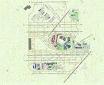
A total rebuild of the Chicago O'Hare airport. Repositioned the runways and taxiways to align with current Google Maps. Also, the Domestic and Intl terminals have been rebuilt and correctly positioned. New Jetways, Elevated roadways near the terminal, Added the new 9C/27C Runway with approaches and Navaids. And also extended the 9R/27L Runway to it's projected new length. Several taxiways have been added, deleted or moved as shown on the latest Airport Diagram chart. Made only for FS2004.
| Filename: | KORD__OHare_Intl_Airport_Chicago.zip |
| License: | Freeware |
| Added: | 30th March 2021, 16:48:51 |
| Downloads: | 1,303 |
| Author: | Johnny Alford |
| Size: | 39.93 MB |
| Category: Flight Simulator 2004 - Scenery | |
| SOFIA Airport (LBSF) v2.0 |
|
Images related to this file:
File Description:

We
are proud to present you the new version of "Sofia airport" addon
scenery for FS2004. The airport is located east from Sofia city wich is
the bulgarian capital. This is the biggest bulgarian airport. At the
end of 2006, Sofia recieved a brand new runway and terminal, called
terminal 2. The runway has two operating ILS from the both sides. The
scenery was created frame-rate friendly as much as possible and that
was our main priority.
Enjoy it!
| Filename: | SOFIA_Airport_LBSF__v20.zip |
| License: | Freeware |
| Added: | 25th February 2008, 01:18:03 |
| Downloads: | 12,999 |
| Author: | Mitya Aleksandrov, Evgeny Genchev, Niko Grozdanov |
| Size: | 4.64 MB |
| Category: Flight Simulator 2004 - Scenery | |
| One Hundred Mile House CAV3, British Columbia, Canada |
|
Images related to this file:
File Description:
One Hundred Mile House is eight miles south of 108 Mile Airport in BC and this version HAS THE MISSING TEXTURES! It is also 75 miles northwest of Kamloops. The runway 08/26 is 1,900 feet long and asphalt (except in the winter, when it is described as "snow"; there is also a note about limited winter maintenance) and almost in the middle of town. The apron is at the eastern (town) end of the runway and on the south side of this there is a large pond which attracts ducks and other water birds. Try to avoid the geese, they can weigh 14lb and come through the prop AND the perspex and up close have dark brown eyes; I speak from an experience 50 feet above the Rockcliffe runway.
| Filename: | One_Hundred_Mile_House_CAV3_British_Columbia_Canad.zip |
| License: | Freeware, limited distribution |
| Added: | 8th February 2010, 09:50:00 |
| Downloads: | 810 |
| Author: | Roger Wensley |
| Size: | 4.02 MB |
| Category: Flight Simulator 2004 - Scenery | |
| St Andre-Avellin CAA2 in Quebec Canada |
|
Images related to this file:
File Description:
St Andre-Avellin is a new airfield in Quebec Canada, 35 miles east of Ottawa and 10 miles north of the Ottawa River, and just northwest of the village of the same name. There is a 03/21 grass runway that is 2,870 feet long and slopes up towards the north. To show this slope I have not "placed" a grass runway (which would immediately flatten the slope) and anway there is not so much traffic that the grass would be notably marked. Because of the lack of an FS-recognised runway I have not made parking or a traffic file as AI would not work; anyway this airfield with constant activity would not reflect reality. There are no facilities at the airfield except a hangar for the owner and space to park.
| Filename: | St_AndreAvellin_CAA2_in_Quebec_Canada.zip |
| License: | Freeware, limited distribution |
| Added: | 9th April 2011, 20:49:47 |
| Downloads: | 170 |
| Author: | Roger Wensley |
| Size: | 816.9 KB |
| Category: Flight Simulator 2004 - Scenery | |
| Jenny Lind Island CWJL in Nunavut, Canada |
|
Images related to this file:
File Description:
This was a DEW line Auxiliary Station on Jenny Lind Island; the island is about 14 miles by 12 miles and off the southeast corner of Victoria Island, 85 miles east of Cambridge Bay. The station was closed in 1992 but is still there as "closed" meant "shut the door and walk away". There has been some later removal of diesel tanks and other polluting items but the buildings are still intact, and the runway is 4,470 feet of gravel 150' wide. At the western end there is an apron and a large hangar. There are of course no lights, signage, or windsock. A North Warning System station was built in 1990, 6 miles inland to the northwest of the runway. This has a shorter (1,400'?) gravel runway (and named CWJX here).
| Filename: | Jenny_Lind_Island_CWJL_in_Nunavut_Canada.zip |
| License: | Freeware, limited distribution |
| Added: | 15th November 2012, 13:55:29 |
| Downloads: | 191 |
| Author: | Roger Wensley |
| Size: | 1.65 MB |
| Category: Flight Simulator X - Scenery | |
| OOMS - Seeb Muscat Int'l Airport 2015 - Oman |
|
Images related to this file:
File Description:
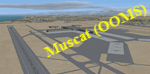
Muscat - Seeb Int'l airport, Oman, serving the the capital of the Sultanate of Oman, is undergoing a major construction of new passenger terminal (North Civilian Apron). The new northern runway (08L/26R) is fully operational with ILS and RNAV, 4000m X 60m.
The current default airport aprons and taxiway remain the same, so simmers could still taxi in and out from the old operational apron to the new runway (A long way though!). An updated version will be pushed once the construction is completed.
Compatible with both FSX and P3D.
| Filename: | OOMS__Seeb_Muscat_Intl_Airport_2015__Oman.zip |
| License: | Freeware, limited distribution |
| Added: | 15th February 2016, 20:23:01 |
| Downloads: | 1,433 |
| Author: | Ahmed Abdessalam |
| Size: | 237.04 KB |
| Category: Prepar3D V1-4 - Scenery | |
| EDDF - Frankfurt-Main, Germany |
|
Images related to this file:
File Description:
This is Ray Smith's FSX file. Ray has given me permission to modify his file for P3Dv4. This is a very accurate rendition with two optional files: one file with the Crosswind runway 18/36 operating (18 takeoff only) where all 4 runways will be used simultaneously and one file as the default airport runway operation. The Northwest runway 7L/25R ia for landing only. ILS frequencies and approaches now corrected to the latest charts and some transitions. Assigned parking as per their website with extra parking including gates for the A380. Taxiways and taxi signs updated to the latest charts. New control tower, the South cargo apron updated, the A380 maintenance apron, extra fuel trucks, support vehicle roads rebuilt and many other scenery improvements and objects added.
| Filename: | EDDF__FrankfurtMain_Germany.zip |
| License: | Freeware |
| Added: | 15th March 2018, 23:40:24 |
| Downloads: | 31,788 |
| Author: | Robert Catherall |
| Size: | 3.18 MB |


© 2001-2026 AVSIM Online
All Rights Reserved
Privacy Policy |