
Where Flight Simulation Enthusiasts Gather from Around the World!
AVSIM Library - Search Results

| Category: Flight Simulator X - Miscellaneous Files | |
| New Zealand airports list |

|
File Description:
A survey of ORBX New Zealand airports (NZ1 and NZ2); tells you if the airports have deluxe grass-veg, people, type of runway surface, and amount of buildings. Other comments are included.
| Filename: | New_Zealand_airports_list.zip |
| License: | Freeware |
| Added: | 1st August 2013, 19:29:00 |
| Downloads: | 214 |
| Author: | Ronald Pokatiloff |
| Size: | 147.39 KB |
| Category: Flight Simulator X - AFCAD Files | |
| Kastelorizo airport (ICAO: LGKJ), Greece |
|
File Description:
This airport serving the Greek island of Kastelorizo (from Italian ''Castello rosso'', means the red castle).
The stock airport has only a runway without markings or lights.
AFCAD update using ADE 1.75.
| Filename: | Kastelorizo_airport_ICAO_LGKJ_Greece.zip |
| License: | Freeware |
| Added: | 30th November 2017, 16:52:55 |
| Downloads: | 628 |
| Author: | Giannis Dedes |
| Size: | 141.61 KB |
| Category: Flight Simulator X - Scenery | |
| EDJA - Memmingen Airport - Memmingerberg, Germany |
|
File Description:
The positions of the gates, the taxiways and the runway are accurate in Google Earth.
The ILS 24 is at 110.1. There is a VOR at 170.2 and the NDB at 341.
| Filename: | EDJA__Memmingen_Airport__Memmingerberg_Germany.zip |
| License: | Freeware |
| Added: | 6th February 2016, 21:20:41 |
| Downloads: | 1,934 |
| Author: | Rene Scharlach |
| Size: | 1.34 MB |
| Category: Flight Simulator X - AFCAD Files | |
| CYYT - St. John's Intl. Airport, Newfoundland |
|
File Description:
This is Scenery for St. Johns airport in Canada. This scenery adds many new features to the airport like runway changes, new gates and jetways, new aprons and taxiways and many more!
| Filename: | CYYT__St_Johns_Intl_Airport_Newfoundland.zip |
| License: | Freeware |
| Added: | 6th January 2013, 11:26:58 |
| Downloads: | 4,606 |
| Author: | Alex Rogawski |
| Size: | 10.99 KB |
| Category: Flight Simulator X - Scenery | |
| LUKK_Chisinau |
|
Images related to this file:
File Description:
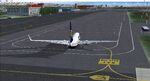
This scenery was built from the official maps for the runway and taxiways with Google Maps as a background image as support. The different signs were positioned without any documentation or references.
| Filename: | LUKK_Chisinau.zip |
| License: | Freeware |
| Added: | 3rd March 2026, 16:17:43 |
| Downloads: | 66 |
| Author: | serge Libon |
| Size: | 245.34 MB |
| Category: Flight Simulator 2004 - AFCAD Files | |
| Approach Lights |
|
File Description:
Maybe you're tired like me to select Approach Lights for your runway in AFCAD (Lee Swordy) but you don't know what they look like ... well this will make it all too easy!
| Filename: | Approach_Lights.zip |
| License: | Freeware |
| Added: | 20th May 2004, 16:48:14 |
| Downloads: | 5,075 |
| Author: | Terblanche Jordaan |
| Size: | 158.56 KB |
| Category: Flight Simulator 2004 - Scenery | |
| Hutchinson Municipal KHUT |
|
Images related to this file:
File Description:
FS2004 Scenery-Hutchinson Municipal Airport (KHUT), Ks serves Hutchinson and Reno County and is owned by the City Of Hutchinson. The airport has more than one runway. The longest is a paved runway extending 7001 feet. The facility is at an elevation of 1542 feet at a distance of about 3 miles from Hutchinson. Scenery Created with FSDS3, Lago's FSE, EZ Scenery and Rwy12. FSDS3 textures included. Must download EZ Scenery and Rwy12 libraries. AFCAD2 and Traffic Tools flight plans included.
| Filename: | Hutchinson_Municipal_KHUT.zip |
| License: | Freeware |
| Added: | 24th April 2006, 02:54:20 |
| Downloads: | 666 |
| Author: | John B. Loney, Jr. |
| Size: | 909.15 KB |
| Category: Flight Simulator 2004 - Utilities | |
| METAR/TAF DECODER - English version |
|
File Description:
METAR/TAF DECODER is a script which replaces the default keyboard shortcuts page of the FS 2004 kneeboard and provides real world METAR and TAF information inside Flight Simulator. The script connects to the main METAR/TAF web application which can be found at http://metar.hvaip.net
- METAR/TAF reports for all airports decoded in plain english/greek
- Runway information including suggestion for active runway based on surface winds
- Crosswind component calculation for landing/take off
| Filename: | METARTAF_DECODER__English_version.zip |
| License: | Freeware |
| Added: | 10th May 2007, 13:00:44 |
| Downloads: | 2,246 |
| Author: | Yorgos Hantzopoulos |
| Size: | 64.48 KB |
| Category: Flight Simulator X - Scenery | |
| Sumter Municipal Airport KSMS |
|
Images related to this file:
File Description:
FSX Scenery - Sumter Municipal Airport (IATA: SMS, ICAO: KSMS, FAA LID: SMS) Sumter, South Carolina, United States, serves Sumter and Sumter County and is owned by the City & County Of Sumter. The airport has more than one runway. The longest is a paved runway extending 5500 feet. The facility is at an elevation of 183 feet at a distance of about 4 miles from Sumter. Created with Instant Scenery. For FS9 version, see ksms_fs9.zip. By John B. Loney, Jr.
| Filename: | Sumter_Municipal_Airport_KSMS.zip |
| License: | Freeware, limited distribution |
| Added: | 2nd November 2009, 20:05:22 |
| Downloads: | 352 |
| Author: | John B. Loney, Jr. |
| Size: | 439.12 KB |
| Category: Flight Simulator 2004 - Scenery | |
| Quonset State Airport KOQU |
|
Images related to this file:
File Description:
Re-upload. FS2004 Scenery-Quonset State Airport (KOQU) serves North Kingstown and Washington County and is owned by Rhode Island Airport Corp. The airport has more than one runway. The longest is a paved runway extending 7998 feet. The facility is at an elevation of 19 feet at a distance of about 3 miles from North Kingstown. Standard and custom textures included. Must have AFCAD2, Traffic Tools, Rwy12 and Lago's FSE for full effect. Main creation with FSDS2. By John B. Loney, Jr.
| Filename: | Quonset_State_Airport_KOQU.zip |
| License: | Freeware, limited distribution |
| Added: | 7th June 2010, 08:28:26 |
| Downloads: | 1,079 |
| Author: | John B. Loney, Jr. |
| Size: | 1.2 MB |


© 2001-2026 AVSIM Online
All Rights Reserved
Privacy Policy |