
Where Flight Simulation Enthusiasts Gather from Around the World!
AVSIM Library - Search Results

| Category: Flight Simulator 2004 - AFCAD Files | |
| Kerry Airport (EIKY), Ireland |

|
Images related to this file:
File Description:

Kerry Airport is located in County Kerry in the Southwest of Ireland and is one of Ryanair's seven Irish bases. This AFCAD was made for default scenery and includes a corrected ILS for runway 26, updated runway and taxiway configuration and lighting, as well as an updated parking layout. This AFCAD was made using real world data issued by the Irish Aviation Authority.
| Filename: | Kerry_Airport_EIKY_Ireland.zip |
| License: | Freeware, limited distribution |
| Added: | 8th January 2010, 21:00:30 |
| Downloads: | 537 |
| Author: | James O'Grady |
| Size: | 3.07 KB |
| Category: Flight Simulator X - Utilities | |
| Final Approach Visualizer V1 |
|
Images related to this file:
File Description:
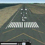
A small utility to see real-world Final Approach Course of ANY runway of ANY airport with Google Earth.
Just input the airport ICAO code, ".kml" files will be generated for each runway,
then run Google Earth and open ".kml" file to see Final Approach Course animated.
You can select approach speed, angle, distance and so on. (Default : 720kt, 3 degrees, 10NM)
| Filename: | Final_Approach_Visualizer_V1.zip |
| License: | Freeware |
| Added: | 5th January 2012, 18:17:36 |
| Downloads: | 1,668 |
| Author: | Dongjin Shin |
| Size: | 3.08 MB |
| Category: Flight Simulator 2004 - AFCAD Files | |
| Princess Juliana International Airport, Philipsburg, St. Maarten, Netherlands Antilles (TNCM/SXM) |
|
File Description:
fs2004 flytampa TNCM afcad. After trying so many times to get the right runway landing and takeoff, I finally got the afcad to work correctly which allows AI to land and take off on runway 9 with downloaded weather and it also has additional gates and parking for your AI traffic. Recommend to have 95%-100% to see TNCM very busy. Happy flying.
| Filename: | Princess_Juliana_International_Airport_Philipsburg.zip |
| License: | Freeware |
| Added: | 3rd October 2008, 20:30:02 |
| Downloads: | 1,500 |
| Author: | ottoniel gonzalez |
| Size: | 3.81 KB |
| Category: Flight Simulator X - Scenery | |
| LSGL - Lausanne La Blecherette Airport |
|
File Description:
The Lausanne La Blecherette Airport is located north of the city of Lausanne in the Canton of Vaud, Switzerland. It has one slope asphalt runway (18/36) of 875m / 2870ft lenght. This is an improved scenery designed with ADE 9x and default FSX-objects of the default Lausanne La Blecherette Airport. Actual Approach charts and a profile picture of the runway are included.
| Filename: | LSGL__Lausanne_La_Blecherette_Airport.zip |
| License: | Freeware |
| Added: | 10th September 2010, 22:27:59 |
| Downloads: | 2,881 |
| Author: | Lukas Koeng |
| Size: | 211.52 KB |
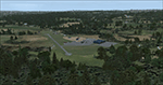
| Category: Fly! II - Scenery | |
| Alta, Northern Norway |
|
File Description:
Alta (ENAT) is a challening airport in northern Norway (69° 58,6' N, 23° 22,5' E), surrounded as it is by high mountains. One of the more difficult approaches is the circling approach, marked by lights in the terrain, for runway 30 (called runway 29 in Fly! 2).
Some approach and departure plates (SID's STAR's, ILS etc) are enclosed in the "Plates" folder.
| Filename: | Alta_Northern_Norway.zip |
| License: | Freeware |
| Added: | 16th August 2003, 04:01:15 |
| Downloads: | 264 |
| Author: | Krister Renard |
| Size: | 364.52 KB |
| Category: Flight Simulator X - Scenery | |
| KEKM - Elkhart Municipal Airport - Elkhart, Indiana |
|
Images related to this file:
File Description:
Elkhart Municipal Airport serves Elkhart and Elkhart County and is owned by the City Of Elkhart, Indiana. The airport has more than one runway. The longest is a paved runway extending 6500 feet. The facility is at an elevation of 778 feet at a distance of about 3 miles from Elkhart. For the enjoyment of the FS community, by John B. Loney, Jr.
| Filename: | KEKM__Elkhart_Municipal_Airport__Elkhart_Indiana.zip |
| License: | Freeware, limited distribution |
| Added: | 22nd March 2013, 19:01:03 |
| Downloads: | 571 |
| Author: | John B. Loney, Jr. |
| Size: | 86.56 MB |
| Category: Flight Simulator X - Scenery | |
| Morristown Municipal Airport KMMU |
|
Images related to this file:
File Description:
FSX Scenery - Morristown Municipal Airport serves Morristown and Morris County and is owned by the Town of Morristown, NJ USA. The airport has more than one runway. The longest is a paved runway extending 5,999 feet. The facility is at an elevation of 187 feet at a distance of about 3 miles from Morristown. Created by John B. Loney, Jr.
| Filename: | Morristown_Municipal_Airport_KMMU.zip |
| License: | Freeware, limited distribution |
| Added: | 10th April 2012, 16:35:46 |
| Downloads: | 511 |
| Author: | John B. Loney, Jr. |
| Size: | 16.65 MB |
| Category: Flight Simulator 2004 - Scenery | |
| Bowman, ND - Bowman Regional - KBWW patch updated |
|
File Description:
My bad that I caught read in my file commander realized that I forgot to include with new airport KBWW for the closed KBPP airport nearby old airport now modify the runway has been marked closed. Please install that will help without confused to the land wrong airport if night runway lights. Now no lights anymore. Sorry for the inconvenience.
| Filename: | Bowman_ND__Bowman_Regional__KBWW_patch_updated.zip |
| License: | Freeware |
| Added: | 4th June 2020, 21:37:55 |
| Downloads: | 86 |
| Author: | Stuart John Gilbert |
| Size: | 4.67 KB |
| Category: Flight Simulator X - AFCAD Files | |
| Carrickmore Airfield, County Tyrone, Northern Ireland |
|
Images related to this file:
File Description:
AFCAD files for Carrickmore Airfield
This is a microlight airstrip in County Tyrone in Northern Ireland.
Runway, taxiway and apron placements per Google Maps. I included stock airport objects to resemble the buildings at the airport. ADE ground polygons are used for runway markings. Some stock objects are from Acceleration pack so this works best if you have Accel pack or FSX:SE.
| Filename: | Carrickmore_Airfield_County_Tyrone_Northern_Irelan.zip |
| License: | Freeware |
| Added: | 18th February 2019, 18:02:08 |
| Downloads: | 220 |
| Author: | Barry Friedman |
| Size: | 1.47 MB |
| Category: Flight Simulator 2004 - Scenery | |
| KCVG - Cincinnati/Northern Kentucky International 2006 |
|
File Description:
KCVG - Cincinnati/Northern Kentucky International for FS2004 A Century of Flight (FS9).
This scenery updates KCVG to its 2006 configuration by adding the new runway 18R/36L (opened
in December 2005) and redesignates old 18R/36L to 18C/36C. The scenery also extends runway 09/27 to 12000' and adds numerous new taxiways, taxiway signage, lighting and navaids to the airport.
| Filename: | KCVG__CincinnatiNorthern_Kentucky_International_20.zip |
| License: | Freeware, limited distribution |
| Added: | 28th January 2006, 05:31:21 |
| Downloads: | 9,999 |
| Author: | George S. Marinakis |
| Size: | 970.63 KB |
© 2001-2026 AVSIM Online
All Rights Reserved
Privacy Policy |