
Where Flight Simulation Enthusiasts Gather from Around the World!
AVSIM Library - Search Results

| Category: Flight Simulator X - Scenery | |
| Morristown Municipal Airport KMMU |

|
Images related to this file:
File Description:
FSX Scenery - Morristown Municipal Airport serves Morristown and Morris County and is owned by the Town of Morristown, NJ USA. The airport has more than one runway. The longest is a paved runway extending 5,999 feet. The facility is at an elevation of 187 feet at a distance of about 3 miles from Morristown. Created by John B. Loney, Jr.
| Filename: | Morristown_Municipal_Airport_KMMU.zip |
| License: | Freeware, limited distribution |
| Added: | 10th April 2012, 16:35:46 |
| Downloads: | 511 |
| Author: | John B. Loney, Jr. |
| Size: | 16.65 MB |
| Category: Flight Simulator X - Scenery | |
| KEKM - Elkhart Municipal Airport - Elkhart, Indiana |
|
Images related to this file:
File Description:
Elkhart Municipal Airport serves Elkhart and Elkhart County and is owned by the City Of Elkhart, Indiana. The airport has more than one runway. The longest is a paved runway extending 6500 feet. The facility is at an elevation of 778 feet at a distance of about 3 miles from Elkhart. For the enjoyment of the FS community, by John B. Loney, Jr.
| Filename: | KEKM__Elkhart_Municipal_Airport__Elkhart_Indiana.zip |
| License: | Freeware, limited distribution |
| Added: | 22nd March 2013, 19:01:03 |
| Downloads: | 571 |
| Author: | John B. Loney, Jr. |
| Size: | 86.56 MB |
| Category: Flight Simulator X - AFCAD Files | |
| Carrickmore Airfield, County Tyrone, Northern Ireland |
|
Images related to this file:
File Description:
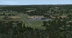
AFCAD files for Carrickmore Airfield
This is a microlight airstrip in County Tyrone in Northern Ireland.
Runway, taxiway and apron placements per Google Maps. I included stock airport objects to resemble the buildings at the airport. ADE ground polygons are used for runway markings. Some stock objects are from Acceleration pack so this works best if you have Accel pack or FSX:SE.
| Filename: | Carrickmore_Airfield_County_Tyrone_Northern_Irelan.zip |
| License: | Freeware |
| Added: | 18th February 2019, 18:02:08 |
| Downloads: | 221 |
| Author: | Barry Friedman |
| Size: | 1.47 MB |
| Category: Flight Simulator 2004 - Scenery | |
| Bowman, ND - Bowman Regional - KBWW patch updated |
|
File Description:
My bad that I caught read in my file commander realized that I forgot to include with new airport KBWW for the closed KBPP airport nearby old airport now modify the runway has been marked closed. Please install that will help without confused to the land wrong airport if night runway lights. Now no lights anymore. Sorry for the inconvenience.
| Filename: | Bowman_ND__Bowman_Regional__KBWW_patch_updated.zip |
| License: | Freeware |
| Added: | 4th June 2020, 21:37:55 |
| Downloads: | 88 |
| Author: | Stuart John Gilbert |
| Size: | 4.67 KB |
| Category: Flight Simulator 2004 - AFCAD Files | |
| Quabbin Reservoir Seadrom |
|
File Description:
This is the second version of my imaginary seaplane base on Quabbin Reservoir in central Massachusetts. It adds a simple plank dock, plenty of AI parking, both dockside and moored, and a water runway that AI planes can use. This version makes the dock a little smaller, adds moored parking, and realigns the runway to keep the AI planes clear of high ground.
| Filename: | Quabbin_Reservoir_Seadrom.zip |
| License: | Freeware, limited distribution |
| Added: | 13th June 2004, 22:37:24 |
| Downloads: | 219 |
| Author: | Mick Morrissey |
| Size: | 547.63 KB |
| Category: Flight Simulator 2004 - AFCAD Files | |
| Flying Cloud AFCAD2 Fix |
|
File Description:
This is an AFCAD2 file for FS2004 that fixes the runway numbers for Flying Cloud Airport in the Twin Cities. The actual runway numbers, and the ones in this AFCAD2 are 10L/28R, 10R/28L, and 16/32. Microsoft had 9L/27R, 9R/27L, and 16/32. The only minor problem is that this does not fix the taxiway signs.
| Filename: | Flying_Cloud_AFCAD2_Fix.zip |
| License: | Freeware |
| Added: | 10th April 2005, 17:28:52 |
| Downloads: | 190 |
| Author: | Warren Goldstein |
| Size: | 4.16 KB |
| Category: Flight Simulator 2002 - AFCAD Files | |
| Hong Kong International Airport (VHHH) |
|
File Description:
AFCAD file for VHHH Hong Kong International Airport (Chek Lap Kok). More relaxed approach compared to the old Kai Tak checkerboard! Parking for 45 airliners at the terminal, properly labelled. Every passenger boarding ramp has an aircraft space available with the aircraft parked at the foot of the boarding ramp. Runway 07R/25L for takeoff, runway 07L/25R for landing.
| Filename: | Hong_Kong_International_Airport_VHHH.zip |
| License: | Freeware |
| Added: | 28th January 2003, 22:16:14 |
| Downloads: | 1,691 |
| Author: | Victor Holderness |
| Size: | 7.69 KB |
| Category: Flight Simulator 2004 - Scenery | |
| Isola Delle Femmine |
|
File Description:
Isola Delle Femmine is a meny litle island (really a big rock) sited at N/W of the Palermo city . The importance of this cliff is the position on the short final to runway 25 of Punta Raisi - Falcone Borsellino (licj); so it is important for flight simulation as the real approaching, because it is a good landmark for the runway.
| Filename: | Isola_Delle_Femmine.zip |
| License: | Freeware |
| Added: | 9th January 2004, 19:43:53 |
| Downloads: | 2,121 |
| Author: | Roberto Puglia &Roberto Badalamenti |
| Size: | 80.23 KB |
| Category: Flight Simulator 2004 - Scenery | |
| Golden Eagle Flying Ranch, Wa. USA |
|
File Description:
Golden Eagle Flying Ranch is situated about 12 nm north of Emma Field in beautyful Washington State. This scenery is self supporting and no other file is required. Lots of candies on this site. You will find a kerosene lit grass runway and a secondary runway for gliders. Also docking facilities for seaplanes. Although not tested this should work fine for FS2002.
| Filename: | Golden_Eagle_Flying_Ranch_Wa_USA.zip |
| License: | Freeware |
| Added: | 15th January 2004, 17:05:32 |
| Downloads: | 2,293 |
| Author: | Leon Louis |
| Size: | 5.24 MB |
| Category: Fly! II - Scenery | |
| Alta, Northern Norway |
|
File Description:
Alta (ENAT) is a challening airport in northern Norway (69° 58,6' N, 23° 22,5' E), surrounded as it is by high mountains. One of the more difficult approaches is the circling approach, marked by lights in the terrain, for runway 30 (called runway 29 in Fly! 2).
Some approach and departure plates (SID's STAR's, ILS etc) are enclosed in the "Plates" folder.
| Filename: | Alta_Northern_Norway.zip |
| License: | Freeware |
| Added: | 16th August 2003, 04:01:15 |
| Downloads: | 264 |
| Author: | Krister Renard |
| Size: | 364.52 KB |


© 2001-2026 AVSIM Online
All Rights Reserved
Privacy Policy |