
Where Flight Simulation Enthusiasts Gather from Around the World!
AVSIM Library - Search Results

| Category: Flight Simulator X - Scenery | |
| Aurora Muni - Greater Kankakee |

|
File Description:
FSX Scenery - Aurora Municipal Airport serves Chicago/Aurora and Kane County and is owned by the City Of Aurora. The airport has more than one runway. The longest is a paved runway extending 6500 feet. The facility is at an elevation of 706 feet at a distance of about 38 miles from Chicago. Greater Kankakee Airport serves Kankakee and Kankakee County and is owned by Kankakee Valley Arpt Auth. The airport has more than one runway. The longest is a paved runway extending 5979 feet. The facility is at an elevation of 629 feet at a distance of about 3 miles from Kankakee. Created with Instant Scenery. By John B. Loney, Jr.
| Filename: | Aurora_Muni__Greater_Kankakee.zip |
| License: | Freeware, limited distribution |
| Added: | 2nd November 2009, 20:05:32 |
| Downloads: | 500 |
| Author: | John B. Loney, Jr. |
| Size: | 1.11 MB |
| Category: Flight Simulator 2004 - Scenery | |
| Mingaladon Airport 2006, Yangon, Myanmar (VYYY) |
|
Images related to this file:
File Description:
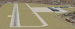
Yangon International Airport "MINGALADON" will be able to accommodate bigger aircrafts and handle more passengers when work on extending its runway and upgrading its facilities is completed in July 2006. The completion of the runway extension will enable Boeing 747 and Airbus 380 airplanes to use the airport. The work on extending the runway from 8100 feet to 11,200 feet began October 2004. The length of the two-storey building will be increased from 340 feet to 800 feet, its width from 140 feet to 200 feet. This scenery buildings and parking areas maybe are different from the real one, but the runway is exact 11228 feet long. The ILS-Correction is already contained here. Re-upload
| Filename: | Mingaladon_Airport_2006_Yangon_Myanmar_VYYY.zip |
| License: | Freeware, limited distribution |
| Added: | 8th June 2010, 01:00:57 |
| Downloads: | 1,367 |
| Author: | HOUSE-RP |
| Size: | 16.95 KB |
| Category: Flight Simulator 2004 - Miscellaneous Files | |
| Active ILS - PAUN (Unalakleet, Alaska) |
|
File Description:
As most know initiating the LOCALIZER at certain airports for the User Aircraft/ATC control is not a function at this time when using AFCAD2. If you add a new LOCALIZER runway to an airport such as PAUN (Unalakleet RWY 14) only the user aircraft can use this runway (without ATC commands) when visibility falls below 3 miles. This ILS bgl file adds all NAVAIDS for making RWY 14 a LOCALIZER/DME Instrument Runway by adding all the radar fixes for both the LOC approach portion and the Published Missed Approach Procedures. All User Planes can now ask ATC for the Localizer runway 14 when Airport weather conditions are either VMC or IMC. **** AFCAD airport included if needed ****
| Filename: | Active_ILS__PAUN_Unalakleet_Alaska.zip |
| License: | Freeware, limited distribution |
| Added: | 21st December 2005, 00:35:20 |
| Downloads: | 747 |
| Author: | Jim Vile |
| Size: | 5.3 KB |
| Category: Flight Simulator X - Scenery | |
| EGNS - Ronaldsway Airport - Isle of Man, UK |
|
Images related to this file:
File Description:
This scenery is for Ronaldsway Airport which is the main civilian airport on the Isle of Man and made only for FSX with 2 optional files: one version with the Crosswind runway activated and in full operation where both runways will be used for takeoff and landing and one version as the default runway operation: terminal remodeled, both runways now at the correct length, taxiways and taxi signs updated to the latest charts, PAPI for runway 21 now on the correct side of the runway, new control tower, fire station, fuel farm, extra fuel trucks and many other scenery additions, airport views are from inside the control tower (when in tower view). Please view the readme before installation.
| Filename: | EGNS__Ronaldsway_Airport__Isle_of_Man_UK.zip |
| License: | Freeware, limited distribution |
| Added: | 9th February 2014, 00:38:16 |
| Downloads: | 12,611 |
| Author: | Craig Scott |
| Size: | 635.18 KB |
| Category: Flight Simulator 2004 - Scenery | |
| Hong Kong Kai Tak 1963 |
|
File Description:
This is Kai Tak airport as it was in 1963. Kowloon Bay has yet to be filled in, and the runway is only 8405 ft long. Includes mesh files by Holger Sandmann and charts of the era scanned by Chic Eather. Navaids backdated to the early 60's, except the IGS for runway 13 is included although not actually installed until 1974. Curving approach lights will help you find the runway. Chek Lap Kok airport has been removed. The IGS and other approaches created by Jim Vile. The AI aircraft will follow the curved approach to runway 13 in good weather or bad. Please note that Jim Vile has produced a modern version of this airport (kaitak98.zip).
| Filename: | Hong_Kong_Kai_Tak_1963.zip |
| License: | Freeware, limited distribution |
| Added: | 27th April 2006, 02:02:13 |
| Downloads: | 15,231 |
| Author: | Tom Gibson and Jim Vile |
| Size: | 5.74 MB |
| Category: Flight Simulator 2004 - AFCAD Files | |
| Nigel Grant's Vancouver Int'l with X-Wind runways |
|
File Description:
A high quality AFCAD2 for use only with FS2004 Vancouver Airport scenery version 4.1 by Nigel Grant. This file has been built with the aid of charts, and features real life runway lengths - runway 08L/26R is 9940ft, runway 08R/26L is 11500ft long. Assigned parking for all airlines and cargo carriers that serve the airport is included, including regional carriers that use the south terminal. An extensive GA area is now available at the airport. Also featured is the Air Canada maintenance area, overrun areas on the runways, overflow parking and many helipads. All aprons are represented as near to real as possible. Using the crosswind runway tecnique, non parallel runway 12/30 has been activated and can be used for take-offs and landings at the same time as both the main 08/26 runways. This AFCAD is not suitable for use with the default FS2004 airport. Enjoy!!
| Filename: | Nigel_Grants_Vancouver_Intl_with_XWind_runways.zip |
| License: | Freeware |
| Added: | 2nd March 2005, 22:30:20 |
| Downloads: | 2,050 |
| Author: | Lee Brompton |
| Size: | 73.54 KB |
| Category: Flight Simulator 2004 - Aircraft Repaints, Textures and Modifications | |
| Minnesota ANG F-4C |
|
File Description:
Textures only for Alphasim's payware Phantom set 2 representing a Minnesota ANG F-4C.
| Filename: | Minnesota_ANG_F4C.zip |
| License: | Freeware |
| Added: | 4th March 2005, 18:19:58 |
| Downloads: | 514 |
| Author: | Bernie Stockwell, Alpha Simulations |
| Size: | 3.11 MB |
| Category: Flight Simulator 2004 - Scenery | |
| Peru and Bolivia Thermals |
|
File Description:
A set of thermals that include the complete Andean Territory of Bolivia and Peru
| Filename: | Peru_and_Bolivia_Thermals.zip |
| License: | Freeware |
| Added: | 30th August 2005, 13:15:55 |
| Downloads: | 742 |
| Author: | Alejandro Villa |
| Size: | 3.49 MB |
| Category: Flight Simulator 2002 - Aircraft Repaints, Textures and Modifications | |
| Aerocaribbean ATR-42-300 |
|
File Description:
Aerocaribbean Textures only set for Francisco
Sanchez-Castañer's ATR-42-300 REG#: CU-T1511.
| Filename: | Aerocaribbean_ATR42300.zip |
| License: | Freeware |
| Added: | 19th June 2002, 18:16:51 |
| Downloads: | 1,644 |
| Author: | Sean Marlin |
| Size: | 1.49 MB |
| Category: Flight Simulator 2002 - Aircraft Repaints, Textures and Modifications | |
| ACES Colombia ATR-42-300 |
|
File Description:
Aces Textures only set for Francisco Sanchez-Castañer's ATR-42-300 REG#: HK-3943X.
| Filename: | ACES_Colombia_ATR42300.zip |
| License: | Freeware |
| Added: | 25th June 2002, 02:55:35 |
| Downloads: | 2,292 |
| Author: | Sean Marlin |
| Size: | 916.42 KB |


© 2001-2026 AVSIM Online
All Rights Reserved
Privacy Policy |