
Where Flight Simulation Enthusiasts Gather from Around the World!
AVSIM Library - Search Results

| Category: Flight Simulator 2004 - Scenery | |
| SCCF - El Loa Airport - Calama, Chile |

|
File Description:
SCCF / CJC - Calama, Chile - El Loa Airport has been improvement. A new runway located and taxiway was used to be formerly a narrow runway. There is a real life 42 Wind Solar Powers in east of airport. I measured all 42 wind powers exactly from Google Earth image.
| Filename: | SCCF__El_Loa_Airport__Calama_Chile.zip |
| License: | Freeware |
| Added: | 4th November 2015, 15:58:31 |
| Downloads: | 966 |
| Author: | Stuart J Gilbert II |
| Size: | 3.88 MB |
| Category: Flight Simulator 2004 - Scenery | |
| 4AK6 - Wolf Lake - Anchorage, Alaska - USA |
|
Images related to this file:
File Description:
Wolf Lake 4AK6 is in Alaska, some 10 miles northeast of Wasilla, on the north side of Knik Arm. It is an airpark, with houses and hangars adjacent to a runway that is 3,800 feet of asphalt aligned 06-24. The runway is lit but the taxiways are not. There is a second runway that is around 2,500 feet long and aligned 36-18, which is grass and unlit. The C-130 is permanently parked, and seeing it land would have been interesting.
| Filename: | 4AK6__Wolf_Lake__Anchorage_Alaska__USA.zip |
| License: | Freeware, limited distribution |
| Added: | 15th October 2014, 13:38:39 |
| Downloads: | 371 |
| Author: | Roger Wensley |
| Size: | 7.32 MB |
| Category: Flight Simulator X - AFCAD Files | |
| Seattle 2008 |
|
File Description:
Smith Graphics Seattle 2008 will update all aspects of the Seattle Tacoma Intl. Airport to November 2008 standards, and meets the Smith Graphics Standard of Excellence. The flagship change in this package is the new fully functional Runway 16R/34L. Taxiway signs and fences have been updated to conform to the new runway. The area around the new runway has been flattened and excluded, and has undergone extensive testing to ensure usability. Future updates will appear as ILS data emerges.
| Filename: | Seattle_2008.zip |
| License: | Freeware, limited distribution |
| Added: | 19th November 2008, 09:28:48 |
| Downloads: | 1,409 |
| Author: | Dakota Smith / Smith Graphics |
| Size: | 140.91 KB |
| Category: Flight Simulator 2004 - AFCAD Files | |
| Seattle 2008 For FS9 |
|
File Description:
Smith Graphics Seattle 2008 For FS9 will update all aspects of the Seattle Tacoma Intl. Airport to November 2008 standards, and meets the Smith Graphics Standard of Excellence. The flagship change in this package is the new fully functional Runway 16R/34L. Taxiway signs have been updated to conform to the new runway. The area around the new runway has been flattened and excluded, and has undergone extensive testing to ensure usability. Future updates will appear as ILS data emerges.
| Filename: | Seattle_2008_For_FS9.zip |
| License: | Freeware, limited distribution |
| Added: | 21st November 2008, 23:58:29 |
| Downloads: | 1,566 |
| Author: | Dakota Smith / Smith Graphics |
| Size: | 136.95 KB |
| Category: Flight Simulator 2004 - Scenery | |
| CYKY - Kindersley Regional Airport, Saskatchewan, Canada |
|
Images related to this file:
File Description:
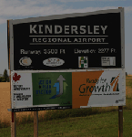
CYKY Kindersley Regional Airport is located in the west-central part of the province of Saskatchewan, Canada. The airport is located 4.6 km north of the town. The scenery consists of custom models of all the buildings at the airport, runway signs, runway and taxiway lighting, rotating beacon, static aircraft, vehicles, animated highway traffic and oil pump jacks, trees that properly change with the seasons, custom tarmac and runway textures, and seasonal ground textures for the airport and surrounding area.
| Filename: | CYKY__Kindersley_Regional_Airport_Saskatchewan_Can.zip |
| License: | Freeware |
| Added: | 14th June 2012, 13:44:10 |
| Downloads: | 1,288 |
| Author: | Gregory Putz |
| Size: | 84.58 MB |
| Category: Prepar3D V5 - Scenery | |
| EIDW Dublin Airport (2022) |
|
Images related to this file:
File Description:
A framerate friendly design of Dublin Airport (DUB/EIDW). Modeled on recent aerial photographs. Includes accurate taxiways, designators and signs at runway hold positions. Gate and parking positions are tailored to real life wing span restrictions and airline use, which will ensure a realistic AI experience. Runway usage has been optimized to avoid singe runway operations and therefore create a better flow with AI Traffic. All airport changes up to October 2022 have been included. Optimized for use with ORBX packages.
| Filename: | EIDW_Dublin_Airport_2022.zip |
| License: | Freeware |
| Added: | 5th October 2022, 02:15:35 |
| Downloads: | 387 |
| Author: | Luc Maaskant |
| Size: | 221.28 KB |
| Category: Flight Simulator 2004 - Miscellaneous Files | |
| Active ILS - PAUN (Unalakleet, Alaska) |
|
File Description:
As most know initiating the LOCALIZER at certain airports for the User Aircraft/ATC control is not a function at this time when using AFCAD2. If you add a new LOCALIZER runway to an airport such as PAUN (Unalakleet RWY 14) only the user aircraft can use this runway (without ATC commands) when visibility falls below 3 miles. This ILS bgl file adds all NAVAIDS for making RWY 14 a LOCALIZER/DME Instrument Runway by adding all the radar fixes for both the LOC approach portion and the Published Missed Approach Procedures. All User Planes can now ask ATC for the Localizer runway 14 when Airport weather conditions are either VMC or IMC. **** AFCAD airport included if needed ****
| Filename: | Active_ILS__PAUN_Unalakleet_Alaska.zip |
| License: | Freeware, limited distribution |
| Added: | 21st December 2005, 00:35:20 |
| Downloads: | 745 |
| Author: | Jim Vile |
| Size: | 5.3 KB |
| Category: Flight Simulator 2004 - Scenery | |
| Mingaladon Airport 2006, Yangon, Myanmar (VYYY) |
|
Images related to this file:
File Description:
Yangon International Airport "MINGALADON" will be able to accommodate bigger aircrafts and handle more passengers when work on extending its runway and upgrading its facilities is completed in July 2006. The completion of the runway extension will enable Boeing 747 and Airbus 380 airplanes to use the airport. The work on extending the runway from 8100 feet to 11,200 feet began October 2004. The length of the two-storey building will be increased from 340 feet to 800 feet, its width from 140 feet to 200 feet. This scenery buildings and parking areas maybe are different from the real one, but the runway is exact 11228 feet long. The ILS-Correction is already contained here. Re-upload
| Filename: | Mingaladon_Airport_2006_Yangon_Myanmar_VYYY.zip |
| License: | Freeware, limited distribution |
| Added: | 8th June 2010, 01:00:57 |
| Downloads: | 1,366 |
| Author: | HOUSE-RP |
| Size: | 16.95 KB |
| Category: Flight Simulator X - Scenery | |
| Aurora Muni - Greater Kankakee |
|
File Description:
FSX Scenery - Aurora Municipal Airport serves Chicago/Aurora and Kane County and is owned by the City Of Aurora. The airport has more than one runway. The longest is a paved runway extending 6500 feet. The facility is at an elevation of 706 feet at a distance of about 38 miles from Chicago. Greater Kankakee Airport serves Kankakee and Kankakee County and is owned by Kankakee Valley Arpt Auth. The airport has more than one runway. The longest is a paved runway extending 5979 feet. The facility is at an elevation of 629 feet at a distance of about 3 miles from Kankakee. Created with Instant Scenery. By John B. Loney, Jr.
| Filename: | Aurora_Muni__Greater_Kankakee.zip |
| License: | Freeware, limited distribution |
| Added: | 2nd November 2009, 20:05:32 |
| Downloads: | 500 |
| Author: | John B. Loney, Jr. |
| Size: | 1.11 MB |
| Category: Flight Simulator 2004 - Scenery | |
| Hong Kong Kai Tak 1963 |
|
File Description:
This is Kai Tak airport as it was in 1963. Kowloon Bay has yet to be filled in, and the runway is only 8405 ft long. Includes mesh files by Holger Sandmann and charts of the era scanned by Chic Eather. Navaids backdated to the early 60's, except the IGS for runway 13 is included although not actually installed until 1974. Curving approach lights will help you find the runway. Chek Lap Kok airport has been removed. The IGS and other approaches created by Jim Vile. The AI aircraft will follow the curved approach to runway 13 in good weather or bad. Please note that Jim Vile has produced a modern version of this airport (kaitak98.zip).
| Filename: | Hong_Kong_Kai_Tak_1963.zip |
| License: | Freeware, limited distribution |
| Added: | 27th April 2006, 02:02:13 |
| Downloads: | 15,205 |
| Author: | Tom Gibson and Jim Vile |
| Size: | 5.74 MB |
© 2001-2026 AVSIM Online
All Rights Reserved
Privacy Policy |