
Where Flight Simulation Enthusiasts Gather from Around the World!
AVSIM Library - Search Results

| Category: Flight Simulator X - AFCAD Files | |
| CYQQ CFB Comox - Update. |

|
File Description:
CYQQ CFB Comox - Update.
I have been advised that ILS approach to runway 12 causing aircraft to land to the right of the runway. The attached file is an update to my previous file (CYQQ_ADE_RWC.BGL). To install: Replace or overwrite your existing file with the attached to correct this situation. In addition to correcting the ILS approach, additional parking spots added and vegetation cleared from the approach to runway 12 which were interfering with the approach lighting.
| Filename: | CYQQ_CFB_Comox__Update.zip |
| License: | Freeware |
| Added: | 20th November 2009, 14:20:08 |
| Downloads: | 363 |
| Author: | Robert Catherall |
| Size: | 26.74 KB |
| Category: Flight Simulator X - Scenery | |
| Donauwoerth-Genderkingen EDMQ Scenery |
|
File Description:
FSX Donauwoerth-Genderkingen EDMQ Scenery. EDMQ is a small airport in the south of Germany located some miles from Augsburg Airport. The airport has one runway with a length of 2500 feet (760m) and is 50 feet (15m) wide. Features corrected runway length and width. Additional parking slots and a new parking place were added. Also you can land here at night, lights on the runway and on the taxiway were added like in reality. By Marc Ulm.
| Filename: | DonauwoerthGenderkingen_EDMQ_Scenery.zip |
| License: | Freeware |
| Added: | 25th December 2010, 11:44:08 |
| Downloads: | 1,255 |
| Author: | Marc Ulm |
| Size: | 1.6 MB |
| Category: Flight Simulator X - Scenery | |
| Pocono Mountains Municipal Airport |
|
Images related to this file:
File Description:
FSX Scenery - Pocono Mountains Municipal Airport (KMPO) serves Mount Pocono and Monroe County, PA and is owned by Pocono Mtns Muni Arpt Auth. The airport has more than one runway. The longest is a paved runway extending 5001 feet. The facility is at an elevation of 1916 feet at a distance of about 2 miles from Mount Pocono. Includes the runway 13/31 which was extended to 5,001 ft x 75 ft. By John B. Loney, Jr.
| Filename: | Pocono_Mountains_Municipal_Airport.zip |
| License: | Freeware, limited distribution |
| Added: | 22nd February 2011, 23:05:51 |
| Downloads: | 594 |
| Author: | John B. Loney, Jr. |
| Size: | 738.21 KB |
| Category: Flight Simulator X - AFCAD Files | |
| 4A2 - Atmautliak Airport, Alaska |
|
File Description:
Atmautluak Airport is a state-owned public-use airport located in Atmautluak, in the Bethel Census Area of the U.S. state of Alaska.
Atmautluak Airport has one runway designated 15/33 with a 3,000 by 75 ft (914 x 23 m) gravel surface. The runway was previously 2,000 by 30 ft. until it was expanded by the state.
All changes made were based on 2006 construction plans. Changed runway to 75 ft. wide.Added aprons, additional parking and buildings.
| Filename: | 4A2__Atmautliak_Airport_Alaska.zip |
| License: | Freeware |
| Added: | 28th December 2012, 00:44:08 |
| Downloads: | 332 |
| Author: | Wayne Roberts |
| Size: | 2.86 KB |
| Category: Flight Simulator X - Scenery | |
| 3S8 Grants Pass OR. v2 |
|
Images related to this file:
File Description:
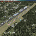
This is a much more accurate version of 3S8 Grants Pass OR. than default FSX,(using default buildings)
NOTE; This is a Fixed version!. Some FlightSim fan's pointed out some issues to me,
1, Corrected the vasi lights from west side to east side of runway.
2, Fixed the "UTX" house on the east side of the field issue.
3, Added the lighter soil around the runway.
4, Corrected runway signs, changed from "30-12" to "31-13".(oops)
| Filename: | 3S8_Grants_Pass_OR_v2.zip |
| License: | Freeware |
| Added: | 29th April 2013, 01:09:45 |
| Downloads: | 624 |
| Author: | Darrell Meadr |
| Size: | 760.05 KB |
| Category: Flight Simulator X - Scenery | |
| CYHZ - Halifax International Airport - NS, Canada - UPDATE |
|
File Description:
UPDATE: CYHZ - Halifax Internationl Airport, Nova Scotia, Canada.
Note: This version can be installed in both FSX and Lockheed Martin P3D v1.4
This is an update to my previous scenery upload, 10-31-2009, to reflect changes to runway 05/23. This runway as been extended from 8800 feet to 10500 feet to accommodate the 'heavies' now using this airport. Taxiway designators update and/or added. Minor adjustment made runway approach headings. Main body of the airport remains unchanged.
| Filename: | CYHZ__Halifax_International_Airport___NS_Canada__U.zip |
| License: | Freeware |
| Added: | 26th November 2013, 02:24:35 |
| Downloads: | 26,546 |
| Author: | Robert Catherall |
| Size: | 2.74 MB |
| Category: Prepar3D V1-4 - Scenery | |
| WBKS Sandakan 2021 |
|
Images related to this file:
File Description:
Sandakan expansion AFCAD for 2021
Includes 2500m lengthen runway and taxiway bravo. However i have shorten it to 1923m even shorter than its default 2133m as the runway is still undergoing expansion and overall expected to be completed in 2021 q4. With this Sandakan airport is currently the shortest runway used for 737 a320 operations in Malaysia. Aip supplement documentation regarding the airport project expansion and other relevant information available in the readme file in this zip.
| Filename: | WBKS_Sandakan_2021.zip |
| License: | Freeware |
| Added: | 7th May 2021, 22:39:51 |
| Downloads: | 265 |
| Author: | ChinJH |
| Size: | 1.26 MB |
| Category: Flight Simulator 2004 - Scenery | |
| Dutch Harbour PADU and St Paul PASN - UPDATES |
|
Images related to this file:
File Description:
This has revised runway circulation for both Dutch Harbour (dutchplus.zip) and St Paul (st_paul.zip) to better reflect reality in helicopter and aircraft operation. It is not realistic for a helicopter to land, continue in a straight line along 6,000' of runway, turn at the far end, then taxi back along the same 6,000' to the aprons. Similarly, a Cessna does not need the same runway length as a 747.
This fix incorporates intermediate turnaround points to allow helicopters and small aircraft to turn around soon after slowing to taxi speed and to taxi back to the aprons at the end of the runway, instead of trudging along the whole length of the runway twice. There are some things that cannot be improved; a plane or helicopter will always taxi all the way from the aprons to the far end of the runway before turning and taking off, and a helicopter or light plane will not "land long" to minimise the taxi length.
The pictures show different turning points. There are also revised AI bgl's to provide better time separation between flights.
| Filename: | Dutch_Harbour_PADU_and_St_Paul_PASN__UPDATES.zip |
| License: | Freeware, limited distribution |
| Added: | 16th August 2012, 19:37:32 |
| Downloads: | 944 |
| Author: | Roger Wensley |
| Size: | 2.53 MB |
| Category: Flight Simulator 2004 - Miscellaneous Files | |
| Active ILS - KMCO (Orlando International Airport) |
|
File Description:
This is the 3rd Airport in a series of new ILS runways. As most know initiating the ILS at certain airports for AI Traffic is not a function at this time when using AFCAD2. If you add a new ILS runway to an airport such as KMCO (Orlando International Airport 17L/35R) only the user aircraft can use this runway when visibility falls below 3 miles. ATC will no longer use this runway for AI Traffic because FS9 sees it as a visual runway. This will cause ATC to vector your AI Traffic back to 17/35 (old numbers) 17R/35L (new numbers) which is also a Terminal departure runway. This file adds all NAVAIDS for making 17L/35R a Precision Instrument Runway. I have added all the radar fixes for both the ILS approach portion and the proper missed approach procedures, altitudes and intersections as per current published plates. All AI Aircraft will now continue to use 17L/35R when Airport visual conditions are less than 3 miles.
| Filename: | Active_ILS__KMCO_Orlando_International_Airport.zip |
| License: | Freeware, limited distribution |
| Added: | 25th June 2004, 01:50:15 |
| Downloads: | 3,846 |
| Author: | Jim Vile |
| Size: | 45.38 KB |
| Category: Flight Simulator X - AFCAD Files | |
| LFRV Meucon-Vannes |
|
File Description:
Vannes-Meucon Airport is a regional airport in France (IATA: VNE, ICAO: LFRV). It supports general aviation with no commercial airline service scheduled.
Summary of Changes:
Realigned runway 9/27 to runway 8/26 (as it is in real life). Note that in FSX although this runway is not closed, ATC will never assign this runway, as it is a grass strip, and ATC prefers the asphalt 4/22 instead. IRL 4/22 is actually 3/21 but I couldn't realign this runway, as it has a localiser approach which can't be removed or moved in ADE
Added taxiways B+D to allow traffic to taxi to/from the end of runway 22 via runway 8/26 without causing pileups. Whilst not completely accurate, its very close.
Added fuel trucks to top end of apron, (on the charts this area is designated as a hangar, I chose not to include this, as the FSX hangars look rubbish) Note that only 1 fuel truck moves at a time.
Added a few extra parking spaces. I dislike the method of using every free space for parking, so I have only included parking where LFRV really has designated parking. The airport now has 11 GA parking spaces small-medium.
| Filename: | LFRV_MeuconVannes.zip |
| License: | Freeware, limited distribution |
| Added: | 20th November 2011, 00:26:06 |
| Downloads: | 326 |
| Author: | Martin Joy |
| Size: | 5.89 KB |


© 2001-2026 AVSIM Online
All Rights Reserved
Privacy Policy |