
Where Flight Simulation Enthusiasts Gather from Around the World!
AVSIM Library - Search Results

| Category: Flight Simulator X - Flight Plans | |
| OB-97 Fayetteville Arkansas |

|
Images related to this file:
File Description:
FSX Flight Plan for OB-97 Fayetteville Arkansas IFR high speed low altitude military training route. This is the eleventh in a series of flight plans I have uploaded. This route goes through mostly flat and rolling terrain in Arkansas, Texas, Oklahoma and Kansas. This route has two different sets of targets. These are great routes for B-52, F-111, B-1B, B-2 A6, A4, Vulcan and any fighter or bomber enthusiasts. Of course you can fly the route with any aircraft of your choice. Included in this package are two spectacular gauges by Karol Chlebowski for TFR flying and Pave Tack which includes many advanced features for bombing, navigation and reconnaissance. These two gauges will greatly enhance your ability to fly these challenging routes and are a great companion of the flight plans. Another option to download Version 2.1 of my mini panel which has all this functionality and more.
| Filename: | OB97_Fayetteville_Arkansas.zip |
| License: | Freeware, limited distribution |
| Added: | 11th July 2011, 04:47:54 |
| Downloads: | 167 |
| Author: | Bill McClellan |
| Size: | 1.03 MB |
| Category: Flight Simulator X - Flight Plans | |
| OB-98 Rapid City South Dakota |
|
Images related to this file:
File Description:
FSX Flight Plan for OB-98 Rapid City South Dakota IFR high speed low altitude military training route. This is the Twelfth in a series of flight plans I have uploaded. This route goes through both mountainous and flat and rolling terrain in South Dakota, Nebraska, Wyoming and Montana. This route has two different sets of targets. These are great routes for B-52, F-111, B-1B, B-2 A6, A4, Vulcan and any fighter or bomber enthusiasts. Of course you can fly the route with any aircraft of your choice. Included in this package are two spectacular gauges by Karol Chlebowski for TFR flying and Pave Tack which includes many advanced features for bombing, navigation and reconnaissance. These two gauges will greatly enhance your ability to fly these challenging routes and are a great companion of the flight plans. Another option to download Version 2.1 of my mini panel which has all this functionality and more.
| Filename: | OB98_Rapid_City_South_Dakota.zip |
| License: | Freeware, limited distribution |
| Added: | 12th July 2011, 02:26:18 |
| Downloads: | 169 |
| Author: | Bill McClellan |
| Size: | 942.19 KB |
| Category: Flight Simulator 2004 - Original Aircraft | |
| Luftwaffe, D.F.S.-230 , Assault Glider V0.2 |
|
Images related to this file:
File Description:

This German assault/freight glider, developed by the DFS (Deutsche Forschungsanstalt fur Segelflug / German Research Institute for Sailplane Flight), was used for the first time during the operation against the Belgian Fort Eben Emael near Maastrich (May 10, 1940). They were also used during Krete invasion (Maleme, 1941), in the Western Desert and on the Russian Front for transport purposes. Were used also to deliver the Otto Skorzeny's commandos against the Gran Sasso mountain-top hotel that was used to hold Mussolini (Sept.12, 1943).
The Royal Italian Air Force (Regia Aeronautica) received from the Luftwaffe almost 20 '230 and 4 Gotha Go-242, but they were used only for training.
UPGRADED VERSION, now with functionally jettisonable undercarriage, drag chute and revised flight dynamics. Complete aircraft. Original GMAX hi-res model, features the usual moving parts, such as all flight controls, canopy and doors (5 different versions); Five different liveries (4 'LW' +1 "R.A.'); multiview 2D panel (NO VC). Created by Manuele Villa.
| Filename: | Luftwaffe_DFS230__Assault_Glider_V02.zip |
| License: | Freeware |
| Added: | 6th May 2010, 08:39:29 |
| Downloads: | 2,276 |
| Author: | Manuele Villa |
| Size: | 19.69 MB |
| Category: Flight Simulator X - Missions | |
| Direct Fly 3: Orbit ( UA ) 1164 - B738 |
|
Images related to this file:
File Description:

Fly the third mission of the serie Direct Fly and bring your passengers safely from San Francisco to San Diego Lindberg Field. The mission is created this time for the default Boing 737-800. A guiding copilot will be on your side, giving you all important informations and hints during the flight, so that you are able to bring the twin-jet straight in to the air and in the end safely back to the ground. The flight is based on the original commuter-flight of United Airlines 1164. As a additional feature, the mission includes a simulation of a ground alert system if you land at San Diego and a altitude alert system if you reach the different altitudes by climbing or descending. With the third mission is the first day of the four days service schedule complete. You only need the Microsoft Flightsimulator X with Service Pack 2 for this mission. No addon or download is required.
| Filename: | Direct_Fly_3_Orbit__UA__1164__B738.zip |
| License: | Freeware |
| Added: | 9th May 2010, 01:36:46 |
| Downloads: | 4,710 |
| Author: | Carsten Wanzelius |
| Size: | 21.83 MB |
| Category: Flight Simulator X - Gauges | |
| PFD for Saitek FIP version 4 |
|
Images related to this file:
File Description:
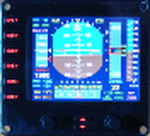
For Saitek Pro Flight Instrument Panel. This is version 4, some mistakes in tapes' numbers are fixed, a minus sign is added to the vertical speed tape when descending, instructions updated (unexpected spaces and words).
This is folder contains 4 PFDs. There are two sizes of numbers for radio height and for vertical speed. There are two positions for DME2, VOR2, Course and autopilot heading, lower left or lower right positions in the FIP. Codes have been reworked to be more FPS friendly.
PFDVGE4 provides horizon, speed, altitude and compass tapes. Localizer and glide slope. Flight director bars. Vertical speed with needle and numbers. Radio height, VOR1, DME1, VOR2, DME2, ADF, Course and autopilot heading in numbers. Autopilot bugs for speed, heading, altitude and vertical speed. Autopilot lights for functions: Master AP, Flight director, Altitude, heading, auto throttle, speed, Mach, approach, back course and NAV. TAT, QNH and Mach. Left knob moves course and right knob moves QNH.
| Filename: | PFD_for_Saitek_FIP_version_4.zip |
| License: | Freeware |
| Added: | 15th November 2011, 02:21:06 |
| Downloads: | 731 |
| Author: | Philippe Verhaege |
| Size: | 854.01 KB |
| Category: Flight Simulator X - Scenery | |
| Victoria Inner Harbor Airport (CYWH) |
|
Images related to this file:
File Description:
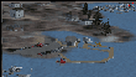
This airport was made using Airport Facilitator X, and Instant Scenery 2. Victoria Inner Harbor Airport is a water airport located in southern Victoria, British Columbia, Canada. The airlines that fly there are Harbor Air, West Coast Air, Kenmore Air, and Whistler Air. This is an airport that flight simulator does not have. I put docks for seaplanes with two seaplanes. I even made it so that you can start off at the dock. I made the small terminal and a parking lot with cars and light poles. I also put the surrounding docks with many boats. There is also a small heliport 0.73 miles away from Victoria Inner Harbor called Shoal Point Heliport. I have made this heliport because it too is another one flight simulator forgot. This was all based on Google Earth and Bing Maps. Please read the read me for instructions on how to install. This is for Flight Simulator X only. By Tyler Lawrence.
| Filename: | Victoria_Inner_Harbor_Airport_CYWH.zip |
| License: | Freeware |
| Added: | 16th January 2012, 23:53:12 |
| Downloads: | 1,488 |
| Author: | Tyler Lawrence |
| Size: | 9.98 MB |
| Category: Flight Simulator X - Aircraft Repaints, Textures and Modifications | |
| Carenado V35B Damage Mod |
|
File Description:
This is my Freeware project to Carenado FSX V35B. This mod adds to your V35B wear and Damage simulation.
This mod is currently not finished!
Features includes currently:
- Engine wear
- Engine Damage with fire and sound effect
- Engine Oil use, adding oil
- Propeller wear with sound effect
- Flaps Motor Wear
- Flaps Motor Damage with sound effect
- Flaps Wear with sound effect
- Flaps Damage with sound effect
- Landing Gear Damage with sound effect
- Landing Gear Motor Wear
- Landing Gear Motor Damage
- Wheel Brake Right and Wheel Brake Left Damage with sound effect
- Flight controls Damage (Aileron,Elevator,Rudder) with sound effect
- AFCS (Automatic Flight Control System) Servos Wear with sound effect
- AFCS (Automatic Flight Control System) Servos Damage
- All Damage situations will be logged and saved. data file can be found in "Carenado BONANZA V35B\data" and "Carenado BONANZA V35B TIP TANKS\data" folders
- More Features will be added...
This mod is not 100% finished! I work on this hardly to finish it.
| Filename: | Carenado_V35B_Damage_Mod.zip |
| License: | Freeware |
| Added: | 11th February 2012, 14:30:41 |
| Downloads: | 144 |
| Author: | Ismail Hakki Guzel |
| Size: | 8.23 MB |
| Category: Flight Simulator X - Gauges | |
| Flypad Gauge |
|
Images related to this file:
File Description:

This gauge has been developed on Win7 for FSX Flight Simulator SP2 or SP1.It should also work with Acceleration, but this is not guaranteed by the author. The gauge is a little extra addon based on the design of a smart phone and provides 9 different displays which are different from all of the standard gauge displays on a regular aircraft panel. It is mainly helpful for the user flying small propeller aircraft, and old timer aircraft. However, the displays are as well attractive for sim pilots flying modern jet aircraft. Use it as if you just grabbed to your smart phone during a flight and check on the status of your aircraft,
or how the terrain awareness situation looks like, how the AI traffic on the radar is, while you proceed with your flight plan. Enjoy the new design of a simple aircraft attitude display during an ILS approach. For credits look at the pdf documentation inside the zip file. By Dietmar Loleit
| Filename: | Flypad_Gauge.zip |
| License: | Freeware |
| Added: | 6th June 2014, 20:59:12 |
| Downloads: | 396 |
| Author: | Dietmar Loleit |
| Size: | 3.82 MB |
| Category: Flight Simulator X - Aircraft Repaints, Textures and Modifications | |
| Ajira Airlines Boeing 737-700W * Fictional * |
|
Images related to this file:
File Description:

Fictional repaint of the PMDG 737-700NGX WL in Ajira Airways livery from the TV show "Lost."----"Ajira Airways Flight 316 was a scheduled passenger flight from Los Angeles, California, United States to Guam, a U.S. territory in the western Pacific. It was due to reach Guam via a stop in Honolulu, Hawaii, United States, on a Boeing 737 owned and operated by Ajira Airways and piloted by Frank Lapidus. It was chosen by Eloise Hawking as a flight for the Oceanic Six to use to return to the Island. The plane crash-landed on Hydra Island in 2007. While some members of the Oceanic Six were teleported onto the Island in 1977 (Jack, Kate, Hurley, and Sayid), most of the passengers survived the crash, though some with minor or severe injuries. 14 days later, Frank flew the plane off Hydra Island with Kate, Claire, Richard, Sawyer, and Miles on board." - Lostpedia
| Filename: | Ajira_Airlines_Boeing_737700W__Fictional_.zip |
| License: | Freeware |
| Added: | 17th June 2014, 08:51:43 |
| Downloads: | 108 |
| Author: | Ray Reyes |
| Size: | 9.5 MB |
| Category: Flight Simulator 2004 - Gauges | |
| FS2004 GPS Map View Gauge v3.0 |
|
File Description:
The ultimate gauge. The Map will show: Airports details (Runways ID's, length & ILS), VOR's and NDB's frequencies,
Intersections and waypoints, Airspaces, Approaches and flight routes. You can toggle the view
you require for your flight. Also you can zoom in/out to see the nearest airports, vor's and
ndb's. The map will indicate A/C heading flightplan title and waypoints ID's.
Version 3 includes more enhancements such as the ability to input the ICAO code or name of any airport and the map will
show all the frequencies of that airport including ATIS, ILS, AND COM. In addition, the map will show the active
runway designations, length and width.
You can also input ICAO code of any VOR/NDB and the map will show their frequencies.
There was a bug in v2.0, in which if you enter ( click on ENT )the ICAO code of an airport, you will lose the flight
plan loaded. Now you can go back to the flight plan and with the NEXT/PREV buttons you have the choice of where to start
your FP.
The gauge will show Flight Plan Title, originating and destination airports, active waypoint, waypoint index and FP
crusing altitude.
I addition, the gauge will show various useful information, such as, Runway IDs, lenght, width and approach magnetic heading,
Airport name, city, and type. NAV1/2 names, codes, distances and ETA's, ADF1/2 names and codes.
Finally, the gaugee will show other information, such as, magvar, indicated airspeed, mach, ground velocity, ambient
wind velocity and direction, bank angle , and a/c altitude ( radio height ).
All the information above and much more on a single gauge window.
| Filename: | FS2004_GPS_Map_View_Gauge_v30.zip |
| License: | Freeware, limited distribution |
| Added: | 14th September 2005, 14:19:46 |
| Downloads: | 10,841 |
| Author: | Talal Alhaj |
| Size: | 710.05 KB |


© 2001-2026 AVSIM Online
All Rights Reserved
Privacy Policy |