
Where Flight Simulation Enthusiasts Gather from Around the World!
AVSIM Library - Search Results

| Category: Flight Simulator 2004 - Utilities | |
| Fuel and Payload Calculator B737NG and B757 ** Update ** |

|
Images related to this file:
File Description:
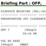
This file contains a spreadsheet template in OpenDocument format to prepare your flight ! Prepare your route, then, using planning tables and filling the fuel and weight form, prepare your payload estimation in this document. A copy of some tables (weights and limitations) for the B737 NG are embedded. A fuel calculator is also embbeded. It will provide automatic fuel load suggestion for each flight once you have completed your flight level and time of flight (based on linear interpolation of a real world flight planning table). Of course you can erase any suggestion with your own value. When it is done, go to the dispatcher briefing tab. Sign it to complete it automatically with some captain notes. In the end, export the dispatcher briefing as a selection in PDF if you wish. Fully reliable when used with your aircraft tables, this document uses the fuel planning methodology described in a PMDG manual and has been validated against a real B737-800 dispatcher briefing. The file contains two templates with automatic fuel load calculation (one for the 737NG, the other for the 757) and two templates without the linear interpolation module (for the Avro RJ and for the B727).
| Filename: | Fuel_and_Payload_Calculator_B737NG_and_B757__Updat.zip |
| License: | Freeware |
| Added: | 11th February 2013, 20:29:55 |
| Downloads: | 593 |
| Author: | Geoffrey Fernandez |
| Size: | 3.46 MB |
| Category: Flight Simulator 2004 - Utilities | |
| FS Earth 5.2 for Google Earth and FS2004 |
|
File Description:
This program acts as a link between Flight Simulator 2004 and Google Earth, letting to follow a flight in real time, over the satellite images generated by Google Earth. Flights can be saved, and many options are available for fine tuning the performance, as well as the map's style (zoom, tilt, orientation). Works on a single computer running FS2004 and Google Earth all together or, for best experience, can be used on two networked computers running respectively FS2004 (master) and Google Earth (slave). AI and Multiplayer traffic is also displayed in Google Earth, with course prediction and other information. Requires Flight Simulator 2004 and Google Earth. The program running in trial mode works only around Anchorage, Alaska, (PANC / ANC) for a maximum of five minutes per flight session. Version 5.2 has new aircraft icons & labels and improves the compatibility with Windows Vista. A version for FSX is available also.
| Filename: | FS_Earth_52_for_Google_Earth_and_FS2004.zip |
| License: | Shareware, time limited |
| Added: | 4th September 2008, 19:11:30 |
| Downloads: | 1,240 |
| Author: | Luciano Napolitano |
| Size: | 3.59 MB |
| Category: Flight Simulator 2002 - Gauges | |
| AFG Heads Up Guidance System Version 2.0 |
|
File Description:
FS2002 Heads Up Guidance System. This photo realistic HUD is based on a real world
HUD used in 737s and regional jets. It's the second version of the award winning AFG HGS v1 which was first true heads up guidance system for MSFS
because it can be used by itself for all phases of flight and has special modes for
instrument and visual approaches. There is a flight path vector and a guidance cue that can
command a change in flight path as small as .04 degrees. Panel.cfgs for DreamFleet's 734,
project magenta and some of the default panels, along with a pdf manual are included. New features include autoland (without default FS2002 approach guidance) which solves the infamous glide slope capture problem. The code has been rewritten so there are much faster frame rates, more accurate guidance, more accurate flight path vectoring and more.
| Filename: | AFG_Heads_Up_Guidance_System_Version_20.zip |
| License: | Freeware, limited distribution |
| Added: | 1st August 2002, 21:32:35 |
| Downloads: | 10,872 |
| Author: | Jon Gibbs |
| Size: | 1.64 MB |
| Category: Flight Simulator 2004 - Aircraft Repaints, Textures and Modifications | |
| FAA Beechcraft B-300F Super King Air N80 |
|
File Description:
FAA Beechcraft B-300F Super King Air N80 in actual FAA colors. Beginning in 1995 all markings identifying the aircrafts as operated by the FAA were removed for security reasons.
N80 (cn FF-15) entered the FAA fleet in 1988 as a calibrator for flight inspection duties and is based at the Flight Inspection Field Office (FIFO) at Atlantic City, (New Jersey). In 1986 the FAA ordered 19 of the Super King Airs, designated BE-300Fs by Beechcraft to reflect the modified version with an upgraded AFIS system auxiliary-power unit, heavier electrical system modified to handle the unique mission requirements of flight inspection, and a secondary air conditioning system to provide for the cooling of the added electronics. Textures only. 3D model: Esa Kaihlanen/Juri Pelkonen, Flight Dynamics: Ari Kaihlanen, Textures Siegfried Schaeffer/Rui Cristina. Sound by Leon Medado. Repainted by Hans Hermann, Virtual Birds Factory
| Filename: | FAA_Beechcraft_B300F_Super_King_Air_N80.zip |
| License: | Freeware, limited distribution |
| Added: | 11th October 2007, 13:06:18 |
| Downloads: | 392 |
| Author: | Repainted by Hans Hermann |
| Size: | 4.79 MB |
| Category: Flight Simulator X - Utilities | |
| FS Earth 5.0 for Google Earth |
|
File Description:
This program acts as an interface between Flight Simulator X and Google Earth, letting to follow a flight in real time, over the satellite images generated by Google Earth. Flights can be saved, and many options are available for fine tuning the performance, as well as the map's style (zoom, tilt, orientation). Works on a single computer running FSX and Google Earth all together or, for best experience, can be used on two networked computers running respectively FSX (master) and Google Earth (slave). AI and Multiplayer traffic is also displayed in Google Earth, with course prediction and other information. Requires Flight Simulator X and Google Earth. The program running in trial mode works only around Anchorage, Alaska, (PANC / ANC) for a maximum of five minutes per flight session. Version 5.0 has improved compatibility with latest releases of Google Earth and several additional improvements. A version for FS2004 is available also.
| Filename: | FS_Earth_50_for_Google_Earth.zip |
| License: | Shareware, time limited |
| Added: | 19th July 2007, 00:46:27 |
| Downloads: | 1,104 |
| Author: | Luciano Napolitano |
| Size: | 2.44 MB |
| Category: Flight Simulator X - Utilities | |
| FS Earth 5.2 for Google Earth and FSX |
|
Images related to this file:
File Description:

This program acts as a link between Flight Simulator X and Google Earth, letting to follow a flight in real time, over the satellite images generated by Google Earth. Flights can be saved, and many options are available for fine tuning the performance, as well as the map's style (zoom, tilt, orientation). Works on a single computer running FSX and Google Earth all together or, for best experience, can be used on two networked computers running respectively FSX (master) and Google Earth (slave). AI and Multiplayer traffic is also displayed in Google Earth, with course prediction and other information. Requires Flight Simulator X and Google Earth. The program running in trial mode works only around Anchorage, Alaska, (PANC / ANC) for a maximum of five minutes per flight session. Version 5.2 has new aircraft icons & labels and improves the compatibility with Windows Vista. A version for FS2004 is available also.
| Filename: | FS_Earth_52_for_Google_Earth_and_FSX.zip |
| License: | Shareware, time limited |
| Added: | 3rd May 2010, 07:38:23 |
| Downloads: | 2,701 |
| Author: | Luciano Napolitano |
| Size: | 3.46 MB |
| Category: Flight Simulator X - Utilities | |
| FS Earth 4.2 for Google Earth |
|
File Description:
This program acts as an interface between Flight Simulator X and Google Earth, letting to follow a flight in real time, over the satellite images generated by Google Earth. Flights can be saved, and many options are available for fine tuning the performance, as well as the map's style (zoom, tilt, orientation). Works on a single computer running FSX and Google Earth all together or, for best experience, can be used on two networked computers running respectively FSX (master) and Google Earth (slave). AI and Multiplayer traffic is also displayed in Google Earth, with course prediction and other information. Requires Flight Simulator X and Google Earth. The program running in trial mode works only around Anchorage, Alaska, (PANC / ANC) for a maximum of five minutes per flight session. Version 4.2 has improved compatibility with Windows Vista and minor bug fixes. A version for FS2004 is available also. By Luciano Napolitano.
| Filename: | FS_Earth_42_for_Google_Earth.zip |
| License: | Shareware, time limited |
| Added: | 9th March 2007, 13:39:05 |
| Downloads: | 2,213 |
| Author: | Luciano Napolitano |
| Size: | 2.44 MB |
| Category: Flight Simulator X - Missions | |
| Jimmy Doolittle Makes History |
|
File Description:
On 24 September 1929, the first blind takeoff, flight and landing occurred at Mitchel Field, Garden City, NY in a Consolidated NY-2 biplane piloted by Lt. James Doolittle. Equipped with specially designed radio and aeronautical instrumentation, it represented the cooperative efforts of many organizations, mainly the Guggenheim Fund’s Full Flight Laboratory, U.S. Army Air Corps, U.S. Dept. of Commerce, Sperry Gyroscope Company, Kollsman Instrument Company and Radio Frequency Laboratories.
This mission is my meager attempt at recreating this flight, albeit in the FSX stock Cessna. To simulate the hood Jimmy used, I've set weather visibility at 1/16 mile to simulate flying blind. Enjoy the mission.
| Filename: | Jimmy_Doolittle_Makes_History.zip |
| License: | Freeware |
| Added: | 5th April 2020, 23:15:10 |
| Downloads: | 101 |
| Author: | JakeRogers |
| Size: | 6.52 MB |
| Category: Flight Simulator X - Utilities | |
| V7.4.1 Addit! Pro Add-on Manager |
|
Images related to this file:
File Description:
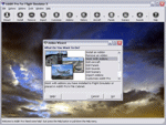
Addit! Pro is a comprehensive addon manager for Flight Simulator X. Easily install, manage and remove aircraft, adventures, flights, flight plans, gauges, missions, panels, A.I. airport and facilities data, scenery, sounds, textures, videos, weather and more! Archive add-ons to Addit! Pro's File Cabinet or recreate them in zip files. Modify your aircraft, panels and sounds. Automatically update FS's Scenery Library. Includes FS Configuration Manager, complete scenery library editor, ZIP/RAR support and much more! See Readme.htm for details. Requires Flight Simulator X: Standard or Deluxe Edition. Shareware $24.95--please register to install an unlimited number of add-ons. See Register.htm. By Joseph Stearns.
| Filename: | V741_Addit_Pro_Addon_Manager.zip |
| License: | Shareware, limited functionality |
| Added: | 4th October 2013, 02:21:07 |
| Downloads: | 294 |
| Author: | Joseph Stearns |
| Size: | 10.86 MB |
| Category: Prepar3D V1-4 - Utilities | |
| Beechcraft King Air 200 - Performance and fuel planner V1.2 |
|
Images related to this file:
File Description:

To establish a flight with this excel file, enter Crew and passengers weight, then input datas in "flight datas" page, then using orange buttons, complete each page (you can return to the menu by clicking on the title of each page), finally, you can print the weight and balance card and datas card, this datas card resume all performance and flight parameters, and, of course, the fuel planning.
Fuel weight, in the weight and balance page please estimate the fuel weight, enter all data then go back to this page to adjust your estimation have the exact fuel weight, this is an excel limitation!
| Filename: | Beechcraft_King_Air_200__Performance_and_fuel_plan.zip |
| License: | Freeware, limited distribution |
| Added: | 9th February 2016, 22:58:04 |
| Downloads: | 1,264 |
| Author: | Frederic Furst |
| Size: | 1.29 MB |


© 2001-2026 AVSIM Online
All Rights Reserved
Privacy Policy |