
Where Flight Simulation Enthusiasts Gather from Around the World!
AVSIM Library - Search Results

| Category: Flight Simulator X - Aircraft Repaints, Textures and Modifications | |
| FSXC Boeing 747-400 |

|
File Description:
747-400 Exclusive FSX Contest Livery
Enjoy, have fun !!!
Take some screenshots or videos and send them to www.facebook.com/fsxcontest
Thanks a lot
FSX Photo and Video Contest Team
| Filename: | FSXC_Boeing_747400.zip |
| License: | Freeware, limited distribution |
| Added: | 18th April 2014, 05:59:01 |
| Downloads: | 29 |
| Author: | Kristof De Vos, Vista Repaint, FSX Photo and Video Contest; fsxcontest |
| Size: | 1.99 MB |
| Category: Flight Simulator 2004 - Scenery | |
| RAF Wattisham UK - circa 1991 |
|
Images related to this file:
File Description:
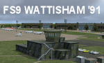
Extremely detailed scenery of this UK Cold War airfield with custom ground polygons and scenery objects, but optimized for good frame rate performance. A package of 24 Phantom FGR2 AI aircraft to complement the scenery is available as a separate download. A separate scenery package in FSX native code is also available in ACG_RAF_Wattisham_FSX_1.zip.
| Filename: | RAF_Wattisham_UK__circa_1991.zip |
| License: | Freeware, limited distribution |
| Added: | 2nd January 2015, 18:49:34 |
| Downloads: | 1,476 |
| Author: | Stephen Legg, John Young and Pete Beeby, Airfield Construction Group (ACG) |
| Size: | 55.64 MB |
| Category: Flight Simulator X - Scenery | |
| RAF Wattisham, UK - Circa 1991 |
|
Images related to this file:
File Description:

Extremely detailed scenery of this UK Cold War airfield, with custom ground polygons and scenery objects, but optimised for good frame rate performance. A package of24 Phantom FGR2 AI aircraft to complement the scenery is available as a separate download. Separate pack in FS9 native code is also available in ACG_RAF_Wattisham_FS9_1.zip.
| Filename: | RAF_Wattisham_UK__Circa_1991.zip |
| License: | Freeware, limited distribution |
| Added: | 2nd January 2015, 18:50:15 |
| Downloads: | 2,674 |
| Author: | Stephen Legg, John Young and Pete Beeby, Airfield Construction Group (ACG) |
| Size: | 112.4 MB |
| Category: Flight Simulator X - AI Aircraft | |
| jetBlue Bombardier C Series CS300 |
|
Images related to this file:
File Description:

Attached is a Jetblue repaint for the new cseries 300
I have included 2 paints
1- Blue Bubbles
1- Blue Pattern w/ ontimeflights.org on fuse (they've been adding this to random aircraft)
you must have the FSPXAI Payware model for these to work
http://secure.simmarket.com/fspxai-bombardier-c-series-fsxp3d-ai-traffic.phtml
Looks great in JB colors!
Let me know with any questions.
Michael Ullman
[email protected]
| Filename: | jetBlue_Bombardier_C_Series_CS300.zip |
| License: | Freeware |
| Added: | 5th October 2017, 07:24:21 |
| Downloads: | 256 |
| Author: | FSPXAI CS300. Model and Paintkit by: FSPXAI - repaint by Michael Ullman |
| Size: | 5.8 MB |
| Category: Flight Simulator 2004 - Sounds | |
| Boeing 777 General Electric GE90-115B Sound Pack |
|
File Description:
SkyHigh Audio Simulations and Audiosim are proud to present what is quite possibly the most realistic sounding GE90 sound pack available for the 777! This sound pack is designed to work with ANY model in FS9, but moreso intended for Posky's 777s with GE90 engines. This sound pack includes many unique and realistic features, including realistic start up 'mooing' sounds and the famous GE90 growl. Realistic interior ambiance noises such as the touchdown, flaps, gear sound, and more are featured in this sound pack. Please visit our website at: www.skyhighflightsim.webs.com, or Audiosim's website at: www.audiosim.webs.com for more info and sound packs!
| Filename: | Boeing_777_General_Electric_GE90115B_Sound_Pack.zip |
| License: | Freeware |
| Added: | 13th November 2011, 04:22:36 |
| Downloads: | 11,375 |
| Author: | Adam Murphy and Jesse Casserly - Skyhigh Audio Simulations, Max Cossette - Audiosim |
| Size: | 35.36 MB |
| Category: Flight Simulator 2004 - Scenery | |
| Byron Bay, Cape Dyer, Cape Hooper, Dewar Lakes, and Durban Island adapted for the FSGenesis 76m North Canada Terrain Mesh |
|
Images related to this file:
File Description:
These are replacement bgl's to convert five northern Canada fields for use with the FSGenesis 76m terrain mesh for northern Canada. The five are Byron Bay CWBB, Cape Dyer CWFD, Cape Hooper CWFH, Dewar Lakes CWFL, and Durban Island CWFB. These are not stand-alone, and the presumption is that you have already downloaded and installed the previously posted sceneries. The installation consists solely of replacing the existing scenery bgl's with the new. There will be further posts of northern airfields in groups of five, alphabetically, and observations regarding the amendments and any further corrections that are required would be welcomed.
| Filename: | Byron_Bay_Cape_Dyer_Cape_Hooper_Dewar_Lakes_and_Du.zip |
| License: | Freeware, limited distribution |
| Added: | 3rd September 2017, 20:01:55 |
| Downloads: | 73 |
| Author: | Roger Wensley |
| Size: | 3.49 MB |
| Category: Flight Simulator 2002 - Aircraft Repaints, Textures and Modifications | |
| Frontier Airlines Convair 340 |
|
File Description:
Gmax Frontier Airlines Convair 340 with panel and sounds.
| Filename: | Frontier_Airlines_Convair_340.zip |
| License: | Freeware, limited distribution |
| Added: | 10th April 2003, 00:58:25 |
| Downloads: | 1,478 |
| Author: | Built by Greg Pepper and Tom Gibson. Repainted by David Grogg. Panel by Greg Pepper, Allen Jennings, and Tom Gibson. Flight Dynamics by FSAviator. |
| Size: | 11.67 MB |
| Category: Flight Simulator 2004 - Scenery | |
| Chicoutimi / St-Honore CYRC in Quebec Canada |
|
Images related to this file:
File Description:
This is the third of five sceneries around Lac Saint-Jean in Quebec, Canada. Saint-Honore is a village on a crossroads 32 miles east of the lake, and the airport, called Chicoutimi in the Nav Canada Flight Supplement, is a mile or so east of the village. It is of the familiar triangular military design with three runways 12-30, 06-24, and 18-36. Of these, the longest is 12-30 at over 6,000 feet and has approach lighting and glide slope indicators. Of the other two 06-24 is now closed, but this scenery is based on the 2010 situation with all three open. There are two apron areas, one just to the south of 12-30 and a second to the northwest of 06-24 and served by a separate taxiway. The largest operator is a training establishment based on the northern apron and with a sizeable fleet of Beechcraft trainers (Skipper) that does not exist as an FS9 plane, so these are represented by a similar stand-in substitute. There is also a helicopter emergency evacuation operation to the east of the large control tower, and other hangars. The south apron has two main companies, Max Aviation and Exact Air, both of which run local regular scheduled flights in the area (though both appear to have now subcontracted these out to other companies) and also engage in training and charter flights. There is also a parachute training company. The ai includes flights by the companies on the field and also GA. The list of AI planes is explained in the AI folder, with details of downloads etc. The fleet of training aircraft is one of the planes in the revised (by Nick Tselepides) Piper Aircraft, designed for AI Traffic by Andras Neumann with a Paintkit by Charles Dayhuff adapted by Graham Eccleston, and Paints by Graham Eccleston, Andras Neuman and Frank Cooper along with the trainer repaint by Nick Tselepides. The Max and Exact aircraft textures are approximations by me; apologies. The use of the runways also as taxiways complicates the AI on runway 12-30 as directed by ATC. The AI will always leave 12-30 by the earliest exit, which means that the fleet of trainers will exit to the southern apron but will then taxi back onto the runway to reach taxiway A or runway 36 (according to wind direction) to proceed to the northern apron. In real life they land long and then taxi straight to the end of the runway to reach taxiway A or runway 36 without using the south apron at all. There is no way to correct this so just be ready to go around.
| Filename: | Chicoutimi__StHonore_CYRC_in_Quebec_Canada.zip |
| License: | Freeware, limited distribution |
| Added: | 12th November 2017, 17:35:21 |
| Downloads: | 342 |
| Author: | Roger Wensley |
| Size: | 29.03 MB |
| Category: Flight Simulator 2004 - Scenery | |
| Prudhoe Bay area on Alaska North Slope US |
|
Images related to this file:
File Description:
The Prudhoe Bay area of the Alaska north slope is dominated by all the equipment and machinery that is necessary for the extraction of oil and its transfer by the pipeline that reaches south to Valdez. Prudhoe Bay airport is now closed, and its replacement just to the south is Deadhorse PASC, with numerous storage, maintenance, and accomodation areas immediately to the north of the apron, and others adjacent to the road between the two. The runway is just under 6,500 feet with approach lights at both ends and ILS on 04 (true heading of 75 degrees). This scenery reflects the overall situation in 2011 and oil production facilities and buildings are included here. The airport buildings and those close to the airport are replicas of the real life buildings; while as distance increases the accuracy fades somewhat there are everywhere replica trucks and cross country vehicles that are true to life. Deadhorse handles around 7,000 passengers per month as staff are rotated in and out on Alaska Air and ERA flights and by oil company private flights. There are also freight flights to complement the trucking effort up the Dalton Highway. The Alaska Airlines terminal building and ERA (the red buildings nearby) are at one end of the apron, while at the other end is a very large and new green terminal, storage, hangar building built by the airport authority. All of the airport components, runways, taxiways, and aprons, are built up on a gravel base to raise them above the surrounding terrain that floods with melting snow, freezes, or dries out, according to the seasons. There are other new airstrips included here that serve the oil industry. Around 33 miles to the east is Badami PABP airport servicing a subsiduary oil producing area, with 5,000 feet of gravel runway. Some 28 miles to the west of Deadhorse is Ugnu-Kuparuk UBW with just over 6,000 feet of gravel (gravel in 2011, it is now asphalted) servicing oil production by Conoco Phillips, which uses 737's to fly staff in and out. A further 32 miles west is Alpine AK15 with 5,400 feet of gravel and also served by the Conoco Phillips 737's. To the south of Alpine and connected by road is the village of Nuiqsut. To the north of Alpine and reachable only by air in the delta of the Sagavanirktok River is CD-3, an oil collection and pump station area with another gravel runway of 3,000 feet. Other airstrips that were prviously posted are now updated, Nuiqsut and Oliktok. I experimented, but decided against trying to reproduce the several hundred miles of pipelines. The are new AI aircraft, and there are notes regarding downloading. There is a new "cement" texture (not its name, but used as that by SBuilder) for the built up gravel bases. It is slightly darker than the original but not so much that any previous use will be spoilt. You may wish to download my "Alaska Frozen Rivers and Lakes" which freezes lakes and the northern sea and makes them landable on wheels.
| Filename: | Prudhoe_Bay_area_on_Alaska_North_Slope_US.zip |
| License: | Freeware, limited distribution |
| Added: | 19th December 2017, 00:38:06 |
| Downloads: | 586 |
| Author: | Roger Wensley |
| Size: | 28.54 MB |
| Category: Flight Simulator X - Scenery | |
| Tindari Geographic Coordinates N 38.08.27 E 15.02.48.Important VFR reference point for planes coming from Palermo and heading to Reggio Calabria |
|
File Description:
I wanted to realize the scenery of the sanctuary of Maria Santissima of Tindari village of Patti, in the province of Messina. It rises on the summit of the homonymous hill and overlooks Marinello's ponds in the homonymous nature reserve. Important VFR reference point for planes coming from Palermo and heading to Reggio Calabria. Geographic Coordinates N 38.08.27 E 15.02.48. For more information on the site search on google. In the Package you will also find instructions for installing the scenery.
| Filename: | Tindari_Geographic_Coordinates_N_380827_E_150248Im.zip |
| License: | Freeware |
| Added: | 24th August 2017, 05:08:31 |
| Downloads: | 255 |
| Author: | Pasquale Marrulli |
| Size: | 1.6 KB |


© 2001-2026 AVSIM Online
All Rights Reserved
Privacy Policy |