
Where Flight Simulation Enthusiasts Gather from Around the World!
AVSIM Library - Search Results

| Category: Flight Simulator 2004 - Scenery | |
| KCMI Update for KCMI Willard airport in Champaign, IL |

|
File Description:
I have made a few changes to parking lot lights and some movement of objects.
This update should have the previous version of kcmi_willard.zip installed already to work..
At request of different people. I have made three different levels of display for KCMI Willard Airport located in Champaign, IL.
To add the new scenery file to your KCMI just install and override the original Scenery folder in the KCMI Folder.
Then to select the level of display I have numerous settings that can be changed.
To change the level of vehicles seen chose one of the following.
KCMI_Vehicles_low.xxx
KCMI_Vehicles_med.xxx
KCMI_Vehicles_high.bgl
The default is the KCMI_Vehicles_high.bgl setting.
If you computer can not handle this high setting, just change KCMI_Vehicles_high.bgl to KCMI_Vehicles_high.xxx
Then change either KCMI_Vehicles_low.xxx or KCMI_Vehicles_med.xxx
By just changing the xxx to bgl
At the low setting, only a few vehicles will be seen.
___________________________________
Also you can change the following bgl files to see how they look also.
KCMI_Power Poles.bgl to KCMI_Power Poles.xxx will eliminate the power lines.
static-planes.bgl to static-planes.xxx will eliminate the two large planes at the corners of the runway.
KCMI_Maintenance.bgl to KCMI_Maintenance.xxx will eliminate related maintenance equipment of the two large planes.
____________________
Then restart your FS9 and it will apply the changes...
| Filename: | KCMI_Update_for_KCMI_Willard_airport_in_Champaign_.zip |
| License: | Freeware |
| Added: | 6th February 2006, 01:45:47 |
| Downloads: | 1,053 |
| Author: | Lawrence F Dorries |
| Size: | 69 KB |
| Category: Flight Simulator 2004 - AI Aircraft | |
| Boeing C-97 Stratofreighter |
|
File Description:
Boeing C-97 Stratofreighter for classic AI Traffic. Derived from the B-29 bomber of WWII, the C-97 served for nearly thirty years as a military/civillian transport, aerial refueler, electronic warfare, and reconnaissance aircraft; with over 900 produced of all types for military use. This model set from Dee Waldron pays homage to the operational life of this important aircraft of military history, and allows you to add it into your classic AI traffic world. This package has two main aircraft, the C-97 and the KC-97. Between them, there are a total of eight models and fourteen texture sets, representing all of the versions of this aircraft I could research. Dee did the original KC-97G/L models, and I added my limited FSDS talent to make the rest. Special thanks to Dee for allowing me to utilize his models for this project, and equal thanks to Tom Gibson of California Classic for giving them to me again when I accidentally deleted them; and for a lot of advice from both of these giants of the hobby. This is a LOD6 model, for FPS economy. Base model and original textures by Dee Waldron; model tweaks, Photoshop paint kit and all included texture repaints by Michael Pearson.
| Filename: | Boeing_C97_Stratofreighter.zip |
| License: | Freeware |
| Added: | 23rd August 2008, 09:49:28 |
| Downloads: | 1,473 |
| Author: | Dee Waldron, Michael Pearson |
| Size: | 4.44 MB |
| Category: Flight Simulator 2004 - Aircraft Repaints, Textures and Modifications | |
| Air Pink Cessna Citation Excel XLS+ (YU-BZM) |
|
Images related to this file:
File Description:

I am proud to present this detailed repaint of the Aryus Works freeware model of the Cessna Citation Excel XLS+, registration YU-BZM, in Air Pink's elegant black, gray and white livery. Air Pink is a private business jet charter airline based in in Belgrade, Serbia, established in 2004 as part of Pink International Company. It is based at Belgrade Nikola Tesla International Airport. Its fleet consists of this single Citation XLS+, 2 Cessna Citation II's, 2 Cessna Citation 550 Bravos and 1 Cessna Citation CJ2. Air Pink flies to destinations in Europe, the Middle East and North Africa. There are a lot of curves on this aircraft and I paid attention to painting their detail and creating as realistic a repaint as possible on this work. The textures in this repaint are 32-bit. This is a complete install; Aryus Works Citation Excel XLS+ model and air files are included. Panel and sound are from the default Lear45. PLEASE NOTE: I recreated several textures in this repaint out of respect for EagleSoft Development's texture Copyright. These EagleSoft textures were released in Aryus Works original Excel paintkit and were used without permission from EagleSoft Development. See Readme file for more details.
| Filename: | Air_Pink_Cessna_Citation_Excel_XLS_YUBZM.zip |
| License: | Freeware, limited distribution |
| Added: | 30th October 2010, 21:49:32 |
| Downloads: | 1,730 |
| Author: | Jeffrey S. Bryner, Aryus Works |
| Size: | 5.33 MB |
| Category: Flight Simulator X - Original Aircraft | |
| Boeing 787-942 VIP-BBJ |
|
Images related to this file:
File Description:
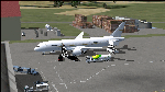
Boeing 787-942 Boeing Business Jet (VIP), AKA "DreamJet", is the Corporate version of this aircraft, modified for individual client specs. The range is extended beyond the normal 787-9 due to additional fuel tanks, a lot less payload weight, and more powerful and efficient engines. The Cabin Pressure is decreased to 6,000 ft, allowing for higher Flight Levels than normal. The tail number on this model can be changed to match the user's preference, since it is not apparent on the exterior (No Airline Call used on Private Aircraft).
This is a huge aircraft and normally seats about 300 passengers, but there are only 48 (including Pilots/Attendants) on this plane. A lot of space remains for luxuries that are well beyond any Business Jet of any kind other than the 747 or A380. Some of these luxuries include automated beds that are hidden in the floorboard and activated by the attendants when requested, and each of these includes a privacy barrier. There is one Large Screen TV with stereo surround sound with theater seating in the fore section, and separate small screen monitors located at every assigned seat (including flight data relay of all positioning and aircraft data viewable). The kitchen is fully equipped with 935 lbs of various food and drinks, with one attendant being a Master Chef. There is a automated Dance Floor that can be activated in the theater area, after the seating chairs are automatically stored below deck. The crew also experiences luxury as the pilots have a twin-bed sleeping area with a private kitchen (2 sleep while 2 fly), as do the attendants (fore and aft upper deck) with twin beds and private kitchens. The aircraft is also more luxurious in that it has 6.000 ft of pressure continuous to 47,000 ft, and has a very low interior noise level. There are also many added safety features that provide for survival in the event of a mishap, making it possible to survive a water crash for several days through the use of 6 inflatable skiff-rafts with engines, radios, and supplies. All attendants are trained and certified Registered Nurses, and they have 25 lbs of medications and supplies stored in the aft. Some of these features add to the empty weight, so the MTOW is the same as a normal aircraft of this design for commercial use (the gear are also modified for these accommodations).
This aircraft is designed for educational use protected under the Fair Use Doctrine:
(http://www.expertlaw.com/library/intellectual_property/fair_use.html)
It cannot be sold or bundled for sale, and such will never be approved by me or the original authors. FREEWARE DISTRIBUTION ONLY!!!
Model design and paint by: Camil Valiquette;
Sound by: Emil Serafino;
Engine/Aerodynamics and Details by: Douglas E. Trapp, ([email protected]) May 2018
| Filename: | Boeing_787942_VIPBBJ.zip |
| License: | Freeware |
| Added: | 20th May 2018, 16:58:42 |
| Downloads: | 882 |
| Author: | Douglas E Trapp |
| Size: | 77.99 MB |
| Category: Flight Simulator 2004 - Scenery | |
| Dolbeau-St-Felicien CYDO in Quebec Canada |
|
Images related to this file:
File Description:
This is the fourth of five sceneries around Lac Saint-Jean in Quebec, Canada. Saint-Felicien is a village on a small river at the western end of Lac Saint-Jean, and the airfield is just under 10 miles to the northeast. At the same distance further to the northeast of the airfield and on a slightly larger river is the village called Dolbeau. The village of Sainte-Methode is closer than either of the other villages but presumably lacked influence. The airfield effectively has one runway aligned 11-29 and just under 5,000 feet long, with approach lights on 11. There is, or was, a second runway aligned north-south but this has badly deteriorated without maintenance and has loose stones that threaten propellor damage. The taxiway that runs east-west is in a similar condition and all planes operate as if there is no taxiway. There is a clubhouse and a maintenance facility along with a line of old hangars that remain in full use, plus planes parked in the open. The landclass has been modified along with the grassed area of the airfield, and in the AI (included with the post of CYRC) there are scheduled flights by Max Aviation, and GA flights etc. It is a really typical airfield in northern(ish) rural Canada with a lot more activity than one might expect.
| Filename: | DolbeauStFelicien_CYDO_in_Quebec_Canada.zip |
| License: | Freeware, limited distribution |
| Added: | 19th November 2017, 15:52:32 |
| Downloads: | 169 |
| Author: | Roger Wensley |
| Size: | 4.17 MB |
| Category: Flight Simulator X - AFCAD Files | |
| Blairstown Airport (1N7), NJ |
|
File Description:
Located 02 miles SW of Blairstown, New Jersey on 151 acres of land, Blairstown Airport is privately owned by J.D. Air Inc. and is home to a moderate number of small GA planes and gliders. This scenery is not completely up to date, as the MegaScenery Earth textures themselves are outdated. Missing are the added taxiway/parking lot north of the existing north taxiway as well as the second hangar area to the north that it leads to. Parking is available on the south tarmac but if that's all taken there is room just to the west in the taxiway offshoot. Also room on the grass, although stay south of the windsock to avoid interfering with glider operations. Glider pilots that wish to start on the grass, select either Runway East or Runway West. Fuel is available by stopping near the gas tank on the south tarmac.
Scenery constructed with use of satellite images/streetview, the author has not been there in person.
This scenery is meant to be used in conjunction with MegaScenery Earth New York 007. It is not required, but apron use is minimized to allow satellite scenery to show through as much as possible, and objects are placed based on the MSE textures - lack of it may make scenery look out of place.
| Filename: | Blairstown_Airport_1N7_NJ.zip |
| License: | Freeware |
| Added: | 8th October 2010, 20:22:59 |
| Downloads: | 247 |
| Author: | Drew Sikora |
| Size: | 576.39 KB |
| Category: Flight Simulator 2004 - Scenery | |
| PASN St Paul Island in Alaska |
|
Images related to this file:
File Description:
This is St Paul Island airport, plus the town and the harbour which has featured alongside Dutch Harbor in the tv series Deadliest Catch.
St Paul is in the Pribilof group of five islands around 250 miles north of Dutch Harbour. The town has a population of less than 600, so a lot smaller than Dutch Harbour and with only one processing plant, Trident.
The Ai includes a PenAir flight, a Coast Guard C-130, and Coast Guard helicopters; sea AI includes a fishing boat and a Coast Guard cutter. The Coast Guard C-130 and helicopter flights are to Dutch Harbor, so both sceneries are required to make it work as it should. The airport has 6,500 feet of 150 feet wide asphalt with 1,000 feet of over-run at each end, aligned 36/18, lit, and with two aprons at the southern end. There is no hangerage except for Coast Guard helicopters. Runway 36 has at its northern end a hill.
In real life the runway slopes up to the north by over 60 feet, but in FS9 it doesn't; hence the change in airport elevation to 80 feet ASL to get the northern end at least partly out of a box canyon. There is fuel available and it is dispensed from a truck, there are no pumps.
| Filename: | PASN_St_Paul_Island_in_Alaska.zip |
| License: | Freeware, limited distribution |
| Added: | 12th August 2012, 17:39:02 |
| Downloads: | 1,100 |
| Author: | Roger Wensley, Sidney Schwartz |
| Size: | 4.06 MB |
| Category: Flight Simulator 2004 - AI Flight Plans | |
| Sorted default FS9 flight plans & GA flight plans sorted by ICAO/country |
|
File Description:
The Master_GA_sorted_country contains: some 20,436 flight plans that have been adopted from Reggie Fields' sorted aircraft registration collections. The following is from his readme file (included folder), "FS2004 General Aviation AI traffic with more correct registration numbers for the originating country. This file is a modification of the FS2004 default GA traffic designed to minimize the number of small single engine aircraft landing at the worlds major commercial airports. This will prevent a lot of go-around orders to commercial jets based on the length of time it takes a C172 to clear a 10,000 ft runway. This file makes commercial AI traffic flow much better than the MS default while retaining the GA aircraft in the airspace." Like Reggie Fields' files, all are free to use and redistribute but can not be sold. AC#defaultfp_sorted_ICAO folder contains all individual default aircraft in seperate files and their FS9 default flight plans are sorted by ICAO. A second folder contains a file for each country with the mentioned GA flight plans sorted by ICAO. This should be of an aide to those of us who wish to put more correct AI aircraft into a region or country. Copy/paste should be easier, this way, when building on each countries' aviation/flights. All files are text (.txt) files (ASCII.) They have no @ and TTOOLS by Lee Swordy is recommended.
| Filename: | Sorted_default_FS9_flight_plans__GA_flight_plans_s.zip |
| License: | Freeware |
| Added: | 10th May 2004, 14:48:30 |
| Downloads: | 2,983 |
| Author: | Rick Connolly |
| Size: | 5.57 MB |
| Category: Flight Simulator 2004 - Scenery | |
| Replacement Dynamic Water Texture Set Version 12 |
|
File Description:
Replacement dynamic water texture set for FS2004 (VERSION 12). The default reflections and water colors leave a lot to be desired in FS2004. As an example; The default "bright green" overcast texture is highly unrealistic in overcast conditions. Most of the FS9 default colours are generally too electric and cartoon like. These replacement textures will change these water environment textures dramatically to a much more convincing and realistic colour and, with improved lighting and reflections in respect to the sun. Version 12 moon light textures are new and there is an improved mid-sun with more convincing reflections. Now when you fly by moonlight you can actually see the moon kissed water and even see some wave action. It actually feels like you are there! There are 3 moon light textures in this download. These replacement textures will generally give a much more realistic tone and color to the water effects in FS2004. The change is quite dramatic and transforms the flight sim experience to a much greater level of realism. It is important to stress the default FS9 textures are fully compatible with these new textures and they can be used in any combinations and can be mixed and matched with the new textures. As a further added bonus a voice control file has been included for "Shoot" which will control FS2004 by voice. It is brilliant and it's free.
| Filename: | Replacement_Dynamic_Water_Texture_Set_Version_12.zip |
| License: | Freeware, limited distribution |
| Added: | 17th January 2004, 19:48:53 |
| Downloads: | 5,195 |
| Author: | Peter Wilding |
| Size: | 5.65 MB |
| Category: Flight Simulator 2004 - Scenery | |
| Monterey Academy CA66 California Scenery |
|
File Description:
This is a scenery upgrade for Monterey Academy Airstrip, California (CA66). This is part Seven of a
series of small airstrip and minor airfield scenery enhancements which are based on real world data
from Google Earth.
Changes to default include an AFCAD file that covers some of the buildings that seem to be
associated with the airstrip, Landclass change to reflect the fact that the strip lies in agricultural
ground rather that the scrubland the default has it in. Note that the buildings are used to appear
the same as they do from directly above rather than a genuine representation of what is probably
there. So from ground level it will look a lot different to the real thing should you be familiar with it!
This is due to the limited number of buildings available ATM.
Also My screenshots are using Flight1 Ground Environment textures, so your land may look different
if you have the default terrain.
Thanks to Jon "Scruffyduck" Masterson for tutorials on LC and scenery design.
Built using EZ_Scenery, Lee Swordy's AFCAD and SBuilder. You must have rwy12 and EZ scenery
libraries installed for the buildings to show, both libraries of objects are free
EZ Library is available from this URL http://www.abacuspub.com/pub/AbacusEZLibraries.exe
rwy12 from Avsim and additional EZ Custom libraries from Avsim also, search under Scenery design.
| Filename: | Monterey_Academy_CA66_California_Scenery.zip |
| License: | Freeware |
| Added: | 25th March 2006, 23:10:11 |
| Downloads: | 589 |
| Author: | Kim Gowney |
| Size: | 250.98 KB |


© 2001-2026 AVSIM Online
All Rights Reserved
Privacy Policy |