
Where Flight Simulation Enthusiasts Gather from Around the World!
AVSIM Library - Search Results

| Category: Flight Simulator 2004 - Scenery | |
| Mail Run 2 |

|
File Description:
This scenery is located in,British Columbia, Canada. See map(included)
Airport name's,
1.Leo Creek.CAH5. Default enhanced. 3900' dirt field
2.Takla Narrows.CBD5. Default enhanced. 2000' gravel. Look out for fires in the area!
3.Ogden Field.CC5A. Addon. 2800' gravel. Ndb on field. OGDEN(OGD)402Khz
Overview: Take the mail to the different airports as instructed. You'll find the instruction signs close to the buildings at each air strip. Not hard to find. Just nose around a bit. This theme takes advantage of the weight and fuel loading area of the sim for each aircraft. Your looking at hauling up to 1500 lbs at any one time so just be aware.
| Filename: | Mail_Run_2.zip |
| License: | Freeware |
| Added: | 17th October 2003, 16:53:46 |
| Downloads: | 1,585 |
| Author: | Frank Betts |
| Size: | 1.99 MB |
| Category: Flight Simulator 2002 - AI Flight Plans | |
| British Midlands/ Star Alliance Complete AI package |
|
File Description:
Complete Frequencies in this flightplan 2002/2003 March for BMI and it's Star Alliance airlines like,
Lufthansa, SAS, Eurowings, Air Canada, United Airlines, using ATC calls signs Bravo Delta(BD).
BMI flies about 2000 flights per week and thats about the same in here. BMI has 53 aircrafts officially
like the Boeing 737-/300/400/500/'s and many more.(Check withen for more details about the aircrafts).
BMI is posted in different Major airports in England. Some planes fly 2 to 3 legs before destination.
All in here.
This is a 2 days work and all data are real gotten from direct contacts. Safe to download.
Realism 99.5%. More uploads and Enjoy!!!
| Filename: | British_Midlands_Star_Alliance_Complete_AI_package.zip |
| License: | Freeware |
| Added: | 9th November 2002, 20:12:11 |
| Downloads: | 2,825 |
| Author: | The Gargoils Project. (Vasilly Giffard) |
| Size: | 16.34 KB |
| Category: Flight Simulator X - AFCAD Files | |
| KMCI - Kansas City Inl - Kansas City, USA |
|
Images related to this file:
File Description:
Kansas City International Airport, originally named Mid-Continent International Airport, is an American public airport located 15 miles North West of the central business district of Kansas City, in Platte County, Missouri, United States. It has consistently ranked in the top-five airports in the North America Airport Satisfaction Study by J. D. Power and Associates. In February 2010, the airport was the highest-rated medium-sized airport receiving five stars in all categories. Its largest carriers are Southwest Airlines and Delta Air Lines, which both operate a large number of daily flights in Terminal B.
Using ADEx 1.55, aeronautical maps and Google Earth the default AFCAD has been updated to reflect today's situation.
| Filename: | KMCI__Kansas_City_Inl__Kansas_City_USA.zip |
| License: | Freeware |
| Added: | 16th May 2013, 18:14:24 |
| Downloads: | 2,011 |
| Author: | Menno C. Robert |
| Size: | 580.54 KB |
| Category: Flight Simulator X - Scenery | |
| Bari City |
|
File Description:
The filmmakers FSX they have not taken into account the city's Italian,
therefore, I decided to make some Italian cities such as the city of Bari.
The scenarios are always built airports, but few are interested in the VFR flight
where the details of the land and the cities are important for the flight.
In the package you will find the file Baricity.bgl that will be placed at the
addon scenery folder and subfolder scenery automatically when FSX scenery you will find it
in the scenario.
In scenery you can fly over the port, the castle
and the church of San Nicola.
Good flight at all. We accept criticism and advice [email protected]
| Filename: | Bari_City.zip |
| License: | Freeware |
| Added: | 28th June 2015, 23:44:44 |
| Downloads: | 786 |
| Author: | Pasquale Marrulli |
| Size: | 11.21 KB |
| Category: Flight Simulator X - Scenery | |
| KPVG - Hampton Roads Executive Airport - Virginia, USA |
|
Images related to this file:
File Description:
FSX Scenery - Hampton Roads Executive Airport (ICAO: KPVG, FAA LID: PVG) is a public-use airport located seven miles (11 km) southwest of the central business district of Norfolk and northwest of Chesapeake, both independent cities in the U.S. state of Virginia. It is privately owned by Virginia Aviation Associates, L.L.C. Although most U.S. airports use the same three-letter location identifier for the FAA and IATA, Hampton Roads Executive Airport is assigned PVG by the FAA but has no designation from the IATA (which assigned PVG to Pudong International Airport in Shanghai, China). All buildings are custom made. AI traffic contains default aircraft. Created for your flight simming pleasure by John B. Loney, Jr.
| Filename: | KPVG__Hampton_Roads_Executive_Airport__Virginia_US.zip |
| License: | Freeware, limited distribution |
| Added: | 7th September 2014, 23:05:56 |
| Downloads: | 851 |
| Author: | John B. Loney, Jr. |
| Size: | 18.89 MB |
| Category: X-Plane - Scenery | |
| BR SP SBSP - Congonhas Airport v1.0.0 |
|
Images related to this file:
File Description:
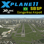
This is an X-Plane 11 and X-Plane 10 scenery package for Sao Paulo's Congonhas Airport (IATA: CGH, ICAO: SBSP), one of the four commercial airports serving São Paulo, Brazil. It includes corrected aprons, ramps, taxiways, lighting system, and (XP11 only) ground services (like push back). This scenery was tested and is operational (as of February 18, 2017) in "X-Plane 11 Public Beta #11 64 bit", Windows 10 Home. It was also tested and is also operational (as of February 18, 2017) in "X-Plane 10.51 64 bit", Windows 10 Home. Only the default X-Plane 11 libraries, by Laminar Research, are needed. No third party libraries are used.
| Filename: | BR_SP_SBSP__Congonhas_Airport_v100.zip |
| License: | Freeware |
| Added: | 19th February 2017, 07:22:34 |
| Downloads: | 138 |
| Author: | Rui Mesquita |
| Size: | 16.14 MB |
| Category: Flight Simulator X - Scenery | |
| Flagship Scenery: Biggin Hill X |
|
Images related to this file:
File Description:

London Biggin Hill airport is one of the smaller London airports located just south of Bromley.
The airport serves regional flights and caters to more of the VFR operations.
This scenery is our first official Flagship release and is has been through keen eyes before its release.
Scenery features are:
- High definition ground image
- High definition ground detailing
- Illuminated taxiway centre light effect
- Precision placed trees and vehicles
- Fuel trucks hidden inside closed hangars
- High-vis 3D approach lights
- Hold short guards and wigwags
- PAPIs
- Photo realistic Rizon Jet FBO Hangar
- Internally lit hangars
- Many static vehicles and details
- Surrounding Houses
| Filename: | Flagship_Scenery_Biggin_Hill_X.zip |
| License: | Freeware, limited distribution |
| Added: | 15th September 2015, 01:00:41 |
| Downloads: | 4,055 |
| Author: | Mark Piccolo - Soarfly Concepts |
| Size: | 38.47 MB |
| Category: Flight Simulator 2002 - AI Flight Plans | |
| Real Flight Plans for Winter -- Buzz |
|
File Description:
All buzz aircraft are operated by KLM uk in buzz colours, but use 'UK' flight numbers.
buzz aircraft are painted in an eye-catching scheme consisting of a yellow fuselage,
purple engines and a tail consisting of a sunflower shape.
Buzz goes under the callsign(ATC) UK- Uniform Kilo. They have a total fleet of 10 aircrafts.
8 Avro's and 2 b737-300.
Complete flightplan from a real winter timetable, valid till 23 March 2003.
10 aircrafts flying to 25 airports mostly in France. Buzz is based in London Stansted.
Real flightnumbers and Tail Registrations (Interchange).
RVSM altitudes, Real time- Departure and Arrivals.
True aircrafts used. Realism 99%, Enjoy. More uploads soon!!!
| Filename: | Real_Flight_Plans_for_Winter__Buzz.zip |
| License: | Freeware |
| Added: | 7th November 2002, 12:57:32 |
| Downloads: | 1,343 |
| Author: | The Gargoils Project. (Vasilly Giffard) |
| Size: | 3.71 KB |
| Category: Flight Simulator 2004 - AI Flight Plans | |
| Era Aalaska Fall 2010 |
|
Images related to this file:
File Description:

In 2009 Era Aviation was acquired by rival Frontier Alaska Group (Frontier Flying Service, Hageland Aviation Services, and Arctic Circle Air) and the Frontier Flying Service 121 mainline operation is in the process of being merged into Era Aviation's certificate. In 2010, the companies were rebranded to operate together as "Era Alaska". Includes mainline flights from Era Aviation, Frontier Flying Service, Hageland Aviation Services, and Arctic Circle Air and were taken from FlightAware for the week of August 29 thru September 4, 2010 Many of the Hageland C208Bs fly IFR only a couple of times per week and may sit around the airports for quite a while. Only IFR flights shown on FlightAware are included in this set.
| Filename: | Era_Aalaska_Fall_2010.zip |
| License: | Freeware |
| Added: | 17th September 2010, 23:40:27 |
| Downloads: | 1,722 |
| Author: | Steve Lewis |
| Size: | 248.67 KB |
| Category: Flight Simulator X - Scenery | |
| Crete Island, Version 2 |
|
Images related to this file:
File Description:
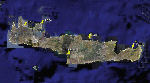
Crete is the bigger than the islands of the Greek archipelago and it is the south rampant of the Aegean sea. This scenery contains the following airports: LGIR, LGSA, LGOB, LGTL and 78 cities.
In this 2nd version I have used the mesh terrain of Yiannis Dermitzakis that offers a bigger realism to the costs. This has put under an obligation to reconstruct the entirety of the populations of the since costs they were located inside the sea. At the same time I have been able to redraw them populations with houses and real facilities that. I believe that I can offer a quite realistic scenery especially in the group of populations of the coast.
| Filename: | Crete_Island_Version_2.zip |
| License: | Freeware |
| Added: | 7th November 2009, 21:08:05 |
| Downloads: | 6,016 |
| Author: | Toni Agramont |
| Size: | 31.14 MB |


© 2001-2026 AVSIM Online
All Rights Reserved
Privacy Policy |