
Where Flight Simulation Enthusiasts Gather from Around the World!
AVSIM Library - Search Results

| Category: Flight Simulator 2004 - Scenery | |
| Caribbe South |

|
Images related to this file:
File Description:
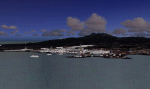
Fully detailled scenery VFR and IFR. It contains 25 airports and 245 cities with yours sea ports in the following islands:
Guadeloupe,Desirare,Les saintes,marie Galante, Dominique,martinique,St Lucia, St Vincent,Cacouan.Bequia,Mustique,Union Island,Carriacou,Grenada,Grenadines,barbados,Tobago and Trinidad
| Filename: | Caribbe_South.zip |
| License: | Freeware |
| Added: | 16th March 2010, 19:47:35 |
| Downloads: | 14,443 |
| Author: | Toni Agramont |
| Size: | 16.91 MB |
| Category: Flight Simulator 2004 - Scenery | |
| Bastia Poretta (LFKB) Corsica France |
|
File Description:
GMAX scenery. Located north of the island of Corsica. One of the two major airports. Very accurate scenery with custom buildings, St Exupery aero-club, canadair hangars and lots of custom vehicles. A lighter version is included for those who don't have a fast computer.
| Filename: | Bastia_Poretta_LFKB_Corsica__France.zip |
| License: | Freeware, limited distribution |
| Added: | 29th February 2004, 23:48:09 |
| Downloads: | 21,561 |
| Author: | Christian Santoni |
| Size: | 2.28 MB |
| Category: Flight Simulator X - AFCAD Files | |
| Greek Waterports |
|
File Description:
This is 5 waterports in some places in greece.The only thing you have to do is just pick a float plane when you choose this airports to take off.You start on the water.
It requires the GRcoastlines.ZIP to work.You can find it in AVSIM library
| Filename: | Greek_Waterports.zip |
| License: | Freeware |
| Added: | 22nd February 2008, 09:20:43 |
| Downloads: | 6,876 |
| Author: | Vassilis Kostoulas |
| Size: | 706.92 KB |
| Category: Flight Simulator 2004 - AFCAD Files | |
| Correction of ILS 08R frequency in Leipzig (EDDP) for Aerosoft Scenery |
|
File Description:
In November 2009 the frequency of the localizer 08R EDDP changed from 111.9 to 111.750.
The supplied BGL file will apply this change to Aerosoft's German Airports 2 (X) for MS Flight
Simulator 2004.
This addon of course does not contain the Aerosoft scenery itself!
| Filename: | Correction_of_ILS_08R_frequency_in_Leipzig_EDDP_fo.zip |
| License: | Freeware |
| Added: | 26th February 2011, 22:37:39 |
| Downloads: | 479 |
| Author: | Michael Henseler |
| Size: | 46.3 KB |
| Category: Flight Simulator 2004 - Scenery | |
| Greece |
|
Images related to this file:
File Description:
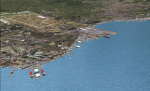
Complete scenery of the Greek nation. It includes 71 cities in the peninsular Greece and 19 of those but important airports. It is completed with 45 islands and in the group I have located 185 cities with their harbors. You'll also find some monuments.
| Filename: | Greece.zip |
| License: | Freeware |
| Added: | 16th July 2010, 17:59:25 |
| Downloads: | 4,600 |
| Author: | Toni Agramont |
| Size: | 63.01 MB |
| Category: Flight Simulator X - Scenery | |
| Virac Airport RPUV with Photoreal Scenery |
|
Images related to this file:
File Description:
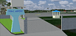
This is my reworked version of RPUV Airport. Now with Photorealistic Scenery, latest colors and updated terminal.
Virac Airport (IATA: VRC, ICAO: RPUV) is the only airport serving the island province of Catanduanes in the Philippines. It is located in the capital, Virac. The airport is classified as a Class 1 principal (major domestic) airport by the Civil Aviation Authority of the Philippines, a body of the Department of Transportation and Communications that is responsible for the operations of not only this airport but also of all other airports in the Philippines except the major international airports.
On October 27, 2013, Cebu Pacific launched the first ever Airbus flight in Virac.
| Filename: | Virac_Airport_RPUV_with_Photoreal_Scenery.zip |
| License: | Freeware |
| Added: | 26th November 2018, 16:20:24 |
| Downloads: | 831 |
| Author: | Aeron M. Tumanut |
| Size: | 35.35 MB |
| Category: Flight Simulator X - Scenery | |
| Norway Regional Pack-1 *Version 1* |
|
Images related to this file:
File Description:

My first Scenery. Not a good or great scenery but just to replace the block-terminals.
Contains: ENSA-Sveagruva - ENSD-Sandane - ENSG-Sogndal - ENOV-ostra-volda
This pack is not a first class scenery like many others because of reasons with my pc operating system but a scenery pack for those that want something that looks like the airport while waiting for a better. VERY IMPORTANT!!! If you have a scenery/mesh fix on any of the airports these airports will merge with that other scenery so you might have two runways. Just remove the other one. NOT TESTED WITH FTX Norway.
| Filename: | Norway_Regional_Pack1__Version_1.zip |
| License: | Freeware |
| Added: | 28th July 2015, 22:07:54 |
| Downloads: | 906 |
| Author: | Hans Christian Knudsen - Knudsenair Simulations |
| Size: | 460.83 KB |
| Category: Flight Simulator X - AFCAD Files | |
| LYBR - Dolac airport - Berane, Montenegro |
|
File Description:
Dolac Airport (Serbian: Aerodrom Dolac) (IATA: IVG, ICAO: LYBR) is an airport located near Berane, Montenegro. Berane was known as Ivangrad from July 1949 to March 1992, hence the IATA code IVG.
It is one of the four Montenegrin airports to feature paved runway and one of three Montenegrin airports to have terminal building. Berane Airport was used for regular airline traffic during the SFRY era, but has since fell into disuse. Today is used mostly by general aviation.
You can select this airport in FSX as Serbia and Montenegro, then Berane, as this was one country when FSX was released.
VFR Charts included
| Filename: | LYBR__Dolac_airport__Berane_Montenegro.zip |
| License: | Freeware |
| Added: | 15th November 2016, 14:54:58 |
| Downloads: | 515 |
| Author: | Danilo Jankovic |
| Size: | 2.47 MB |
| Category: Flight Simulator 2004 - Gauges | |
| FS2004 GPS Map View Gauge v2.0 |
|
File Description:
The ultimate gauge. The Map will show: Airports details (Runways ID's, length & ILS), VOR's and NDB's frequencies,
Intersections and waypoints, Airspaces, Approaches and flight routes. You can toggle the view
you require for your flight. Also you can zoom in/out to see the nearest airports, vor's and
ndb's. The map will indicate A/C heading flightplan title and waypoints ID's.
Version 2 includes more enhancements such as the ability to input the ICAO code of any airport and the map will show all the frequencies of that airport including ATIS, ILS, AND COM. In addition, the map will show the active runway designations, length and width.
| Filename: | FS2004_GPS_Map_View_Gauge_v20.zip |
| License: | Freeware, limited distribution |
| Added: | 18th August 2005, 22:15:05 |
| Downloads: | 5,159 |
| Author: | Talal Alhaj |
| Size: | 372.12 KB |
| Category: Flight Simulator 2004 - Scenery | |
| East Germany 1963 |
|
File Description:
This scenery includes most airports in East Germany that had airline service in 1963. They include Berlin-Schönefeld, Eisenach, Erfurt, Karl-Marx-Stadt (Chemnitz), Leipzig-Schkeuditz (Halle), Leipzig-Mockau, Dresden-Klotsche, Barth, Heringsdorf, Anklam, and Sellin. Most airport terminals and many other buildings were created in GMAX, along with many of the small details like Trabant cars, Ikarus buses, security personnel, flags, posters, etc. The center of Berlin also has had details added, including the Wall, Checkpoint Charlie, guard posts, and several others. Many library objects were also used to add a great deal of detail to these airports and surroundings. Details in several text files included in the package.
| Filename: | East_Germany_1963.zip |
| License: | Freeware, limited distribution |
| Added: | 25th October 2008, 02:29:15 |
| Downloads: | 5,865 |
| Author: | Mike Stevens |
| Size: | 5.17 MB |


© 2001-2026 AVSIM Online
All Rights Reserved
Privacy Policy |