
Where Flight Simulation Enthusiasts Gather from Around the World!
AVSIM Library - Search Results

| Category: Flight Simulator X - Scenery | |
| Detailed Terrain Features for Southern Africa, Update 10 |

|
Images related to this file:
File Description:
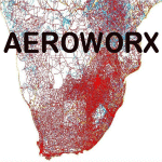
Scenery consist of Updated Terrain Vector data concerning Coastlines, rivers, dams, lakes, streams, roads, traffic, railroads, power lines and extrusion bridges for Southern African countries South of the Equator. Work was done around FAVG (Virginia), FALL (Lydenburg) Airfields and in the areas around Durban, Western Cape and Eastern Cape, With this scenery it is important to install the previous release of "fsxWorx01" and updates 1 to 9 before this file.
| Filename: | Detailed_Terrain_Features_for_Southern_Africa_Upda.zip |
| License: | Freeware |
| Added: | 25th May 2014, 13:07:44 |
| Downloads: | 2,831 |
| Author: | Hannes Steyn, Aeroworx |
| Size: | 4.72 MB |
| Category: Flight Simulator 2004 - Scenery | |
| Julius Nyerere Airport International Airport (HTDA) V4 |
|
Images related to this file:
File Description:
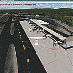
Thanks for downloading Julius Nyerere International Airport (HTDA) Version 4. This is the Largest Airport in Tanzania. The Airport scenery was built from Sketchup, Instant Scenery,tropical trees macros by Gerrish Gray, SBUILDER and ADE. This is version 4, it includes Terminal 1 (Remodeled), Terminal 2, Terminal 3 (expanded), VIP terminal, Fire Station, Radar, Pumping station and Control tower in the correct position. . . Needs RWY12 Object library for objects.
| Filename: | Julius_Nyerere_Airport_International_Airport_HTDA_.zip |
| License: | Freeware |
| Added: | 23rd February 2021, 20:02:54 |
| Downloads: | 758 |
| Author: | EMMANUEL MWANDOSYA |
| Size: | 70.5 MB |
| Category: Flight Simulator X - Scenery | |
| Sacramento Executive Airport (KSAC) VERSION 2 |
|
File Description:
This is Version 2 of Sacramento Executive Airport. This version fixes a random flashing beacon light that was located near the southern fuel station. This beacon appeared with scenery settings of 'dense' or better. This version contains all needed files, and no earlier versions are required. Please be sure to delete your original KSAC scenery files. View Readme file for installation and notes. Compiled using Airport Design Editor.
| Filename: | Sacramento_Executive_Airport_KSAC_VERSION_2.zip |
| License: | Freeware |
| Added: | 29th October 2008, 10:19:39 |
| Downloads: | 827 |
| Author: | Phillip Coyle |
| Size: | 410.56 KB |
| Category: Flight Simulator 2004 - Scenery | |
| Leeuwarden Airbase 'EHLW' V2.0 |
|
File Description:
Detailed and accurate yet framerate friendly scenery for the Leeuwarden Airbase also known as "Fighter town Europe". (ICAO designation EHLW). Leeuwarden is one of the two Main Operating bases (MOB) of the F-16 fleet. It has two F-16 squadrons (322 & 323) and one SAR squadron which flies the AB412SP helicopter. The annual exercises Frisian Flag, DWIC en FWIT are held on this airbase. The following items are changed/new with version 2. Added new ILS for rwy 09/27 (This is ILS installation from Twente AB, which will be closed), including new ILS glide slope antennas for 09/27 and localizer antennas for all runways. Added barrier's to the runways, tuning in the ILS freq will put the cable up at the end of the runway! Upgrade and cleanup of the texture to improve frame rate. Optimalization of macro's to reduce polygon resulting a slightly higher frame rate. Also now included an AFCAD file. Scenery is compatible with default scenery and the NL2000 scenery.
| Filename: | Leeuwarden_Airbase_EHLW_V20.zip |
| License: | Freeware, limited distribution |
| Added: | 15th December 2006, 11:34:59 |
| Downloads: | 4,207 |
| Author: | Marcel Ritzema |
| Size: | 795.71 KB |
| Category: Flight Simulator 2004 - Scenery | |
| HAAB Bole Intl. Airport Addis Ababa Ethiopia |
|
File Description:
Since nobody decided to make HAAB scenery until now, I decided to share my HAAB scenery with you. In fact I've built
it for personal use only, because I was expecting someone who is interested in Addis Ababa Airport to build it, but I didn't
see any thing. The scenery is pretty nice and extremely close to real. You will note 2 new things in the scenery, the first
one is the new pax terminal building and the second one is the new cargo complex. I've assigned rwy 7L\25R for take-off
only and rwy 7R\25L for landing only in order to facilitate air traffic within the airport also to avoid any bug or delay in
departure or arrival time. Bole Airport is the main hub of Ethiopian Airlines, the national airline of Ethiopia, in addition it
is one of the main pilot training and aircraft maintenance centers in Africa. Airport layout designed by using Google
Earth.
| Filename: | HAAB__Bole_Intl_Airport__Addis_Ababa__Ethiopia.zip |
| License: | Freeware |
| Added: | 3rd December 2008, 17:55:08 |
| Downloads: | 8,702 |
| Author: | Nuhaid Abdulkhaleq |
| Size: | 2.35 MB |
| Category: Flight Simulator X - AFCAD Files | |
| Camden County Airport (19N), NJ |
|
File Description:
Located 01 miles SW of Berlin, New Jersey on 75 acres of land, Camden County Airport is a small general aviation airport privately owned by Albion Airport, Inc. The airport can handle small commuter planes (like the Cessna 208B) as well as small GA craft. Tiedowns are available on both the grass turf at the west end of the airport and the tarmac on the east end. Fuel is only available on the tarmac - park next to the fuel trucks. Trees are summer time ONLY.
Scenery constructed with use of Google Maps images/streetview, the author has not been there in person.
This scenery is meant to be used in conjunction with MegaScenery Earth New Jersey/Delaware 004. It is not required, but apron use is minimized to allow satellite scenery to show through as much as possible, and objects are placed based on the MSE textures - lack of it may make scenery look out of place.
| Filename: | Camden_County_Airport_19N_NJ.zip |
| License: | Freeware |
| Added: | 8th October 2010, 14:04:03 |
| Downloads: | 243 |
| Author: | Drew Sikora |
| Size: | 944.87 KB |
| Category: Flight Simulator X - AFCAD Files | |
| Air-List-Ads Airport (JY07), NJ |
|
File Description:
This is a small turf strip 1500x70 feet located near the border of NJ and PA in the northwestern part of the state. It's not officially listed so I don't have any more data than that. No services of any kind are available. Trees are summer ONLY. If you fly VFR around the area, this will at least prevent you from seeing a random-looking grass strip over some trees and half a neighborhood. Runway headings are 11/29
Scenery constructed with use of satellite images/streetview, the author has not been there in person.
This scenery is meant to be used in conjunction with MegaScenery Earth New York 007. It is not required, but apron use is minimized to allow satellite scenery to show through as much as possible, and objects are placed based on the MSE textures - lack of it may make scenery look out of place.
| Filename: | AirListAds_Airport_JY07_NJ.zip |
| License: | Freeware |
| Added: | 16th October 2010, 08:57:57 |
| Downloads: | 182 |
| Author: | Drew Sikora |
| Size: | 283.7 KB |
| Category: Flight Simulator X - AFCAD Files | |
| Old Bridge Airport (3N6), NJ |
|
File Description:
Located 05 miles S of Old Bridge, New Jersey on 120 acres of land, Old Bridge Airport is a public airstrip. Fuel is available by stopping next to the tank north of the parking area. This airport has hangars for transient aircraft - two hangars next to the parking area are open for parking. You can also start in them by selecting one of the DOCK parking options. Immediately adjacent to the airport is Raceway Park, which features a drag strip, road course, dirt bike course, and karting/motoX areas. Trees are summertime ONLY.
Scenery constructed with use of satellite images/streetview, the author has not been there in person.
This scenery is meant to be used in conjunction with MegaScenery Earth New Jersey/Delaware 001. It is not required, but apron use is minimized to allow satellite scenery to show through as much as possible, and objects are placed based on the MSE textures - lack of it may make scenery look out of place.
| Filename: | Old_Bridge_Airport_3N6_NJ.zip |
| License: | Freeware |
| Added: | 22nd November 2010, 18:40:52 |
| Downloads: | 211 |
| Author: | Drew Sikora |
| Size: | 1.61 MB |
| Category: Flight Simulator X - AFCAD Files | |
| Var-Sky Airport (JY08), NJ |
|
File Description:
Located 02 miles E of Woodstown, New Jersey on 38 acres of land, Var-Sky Airport is a private turf strip 1165' in length and a slightly challenging approach with trees closely bordering the sides of both runway ends. This airport has lighting on the runway however there is no beacon and the windsock (located atop the hangar) is not lit. There are no services offered for transient aircraft. There is no hard surfaced runway so having your terrain mesh settings as high as possible is recommended.
Scenery constructed with use of satellite images/streetview/aerial photos - the author has not been there in person.
This scenery is meant to be used in conjunction with MegaScenery Earth New Jersey/Delaware 004. It is not required, but apron use is minimized to allow satellite scenery to show through as much as possible, and objects are placed based on the MSE textures - lack of it may make scenery look out of place.
| Filename: | VarSky_Airport_JY08_NJ.zip |
| License: | Freeware |
| Added: | 19th April 2011, 06:21:50 |
| Downloads: | 195 |
| Author: | Drew Sikora |
| Size: | 361.96 KB |
| Category: Flight Simulator X - AFCAD Files | |
| Malone Airport (NJ61), NJ |
|
File Description:
Located 02 miles E of Frenchtown, New Jersey on 45 acres of land, Malone is a private airport with two turf strips, the longest of which is 2400' in length. There are no services offered, although there is room next to the existing planes to park if you wish - collisions are disabled with the aircraft. Both runways have their hard surfaces removed so turn your mesh settings as high as possible. Both runways slope down from the hangar/house area. Airport is unlit and daytime VFR operations only are recommended.
Scenery constructed with use of satellite images/streetview/aerial photos - the author has not been there in person.
This scenery is meant to be used in conjunction with MegaScenery Earth New York 007. It is not required, but apron use is minimized to allow satellite scenery to show through as much as possible, and objects are placed based on the MSE textures - lack of it may make scenery look out of place.
| Filename: | Malone_Airport_NJ61_NJ.zip |
| License: | Freeware |
| Added: | 20th September 2011, 13:57:18 |
| Downloads: | 284 |
| Author: | Drew Sikora |
| Size: | 958.34 KB |


© 2001-2026 AVSIM Online
All Rights Reserved
Privacy Policy |