
Where Flight Simulation Enthusiasts Gather from Around the World!
AVSIM Library - Search Results

| Category: Flight Simulator X - Scenery | |
| 2016 Kigali Intl (HRYR) Rwanda |

|
Images related to this file:
File Description:
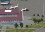
This sequel to the 2009 Kigali Intl (HRYR) Rwanda scenery (by Jacques Botha and Frits Beyer) brings it up to date with the current layout and enables full compliance with FTX Global/Vector and FSX. Buildings are added and adjusted to their real-world locations, and the new taxiway and south apron are added according to the May 2016 satellite imagery. In addition to real-world gate locations, custom apron markings are added along with apron lighting. The landclass around Kigali is also updated, and SRTMGL1 (30m) mesh is included. This scenery can be complemented by the Goma (FZNA) and Gisenyi (HRYG) scenery (FSX_FZNA-HRYG_CS.zip), and GA flightplans are included to supplement the commercial traffic at Kigali and provide more activity at FZNA and HRYG.
Updates were created or rebuilt in a manner which carefully aligns airport data with current satellite imagery. Scenery was created using Airport Design Editor X v1.70.6042, SBuilderX 3.13, and the FSX Object Placement Tool. Scenery objects were added and modified from stock FSX scenery to resemble as closely as possible the actual airports. The FSX apron lights included are from the set created by Jim Dhaenens.
| Filename: | 2016_Kigali_Intl_HRYR_Rwanda.zip |
| License: | Freeware |
| Added: | 4th August 2016, 21:10:09 |
| Downloads: | 3,382 |
| Author: | Carlyle Sharpe, Jacques Botha, and Frits Beyer |
| Size: | 17.12 MB |
| Category: Flight Simulator 2004 - AFCAD Files | |
| Simflyers Washington Dulles (KIAD) with Active Crosswind Runway |
|
File Description:
A high spec AFCAD2 for the 'Simflyers' Washigton Dulles (KIAD) scenery. This is the first and only AFCAD2 available at Avsim for this scenery and has been built from scratch. Using the Crosswind runway technique, Runway 12/30 is now open for use at the same time as the 01R/19L and 01L/19R runways. A tower view is now available at the airport. All taxiways and gates/ramps are named and match the scenery. All gates and cargo ramps feature airline assignments. All concourses are represented to be as near real as possible. Concourse 'G' (United Express) does not exist on this scenery (it was not built when simflyers released the scenery), so ive placed 23 gates for United Express on the holding area, just to the south of the real life location of this concourse (see the screenshots). An extensive GA Apron is also provided. All traffic flows smoothly and this afcad will certainly bring the airport to life.
| Filename: | Simflyers_Washington_Dulles_KIAD_with_Active_Cross.zip |
| License: | Freeware, limited distribution |
| Added: | 10th July 2005, 20:47:27 |
| Downloads: | 2,459 |
| Author: | Lee Brompton |
| Size: | 1.26 MB |
| Category: Flight Simulator 2004 - Scenery | |
| SWUY Coari/Urucu, Brazil |
|
File Description:
Googly scenery for SWUY Coari/Urucu, Brazil, a small domestic airport
located near Brazil's largest inshore gas source and serving the city
of Coari (some distance away), one of the largest cities in the Amazonas
state. The airport is served about four times daily by ATR aircraft of
Total Linhas Aereas on domestic flights, plus general aviation traffic.
Flight Simulator 2004 has made no provision for traffic with only a runway
provided and this scenery seeks to redress the situation.
The scenery does not purport to be ultra-accurate. Based on high quality
satellite imagery from Google Earth, the layout is proportionally correct but the
added airport features, such as buildings, are built from default Microsoft objects
and add-on libraries so will not look exactly like the real thing.
You are not obliged to download and install any additional scenery libraries,
but to enjoy this scenery in its entirety, you may wish to. It will work fine,
with or without.
| Filename: | SWUY_CoariUrucu_Brazil.zip |
| License: | Freeware |
| Added: | 16th April 2008, 19:26:04 |
| Downloads: | 1,206 |
| Author: | John Hinson |
| Size: | 61.58 KB |
| Category: Flight Simulator 2004 - Scenery | |
| NTGK Kaukura, French Polynesia |
|
File Description:
Googly scenery for NTGK Kaukura, a small airport on Motu Panao island of Kaukura
atoll, part of the Tuamotu group in French Polynesia. The airport, opened in 1994,
is served just a couple of times per week by ATR turboprop aircraft of Air Tahiti.
Flight Simulator 2004 has only provided a runway at this airport and this scenery
seeks to redress the situation so that you and your "AI" traffic can use the
airport.
The scenery does not purport to be ultra-accurate. Based on high quality
satellite imagery from Google Earth, the layout is proportionally correct but the
added airport features, such as buildings, are built from default Microsoft objects
and add-on libraries so will not look exactly like the real thing.
You are not obliged to download and install any additional scenery libraries,
but to enjoy this scenery in its entirety, you may wish to. It will work fine,
with or without.
| Filename: | NTGK_Kaukura_French_Polynesia.zip |
| License: | Freeware |
| Added: | 19th April 2008, 20:34:24 |
| Downloads: | 1,572 |
| Author: | John Hinson |
| Size: | 70.52 KB |
| Category: Flight Simulator 2004 - Scenery | |
| Turangi Airfield, New Zealand. NZTN. Version-2 UPDATE and FIX. |
|
File Description:
Welcome to Turangi Airfield, 1nm North of the township of Turangi, at the southern end of the
beautiful Lake Taupo, in the central North Island of New Zealand.
The airfield is home to the Turangi Aero Club, and is served by Mountain Air, undertaking tourist flights
around the National Park and central North Island volcanoes, and flights to the Chateau and skifields
at Mount Ruapehu.
This scenery is built to fit into the freeware "Turangi" photoreal area scenery by Robin Corn, freely available
from avsim.com, filename...... godzoneturangi.zip .
This version corrects an error i made in the first scenery, when i accidentally mixed some pictures of another airfield
in with the Turangi pictures i was using for building. It corrects the type of buildings, and their locations on the airfield.
Update also adds a few other detail changes and additions.
This is a TOTAL replacement for my previous scenery. Requires some EZ Scenery Object Sets (see INSTALL instructions for details).
| Filename: | Turangi_Airfield_New_Zealand__NZTN__Version2_UPDAT.zip |
| License: | Freeware, limited distribution |
| Added: | 13th November 2008, 12:52:09 |
| Downloads: | 733 |
| Author: | Lawrie Roache |
| Size: | 549.77 KB |
| Category: Flight Simulator 2004 - Scenery | |
| VAUD Udaipur/Dabok, India |
|
Images related to this file:
File Description:
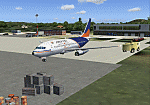
Googly scenery for VAUD Udaipur/Dabok, (also sometimes referred to as VAID) a small domestic airport in
India served by about six flights a day by jets and propeller aircraft from
airlines such as Alliance Air, Jagson Airlines and Jet Airways. These
scenery files improve/add aprons, taxiways, buildings and other airport
features to Flight Simulator's basic representation.
The scenery does not purport to be ultra-accurate. Based on high-detail satellite
imagery from Google Earth, the layout is proportionally correct but the added
[File re-uploaded at request of AVSIM]
airport features, such as buildings, are built from default Microsoft objects
and add-on libraries so will not look exactly like the real thing.
You are not obliged to download and install any additional scenery libraries,
but to enjoy this scenery in its entirety, you may wish to. It will work fine,
with or without.
[File re-uploaded at request of AVSIM]
| Filename: | VAUD__UdaipurDabok_India.zip |
| License: | Freeware |
| Added: | 23rd May 2010, 01:22:29 |
| Downloads: | 1,424 |
| Author: | John Hinson |
| Size: | 67.47 KB |
| Category: Flight Simulator 2004 - Scenery | |
| OPGD Gwadar International, Pakistan |
|
Images related to this file:
File Description:
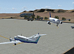
Googly scenery for OPGD Gwadar International, Pakistan. In Flight Simulator
2004 only general aviation parking is provided at this so-called international airport but in the real world it is served two or three times a day by Airbii of Airblue and ATRs of Pakistan International Airways. These scenery files improve or add
aprons, taxiways, buildings and other airport features to Flight Simulator's limited
representation and allow "AI" traffic to land, taxi, park and take off in a realistic
manner.
The scenery does not purport to be ultra-accurate. Based on high-detail satellite
imagery from Google Earth, the layout is proportionally correct but the added
airport features, such as buildings, are built from default Microsoft objects
and add-on libraries so will not look like the real thing.
You are not obliged to download and install any additional scenery libraries,
but to enjoy this scenery in its entirety, you may wish to. It will work fine,
with or without.
[File re-uploaded at request of AVSIM]
| Filename: | OPGD_Gwadar_International_Pakistan.zip |
| License: | Freeware |
| Added: | 23rd May 2010, 01:26:15 |
| Downloads: | 1,065 |
| Author: | John Hinson |
| Size: | 58.09 KB |
| Category: Flight Simulator 2004 - Scenery | |
| OPGD Gwadar International, Pakistan |
|
Images related to this file:
File Description:
Googly scenery for OPGD Gwadar International, Pakistan. In Flight Simulator
2004 only general aviation parking is provided at this so-called international airport but in the real world it is served two or three times a day by Airbii of Airblue and ATRs of Pakistan International Airways. These scenery files improve or add
aprons, taxiways, buildings and other airport features to Flight Simulator's limited
representation and allow "AI" traffic to land, taxi, park and take off in a realistic
manner.
The scenery does not purport to be ultra-accurate. Based on high-detail satellite
imagery from Google Earth, the layout is proportionally correct but the added
airport features, such as buildings, are built from default Microsoft objects
and add-on libraries so will not look like the real thing.
You are not obliged to download and install any additional scenery libraries,
but to enjoy this scenery in its entirety, you may wish to. It will work fine,
with or without.
[File re-uploaded at request of AVSIM]
| Filename: | OPGD_Gwadar_International_Pakistan.zip |
| License: | Freeware |
| Added: | 15th May 2010, 23:51:51 |
| Downloads: | 170 |
| Author: | John Hinson |
| Size: | 58.09 KB |
| Category: Flight Simulator 2004 - Scenery | |
| LTBM Isparta, Turkey |
|
Images related to this file:
File Description:
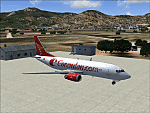
Googly scenery for LTBM Isparta, Turkey - a small airport for which nothing more than a runway has been provided in Flight Simulator 2004. These scenery files add the apron, taxiways, buildings and other airport features so that you and your "AI" traffic can land, taxi, park and take off in a realistic manner.
The airport appears to used mainly for occasional tourism flights, particularly traffic to and from Iran.
The scenery does not purport to be ultra-accurate. Based on high-detail satellite imagery from Google Earth, the layout is proportionally correct but the added airport features, such as buildings, are built from default Microsoft objects and add-on libraries so will not look like the real thing.
You are not obliged to download and install any additional scenery libraries, but to enjoy this scenery in its entirety, you may wish to. It will work fine, with or without.
[File re-uploaded at request of AVSIM]
| Filename: | LTBM_Isparta_Turkey.zip |
| License: | Freeware |
| Added: | 26th June 2010, 13:53:59 |
| Downloads: | 1,558 |
| Author: | John Hinson |
| Size: | 88.64 KB |
| Category: Flight Simulator 2004 - Scenery | |
| WRRB Bima/Mohammad Salahuddin, Indonesia |
|
Images related to this file:
File Description:
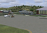
Googly scenery for WRRB Bima/Mohammad Salahuddin, Indonesia. In Flight Simulator
2004 little is provided other than a runway at this small domestic airport,
although in the real world it sees regular local flights from airlines
such as Merpati Nusentara and Pelita Air Service. These scenery files add aprons,
taxiways, buildings and other airport features to Flight Simulator's limited
representation and allow "AI" traffic to land, taxi, park and take off in a
realistic manner.
The scenery does not purport to be ultra-accurate. Based on high-detail satellite
imagery from Google Earth, the layout is proportionally correct but the added
airport features, such as buildings, are built from default Microsoft objects
and add-on libraries so will not look exactly like the real thing.
You are not obliged to download and install any additional scenery libraries,
but to enjoy this scenery in its entirety, you may wish to. It will work fine,
with or without.
[File re-uploaded at request of AVSIM]
| Filename: | WRRB_BimaMohammad_Salahuddin_Indonesia.zip |
| License: | Freeware |
| Added: | 15th June 2010, 01:03:28 |
| Downloads: | 1,931 |
| Author: | John Hinson |
| Size: | 65.89 KB |


© 2001-2026 AVSIM Online
All Rights Reserved
Privacy Policy |