
Where Flight Simulation Enthusiasts Gather from Around the World!
AVSIM Library - Search Results

| Category: Flight Simulator 2004 - Scenery | |
| The Real VCBI - Bandaranayaike International Airport Scenery |

|
File Description:
This is the complete & high detailed scenery of Bandaranayaike International Airport, Katunayaka,Sri Lanka, for Microsoft® Flight Simulator 2004. If you are a Sri Lankan flightsimmer or like to fly around Sri Lanka in Flight Simulator 2004, then this is a must for you!. Since this is a BIG download, you can watch following trailer video on Youtube before downloading. http://www.youtube.com/watch?v=BdZV9nc-WRM
| Filename: | The_Real_VCBI__Bandaranayaike_International_Airpor.zip |
| License: | Freeware, limited distribution |
| Added: | 27th February 2009, 18:59:43 |
| Downloads: | 3,700 |
| Author: | Gayan Liyanaarachchi |
| Size: | 40.25 MB |
| Category: Flight Simulator X - Scenery | |
| FSX Scenery ZWKL Korla Licheng Airport China |
|
Images related to this file:
File Description:
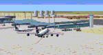
A flight sim colleague requested this airport as there is no ZWKL in the default FSX setup, nor are there any free 3rd party offerings on the major websites. This is my first attempt at an Asian airport and it is "built from scratch", so there are known issues.
ZWKL Korla Licheng Airport serves the city of Korla in Xinjiang autonomous region of the People's Republic of China.
The airport features custom made hangars, buildings, and terminal, some with interiors and transparent glass for night lighting.
Some previous scenery files required.
By Dan French.
| Filename: | FSX_Scenery_ZWKL_Korla_Licheng_Airport_China.zip |
| License: | Freeware, limited distribution |
| Added: | 13th June 2023, 00:27:35 |
| Downloads: | 176 |
| Author: | Dan French |
| Size: | 1.16 MB |
| Category: Flight Simulator 2004 - Scenery | |
| Alaska Scenery Ellamar IZ9 and Tatitlek 7KA |
|
File Description:
2 small sceneries made using Lago's FS Enhancer 2004 (best if used with FSGenesis Alaska-Yukon mesh or some objects may be floating or sunk in terrain).
These are sceneries for two very close spots in Alaska ... They are Ellamar (IZ9), a floatplane dock and scattered houses and Tatitlek (7KA), a small gravel strip with more scattered houses.
| Filename: | Alaska_Scenery_Ellamar_IZ9_and_Tatitlek_7KA.zip |
| License: | Freeware |
| Added: | 6th July 2004, 22:46:45 |
| Downloads: | 1,742 |
| Author: | David King |
| Size: | 60.22 KB |
| Category: Flight Simulator 2004 - Scenery | |
| Phoenix, Arizona 30 Meter Terrain Mesh Scenery |
|
File Description:
Mesh Scenery for Microsoft Flight Simulator 2004 and 2002.USGS NED 30 meter (1 arc-second), resampled to LOD10 (38.2 meters). This terrain mesh is centered at Phoenix, Arizona. Coverage area: From about West 111° to West 113° and North 33° to North 34°.
| Filename: | Phoenix_Arizona_30_Meter_Terrain_Mesh_Scenery.zip |
| License: | Freeware |
| Added: | 3rd January 2004, 19:53:36 |
| Downloads: | 3,719 |
| Author: | Phil Cruikshank |
| Size: | 4.66 MB |
| Category: Flight Simulator 2004 - Scenery | |
| San Jose, Costa Rica Scenery Add-on |
|
File Description:
This adds: the toll road, some restaurants (Rostipollos, La Candela...), some hotels, some malls, and some buildings near MROC to make more realism (for rwy 25 APP vey nice!!!). Please read the text file fot the requirements (IMPORTANT). Good luck.
| Filename: | San_Jose_Costa_Rica_Scenery_Addon.zip |
| License: | Freeware, limited distribution |
| Added: | 24th March 2008, 00:59:21 |
| Downloads: | 3,039 |
| Author: | Robert Gonzales |
| Size: | 2.34 KB |
| Category: Flight Simulator 2004 - Scenery | |
| Kremmling, Mc Elroy (20V), Colorado, Photo-Scenery |
|
Images related to this file:
File Description:

Kremmling, Mc Elroy (20V), Colorado, Photo-Scenery (FS9 & FSX)
Ever wanted to know how the scenery looks like around Kremmling VOR? Now you got the chance! This region covers the area around Kremmling and the northern part of the Gore Range. At Kremmling the Colorado River meets both the Blue River and the Muddy Creek. West of Kremmling you can see Gore Canyon. This rugged and steep canyon is almost 1000ft deep and was carved by the Colorado River on its way thru the Gore Range.
To explore the scenery depart from Mc Elroy Airfield (20V) in Kremmling and head north. High resolution versions of this scenery for FS9 and FSX (much sharper, but larger and multiple downloads) are available at www.blueskyscenery.com/GNB_West.html . The screenies are taken from the high-res versions, so expect this version to be slightly more blurry. Thanks to Joop Mak for providing custom AFCADs that correct airport layouts so that they align with the photo-textures! They are available at www.blueskyscenery.com/AFCADs.html . YourDonation@Work: Dedicated to Michael.
| Filename: | Kremmling_Mc_Elroy_20V_Colorado_PhotoScenery.zip |
| License: | Freeware, limited distribution |
| Added: | 21st April 2010, 17:39:09 |
| Downloads: | 1,141 |
| Author: | Gottfried Razek, blueskyscenery.com |
| Size: | 91.2 MB |
| Category: Flight Simulator 2004 - Scenery Design | |
| Miscelleanous Objects for EZ-Scenery Vol. 4 |
|
File Description:
30's style objects: 14-story Skyscraper w/ night lighting, Terminal w/ night lighting, Radio Tower w/ night static light, 2 Look Out Towers w/ night lighting, 2 Elevated Buildings w/ night lighting. Contemporary objects: 2 Satellite Dishs, Simple Cemetery Cross. Library bgl, txt files, DXT1 textures and ID pics included.
| Filename: | Miscelleanous_Objects_for_EZScenery_Vol_4.zip |
| License: | Freeware |
| Added: | 20th February 2006, 06:45:22 |
| Downloads: | 4,975 |
| Author: | Lou Frost |
| Size: | 1.17 MB |
| Category: Flight Simulator 2004 - Scenery | |
| IONE, Washington - S23 - Airport and adjacent scenery |
|
Images related to this file:
File Description:
Ione is a small airport close to the Washington-Canadian border, about 60 nm North of KSFF (Felts). The ICAO code S23. It now has NDB and VOR; frequencies for these are NDB- 379, VOR-113.20. This airport is an enhanced version of the default S23. It handles small AC only. This is for FS9.
This project started out as an enhancement for my ski-patrol bro who lives in Ione and grew into a major project. This project has four, basic major parts -
1. the airport itself.
2. back road area with a few farm houses, gas station and church.
3. small town - courtesy of Opa Marshall who spent much time with me on suggestions and guidance.
4. Camp ground area.
We hope you will enjoy this work. Readme file has contact info and airport ID of some close by airports. Bob
| Filename: | IONE_Washington__S23__Airport_and_adjacent_scenery.zip |
| License: | Freeware |
| Added: | 2nd February 2010, 10:19:49 |
| Downloads: | 1,333 |
| Author: | Robert Lacy & David "Opa" Marshall |
| Size: | 2.06 MB |
| Category: Flight Simulator X - Scenery Design | |
| Make Scenery with the Object Placement Tool |
|
Images related to this file:
File Description:
The Deluxe version of Flight Simulator X contains a very easy-to-use tool for placing scenery objects visually within the game. Unfortunately, the Microsoft developers neglected to tell anybody.
This document contains an illustrated explanation of this tool and how to use it.
My most sincere apologies - I am unable, for lack of free time, to offer support of any kind. For questions or problems, please post in the Avsim scenery design forum.
| Filename: | Make_Scenery_with_the_Object_Placement_Tool.zip |
| License: | Freeware |
| Added: | 22nd November 2009, 18:03:12 |
| Downloads: | 6,981 |
| Author: | Luis Feliz-Tirado |
| Size: | 672.71 KB |
| Category: Flight Simulator 2004 - Scenery | |
| Colorado Springs South (KCOS), Colorado, Photo-Scenery |
|
Images related to this file:
File Description:
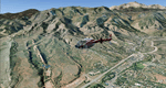
Colorado Springs South (KCOS), Colorado, Photo-Scenery (FS9 & FSX)
This region covers the area of Colorado Springs. Just west of the city you can fly around Pikes Peak. At 14.115ft it is the easternmost of Colorado's 54 fourteeners. Northwest of the city lies the Garden Of Gods with its many vertical rock formations. They are made of sedimentary beds red and white sandstones, conclomerates and limestone that were deposited horizontally but have been tilted vertically and faulted by the immense mountain building forces caused by the uplift of the Pikes Peak massiv. Deep within Chayenne Mountain is the North American Aerospace Defense Command's (NORAD) main technical facility which collects and evaluates data from a worldwide system of satellites, radars and other sensors.
High resolution versions of this scenery for FS9 and FSX (much sharper, but larger and multiple downloads) are available at www.blueskyscenery.com/GNB_South3East.html . The screenies are taken from the high-res versions, so expect this version to be slightly more blurry. YourDonation@Work: Dedicated to Veit and Hector.
| Filename: | Colorado_Springs_South_KCOS_Colorado_PhotoScenery.zip |
| License: | Freeware, limited distribution |
| Added: | 5th February 2010, 16:30:42 |
| Downloads: | 1,982 |
| Author: | Gottfried Razek, blueskyscenery.com |
| Size: | 95.63 MB |


© 2001-2026 AVSIM Online
All Rights Reserved
Privacy Policy |