
Where Flight Simulation Enthusiasts Gather from Around the World!
AVSIM Library - Search Results

| Category: Flight Simulator 2004 - Scenery | |
| Project México Real LOD10 File 11 of 11 |

|
File Description:
File 11th of 11 of a Terrain Mesh that covers the entirety of Mexican Territory and related bordering U.S., Guatemala and Belice areas, part of the "Proyecto México Real" project, compiled at LOD10 (1.24 arcseconds in latitude and 1.65 arcseconds in longitude) resolution from INEGI data. Intended to enhance the virtual flying experience complementing the LOD8 and LOD9 versions compiled from the same data. Compatible backwards with Flight Simulator 2000, Flight Simulator 2002 and Combat Flight Simulator 2. Refer to the file contents about the cover area to this compressed file.
| Filename: | Project_Mxico_Real_LOD10_File_11_of_11.zip |
| License: | Check within download |
| Added: | 6th June 2006, 01:52:33 |
| Downloads: | 3,095 |
| Author: | Juan José Galván Bautista |
| Size: | 69.98 MB |
| Category: Flight Simulator 2004 - Scenery | |
| JRM Bahamas EZ Scenery Part #3 |
|
File Description:
FS2004 JRM Bahamas EZ Scenery Part #3
FS9+ EZ scenery Eleutheria Island JRM_Bhm3.zip (see JRM_bhm1.zip & JRM_bhm2.zip) This scenery utilizes FS Global Terrain Mesh and GroundEnv-1. All objects are available by download linked inside. Requires LAGO registered with updates. Completes Eleutheria & Cat Islands.Payware expected detail in which you can even motorcar on sightseeing trips stopping and watching all the eye candy. This scenery completes Eleutheria & Cat Island Bahamas FS9 & FSX only. My best yet and more to come! jimmy R martin [email protected] John 3:16
| Filename: | JRM_Bahamas_EZ_Scenery_Part_3.zip |
| License: | Freeware |
| Added: | 25th March 2006, 03:42:23 |
| Downloads: | 943 |
| Author: | jimmy R martin |
| Size: | 468.29 KB |
| Category: Flight Simulator 2004 - Scenery | |
| Stade-Agathenburg (EDHS) |
|
File Description:
Scenery Add-on of Stade-Agathenburg/North Germany/Lower Saxony. This Scenery is not really new; it is originally for fs2000. Ascension Day 2001 when there was a meeting of several aeroclubs and there was much traffic though I know there is not normally so many airplanes on normal days. A crowded airport looks much better. If you have a former version you only need to exchange the scenery folder and intall the af2.bgl. Some flusi-friends told me about mesh problems so I decided to make the ground new with the freeware Afcad.
| Filename: | StadeAgathenburg_EDHS.zip |
| License: | Freeware |
| Added: | 28th February 2006, 01:02:11 |
| Downloads: | 1,568 |
| Author: | Uwe Schweitzer |
| Size: | 1.63 MB |
| Category: Flight Simulator 2004 - Scenery | |
| Hauraki Gulf |
|
File Description:
This replaces all my previous Pakatoa Island and Hauraki Gulf sceneries.
An ongoing project - maybe more to come.
You must have Christian Stock's NZ mesh in the form of "Mountains of New Zealand" and topo in the form of "Lakes and Rivers of New Zealand".
Pakatoa Island: A few houses plus a jetty with parking for float planes.
Waiheke Island: Floatplane parking and a ferry terminal at Matiatia Beach. Jetty at Orapiu.
Kawau Island: Jetty at Mansion House Bay..including the Mansion House.
Auckland: Ferry Terminal.
Also included...Afcads for Floatplane and ferry boat parking.
| Filename: | Hauraki_Gulf.zip |
| License: | Freeware |
| Added: | 21st October 2008, 08:47:41 |
| Downloads: | 390 |
| Author: | Godfrey Tier |
| Size: | 4.81 MB |
| Category: Flight Simulator 2002 - Utilities | |
| Ground2K V3.0 |
|
File Description:
Ground2K V3.0
Full installation, compatible with previous versions.
Old Ground2k users : uninstall previous release and install the new one in the same folder.
Installation : unzip in a temporary folder, run Setup.exe
Modification/additions (see green words in the guide)
- Right screen location for landclass et waterclass
- Possible displaying of landclass/waterclass textures
- Save and re-use the characteristics of a poly/line
- Coastlines : add altitude for generated water polygons
- Re-mesh : add meter/feet option
- Reference point coordinates : allowed modifications
- Lines : car night lights option
- Example of new line type + bitmap
| Filename: | Ground2K_V30.zip |
| License: | Freeware |
| Added: | 9th April 2003, 15:56:12 |
| Downloads: | 3,080 |
| Author: | Christian Fumey |
| Size: | 4.33 MB |
| Category: Flight Simulator 2004 - Scenery | |
| Project Mexico Real LOD10 File 10 of 11 |
|
Images related to this file:
File Description:
Re-upload. File 10th of 11 of a Terrain Mesh that covers the entirety of Mexican Territory and related bordering U.S., Guatemala and Belice areas, part of the "Proyecto Mexico Real" project, compiled at LOD10 (1.24 arcseconds in latitude and 1.65 arcseconds in longitude) resolution from INEGI data. Intended to enhance the virtual flying experience complementing the LOD8 and LOD9 versions compiled from the same data. Compatible backwards with Flight Simulator 2000, Flight Simulator 2002 and Combat Flight Simulator 2. Refer to the file contents about the cover area to this compressed file.
| Filename: | Project_Mexico_Real_LOD10_File_10_of_11.zip |
| License: | Check within download |
| Added: | 5th September 2010, 20:55:05 |
| Downloads: | 3,060 |
| Author: | Juan Jose Galvan Bautista |
| Size: | 70.54 MB |
| Category: Flight Simulator X - Scenery | |
| British Columbia Floatbases |
|
Images related to this file:
File Description:
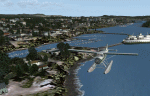
This is a collection of floatbases around the coast of British Columbia made with default scenery objects, and derived from Google Earth and the Canada Waterdrome Supplement. This scenery is designed to complement the work of others and therefore doesn't include waterdromes made by others such as Sidney Schwartz's CYYJ, Ganges Harbour and BCPNW Float Bases which covers an area around the Gulf Islands. You must have Ultimate Terrain Canada for these sceneries to work and in areas away from the immediate coast (Fraser River), a SRTM mesh for the correct elevations.
| Filename: | British_Columbia_Floatbases.zip |
| License: | Freeware |
| Added: | 16th May 2012, 14:02:09 |
| Downloads: | 1,538 |
| Author: | Chris Peschke |
| Size: | 183.32 KB |
| Category: Flight Simulator 2004 - Scenery | |
| Project Mexico Real LOD10 File 3 of 11 |
|
Images related to this file:
File Description:
Re-upload. File 3rd of 11 of a Terrain Mesh that covers the entirety of Mexican Territory and related bordering U.S., Guatemala and Belice areas, part of the "Proyecto Mexico Real" project, compiled at LOD10 (1.24 arcseconds in latitude and 1.65 arcseconds in longitude) resolution from INEGI data. Intended to enhance the virtual flying experience complementing the LOD8 and LOD9 versions compiled from the same data. Compatible backwards with Flight Simulator 2000, Flight Simulator 2002 and Combat Flight Simulator 2. Refer to the file contents about the cover area to this compressed file.
| Filename: | Project_Mexico_Real_LOD10_File_3_of_11.zip |
| License: | Check within download |
| Added: | 8th June 2010, 03:17:03 |
| Downloads: | 3,253 |
| Author: | Juan Jose Galvan Bautista |
| Size: | 73.67 MB |
| Category: Flight Simulator 2004 - Scenery | |
| Alta circling approach |
|
File Description:
The old circling approach for runway 30 at Alta, Norway (ENAT) is a challenging approach. I don't think it is used anymore, but it was still in use during the 1980:s and perhaps even into the 1990:s when SAS flew DC-9 i northern Norway. During the approach you fly a circle, following lights in the terrain and keeping track of the altitude. Included in this zip-archive are the bgl-files for the lights and the old approach plates for Alta. Recommended additional installations are Norway airports and Norway Mesh.
Happy flying!
| Filename: | Alta_circling_approach.zip |
| License: | Freeware |
| Added: | 20th May 2010, 02:48:06 |
| Downloads: | 438 |
| Author: | Krister Renard |
| Size: | 328.64 KB |
| Category: Flight Simulator 2004 - Scenery | |
| Cessnock and Hidden Valley Farm, NSW, AUSTRALIA. |
|
File Description:
CESSNOCK just a short 25 minute flight from Sydney. Cessnock
was once the center of a large coal mining industry, is now
one of the main jumping off points for the wine growing district
of the Hunter Valley. HIDDEN VALLY FARM is your destination
for that "rural" type getaway. The grass strip will accomodate
single and twin engined aircraft. If your really good, try the Lear.
Directions to the farm at Cessnock and Warnervale (warn2004.zip) airports.
For use with or without SATPAC mesh scenery.
Textured required are Airport 2.6, VOD, Nova and Nova Gold.
| Filename: | Cessnock_and_Hidden_Valley_Farm_NSW_AUSTRALIA.zip |
| License: | Freeware |
| Added: | 4th June 2004, 14:03:01 |
| Downloads: | 2,053 |
| Author: | Clive Marriott |
| Size: | 3.34 MB |


© 2001-2026 AVSIM Online
All Rights Reserved
Privacy Policy |