
Where Flight Simulation Enthusiasts Gather from Around the World!
AVSIM Library - Search Results

| Category: Flight Simulator 2004 - Scenery | |
| US North Cascades Mountains and Northwest Washington Coast |

|
File Description:
The files in this package completely replace the FS default landscape of the North Cascades Mountains and coastal areas of northwestern Washington State. Between Bellingham and Arlington (N-S), Orcas Island and Lake Chelan (W-E) you can now enjoy your VFR flights with accurate locations of coastlines, lakes, rivers, streams, roads, railroads, and power lines, as well as land use type (landclass) and terrain (add-on mesh). Also added are the larger glaciers of the majestic North Cascades volcanoes and peaks as well as several forestry roads and clearcuts outside the National Park and Wilderness areas. Made mostly with Christian Fumey's "Ground2K4" and Jim Keir's "Slartibartfast". Fully compatible with the recent freeware LOD10 add-on meshes of the western US. Mesh and landclass files will work in FS2002 but not the special scenery enhancements.
| Filename: | US_North_Cascades_Mountains_and_Northwest_Washingt.zip |
| License: | Freeware, limited distribution |
| Added: | 18th May 2004, 23:12:57 |
| Downloads: | 14,321 |
| Author: | Holger Sandmann |
| Size: | 12.72 MB |
| Category: Flight Simulator X - Scenery | |
| Yeu island - LFEY |
|
Images related to this file:
File Description:
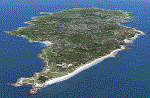
The island of Yeu (LFEY) is located in the west of France, in the south-west of Nantes. Its main runway is located on the wild coast, near the great lighthouse.
It is made up of :
- A new mesh based ASTER compiled in LOD11 and a very local mesh for the airport, compiled in LOD13 to get a good compatibility with the specific payware meshes.
- Photorealistic texture at 0.5 m/pixel based on aerial photography.
- The airfield and runway. The runway is flat, allowing to preserve the AI traffic. The grass strip is modeled with its relief. There is therefore no AI traffic on the grass strip.
- The port of Port-Joinville and several notable buildings made with Gmax (churches, chapel, castle, fort, ruins, beacons, etc)
- Generic or custom objects created with Gmax (boats, buildings).
| Filename: | Yeu_island__LFEY.zip |
| License: | Freeware |
| Added: | 29th December 2012, 04:03:47 |
| Downloads: | 1,720 |
| Author: | marc guitteny |
| Size: | 217.78 MB |
| Category: Flight Simulator 2004 - Scenery | |
| Glacier Bay National Park, Alaska |
|
File Description:
Add-on meshes can greatly improve the detail of the FS terrain but often conflict with the inaccurate placement of the other default FS landscape elements, particularly in coastal and mountainous areas. This project showcases new methods and software that allow for semi-automated development of FS landscapes from accurate source data. The files completely replace the default FS landscape of Southeast Alaska's Glacier Bay National Park and the adjacent Lynn Canal area between Juneau and Skagway (N58-60 W134-138), including shorelines, islands, and lakes, as well as glaciers, landclass, man-made features, and a LOD9 (76-m) terrain mesh. Optional AI floatplane traffic at four seaplane bases is included. A LOD10 (38-m) mesh of the same area is available as a separate optional download. FS2002 users please use fs8glbay.zip instead.
| Filename: | Glacier_Bay_National_Park_Alaska.zip |
| License: | Freeware, limited distribution |
| Added: | 16th February 2004, 03:40:31 |
| Downloads: | 17,196 |
| Author: | Holger Sandmann, Jim Keir |
| Size: | 10.43 MB |
| Category: Flight Simulator 2002 - Scenery | |
| Alaska Bush Scenery: Coghill Lake |
|
File Description:
Situated off College Fiord at the upper end of Prince William Sound, Coghill Lake is conveniently positioned for stopping off en-route between the Anchorage & Valdez areas. It's the actual location of a holiday cabin owned by the US Forest Service which can only be reached by floatplane, however I've added 2 airstrips to the area for extra interest. Coghill's main landing strip is sandy & partially overgrown, but has a good available length of 635m/2100' and some low-intensity edge lights. Ample parking for visitors is provided in a separate ramp area amongst the trees, reached via a basic but lit & signposted taxiway. Adjacent access by floatplane is possible using the small lagoon, as well as by College Fiord itself for larger loads. The other strip, a mile southwest across the river, only gets seasonal use by agricultural aircraft for spraying the local conifer plantations; its narrow gravel runway is slightly shorter at 588m/1930' & is a more challenging proposition with the surrounding trees and heavy brush all encroaching on the landing strip. Includes 2 versions: 1 for Eddie Denney's FS2002 mesh (recommended as this makes the airstrip profiles uneven), and another for both Eddie Denney's FS2000 mesh and the default mesh.
| Filename: | Alaska_Bush_Scenery_Coghill_Lake.zip |
| License: | Freeware, limited distribution |
| Added: | 28th May 2003, 19:07:22 |
| Downloads: | 1,933 |
| Author: | James Belk |
| Size: | 2.98 MB |
| Category: Prepar3D V5 - Scenery | |
| CVX_ETM12m HPX for ANGOLA vers. 2.0 |
|
Images related to this file:
File Description:
Hydro Polys for lakes and river and coastline.It is imperative to have already installed the ETM12m v2 AO - Enhanced Terrain Mesh 12m v2 for ANGOLA vol.01/02/03/04/05/06/07/08/09/10/11/12. This is a work in progress. This release replace and delete the previous version 1.40 (Please remove it before install new version) .
| Filename: | CVX_ETM12m_HPX_for_ANGOLA_vers_20.zip |
| License: | Freeware |
| Added: | 16th February 2021, 19:59:39 |
| Downloads: | 116 |
| Author: | Giovanni Miduri |
| Size: | 11.82 MB |
| Category: Flight Simulator X - Scenery | |
| New Caledonia |
|
Images related to this file:
File Description:
A complete scenery of all islands with:
-New landclass
-New mesh on basis SRTM-v4
-New waterclass
-New layout of banks, roads, rivers
-Limits of the coral barrier.
-Generic objects (pylons, cranes, ships, boats and buildings)
-Airport replaced at its good altitude
-Some remarkable buildings (Djibaou Arts Center, Church, Amedee lighthouse)
-Additional buildings
| Filename: | New_Caledonia.zip |
| License: | Freeware, limited distribution |
| Added: | 12th September 2010, 18:24:47 |
| Downloads: | 3,257 |
| Author: | Marc Guitteny |
| Size: | 26.57 MB |
| Category: Flight Simulator 2004 - Scenery | |
| VFR Balice EPKK ext II V2 |
|
Images related to this file:
File Description:
Very beautiful VFR scenery. Designed on ground textures of the old town Krakow in
the vicinity of EPKK Balice (Poland). This is an extension II of the base scenery VFR Balice with day and night textures. Almost one thousand 3D objects and photorealistic textures. Scenery does not contain EPKK airport itself and a mesh. EPKK airport can be
downloaded from www.pl-vacc.org
| Filename: | VFR_Balice_EPKK_ext_II__V2.zip |
| License: | Freeware, limited distribution |
| Added: | 6th May 2010, 18:50:18 |
| Downloads: | 2,076 |
| Author: | Lothar Tomczyk, Jakub Mista, Artur Apryjas |
| Size: | 42.01 MB |
| Category: Flight Simulator 2004 - Scenery | |
| Roxburgh Aerodrome - NZRX |
|
Images related to this file:
File Description:
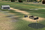
Situated between Dunedin and Queenstown, New Zealand. An important centre during the Central Otago goldrush of the 1860s, in more recent times Roxburgh has relied on a mixture of livestock and
stone fruit production. Roxburgh Trotting Club.
Made for Christian Stock's NZ mesh in the form of "Mountains of New Zealand" and topo in the form of "Lakes and Rivers of New Zealand".
| Filename: | Roxburgh_Aerodrome__NZRX.zip |
| License: | Freeware |
| Added: | 12th January 2011, 02:59:10 |
| Downloads: | 274 |
| Author: | Godfrey Tier |
| Size: | 1.28 MB |
| Category: Flight Simulator 2002 - AI Flight Plans | |
| Delta Connection - Skywest schedule |
|
File Description:
Includes all Delta Connection flights operated by Skywest Airlines. The hubs used for these flights are Salt Lake City and Dallas/FtWorth. Most flights are short hops into smaller cities and towns in neighboring states. The flight plans mesh perfectly with Skywest's current Delta Connection fleet of 47 CRJ-200s and 15 EMB-120s. Requires TTools v1.3.2 by Lee Swordy. AFCAD highly recommended.
| Filename: | Delta_Connection__Skywest_schedule.zip |
| License: | Freeware |
| Added: | 17th December 2002, 05:34:21 |
| Downloads: | 1,364 |
| Author: | Allen Bagwell |
| Size: | 10.86 KB |
| Category: Flight Simulator 2002 - Scenery | |
| Klawock Seaplane Base, Alaska |
|
File Description:
Klawock Seaplane Base, Alaska. Located about 2 miles south of the south end of Klawock runway. Semi fictional in that the base exists but is fictional in the way it is depicted here, since no photos are available, as is the case with many Alaska seaplane bases. Will work with or without Ed Denny’s FS2000 mesh. Requires TREES_V3.ZIP by Gerrish Gray.
| Filename: | Klawock_Seaplane_Base_Alaska.zip |
| License: | Freeware |
| Added: | 7th July 2003, 19:10:38 |
| Downloads: | 840 |
| Author: | Morton Rupp |
| Size: | 5.47 MB |


© 2001-2026 AVSIM Online
All Rights Reserved
Privacy Policy |