
Where Flight Simulation Enthusiasts Gather from Around the World!
AVSIM Library - Search Results

| Category: Flight Simulator 2004 - Scenery | |
| Alaska Duffys Tavern - DDT |

|
File Description:
Small airstrip in Alaska with some work buildings and a house. This scenery needs Lago's FS Enhancer for FS2004 to work. It is made on FS Genesis Alaska/Yukon terrain mesh but objects should work with other meshes since they are located within the air strip area.
| Filename: | Alaska_Duffys_Tavern__DDT.zip |
| License: | Freeware |
| Added: | 7th July 2004, 23:50:30 |
| Downloads: | 1,494 |
| Author: | David King |
| Size: | 2.93 KB |
| Category: Flight Simulator 2004 - Scenery | |
| Idaho STOLports |
|
File Description:
Three fun Airstrips in Idaho Mile Hi USFS, Vinesairstrip, and SkylineSTOLport that were not included in FS2004. only STOLaircraft should be used for these airstrips the default Piper Cub will do fine but Zenith 801 or Helio couriers work also. FS genesis Rockies 38.8m mesh required.
| Filename: | Idaho_STOLports.zip |
| License: | Freeware |
| Added: | 13th December 2005, 13:49:08 |
| Downloads: | 561 |
| Author: | Paul Leverich |
| Size: | 232.53 KB |
| Category: Flight Simulator X - Scenery | |
| Updated EGGP Liverpool |
|
File Description:
Updated EGGP - Liverpool Airport for FSX. Blended to fit Horizon GenX Scenery and Mesh, removing cliff and valley effect. This update fixes a problem with aircraft travelling to / from General Parking using section of runway instead of remaining on taxiway 'A' Original file was EGGP Liverpool.zip
| Filename: | Updated_EGGP_Liverpool.zip |
| License: | Freeware, limited distribution |
| Added: | 20th October 2007, 23:12:42 |
| Downloads: | 3,081 |
| Author: | Tony Meredith |
| Size: | 558.08 KB |
| Category: Flight Simulator X - Scenery | |
| Western Sahara VFR - Terrain Mesh SRTM 1 Arc/Sec version 3 |
|
Images related to this file:
File Description:
Enhanced Terrain Mesh from data source NASA SRTM 1 Arc/Sec (30 meters) version 3 at LOD 11 (19mt meters/pixel). Coverage: Lat 28 to Lat 20. Re-design coastline of the Western Sahara and replaced Dakhla Airport (GMMH). Fully compatible also with P3D.
| Filename: | Western_Sahara_VFR__Terrain_Mesh_SRTM_1_ArcSec_ver.zip |
| License: | Freeware |
| Added: | 27th April 2015, 12:58:28 |
| Downloads: | 927 |
| Author: | Giovanni Miduri |
| Size: | 373.13 MB |
| Category: Flight Simulator X - Scenery | |
| Kabel Car Complex - Cape Town South Africa |
|
File Description:
Kabel Car Complex for FSX,not the real thing just that i saw in Google.
For this scenery to work right you got to have a mesh installed,you can use the Aeroworx one from her at avsim or the NMG Trading one both will work.
| Filename: | Kabel_Car_Complex__Cape_Town_South_Africa.zip |
| License: | Freeware |
| Added: | 6th October 2008, 20:57:08 |
| Downloads: | 1,355 |
| Author: | Frits Beyer |
| Size: | 379.86 KB |
| Category: Flight Simulator 2004 - Miscellaneous Files | |
| Scenery Guide V2 |
|
File Description:
Provides info about high detail terrain mesh areas as well as describing the location of most 3D objects within FS2004. It lists the location of cities, bridges, dams, landmarks, thermals for gliders, icebergs, oil platforms, windmills, dare devil hoops, aerobatic boxes and barnstorming barns plus heaps more.
| Filename: | Scenery_Guide_V2.zip |
| License: | Freeware |
| Added: | 1st April 2007, 10:28:30 |
| Downloads: | 2,099 |
| Author: | Anthony Lynch |
| Size: | 20.25 KB |
| Category: Flight Simulator 2004 - AFCAD Files | |
| Gerald's Bottom AFCAD/Montserrat SRTM |
|
File Description:
Montserrat has opened a brand new airport at Gerald's Bottom (MNI\TRPM), the newest airport in the Caribbean and a replacement for the destroyed Bramble airport. To commemorate its opening, here is an AFCAD file along with LOD9 Mesh data of the island for your flying enjoyment.
| Filename: | Geralds_Bottom_AFCADMontserrat_SRTM.zip |
| License: | Freeware |
| Added: | 11th July 2005, 07:40:54 |
| Downloads: | 977 |
| Author: | John Holden |
| Size: | 678.65 KB |
| Category: X-Plane - Scenery | |
| WX37 Susi Air Beoga Airstrip v1.0.0 |
|
Images related to this file:
File Description:
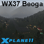
This is an X-Plane 11 scenery for Beoga Airstrip (WX37) in Beoga, Papua, Indonesia. This is one of the destinations for "PT ASI Pujiastuti Aviation", operating as Susi Air, an Indonesia airlines established in late 2004 by Mrs. Susi Pudjiastuti. This scenery was tested and is operational (as of January 08, 2017) in "X-Plane 11 Public Beta #5 64 bit", Windows 10 Home. It was also tested but is NOT operational (as of January 08, 2017) in "X-Plane 10.51 64 bit", Windows 10 Home, unless you'd like to operate in a toboggan or a roller coaster (terrain mesh issues with XP10, hence the scenery has a quite bad mesh). Sorry, XP11 only.
| Filename: | WX37_Susi_Air_Beoga_Airstrip_v100.zip |
| License: | Freeware |
| Added: | 8th January 2017, 23:47:40 |
| Downloads: | 61 |
| Author: | Rui Mesquita |
| Size: | 2.43 MB |
| Category: Flight Simulator 2002 - Scenery | |
| Red Lake Cabin v2 |
|
File Description:
This is a simple fictional alaskan scenery located on the northern shore
of Red Lake about 20 nm southwest of Rainy Pass (6AK). It contains a few
small buildings, NDB, a waterstrip and a 600 m gravelstrip on the beach.
It's not too spectacular, but a very nice starting point for bushflying.
As well as it's just a few meters away from the Iditarod-Checkpoint at
Finger Lake (FL - see the two flightplans included).
This is an enhanced version of 'RLCABIN.zip'. I added some items, to
make the place look more realistic and lively.
Requires Gerrish's Trees Library v3 ('trees_v3.zip')!
Works fine with both Eddie Denney's Alaska-Mesh and FS2002 Default-Mesh!
| Filename: | Red_Lake_Cabin_v2.zip |
| License: | Freeware |
| Added: | 8th August 2003, 21:37:02 |
| Downloads: | 350 |
| Author: | Uli Klapp |
| Size: | 1.72 MB |
| Category: Flight Simulator 2004 - Scenery | |
| LOD10 (38-m) Glacier Bay National Park, Alaska |
|
File Description:
This LOD10 (38-m) add-on mesh of Glacier Bay National Park and the adjacent Lynn Canal area between Juneau and Skagway (N58-60 W134-138) is an optional (!) upgrade of gl_bay_1.zip (by Holger Sandmann and Jim Keir). It adds more detail to the mountainous areas and allows to locally override other installed Alaska add-on meshes without having to deactivate them. The USGS NED seamless digital elevation data used for this mesh have a 2-arcsec (~60-m) resolution. Thus, the compilation as LOD10 (38-m) will reveal all terrain details contained in the source data. Please read the gl_bay_1.zip read-me file for further information about the special features of the Glacier Bay Project.
| Filename: | LOD10_38m_Glacier_Bay_National_Park_Alaska.zip |
| License: | Freeware, limited distribution |
| Added: | 16th February 2004, 03:40:57 |
| Downloads: | 8,593 |
| Author: | Holger Sandmann |
| Size: | 24.98 MB |


© 2001-2026 AVSIM Online
All Rights Reserved
Privacy Policy |