
Where Flight Simulation Enthusiasts Gather from Around the World!
AVSIM Library - Search Results

| Category: Flight Simulator X - Scenery | |
| CYML - Charlevoix |

|
Images related to this file:
File Description:
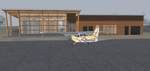
CYML - Charlevoix airport. Detailled scenery of the airport and it's building. There's also some other buildings and structures in the Charlevoix region.
Lanclass and mesh by Gilles Gauthier and special participation of Jean-Pierre Fillion.
| Filename: | CYML__Charlevoix.zip |
| License: | Freeware |
| Added: | 25th April 2011, 16:46:27 |
| Downloads: | 2,972 |
| Author: | Jean St-Cyr |
| Size: | 13.23 MB |
| Category: Flight Simulator X - Scenery | |
| KPTK, Oakland County International Airport, Michigan |
|
Images related to this file:
File Description:
New setup with photoreal background of this county-owned public-use airport. The airport holds an open house every year, showing aircraft based at KPTK, military aircraft and vintage aircraft. I used FreeMeshX as mesh.
| Filename: | KPTK_Oakland_County_International_Airport_Michigan.zip |
| License: | Freeware |
| Added: | 30th November 2018, 19:16:34 |
| Downloads: | 509 |
| Author: | Tim van Ringen |
| Size: | 19.96 MB |
| Category: Flight Simulator 2002 - Scenery | |
| Lillooet-Thompson Region, Southwestern B.C., Canada Mesh |
|
File Description:
New high-resolution (76-m) terrain mesh of 30,000 square km of southwestern British Columbia, covering a 4-degree longitude by 1-degree latitude transect from the mainland coast to Kamloops (N50-51, W120-124). This is probably one of the more spectacular regions of B.C. to represent in such vivid detail. Visit the Fraser and Stein River canyons, Princess Louisa Inlet, and the glacial lakes in the Pemberton area. Made from 50-m digital elevation data, resampled to LOD9 (76-m) horizontal spacing. Designed as an add-on to my LOD7 mesh of the entire province but can be used independently. By Holger Sandmann.
| Filename: | LillooetThompson_Region_Southwestern_BC_Canada_Mes.zip |
| License: | Freeware, limited distribution |
| Added: | 19th January 2003, 23:07:36 |
| Downloads: | 4,462 |
| Author: | Holger Sandmann |
| Size: | 5.35 MB |
| Category: Flight Simulator 2002 - Scenery | |
| Western Pacific, Eastern New Guinea Terrain Mesh |
|
File Description:
GTOPO30 Tile: E140N40 to E180S10. This data adds a small but pleasant increase in visual detail in most areas. Constructed from GTOPO30 data (3 arcsec source resolution, ~1000m) and converted to MS FS2002 format at LOD7 (305.8m). Production procedures used result in coverage of 98%(!) of the source area.
| Filename: | Western_Pacific_Eastern_New_Guinea_Terrain_Mesh.zip |
| License: | Freeware, limited distribution |
| Added: | 31st August 2002, 16:55:28 |
| Downloads: | 997 |
| Author: | Steve Greenwood |
| Size: | 2.87 MB |
| Category: Flight Simulator 2004 - Scenery | |
| Update - Terrain Mesh for Canada's Maritime Provinces |
|
File Description:
This package contains two files updating river and lake elevation for FS2002 and FS2004 in LOD09 terrain mesh (in Maritimes09a.zip and Maritimes09b.zip) for Canada's Maritime Provinces (including also Newfoundland, parts of Labrador and Saint-Pierre-et-Miquelon).
| Filename: | Update__Terrain_Mesh_for_Canadas_Maritime_Province.zip |
| License: | Freeware, limited distribution |
| Added: | 1st September 2003, 01:52:28 |
| Downloads: | 4,244 |
| Author: | Gilles Gauthier |
| Size: | 12.86 KB |
| Category: Flight Simulator 2004 - Scenery | |
| Atlas Mountains, Morocco 76m SRTM Terrain Mesh |
|
File Description:
USGS SRTM 3 arc-second, resampled to LOD9 (76 meters). This is a terrain mesh scenery of the Atlas Mountains in Morocco, Africa. It includes the High Atlas, the cities of Agadir & Marrakech and northwestern parts of the Sahara Desert.
| Filename: | Atlas_Mountains_Morocco_76m_SRTM_Terrain_Mesh.zip |
| License: | Freeware |
| Added: | 4th April 2004, 19:46:58 |
| Downloads: | 15,261 |
| Author: | Andreas Trawny |
| Size: | 15.95 MB |
| Category: Flight Simulator 2004 - Scenery | |
| Cape Farvel, Greenland 76m SRTM Terrain Mesh |
|
File Description:
USGS SRTM 3 arc-second, resampled to LOD9 (76 meters). This is a terrain mesh scenery of Cape Farvel in southern Greenland. Coverage area: From West 45.6° to West 42.8° and North 59.6° to North 60.4°. (Cape Farvel is the only part of Greenland available as SRTM elevation model)
| Filename: | Cape_Farvel_Greenland_76m_SRTM_Terrain_Mesh.zip |
| License: | Freeware, limited distribution |
| Added: | 17th April 2004, 23:35:14 |
| Downloads: | 4,184 |
| Author: | Andreas Trawny |
| Size: | 1.55 MB |
| Category: Flight Simulator 2004 - Scenery | |
| Europe SRTM mesh part 10: Lower Danube |
|
File Description:
Europe SRTM LOD9 mesh part 10 of 13: Covers a wide area centered over the Danube valley from Novi Sad to the Black Sea (42°N-46°N, 19°E-30°E). Includes Balkans & Transylvanian moutain ranges, and parts of the following countries: Romania, Bulgaria, Serbia and Albania.
This Europe SRTM project was optimized for the lowest HDD space use: Each part macthing exactly the boundaries of its neighbors, you'll have a complete corevage of Europe without gap or overlapping scenery. Based on SRTM Data v1 and v2 (3 arcsec, 90m) and sampled to LOD9 resolution (76m). Each SRTM tile was carefully checked and repaired with Blackart v4.02: water areas are now flattened (lighter mesh), and SRTM voids were treated taking advantage of Blackart's sophisticated interpolation algorithm. When required, biggest voids were patched with oversampled SRTM 30 arcsec data and/or manual input.
| Filename: | Europe_SRTM_mesh_part_10_Lower_Danube.zip |
| License: | Freeware, limited distribution |
| Added: | 19th October 2005, 17:55:10 |
| Downloads: | 11,735 |
| Author: | Yohann Baptiste |
| Size: | 39.14 MB |
| Category: Flight Simulator 2004 - Scenery | |
| Peninsular Malaysia Mesh Terrain: AREA 1/6 |
|
File Description:
Scenery based on SRTM-30 digital elevation model (DEM). Interpolation process done using Blackart and MicroDEM, all scenery files compiled at LOD9. Airport Coverage: Butterworth, Langkawi, Penang, Sultan Abdul Halim, Taiping, Hat Yai, Pattani, Songkhla, Trang
& Yala.
| Filename: | Peninsular_Malaysia_Mesh_Terrain_AREA_16.zip |
| License: | Freeware |
| Added: | 17th July 2005, 17:07:23 |
| Downloads: | 3,608 |
| Author: | Mohammad Omar |
| Size: | 4.63 MB |
| Category: Flight Simulator 2004 - Scenery | |
| Peninsular Malaysia Mesh Terrain: AREA 2/6 |
|
File Description:
Scenery based on SRTM-30 digital elevation model (DEM). Interpolation process done using Blackart and MicroDEM, all scenery files compiled at LOD9. Airport Coverage: Sultan Azlan Shah.
| Filename: | Peninsular_Malaysia_Mesh_Terrain_AREA_26.zip |
| License: | Freeware |
| Added: | 17th July 2005, 17:26:00 |
| Downloads: | 2,570 |
| Author: | Mohammad Omar |
| Size: | 4.11 MB |


© 2001-2026 AVSIM Online
All Rights Reserved
Privacy Policy |