
Where Flight Simulation Enthusiasts Gather from Around the World!
AVSIM Library - Search Results

| Category: Flight Simulator 2004 - Scenery | |
| Himalayas LOD9 Base Mesh, Volume 3 - Southwestern Ranges |

|
Images related to this file:
File Description:
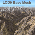
Detailed terrain mesh of the Southwestern Himalayan Ranges, N28-37 E78-82. The files in this package are based on Shuttle Radar (SRTM) Version 2 data but with many of the void areas, especially the most significant sections, filled with elevation data generated from topographic maps by Jonathan de Ferranti. While Jonathan's work is unrelated to flight simulation he kindly gave me permission to compile his data for use in FS. The result is a wonderful improvement in detail and accuracy over any existing mesh file, freeware or commercial, based on SRTM or DTED data alone.
Due to the large area of the Himalayas I've compiled the source data as two separate series: the "Himalayan Peaks" series covers prominent mountains and ranges in higher detail and locally overrides any existing LOD9 terrain mesh. In addition, the LOD9 "base mesh" series, with LOD8 and LOD7 "buffer" mesh files, covering the entire Himalayas, is meant for those who do not yet have an add-on terrain mesh of these beautiful mountains.
| Filename: | Himalayas_LOD9_Base_Mesh_Volume_3__Southwestern_Ra.zip |
| License: | Freeware, limited distribution |
| Added: | 30th May 2010, 10:00:26 |
| Downloads: | 155,810 |
| Author: | Holger Sandmann, Jonathan de Ferranti |
| Size: | 62.16 MB |
| Category: Flight Simulator 2004 - Scenery | |
| Himalayas LOD9 Base Mesh, Volume 2 - Southcentral Ranges |
|
Images related to this file:
File Description:
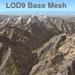
Detailed terrain mesh of the Southcentral Himalayan Ranges, N26-32 E82-90. The files in this package are based on Shuttle Radar (SRTM) Version 2 data but with many of the void areas, especially the most significant sections, filled with elevation data generated from topographic maps by Jonathan de Ferranti. While Jonathan's work is unrelated to flight simulation he kindly gave me permission to compile his data for use in FS. The result is a wonderful improvement in detail and accuracy over any existing mesh file, freeware or commercial, based on SRTM or DTED data alone.
Due to the large area of the Himalayas I've compiled the source data as two separate series: the "Himalayan Peaks" series covers prominent mountains and ranges in higher detail and locally overrides any existing LOD9 terrain mesh. In addition, a LOD9 "base mesh" series, with LOD8 and LOD7 "buffer" mesh files, covering the entire Himalayas, is meant for those who do not yet have an add-on terrain mesh of these beautiful mountains.
| Filename: | Himalayas_LOD9_Base_Mesh_Volume_2__Southcentral_Ra.zip |
| License: | Freeware, limited distribution |
| Added: | 29th May 2010, 09:05:56 |
| Downloads: | 9,453 |
| Author: | Holger Sandmann, Jonathan de Ferranti |
| Size: | 90.25 MB |
| Category: Flight Simulator X - Scenery | |
| Millau Viaduct Bridge Patch |
|
File Description:
Patch for scenery Millau Viaduct Bridge.
In order to obtain a better adaptation of the viaduct with the ground, this archive contains three choices, according to the installed add-ons in your Scenery library:
options-1 Without UTX Europe and with Mesh France of France VFR. Option-2 With UTX Europe without Mesh France of France VFR.
Option-3 Without UTX Europe and Without Mesh France of France VFR.
The scenery " millau_Viaduct_FSX.zip " is needed. Download on AVSIM File Library.
| Filename: | Millau_Viaduct_Bridge_Patch.zip |
| License: | Freeware, limited distribution |
| Added: | 31st March 2008, 17:54:03 |
| Downloads: | 4,338 |
| Author: | Jean-Claude Irle |
| Size: | 11.23 KB |
| Category: Flight Simulator 2002 - Scenery | |
| La Rioja, Spain Mesh |
|
File Description:
This little area is a part of a big area named LA RIOJA. La Rioja is a photographic scenery made with the SDK of Microsoft method and using the elevations of Spain following the SMG (Spain Mesh Group)system. Also it has houses and trees made with AUTOGEN. The scenery is 380 MB big and it has more than 634 photos seamless.The resolution is 4,75m/pixel, and the area is about 200x150 Km2. If anybody need the big scenery please contact me. It´s necessary 1 CD.
| Filename: | La_Rioja_Spain_Mesh.zip |
| License: | Freeware |
| Added: | 2nd November 2002, 14:07:09 |
| Downloads: | 919 |
| Author: | Julio Estefanía Estefania |
| Size: | 16.87 MB |
| Category: Flight Simulator 2002 - Scenery | |
| Gaia Mesh System Crete |
|
File Description:
Part of the shareware package - Gaia Mesh System - Greece - Turkey - Middle East - produced by Fsfreeware. This Scenery cover the Whole of the Island of Crete in Greece.
| Filename: | Gaia_Mesh_System_Crete.zip |
| License: | Freeware |
| Added: | 26th August 2002, 23:03:47 |
| Downloads: | 1,822 |
| Author: | Raimondo Taburet and Fsfreeware.com |
| Size: | 481.79 KB |
| Category: Orbiter - Spaceships | |
| SaturnV High Resolution Mesh |
|
File Description:
nasa saturn5 mesh only package to replace the nassp default saturn5 launcher. two versions included, one lowres with 26000 polys and one highres version with 40000 polys. recomeded hardware for the highres is 1.4ghz/512mbram/geforce3ti or better. also included 3ds source code files. YOU NEED NASSP3 or NASSP4 addon to run this.
| Filename: | SaturnV_High_Resolution_Mesh.zip |
| License: | Freeware |
| Added: | 24th April 2003, 02:08:07 |
| Downloads: | 3,402 |
| Author: | Thomas Ruth |
| Size: | 1.77 MB |
| Category: Flight Simulator 2002 - Scenery | |
| Palisades SRTM Altitude Mesh |
|
File Description:
Ever wanted to fly down the VFR corridor over the Hudson River and gawk at all the skyscrapers in New York City? ... in your dreams! The Department of Fatherland Security has closed it down.
But, we still have Flight Simulator. Unfortunately, the altitude mesh for this area is somewhat lacking in detail.
This Palisades altitude mesh remedies that. Covers the Palisades cliffs, of course (but no Amusement Park, sniff), and also Riverside, Morningside, and Washington Heights, and Fort Tryon. In fact, all 5 Boroughs of New York City are covered, as well as most of central and northern New Jersey (visit beautiful downtown Hoboken!), and the larger part of Long Island. Also Rockland, Westchester, Orange, Putnam counties and more. And even Bear Mountain State Park.
Approximate coverage: N40* to N42* and W73* to W75*.
Made from NASA Shuttle Radar Topography Mission data (3 arc-second resampled to LOD9 - horizontal resolution of 76.4 meters) using SRTM to BGL by Matthew Styles (available in the AvSim library.) Very easy to use - give it a try.
BONUS: includes simple instructions so that anyone can make altitude mesh for their area from SRTM data using SRTM to BGL by Matthew Styles. Sorry, SRTM data only available for the Americas at the moment. The rest of the world coming soon. Check inside for more details.
No support of any kind is offered for this package - very sorry.
| Filename: | Palisades_SRTM_Altitude_Mesh.zip |
| License: | Freeware |
| Added: | 12th June 2003, 16:09:26 |
| Downloads: | 2,165 |
| Author: | Luis, scenery design forum |
| Size: | 3.48 MB |
| Category: Flight Simulator 2004 - Scenery | |
| Thai Mesh Part 1 |
|
File Description:
This is mesh scenery for Thailand. It was created using SRTM 3ARCSEC data using SRTM to BGL. I did not attempt to correct any data, or fix blank areas by merging with other mesh, but overall I'm satisfied with the results and have noticed few problems. It may also work in FS2002, but I did not try this.
| Filename: | Thai_Mesh_Part_1.zip |
| License: | Freeware, limited distribution |
| Added: | 22nd November 2003, 08:45:50 |
| Downloads: | 6,529 |
| Author: | Martin Strong |
| Size: | 18.3 MB |
| Category: Flight Simulator 2004 - Scenery | |
| Thai Mesh Part 4 |
|
File Description:
This is mesh scenery for Thailand. It was created using SRTM 3ARCSEC data using SRTM to BGL. I did not attempt to correct any data, or fix blank areas by merging with other mesh, but overall I'm satisfied with the results and have noticed few problems. It may also work in FS2002, but I did not try this.
| Filename: | Thai_Mesh_Part_4.zip |
| License: | Freeware, limited distribution |
| Added: | 22nd November 2003, 21:13:36 |
| Downloads: | 5,804 |
| Author: | Martin Strong |
| Size: | 31.25 MB |
| Category: Flight Simulator 2004 - Scenery | |
| Pennsylvania 30 Meter Mesh |
|
File Description:
Mesh Scenery for Microsoft Flight Simulator 2004 and 2002 covers the entire State of Pennsylvania. Compiled from NED 1 arc sec (30 meter) Data. Compression and conversion to bgl with MS Flight simulator SDK at LOD set to "Auto". Enjoy some nice VFR flying. Requires all 8 zips. 7 of 8.
| Filename: | Pennsylvania_30_Meter_Mesh.zip |
| License: | Freeware |
| Added: | 11th December 2003, 04:12:29 |
| Downloads: | 2,497 |
| Author: | Phil Cruikshank |
| Size: | 5.24 MB |


© 2001-2026 AVSIM Online
All Rights Reserved
Privacy Policy |