
Where Flight Simulation Enthusiasts Gather from Around the World!
AVSIM Library - Search Results

| Category: Flight Simulator 2004 - Scenery | |
| Europe SRTM mesh part 01: LOD7 buffer mesh |

|
File Description:
Europe SRTM LOD9 mesh part 1 of 13: This is a LOD7 mesh covering the whole Europe from 35°N to 60°N and 12°W to 30°E, to be used as a buffer mesh in conjection with the LOD9 mesh. This Europe SRTM project was optimized for the lowest HDD space use: Each part macthing exactly the boundaries of its neighbors, you'll have a complete corevage of Europe without gap or overlapping scenery. Based on SRTM Data v1 and v2 (3 arcsec, 90m) and sampled to LOD7 resolution (300m). Each SRTM tile was carefully checked and repaired with Blackart v4.02: water areas are now flattened (lighter mesh), and SRTM voids were treated taking advantage of Blackart's sophisticated interpolation algorithm. When required, biggest voids were patched with oversampled SRTM 30 arcsec data and/or manual input.
| Filename: | Europe_SRTM_mesh_part_01_LOD7_buffer_mesh.zip |
| License: | Freeware, limited distribution |
| Added: | 19th October 2005, 16:11:05 |
| Downloads: | 19,070 |
| Author: | Yohann Baptiste |
| Size: | 50.28 MB |
| Category: Prepar3D V1-4 - Scenery | |
| ITALY ETM20m - Enhanced Terrain Mesh vol. 02 |
|
Images related to this file:
File Description:
Italy - ETM Enhanced Terrain Mesh 0.73 arc sec (20 meters). This Terrain Mesh is fully compatible with FSX/P3D (all versions). This is a work in progress. Volume 02 - Campania, Basilicata and Puglia
| Filename: | ITALY_ETM20m__Enhanced_Terrain_Mesh_vol_02.zip |
| License: | Freeware |
| Added: | 17th December 2018, 23:46:26 |
| Downloads: | 360 |
| Author: | Giovanni Miduri |
| Size: | 44.15 MB |
| Category: Flight Simulator X - AFCAD Files | |
| VQPR - Paro Intl Airport,Tibet |
|
Images related to this file:
File Description:
A modification of default Paro Intl Airport, Tibet for FSX using ADE with information from google earth. Addon terrain mesh is required as default FSX mesh is incorrect and makes the airport unusable.
| Filename: | VQPR__Paro_Intl_AirportTibet.zip |
| License: | Freeware |
| Added: | 2nd September 2013, 13:29:20 |
| Downloads: | 554 |
| Author: | Himanshu Singh |
| Size: | 3.05 KB |
| Category: Prepar3D V1-4 - Scenery | |
| ITALY ETM20m - Enhanced Terrain Mesh vol. 06 |
|
Images related to this file:
File Description:
Italy - ETM Enhanced Terrain Mesh 0.73 arc sec (20 meters). This Terrain Mesh is fully compatible with FSX/P3D (all versions). This is a work in progress. Volume 06 - Liguria and Emilia Romagna
| Filename: | ITALY_ETM20m__Enhanced_Terrain_Mesh_vol_06.zip |
| License: | Freeware |
| Added: | 17th December 2018, 23:48:30 |
| Downloads: | 345 |
| Author: | Giovanni Miduri |
| Size: | 48.03 MB |
| Category: Flight Simulator 2004 - Scenery | |
| Hawaii Islands SRTM Terrain Mesh |
|
File Description:
76m LOD9 SRTM Terrain Mesh of the Hawaiian Islands.
| Filename: | Hawaii_Islands_SRTM_Terrain_Mesh.zip |
| License: | Freeware, limited distribution |
| Added: | 24th July 2004, 05:43:13 |
| Downloads: | 9,078 |
| Author: | Tom Finley |
| Size: | 6.57 MB |
| Category: Prepar3D V1-4 - Scenery | |
| ITALY ETM20m - Enhanced Terrain Mesh vol. 03 |
|
Images related to this file:
File Description:
Italy - ETM Enhanced Terrain Mesh 0.73 arc sec (20 meters). This Terrain Mesh is fully compatible with FSX/P3D (all versions). This is a work in progress. Volume 03 - Southern Lazio, Molise and Gargano.
| Filename: | ITALY_ETM20m__Enhanced_Terrain_Mesh_vol_03.zip |
| License: | Freeware |
| Added: | 17th December 2018, 23:46:47 |
| Downloads: | 328 |
| Author: | Giovanni Miduri |
| Size: | 48.82 MB |
| Category: Prepar3D V1-4 - Scenery | |
| ITALY ETM20m - Enhanced Terrain Mesh vol. 08 |
|
Images related to this file:
File Description:
Italy - ETM Enhanced Terrain Mesh 0.73 arc sec (20 meters). This Terrain Mesh is fully compatible with FSX/P3D (all versions). This is a work in progress. Volume 08 - Western Alps; Marittime and Cozie
| Filename: | ITALY_ETM20m__Enhanced_Terrain_Mesh_vol_08.zip |
| License: | Freeware |
| Added: | 19th December 2018, 22:49:32 |
| Downloads: | 335 |
| Author: | Giovanni Miduri |
| Size: | 22.6 MB |
| Category: Flight Simulator X - Scenery | |
| Extreme Southwestgreenland |
|
File Description:
Everybody who flies in Greenland knows, how incorrect the default scenery is.
This is a new terrain mesh scenery which covers Westgreenland - from Lat N 65 to N 62.
As SRTM data do not cover above N 60 - no Greenland mesh scenery has been produced. Like Extreme Westgreenland this is the one of the most detailed Greenland terrain mesh released up to release date of this scenery.
This great package covers more than 60.000 sq. km. area. This includes:
- LOD11 Mesh (terrain/elevation)
- Redesigned coastline
- Redesign lakes
| Filename: | Extreme_Southwestgreenland.zip |
| License: | Freeware, limited distribution |
| Added: | 26th November 2007, 04:29:14 |
| Downloads: | 4,079 |
| Author: | Ulrik Motzfeldt |
| Size: | 62.32 MB |
| Category: Flight Simulator 2004 - Scenery | |
| Middle East SRTM Mesh - Lebanon, Israel and Egypt Part2 |
|
File Description:
Middle East SRTM Mesh - Lebanon, Israel and most of Egypt LOD9 Terrain Mesh in 3 parts, created from SRTM 3arc sec spatial data - this is Part 2. Mesh covers area from N25 - N34 and E29 - E36. It gives You possibility to fly above continuous terrain of Lebanon, Israel and Egypt. Holes were cleared using SRTM/DTED0 merger by Martin Domig, MICRODEM and SRTMFill.
| Filename: | Middle_East_SRTM_Mesh__Lebanon_Israel_and_Egypt_Pa.zip |
| License: | Freeware, limited distribution |
| Added: | 23rd April 2004, 12:55:58 |
| Downloads: | 6,646 |
| Author: | Ryszard Winawer |
| Size: | 21.07 MB |
| Category: Flight Simulator 2004 - Scenery | |
| New Caledonia (Landclass and Terrain Mesh) |
|
Images related to this file:
File Description:
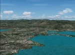
FS2004 Landclass and Terrain Mesh--New Caledonia. This is a complete Landclass and Terrain Mesh makeover for New Caledonia and its outlying islands. Andy Weir and Ian Thatcher have graciously allowed me to integrate their Terrain Mesh into this scenery. All known airports have now been added to New Caledonia and the local islands are designed for AI aircraft operation.
| Filename: | New_Caledonia_Landclass_and_Terrain_Mesh.zip |
| License: | Freeware |
| Added: | 18th April 2010, 09:59:48 |
| Downloads: | 1,110 |
| Author: | Charles Reid |
| Size: | 24.88 MB |


© 2001-2026 AVSIM Online
All Rights Reserved
Privacy Policy |