
Where Flight Simulation Enthusiasts Gather from Around the World!
AVSIM Library - Search Results

| Category: Prepar3D V1-4 - Scenery | |
| ITALY ETM20m - Enhanced Terrain Mesh vol. 03 |

|
Images related to this file:
File Description:
Italy - ETM Enhanced Terrain Mesh 0.73 arc sec (20 meters). This Terrain Mesh is fully compatible with FSX/P3D (all versions). This is a work in progress. Volume 03 - Southern Lazio, Molise and Gargano.
| Filename: | ITALY_ETM20m__Enhanced_Terrain_Mesh_vol_03.zip |
| License: | Freeware |
| Added: | 17th December 2018, 23:46:47 |
| Downloads: | 328 |
| Author: | Giovanni Miduri |
| Size: | 48.82 MB |
| Category: Prepar3D V1-4 - Scenery | |
| ITALY ETM20m - Enhanced Terrain Mesh vol. 08 |
|
Images related to this file:
File Description:
Italy - ETM Enhanced Terrain Mesh 0.73 arc sec (20 meters). This Terrain Mesh is fully compatible with FSX/P3D (all versions). This is a work in progress. Volume 08 - Western Alps; Marittime and Cozie
| Filename: | ITALY_ETM20m__Enhanced_Terrain_Mesh_vol_08.zip |
| License: | Freeware |
| Added: | 19th December 2018, 22:49:32 |
| Downloads: | 335 |
| Author: | Giovanni Miduri |
| Size: | 22.6 MB |
| Category: Flight Simulator X - Scenery | |
| Extreme Southwestgreenland |
|
File Description:
Everybody who flies in Greenland knows, how incorrect the default scenery is.
This is a new terrain mesh scenery which covers Westgreenland - from Lat N 65 to N 62.
As SRTM data do not cover above N 60 - no Greenland mesh scenery has been produced. Like Extreme Westgreenland this is the one of the most detailed Greenland terrain mesh released up to release date of this scenery.
This great package covers more than 60.000 sq. km. area. This includes:
- LOD11 Mesh (terrain/elevation)
- Redesigned coastline
- Redesign lakes
| Filename: | Extreme_Southwestgreenland.zip |
| License: | Freeware, limited distribution |
| Added: | 26th November 2007, 04:29:14 |
| Downloads: | 4,079 |
| Author: | Ulrik Motzfeldt |
| Size: | 62.32 MB |
| Category: Flight Simulator 2004 - Scenery | |
| Middle East SRTM Mesh - Lebanon, Israel and Egypt Part2 |
|
File Description:
Middle East SRTM Mesh - Lebanon, Israel and most of Egypt LOD9 Terrain Mesh in 3 parts, created from SRTM 3arc sec spatial data - this is Part 2. Mesh covers area from N25 - N34 and E29 - E36. It gives You possibility to fly above continuous terrain of Lebanon, Israel and Egypt. Holes were cleared using SRTM/DTED0 merger by Martin Domig, MICRODEM and SRTMFill.
| Filename: | Middle_East_SRTM_Mesh__Lebanon_Israel_and_Egypt_Pa.zip |
| License: | Freeware, limited distribution |
| Added: | 23rd April 2004, 12:55:58 |
| Downloads: | 6,646 |
| Author: | Ryszard Winawer |
| Size: | 21.07 MB |
| Category: Flight Simulator 2004 - Scenery | |
| New Caledonia (Landclass and Terrain Mesh) |
|
Images related to this file:
File Description:
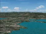
FS2004 Landclass and Terrain Mesh--New Caledonia. This is a complete Landclass and Terrain Mesh makeover for New Caledonia and its outlying islands. Andy Weir and Ian Thatcher have graciously allowed me to integrate their Terrain Mesh into this scenery. All known airports have now been added to New Caledonia and the local islands are designed for AI aircraft operation.
| Filename: | New_Caledonia_Landclass_and_Terrain_Mesh.zip |
| License: | Freeware |
| Added: | 18th April 2010, 09:59:48 |
| Downloads: | 1,110 |
| Author: | Charles Reid |
| Size: | 24.88 MB |
| Category: Flight Simulator 2004 - AI Aircraft | |
| EasySky Airlines Pack "Patch" |
|
Images related to this file:
File Description:

*In the first uploaded forget to add the flight plan. Already in this new upload that is already fixed so you can enjoy that little traffic in Honduras. EasySky is the new low-cost airline in Honduras, currently have a Boeing 737-200, 2 Jetstream 31 ex-Rollins Air and 1 Beechcraft King Air C90, currently only fly between San Pedro Sula - Roatan and La Ceiba - Roatan, but have plans to fly to Tegucigalpa, Liberia (Costa Rica), San Andres (Colombia), Tikal (Guatemala) and Cancun in Mexico. This package includes the current Flight Plan for this season only operating Jetstream aircraft, and charter flights in the King Air. Textures only you will need the base models of Project AI and Henry Tomkiewicz. Enjoy!
| Filename: | EasySky_Airlines_Pack_Patch.zip |
| License: | Freeware |
| Added: | 13th May 2012, 21:36:50 |
| Downloads: | 525 |
| Author: | Luis A. Flores |
| Size: | 952.04 KB |
| Category: Orbiter - Spaceships | |
| Ariane 5 MEP |
|
File Description:
This is just a simple addon that I have made. This addon requires the Tompa's Kourou & ariane 5 mesh addons & spacecraft.dll.
--------------------
Special Thanks to Jack Higgans for the MER Cruise mesh. Thank you =)
| Filename: | Ariane_5_MEP.zip |
| License: | Freeware |
| Added: | 28th December 2003, 18:32:30 |
| Downloads: | 748 |
| Author: | Zachary Grillo |
| Size: | 255.64 KB |
| Category: Flight Simulator 2004 - Scenery | |
| LOD 10 mesh terrain scenery of Slovenia, final version |
|
File Description:
Sampled to LOD10, this is a standard version of
mesh terrain covering N45E13 - N47E17.
It is perfectly compatible with Austria professional and mesh
of Italy by Pietro Mauri.All incompatibilities with flattens around
airports were corrected.
| Filename: | LOD_10_mesh_terrain_scenery_of_Slovenia_final_vers.zip |
| License: | Freeware |
| Added: | 13th November 2005, 23:09:48 |
| Downloads: | 6,281 |
| Author: | Mirko Ternik/FSSlovenia Team |
| Size: | 25.79 MB |
| Category: Prepar3D V1-4 - Scenery | |
| ITALY ETM20m - Enhanced Terrain Mesh vol. 09 |
|
Images related to this file:
File Description:
Italy - ETM Enhanced Terrain Mesh 0.73 arc sec (20 meters). This Terrain Mesh is fully compatible with FSX/P3D (all versions). This is a work in progress. Volume 09 - Pianura Padano-Veneta (Padano - Veneto Plan)
| Filename: | ITALY_ETM20m__Enhanced_Terrain_Mesh_vol_09.zip |
| License: | Freeware |
| Added: | 23rd December 2018, 17:22:09 |
| Downloads: | 329 |
| Author: | Giovanni Miduri |
| Size: | 46.21 MB |
| Category: Flight Simulator 2004 - Scenery | |
| Greece SRTM Mesh Part 1 |
|
File Description:
This terrain mesh scenery covers Greece, including all Aegean sea islands, plus most parts of Albania and Macedonia up to 41°50'N. Some parts of Bulgaria and Turkey are also included in northern and eastern boundaries of the mesh. The greek island of Crete isn't part of this mesh because SRTM data isn't yet released for the whole island.
Based on SRTM Data (3 arcsec, 90m), generated with Matthew Styles's program "SRTM To BGL v1.04", sampled to LOD9 resolution (76m). While only tested with Fs2004, this mesh should also run with FS2002.
This part contains northern parts of the mesh: Greece-N.bgl, Greece-NE1.bgl and Greece-NE2.bgl. See Greece_Mesh_Part1-1.jpg for exact bgl coverage.
| Filename: | Greece_SRTM_Mesh_Part_1.zip |
| License: | Freeware |
| Added: | 10th November 2003, 02:08:20 |
| Downloads: | 10,988 |
| Author: | Yohann Baptiste |
| Size: | 17.75 MB |


© 2001-2026 AVSIM Online
All Rights Reserved
Privacy Policy |