
Where Flight Simulation Enthusiasts Gather from Around the World!
AVSIM Library - Search Results

| Category: Flight Simulator X - Scenery | |
| Smithers, CYYD |

|
File Description:
Contained is an approximation of CYYD, Smithers Regional Airport, BC, made using the fsx object placement tool. Just pop it in your fsx\add on scenery\scenery folder. This scenery works well with Combat Planes Northern Adventures sampler. Notice that any xml mission file can be converted to a permanent bgl file for personal use with the bgl compiler of the SDK or Abacus Scenery Shortcut. For example, the Combat Planes Terrace Airport, CYXT. Thus, with this file and the above mentioned, one can have a nice circuit to fly from Smithers through Terrace down to Sandspit and back up to the Sitkine Area, to be improved in the future no doubt with Tongass Fjords II. FSG North America terrain mesh highly recommended.
| Filename: | Smithers_CYYD.zip |
| License: | Freeware |
| Added: | 17th February 2007, 15:36:47 |
| Downloads: | 1,452 |
| Author: | Joe Solomon |
| Size: | 26.78 KB |
| Category: Flight Simulator X - Scenery | |
| Locher/Sarentino Airfield scenery for MS FSX and LM Prepar3D |
|
Images related to this file:
File Description:
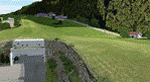
This scenery package is a representation of "Locher" airfield, a private grass field in the Trentino (or South Tyrol) area, close to the town of Sarentino (or Sarnthein, or Sarntal) in northern Italy. The town is very close to the border with Austria (hence the many versions of the town name). The field belongs to Locher Gebhard and shares the premises with Mr. Gebhard's factory, apparently producing metallic fire rated doors.
Features of the Locher airfield scenery include:
- Photoreal area with seasonal variations and watermask
- Custom mesh for a large area around the field
- Custom buildings and rock formations around the hangar, as well as sloped taxiway
- Custom landmarks on approach from the south, including power cables over the valley
| Filename: | LocherSarentino_Airfield_scenery_for_MS_FSX_and_LM.zip |
| License: | Freeware |
| Added: | 25th September 2017, 03:37:52 |
| Downloads: | 6,946 |
| Author: | Vassilios Dimoulas |
| Size: | 316.11 MB |
| Category: Flight Simulator 2004 - Miscellaneous Files | |
| Tips and Tricks for FS2004 - Number 7. |
|
Images related to this file:
File Description:

Tips and Tricks - Number 7. This issue contains some VERY important information for anyone who "collects" scenery as well as an explanation of an error message we see from time to time. For anyone wanting to learn more about the use of "mesh", an excellent resource link is listed. An assortment of other tips, tricks and recommendations are included as usual - a little something for everyone. Some of these items have come from readers of this series and I thank them all. You will also find links to several unique sites that I believe you will find of value. Compiled in .doc and .pdf formats for your flying enjoyment by David "Opa" Marshall. --
This is a re-upload of the file which became "missing" after the hack.
| Filename: | Tips_and_Tricks_for_FS2004__Number_7.zip |
| License: | Freeware |
| Added: | 8th June 2010, 02:15:11 |
| Downloads: | 8,179 |
| Author: | David "Opa" Marshall |
| Size: | 940.44 KB |
| Category: Flight Simulator 2004 - Scenery | |
| Bardenas Reales Firing Range Version 1.0 |
|
File Description:
Photorealistic scenery of the Firing Range of Bardenas Reales, in Navarra, Spain, close to LEZG ( N42º10.6',W1º28.0'). Created on 1951, this range was the practice area for air to surface weapons for the spanish air force pilots of EF18M, F1M, F5M and AV8 harriers. Usually is used for other allied forces like USAF F16. Actually the use of the firing range is decreasing @ 20% of the full capacity of 100 operations by day. Only textures 4.75 m/pixel, we recomend mesh EVA4,(http://www.airhispania.com/eva/eva.htm) or similar containing detailed topo of spain. Created By Jose Ramon Rodriguez ( this a present to all my friends of Virtual ZAragoza Airbase - www.basezaragozavirtual.tk -, specially to Diego Novillo by his support and illusion in this, and other projects, thx.
| Filename: | Bardenas_Reales_Firing_Range_Version_10.zip |
| License: | Freeware |
| Added: | 18th July 2006, 19:31:31 |
| Downloads: | 3,877 |
| Author: | Jose Ramon Rodriguez |
| Size: | 13.71 MB |
| Category: Flight Simulator 2004 - Scenery | |
| San Francisco Int. (SFO) High Res Ground Scenery |
|
File Description:
This scenery contains high resolution ground scenery for the airport of San Francisco Intl. (SFO). It makes me kind of nostalgic, because that's the area where I first successfully tried my hi-res mesh technique for FS2004. The scenery has a resolution of 1.2m/pix (4.7m/pix is FS2004-standard). Coverage is the area around SFO containing the San Bruno Mountain Park and the San Adreas Res. So it's quiet a sight! And don't forget to bring some flowers :-) The scenery gives best results when combined with with my "San Francisco" standard resolution ground scenery, which covers a much larger area at 4.7m/pix and matches perfectly in color and everything...
Won't work in FSX. For FSX please wait for the upcoming FSX-version of this scenery.
| Filename: | San__Francisco_Int_SFO_High_Res_Ground_Scenery.zip |
| License: | Freeware, limited distribution |
| Added: | 27th November 2006, 10:58:19 |
| Downloads: | 16,822 |
| Author: | Gottfried Razek |
| Size: | 41.8 MB |
| Category: Flight Simulator 2004 - Scenery | |
| Ko Samui, Thailand (VTSM) v4.0 |
|
File Description:
Samui is a small, but busy airport on the island of Ko Samui. It is located in Southern Thailand, and is an exotic resort destination. In 1989 Bangkok Airways opened their own airport on the island, which decreased the travel time from Bangkok considerably. The airport is currently served by Bangkok Airways, although an occasional private aircraft will land here. This scenery is a detailed and accurate representation of this airport as it looks today. I consulted with several visitors to the airport, as well as the AIP for Thailand. Landsat imagery was used to modify the shoreline, and a custom landclass is included. Taxiway and parking areas were modified by using AFCAD2. This scenery is compatible with 3rd-party mesh scenery for Thailand.
| Filename: | Ko_Samui_Thailand_VTSM_v40.zip |
| License: | Freeware, limited distribution |
| Added: | 25th April 2004, 21:10:31 |
| Downloads: | 11,748 |
| Author: | Martin Strong |
| Size: | 5.34 MB |
| Category: Flight Simulator 2004 - Scenery | |
| Beaver Creek CYXQ in Yukon Territory, Canada |
|
Images related to this file:
File Description:
Beaver Creek is located at mile 1202 of the Alaska Highway, just east of the Alaska/Yukon border. The populaton is around 100 and the main employment is with the Border Agency, the White River First Nation, or with local tourist lodges. The airfield is a mile north of the town and close to the Canadian border post, which is included in the scenery. It was built by Jack Stalberg in the 1960's, and I have no further information beyond the fact that he loved to fly. The airport serves as an "airport of entry", though it is restricted in hours of opening and in the size of aircraft that it can handle; up to a maximum of only 15 seats. The single runway is 3,745 feet long and 100 feet wide, gravel, aligned 13-31 in FS9, lit, and with vasi at both ends. Righthand circuits for runway 13. There is a 340 feet threshold displacement to runway 31, which is of course unmarked on a gravel runway. The terminal building was recently reclad; I don't like it, but they didn't consult me. The ai reflects the sort of traffic the airfield gets; ie brief paperwork stopovers for GA or small charter flights into Canada from Alaska, usually in the mornings.I have adjusted the local scenery terrain levels to remove adjacent hills that I believe do not exist in real life but are part of the Northern Canada terrain mesh that I have installed. If you do not have this mesh you may find that the scenery works fine for you without the API flatten that is included here. The airfield is at 2,129 feet ASL.
| Filename: | Beaver_Creek_CYXQ_in_Yukon_Territory_Canada.zip |
| License: | Freeware, limited distribution |
| Added: | 28th January 2019, 06:19:20 |
| Downloads: | 175 |
| Author: | Roger Wensley |
| Size: | 4.68 MB |
| Category: Flight Simulator 2004 - Miscellaneous Files | |
| Some Curved or Angled Approaches, Beirut, Washington Reagan, Lugano and Swiss valleys |
|
File Description:
This little project started from my Air Glaciers package when I noticed how indifferent the AI pilots were to terrain. Intrigued by the work of Jim Vile on his "active approach" series I have experimented with interesting approaches that FS9 has not implemented. Using XML files I created curved approaches for Beirut Runway 21 ILS (inbound flights arc across the city), the visual turn to final for Washington Reagan's Runway 19, the circling approach for runway 19 at Lugano in Switzerland (just an arc in this case) and valley approaches for airports in Switzerland at Sion, Samedan and Locarno. Due to AI limitations in FS9 these have all needed to be created as ILS approaches, even at airports without an ILS. Note that your AFCAD layouts do not need to have ILS added to airports that don't have it. In some cases the approach will be called an ILS by the controller, if you can live with that, you might like these. Note that I've included the source XML for each of the approaches so that you can improve upon them if you wish. Note also that they have been tested with the default Microsoft mesh and an addon mesh might alter the proximity of terrain to aircraft. AI aircraft FDEs will, in some cases, be stretched to (and beyond?) their limits. In the case of Beirut I have included two approaches (BOB NDB and "Wide Arc"), the latter less demanding than the former, in case your AI can't fly the BOD NDB approach.
Note that although the approaches are designed for AI, I have built full procedures for Lugano and Sion for the user to fly.
| Filename: | Some_Curved_or_Angled_Approaches_Beirut_Washington.zip |
| License: | Freeware, limited distribution |
| Added: | 8th April 2005, 03:19:33 |
| Downloads: | 2,763 |
| Author: | Matthew Ministry |
| Size: | 478.08 KB |
| Category: Flight Simulator 2004 - Scenery | |
| Even More Private Strips |
|
File Description:
Even more 'Private Strips' from around England and Wales. When combined with my previous "Private Strips Revisited" upload these will give a total of nearly 500 little airfields, which have been predominantly created to provide a source for GA and microlight ai traffic flights, without having to clutter up the more major airfields. All airfields have parking for (usually) two aircraft and associated taxiways to facilitate their coming and going.
Please note :- these sceneries have been designed for use in FS2004 with the original UK VFR Photographic scenery and mesh. They rely for details on the "usual" collections of library objects, specifically EZ-Scenery, UKVFR and Rwy12 libraries. Whilst other configurations will probably work, to a degree, you'll have to try them and see if they suit you. See the enclosed ReadMe for further details.
| Filename: | Even_More_Private_Strips.zip |
| License: | Freeware |
| Added: | 3rd August 2021, 00:59:25 |
| Downloads: | 139 |
| Author: | Chris Eve |
| Size: | 495.15 KB |
| Category: Flight Simulator 2004 - AFCAD Files | |
| YALG Adels Grove, Queensland, Australia |
|
Images related to this file:
File Description:
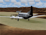
Googlyafcad A&F Data file for Adels Grove, based on Google Earth satellite data.
Unfortunately, Microsoft have omitted this location from Flight Simulator 2004 and this file will allow you and your "AI" traffic to land, taxi, park and take off in a realistic manner.
Adels Grove is a small airstrip serving Lawn Hill National Park, a port of call on the Heron Airlines Northern Affordable Air Tour. The very last commercially operated de Havilland Heron flight called here in 2003 but the service still operates and is now worked by Metroliner aircraft.
These files have been tested with Flight Simulator 2004 default scenery, Visual Australia (VOZ) enhanced scenery and add-on mesh by Andy Weir and is compatible with all. [File re-uploaded at request of AVSIM]
| Filename: | YALG_Adels_Grove_Queensland_Australia.zip |
| License: | Freeware |
| Added: | 20th June 2010, 10:48:26 |
| Downloads: | 412 |
| Author: | John Hinson |
| Size: | 60.12 KB |


© 2001-2026 AVSIM Online
All Rights Reserved
Privacy Policy |