
Where Flight Simulation Enthusiasts Gather from Around the World!
AVSIM Library - Search Results

| Category: Flight Simulator 2004 - Scenery | |
| New York City Default Bridges and Objects v2.0 |

|
File Description:
I originally planned on "fixing" the George Washington Bridge, which was inadvertantly "sunk" by FSG's 38m mesh, and ended up repositioning and scaling a whole bunch of other default bridges and objects within about 50 miles of NYC. This addon was designed and tested for use with FS 9.1, FSG 38m mesh (available here at AVSIM), and Freeflow NE, UT/USA and USA Roads. It should also work with other road and water packages. I did not create any new scenery, I only repositioned default objects to their correct locations.
This should be the final version for a while. This version was tested with and adds compatibility for Megascenery NY and Aerosoft's Manhattan scenery. I also removed a few more objects that were placed in the water, and moved back to land a bunch of cranes around KEWR that were in the water.
Fixed stuff: All inappropriately placed NYC and Newark bridges (major, not autogen) up to Bear Mountain in the north and south to about the Verrazanno; Belmont Racing track; Shea Stadium; Meadowlands Stadium; World's Fair Tower; US Open Stadium. Added Meadowlands Race track and a few bridges around Newark, moved cranes around KEWR back to land, removed several objects in the water.
| Filename: | New_York_City_Default_Bridges_and_Objects_v20.zip |
| License: | Freeware |
| Added: | 10th November 2005, 16:48:46 |
| Downloads: | 6,560 |
| Author: | Thomas Perry |
| Size: | 558.69 KB |
| Category: Flight Simulator X - Flight Plans | |
| Flight to the Mayan Curse "Hondo" |
|
File Description:
"AT 8:45 PM the land slided inward for more than 3 minutes. It felt like if everything was being sucked down to the bowels of the earth." Gonzalo Carnesco told the chief of police near the town of Pallasco in the central mountains of Honduras.---Dr. Giulio Ranzetti of the Roman-Mayan Institute of Mysterious Civilizations knew he had to go to "Hondo" for he was sure
he had read, many years ago while exploring the Honduran Jungles, the incredible Mayan Prediction of the "End" as they
called the fracture of the earth. This seemed pretty near to that prediction.
Now you come in......Dr. Ranzetti has hired you to fly him and his two women assistants to the emergency camp near the huge hole, now known as "Hondo". From there you will take the small one man helicopter and fly into the "hole" and take samples and photos of the incredible situation....If you get out of there alive, he is to be flown back to Tegucigalpa where he and his assistants
will fly back to Rome and maybe with the ported evidence...unriddle this riddle.
| Filename: | Flight_to_the_Mayan_Curse_Hondo.zip |
| License: | Freeware, limited distribution |
| Added: | 12th May 2008, 17:09:45 |
| Downloads: | 417 |
| Author: | Gera Godoy Canaova |
| Size: | 2.35 MB |
| Category: Flight Simulator 2004 - Sounds | |
| ATC Voices -Airport names set 14 |
|
File Description:
A collection of 34 additional, improved or corrected airport names, for
use with Flight Simulator 2004 and FS2002. Installation requires the
EditVoicepack software (see
http://bevelstone.xs4all.nl/FlightSimulator/EditVoicepack) by Lars
Møllebjerg which is also available as a free download from the usual
Flight Simulator download sites such as Avsim.
The airports represented here are:
CYC: Caye Chapel (Belize),
EG58: Little Staughton (United Kingdom),
EG83: Eshott (United Kingdom),
FLJK: Lower Zambezi Reserve/Jeki (Zambia),
FLMO: Monze (Zambia),
HBBO: Kirundo (Burundi),
HE1B: Bilbays (Egypt),
HLFL: Bu Attifel (Libya),
HLML: Bilbays (Egypt),
HRYU: Ruhengeri (Rwanda),
LFDP: St Pierre d'Oleron (France),
LFDV: Couhe (France),
MHIC: Islas Del Cisne (Honduras),
MMJA: Jalapa (Mexico),
MP0H: Punta Cocos (Panama),
MYCB: New Bight (Bahamas),
MYMM: Mayaguana (Bahamas),
MZ03: Maya Beach (Belize),
SBCJ: Parauapebas/Carajas (Brazil),
THORNHILL FINAL and THORNHILL PATTERN: Gweru/Thornhill AB (Zimbabwe)
UKCV: Mariupol (Ukraine),
UKDB: Berdyansk (Ukraine),
UT0M: Maymanak (Uzbekistan),
UT0U: Navoi (Uzbekistan),
UTSK: Karshi Khanabad (Uzbekistan),
WAAU and WAWW : Kendari/Wolter Monginsidi di Kendari (Indonesia) - old and new codes,
WBGP: Kapit (Malaysia),
WRLR: Tarakan (Indonesia),
WRLT: Tanjung Santan (Indonesia),
YALG: Adels Grove (Australia),
YCIG: Corrigin (Australia), and
YKLN: Kulin (Australia).
| Filename: | ATC_Voices_Airport_names_set_14.zip |
| License: | Freeware |
| Added: | 16th May 2008, 11:24:14 |
| Downloads: | 1,650 |
| Author: | John Hinson |
| Size: | 24.62 KB |
| Category: Flight Simulator 2004 - Scenery | |
| Byron Bay, Cape Dyer, Cape Hooper, Dewar Lakes, and Durban Island adapted for the FSGenesis 76m North Canada Terrain Mesh |
|
Images related to this file:
File Description:
These are replacement bgl's to convert five northern Canada fields for use with the FSGenesis 76m terrain mesh for northern Canada. The five are Byron Bay CWBB, Cape Dyer CWFD, Cape Hooper CWFH, Dewar Lakes CWFL, and Durban Island CWFB. These are not stand-alone, and the presumption is that you have already downloaded and installed the previously posted sceneries. The installation consists solely of replacing the existing scenery bgl's with the new. There will be further posts of northern airfields in groups of five, alphabetically, and observations regarding the amendments and any further corrections that are required would be welcomed.
| Filename: | Byron_Bay_Cape_Dyer_Cape_Hooper_Dewar_Lakes_and_Du.zip |
| License: | Freeware, limited distribution |
| Added: | 3rd September 2017, 20:01:55 |
| Downloads: | 73 |
| Author: | Roger Wensley |
| Size: | 3.49 MB |
| Category: Flight Simulator 2004 - Scenery | |
| Edinburgh Island, FOX-2, Horton River, Igloolik, & Kimmirut, adapted for the FSGenesis 76m North Canada Terrain Mesh |
|
Images related to this file:
File Description:
These are replacement bgl's to convert five northern Canada fields for use with the FSGenesis 76m terrain mesh for northern Canada. The five are Edinburgh Island CWEI, the FOX-2 DEW line station, Horton River CWHR, Igloolik CYGT, and Kimmirut CYLC. These are not stand-alone, and the presumption is that you have already downloaded and installed the previously posted sceneries. This installation consists solely of replacing the existing scenery bgl's with the new. There will be further posts of northern airfields in groups of five, alphabetically, and observations regarding the amendments and any further corrections that are required would be welcomed.
| Filename: | Edinburgh_Island_FOX2_Horton_River_Igloolik__Kimmi.zip |
| License: | Freeware, limited distribution |
| Added: | 10th September 2017, 19:29:57 |
| Downloads: | 86 |
| Author: | Roger Wensley |
| Size: | 3.55 MB |
| Category: Flight Simulator 2004 - Scenery | |
| Private Strips - revisited |
|
File Description:
Herewith my previously uploaded collections of various Private/Extra/Grass/Microlight/Miscellaneous etc. airfields from around England and Wales, all now in one place and re-edited with parking and taxiways for the facilitation of ai aircraft.
Please note :- these sceneries have been designed for use in FS2004 with the original UK VFR Photographic scenery and mesh. They rely for details on the "usual" collections of library objects, specifically EZ-Scenery, UKVFR and Rwy12 libraries. Whilst other configurations will probably work, to a degree, you'll have to try them and see if they suit you.
See the enclosed ReadMe for further details.
| Filename: | Private_Strips__revisited.zip |
| License: | Freeware |
| Added: | 6th March 2021, 16:15:32 |
| Downloads: | 156 |
| Author: | Chris Eve |
| Size: | 2 MB |
| Category: Flight Simulator 2004 - Scenery | |
| Hauraki Gulf, v6 |
|
Images related to this file:
File Description:
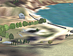
This replaces all my previous Pakatoa Island and Hauraki Gulf sceneries. You must have Christian Stock's NZ mesh in the form of "Mountains of New Zealand" and topo in the form of "Lakes and Rivers of New Zealand" (payware).
New additions...PAKIHI ISLAND: Small jetty and nearby buildings. TAKANGAROA ISLAND: House on Island. House & Jetty island north of Takangaroa Island. MOTUREKAREKA ISLAND: Wreck of the Rewa. PONUI ISLAND: Chamberlain's Bay Airstrip. Chamberlain's Donkey Farm. Third Bay Airstrip. Motunau Bay Jetty. KARAMURAMU ISLAND: Jetty and quarry. ROTOROA ISLAND: Rotoroa Jetty. MOTUIHE ISLAND: Motuihe Wharf.
| Filename: | Hauraki_Gulf_v6.zip |
| License: | Freeware |
| Added: | 17th April 2010, 16:10:12 |
| Downloads: | 218 |
| Author: | Godfrey Tier |
| Size: | 6.61 MB |
| Category: X-Plane - Scenery | |
| WA0B Susi Air Idedua Airstrip v1.0.0 |
|
Images related to this file:
File Description:

This is an X-Plane 11 scenery for Idedua Airstrip (WA0B) in Idedua, Papua, Indonesia. This is one of the destinations for "PT ASI Pujiastuti Aviation", operating as Susi Air, an Indonesia airlines established in late 2004 by Mrs. Susi Pudjiastuti. This scenery was tested and is operational (as of January 10, 2017) in "X-Plane 11 Public Beta #5 64 bit", Windows 10 Home. It was also tested and is partially operational (as of January 10, 2017) in "X-Plane 10.51 64 bit", Windows 10 Home. XP10's runway presents a much higher runway slope, given mesh issues.
| Filename: | WA0B_Susi_Air_Idedua_Airstrip_v100.zip |
| License: | Freeware |
| Added: | 13th January 2017, 20:10:39 |
| Downloads: | 97 |
| Author: | Rui Mesquita |
| Size: | 1.99 MB |
| Category: Flight Simulator 2002 - Scenery | |
| Patches for LOD7/LOD9 Terrain Meshes of British Columbia and Southeast Alaska |
|
File Description:
Patches (flatten files) for 108 lakes in British Columbia and Southeast Alaska that were either sunken below or raised above the terrain surface due to discrepancies between my add-on LOD7 and LOD9 mesh files and FS2002's default scenery. In some areas, such as the Prince George/Burns Lake region, the effect of the patches is obvious even from a great distance; in other areas, you'll have to be close to the lake to notice the difference. Also included are flatten files for nine airfields that had problems with sloping terrain or texture "bleed-through".
| Filename: | Patches_for_LOD7LOD9_Terrain_Meshes_of_British_Col.zip |
| License: | Freeware, limited distribution |
| Added: | 18th February 2003, 22:28:49 |
| Downloads: | 2,831 |
| Author: | Holger Sandmann |
| Size: | 613.45 KB |
| Category: Flight Simulator 2002 - Miscellaneous Files | |
| Anchorage South and Seaward Sectional Charts |
|
File Description:
The northern coast of the Gulf of Alaska is a paradise for Bush pilots. You´ll find many small interesting airstrips and exciting glacier formations up here, especially when you use some third party mesh and landclass files. While it can be used "as is" without any other software, it will develop its full potential if used as moving map with SimSystem´s FSFlightMax or FSGarmin. It wouldn´t have been possible without Richard Harvey and his love to flightsimming, so please consider this file to be "donationware" and make a however small contribution to the Richard Harvey Endowed Scholarship.
| Filename: | Anchorage_South_and_Seaward_Sectional_Charts.zip |
| License: | Check within download |
| Added: | 24th March 2003, 02:02:27 |
| Downloads: | 2,483 |
| Author: | Uwe Rademacher |
| Size: | 19.79 MB |


© 2001-2026 AVSIM Online
All Rights Reserved
Privacy Policy |